The Caucasus is situated between the Black Sea and the Caspian Sea and is mainly occupied by Armenia, Azerbaijan, Georgia and Russia.
The Caucasus Mountains include the Greater Caucasus in the north and Lesser Caucasus in the south. The Greater Caucasus runs west-northwest to east-southeast, from the Caucasian Natural Reserve in the vicinity of Sochi on the northeastern shore of the Black Sea, nearly to Baku (the lowest capital in the world at some -60m below sea-level) on the Caspian Sea.
The most widely accepted border between Asia and Europe runs along the crest of the Greater Caucasus. It is home to Mount Elbrus. With an elevation of 18,510 feet (5,642 meters), it is part of the Caucasus Range that straddles Asia and Europe, although most geographers place it in Europe.
The Lesser Caucasus is a range of folded mountains that runs through Georgia, Armenia, and Azerbaijan.

To the south, the Aras river forms the border between Iran and Armenia, and Azerbaijan. It is said the Garden of Eden was in the valley of the Aras river. The river runs west to east and is 1070 km long before it joins the Kura river in Azerbaijan 121km before it ends in the Caspian sea. It is by some, in combination with the Turkish border, considered to be the border between Europe and Asia, placing Armenia, Georgia and Azerbaijan in Europe.
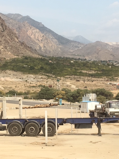
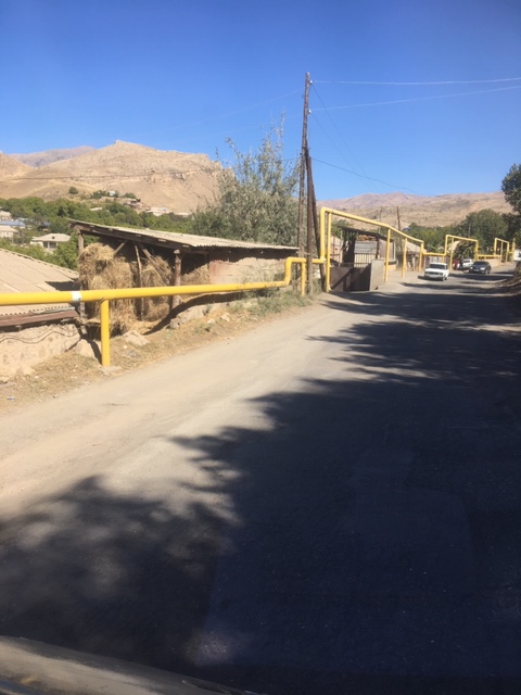
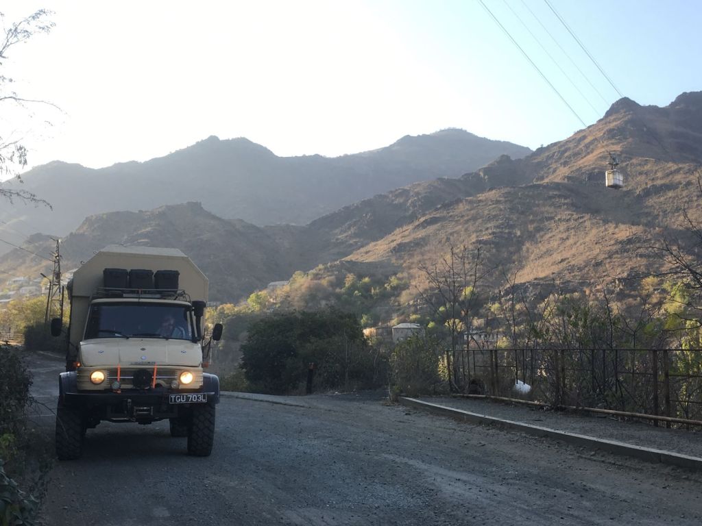
Right at the border crossing of Iran with Armenia shepherds lead their flocks across the road filled with lorries and diesel trucks.
The Caucasian race (also Caucasoid or Europid) is a grouping of human beings which includes ancient and modern populations from Europe, Western Asia, Central Asia, South Asia, North Africa, and the United States.
The grouping was proposed by a German physician Johan Friedrich Blumenbach(1752-1840) who was a prominent anatomist and early anthropologist. His dissertation ‘On the Unity of Mankind’ (1795) is considered a starting point for the study of anthropology.
Blumenbach classifies the human race in to the categories of Caucasian, Malaysian, Ethiopian, American, and Mongolian. The term Caucasian was coined by Blumenbach in recognition of the notion of the Caucasus as a pivotal crossroads for the migration of Indo-European people across Asia and Europe.
There is no evidence that Blumenbach considered any of the races superior to others, but his classification has been misused by political leaders to suggest that “Caucasians” were created in God’s image as an ideal form of humanity.
In any case, Blumenbach’s classification was a valiant effort to bring logic to the hitherto random denomination of ethnicity. His theory was formulated without any technological means (such as DNA profiles), more than 200 years ago, and it is understandable that the theory has been shown to be flawed on genetic grounds. It seems very odd that nations still make distinctions along the Blumenbach racial lines. We still have to fill out forms that ask us to tick whether we are ‘Caucasian’ or ‘other’…
The Caucasus was subject to foreign imperial domination for the great majority of its history during which it experienced long periods of incorporation in the Persian, Arabian, Mongol, Ottoman, Russian and Soviet empires. In cultural terms, the post-Soviet Caucasus (Armenia, Azerbaijan, Georgia and the autonomous North-Caucasian entities within the Russian Federation) is a multiethnic, heterogeneous region in which the followers of a number of religions (Shiite and Sunni Islam, Russian and Georgian Orthodoxy, the Armenian-Gregorian Church, Judaism) practice their faith. The region acts as a transition between East and West, Europe and the Middle East.
October 12
The border of Iran with Armenia runs along the famous Aras river referred to above. Our search for the Garden of Eden is hampered by border fences on each side of the river.
If the definition of this river as the border between Asia and Europe is adhered to, we are entering Europe today.

The border crossing takes an age. We spent a lot of time on the Iranian side where it is important to get all the right stamps in our carnet de passage. This document is worth £8000 for us, but for some in the group with more expensive campers it is as much as £45000!! So patience is the name of the game here, patience and politeness. Everything is written in the “big book” by the customs officers by hand. Finally we are officially out of Iran.
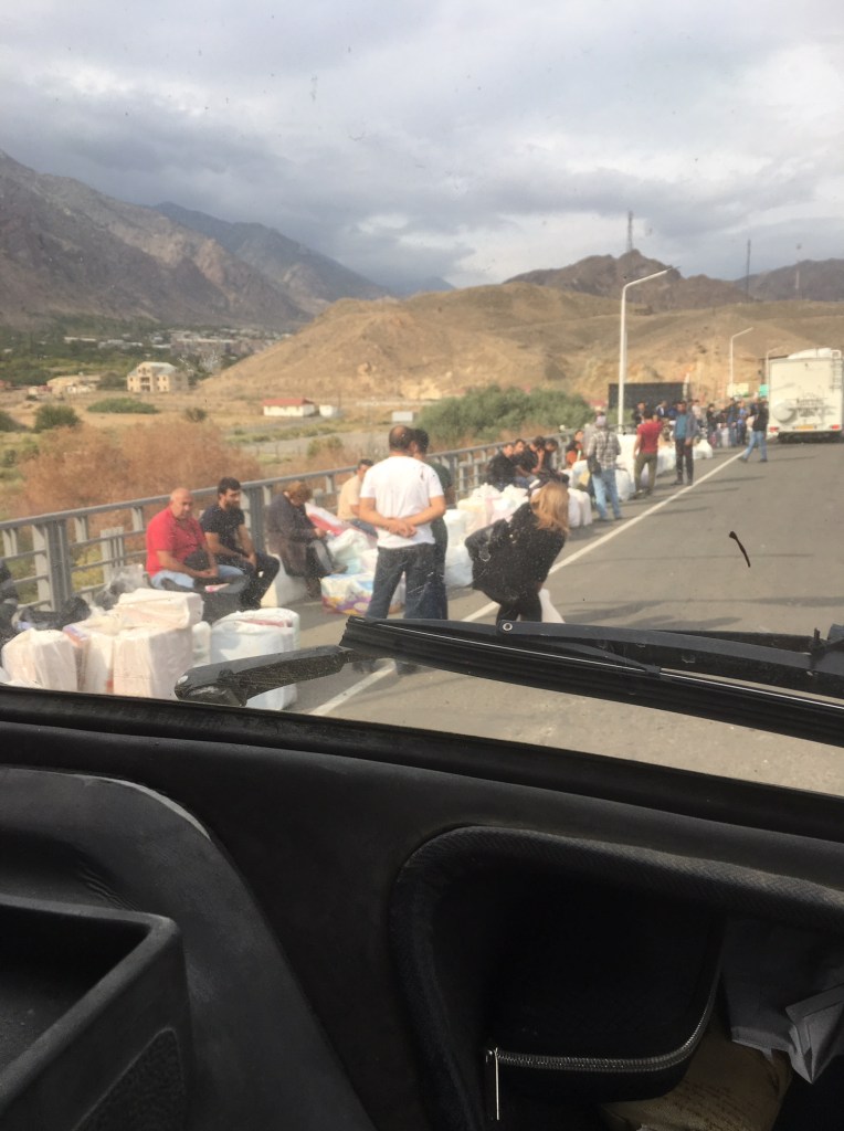
But this is not the end of the border: now we have to enter Armenia. A large crowd of people carrying all kinds of domestic items such as ironing boards, pots and pans, drying racks for clothes, and food such as bananas, have assembled in front of the passport control. An officer in charge keeps shouting instructions. We have no clue what we should do, but try to stay in the ever moving sea of people towards the place where we can get our passport stamped. Our car is unlocked, but it is difficult to leave the queue now. It feels less safe than earlier border posts, but perhaps this is just because of the shouting officers and the cheap goods that are trafficked across. How can there be any profit in bringing these into Armenia?
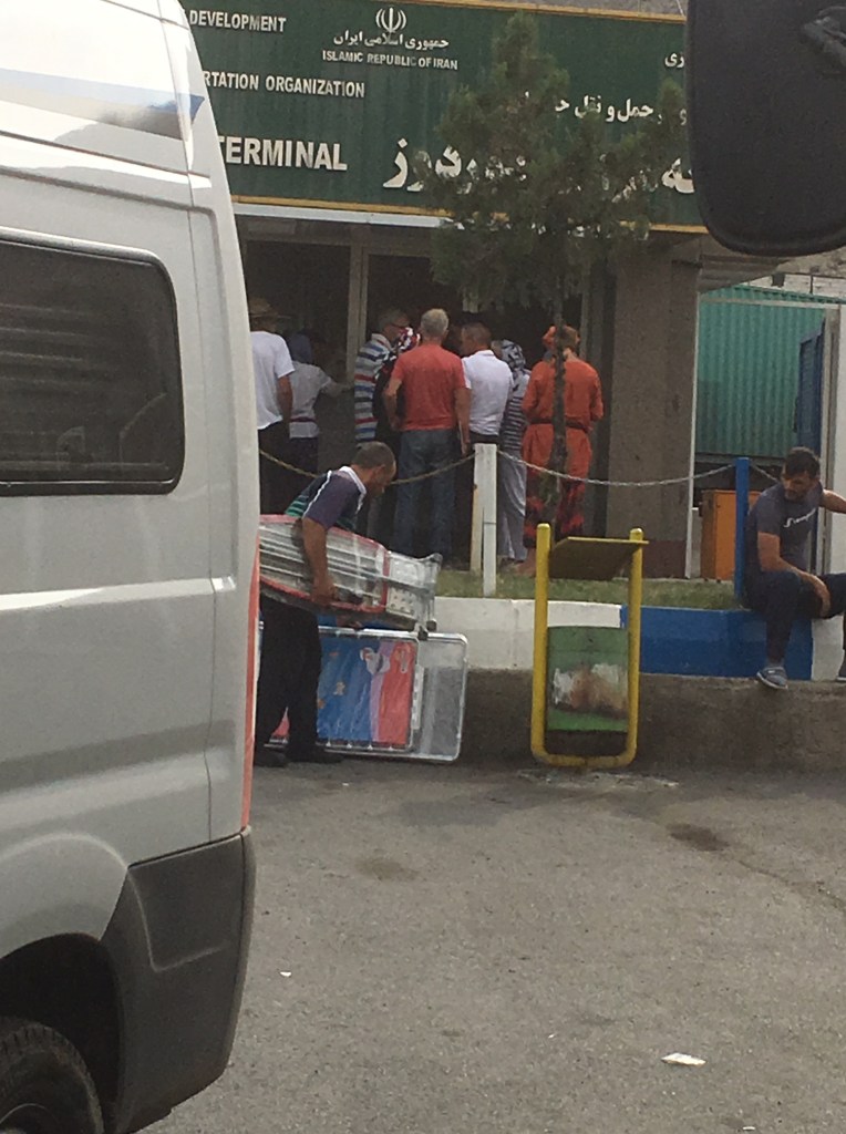
Later we learn that Armenia imports pretty much everything and has hardly any manufacturing left. We get our passports stamped and Miep wants to return to the car while Roelf works on importing the car at the next desk. Pffff, everything is still in place and Miep can get to work on the blog while our Iranian sim card is still working. Some hours later Roelf and all the group are done and we can move the car into Armenia. Lots of shouting again and discussion on which cars need to go through the Xray machine. Not us, but Miep is not allowed, as passenger, to sit in the car as it drives across the imaginary line that is the border. So she has to walk back through the immigration office where all the people are still waiting. It turns out it has now closed the doors. Is it closed for the day? Or is it closed because there are too many people inside? How will she get through and back into the Unimog? Paul from our group is also there and getting quite anxious. He manages to interest a female officer who understands our plight and she gets someone to unlock the door. We squeeze through while the many Armenians have to wait. We hope they will get through today because it has now started to rain. It is a sorry sight, all these people, trying to make some money by importing any goods they can carry. Two big bags per person.
We are now all through and in Armenia. Immediately the road is of desperate quality and it is now getting dark and it rains heavily.
We have to get car insurance and we are longing for our first alcoholic drink since entering Iran. The small shop next to the insurance office has nearly sold out of beers with all those thirsty Dutch travellers! Finally we have all our paperwork and we can move to our agreed camping spot. Avoiding potholes we make it to Meghri, but there, in the rain we find our tour guides giving us new coordinates: the original parking lot was too small and it looks to us also rather steeply up the hill. We drive on and get to a good camping spot on level ground. We are ready for a drink and we all sit in the usual big circle trying not to get drunk on one beer.
Armenia is one of the oldest countries in the world with a recorded history of 3500 years. The oldest known ancestors of modern Armenians, also known as Proto-Armenians, were indigenous to the Armenian Highland in Eastern Anatolia. These tribes formed the Nairi tribal union, which existed until late 13th century BC. The words ‘Nairi’ and ‘Nairian’ are still used by Armenians as poetic synonyms of the words ‘Armenia’ and ‘Armenian’.
At the end of the second millennium BC, another Indo-European ethnic group, referred to by the Greeks as Armens, migrated to the Armenian Highland from the Northern Balkans. According to Greek mythology, which actually reflects this tribal migration, the forefather of Armenians – Armenios – was one of the Argonauts.
The first significant state of the Armenian Highland was the Kingdom of Ararat with its capital on the shore of lake Van. This state was formed in the XI century BC and existed until VII century BC. In 782 BC king Argishti I founded the city of Erebuni, which is today’s Yerevan, the capital of Armenia.
In the late VII century BC, the Kingdom of Ararat fell to Scythian invasions but was resurrected several decades later. In the tri-lingual Bisotun inscription of Persian king Darius the Great (see this blog’s Iran North-West section) the country is referred to as ‘Armenia’ in the Persian and Elamite versions.
Armenia became a satrapy of Achaemenid Persia, and later part of the Seleucid Empire. It restored its full independence in 190 BC under the king Artashes I.
During its peak during the reign of Tigran the Great (95-55 BC), Armenia stretched from the Caspian Sea in the East to the Mediterranean Sea in West, and from Mesopotamia in the South to the river Kura in North.
In the middle of the first century AD a new royal dynasty – the Arshakuni (the Arsacids) – came to power in Armenia. This dynasty was related to the royal family of Persia, with the same family name. At this time Armenia and Persia enjoyed a long period of peace and cooperation, until in 251 AD the Sassanid dynasty came to power in Persia. The Sassanids tried to assimilate the Armenian nation. The Sassanids justified their advances on the basis that the Armenian religion was Zoroastrianism like the main religion in Persia.
Resisting the Persian efforts, the Armenian king Trdat III in 301 AD, created the Armenian Apostolic Church, with Gregory the Illuminator as its first bishop, and declared Christianity the state religion of Armenia, thus making Armenia the first Christian state in the world.
The Arshakuni dynasty was dissolved in the year 428 AD, when the eastern part of Armenia was annexed to Persia, while the western part was put under Byzantine rule.
The Arab caliphate conquered Armenia in 658AD. After more than two centuries of struggle with the Arab Caliphate, Armenia regained its independence as the Bagratuni kingdom in 886. However, the country was annexed by the Byzantine Empire in 1045.
Before the fall of the Bagratuni kingdom a number of Armenian princes managed to escape from Armenia and found refuge in Cilicia, a region at the north-eastern corner of the Mediterranean Sea, where Armenians formed the majority of the population. In 1080 their leader, prince Ruben, founded in Cilicia a new kingdom, which became known as Cilician Armenia, or Armenia Minor (Little Armenia). The new Armenian state established close relations with European countries and played an important role during the Crusades, providing a safe haven for the Christian armies. Cilician Armenia survived for three centuries before it fell to Egyptian Mameluks in 1375.
Around the time of the fall of the Cilician Armenia, the historical Armenian homeland was divided between the Ottoman Empire (Western Armenia) and Persia (Eastern Armenia).
Despite being ruled by and surrounded by countries with a different religion and culture for more than five centuries, Armenians managed to preserve their own language, and their national, religious and cultural identity.
In 1828 the Russian Empire captured Eastern Armenia from Persia during the Russo-Iranian wars. The Ottomans retained control of Western Armenia where the living conditions of Armenians gradually deteriorated despite some token gestures by the Ottoman government such as the recognition of a special Armenian constitution in 1863.
The so-called “Armenian Question” emerged in the relations between the Ottoman Empire and other European superpowers. After the Russo-Turkish War of 1877-78, Russia insisted in the Treaty of San Stefano that the Sultan’s Armenian subjects be protected against Ottoman discrimination and aggression from the Kurds. This demand was later softened by the British at the Congress of Berlin.
Despite the ‘concerns’ of other western nations, massacres became a common phenomenon in the Armenian provinces and in Cilicia which had a large Armenian population.
After coming to power in the Ottoman Empire in the beginning of the 19 hundreds, the Young Turks coined the phrase “No Armenians – no Armenian Question”. Under cover of the complex political situation of World War I, hundreds of Armenian intellectuals of Constantinople were executed without trial on April 24th, 1915. The Ottomans feared that the Armenians would see the war as an opportunity to escape from Islamic domination and be supportive of the allied forces. They conscripted, disarmed and executed all Armenian males aged 15-62. Armenian women, children and the elderly were deported to the Syrian desert Der-el-Zor. Most of them were brutally murdered on the way by Turkish soldiers and Kurdish nomads, or died of starvation. More than one and half million Armenians, i.e. 80% of the Armenian population of Western Armenia, perished in this Genocide, which is still not being formally recognised by many countries including Great Britain and the Netherlands out of fear of spoiling relationships with Turkey who even today deny all events despite written and photographic evidence of these terrible crimes.
After World War I, Armenia came under the rule of the Soviet Union. During the 71 years of Soviet rule, the Soviet Republic of Armenia experienced a period of relative security, and of economic and cultural development. However the relationship with the neighbouring Soviet Republic of Azerbaijan was very tense because of Armenia’s desire to be reunited with Nagorno-Karabakh in Azerbaijan, where Armenians form the majority of the population.
Armenia was restored to full independence on September 21, 1991, and became a member of the United Nations on March 2, 1992. On January 25, 2001, Armenia also became a member of the Council of Europe.
The turbulent and sometimes violent history of the Armenians has resulted in a strong and vibrant diaspora. Of the total of 11 million Armenians only 3 million live in Armenia itself. Some 8 million live across 85 countries all across the world.
October 13
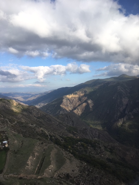
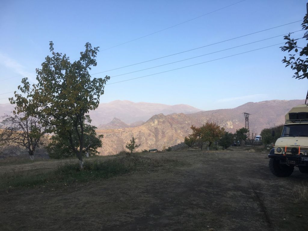
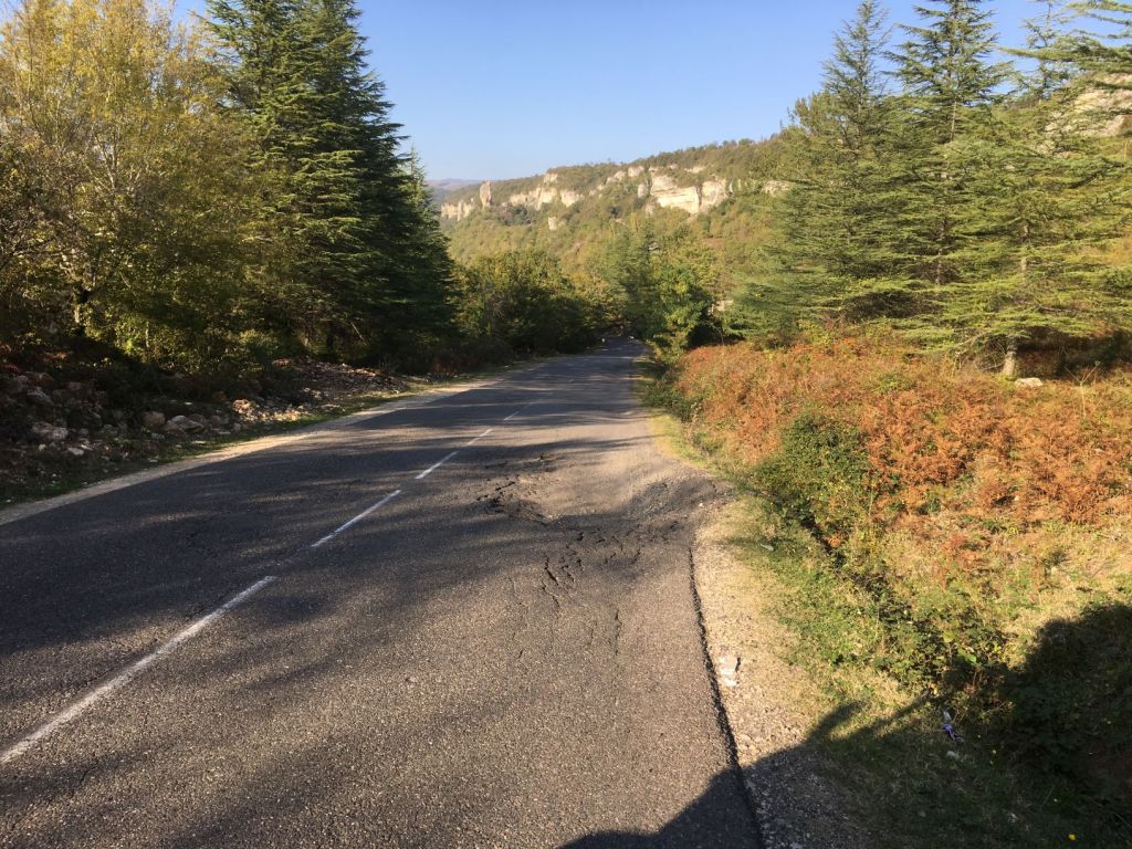
We are away early. The roads are steep here and we do not want to stay behind. On steep roads we cannot drive faster than 40 km/hr in third gear and 25 km/hr in second gear. So 200 km can be a very long drive. Here we even have to go up in first gear in part. Wow, this is mountainous terrain indeed. We cannot understand how this road, which we imagine is the only one into Armenia from the south, can be in such poor condition. How do the lorries that take oil into Armenia manage? But spectacular it is too. The road winds up a valley higher and higher and new vistas appear all the time. Here we see trees again; it has been some time since we saw continuous forest. The autumn colours are on display. And the sky is a dark blue, the kind we know so well from Scotland in September. It is stunning.
But driver beware: potholes, missing asphalt, stones on the road from the rockfalls that must happen all the time. They are working on the road too. But it is not in an organised fashion. There are bits of road works and then nothing and then a clutch of machinery again. Occasionally someone is controlling the traffic, but most of the time we just have to make it up ourselves. Drive over on the wrong side, zigzag around oncoming traffic, wait until cars behind get annoyed and decide it is time to just go and urge us on. Remarkably no accidents seem to happen.
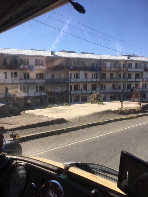
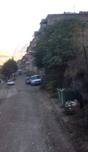
We stop at the first larger town. The bad influences of the Soviet times on infrastructure are everywhere.
Terrible housing blocks, balconies nearly falling off, the ubiquitous gas pipes running overground, we have seen it everywhere and here it is in even poorer state than in the Stans it seems.
But the people are cheerful and when we find the shop that sells sim cards, the young man who helps us is mightily proud of his town. He is efficient and we are sorted with cards in our phone, iPad and computer! Then coffee in a modern café that seems to have just opened, they are still working on some of the toilets, but they are operational and it is nice to be back to western style of plumbing and flushing. On the wall hang pictures of famous Armenians. We try to guess, but we only know Charles Aznavour.
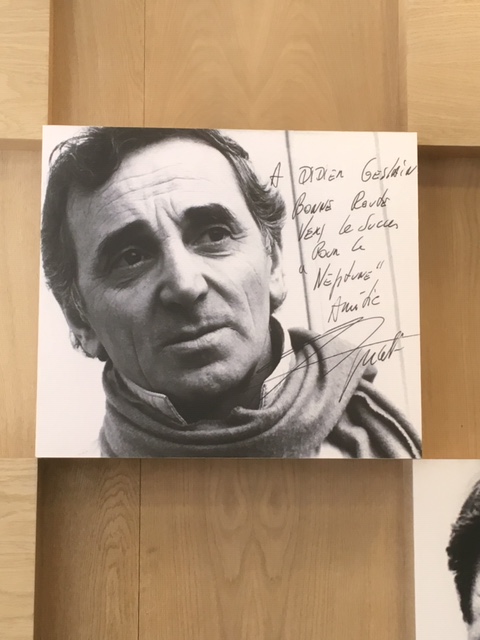
He is a total hero here, his picture is everywhere and there is a museum about him in the capital. Khachaturian, the composer, is another famous Armenian and of course Gary Kasparov, the former chess world champion.
We move on and now drive up another valley, further north towards a monastery that can be reached with a long cable car. We are keen to see the landscape from the air, but it is taking a long time to find the right road towards the cable car. Apps from the group are beginning to come in, campers have got stuck on minor roads, having to turn back. We get to a point where several of our group have assembled. Some have now given up on the cable car and move on. Others, like us, want to give it another go. It becomes clear that the best way to get there is from the north, a little detour but suddenly the road is good. This is a road built for visitors who fly into Yerevan, the capital. Those coming up from the south….well… few tourists would come that way anyway!
We get to the ticket office of the “wings over Europe” cable car to find the first available ‘flight’ for us is 1.5 hours later. Now it is getting tricky to make our rendezvous, but Miep is keen and buys the tickets anyway. We have a nice meal with Armenian specialties to fill in some time and Lida and Kees joins us. They want to move on and we tell them, and the group, that we will not make the campsite, but join them again the next day. It is a shame to race on and miss out on properly viewing things on the way.
The flight is only some 15 minutes (5 km), but the views are wonderful.
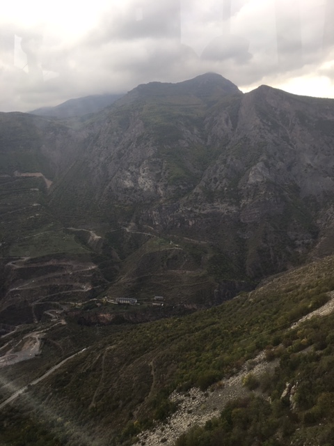
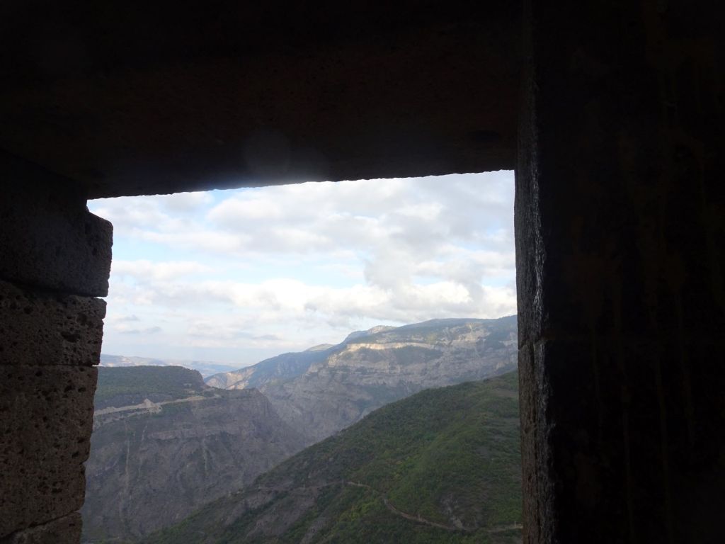
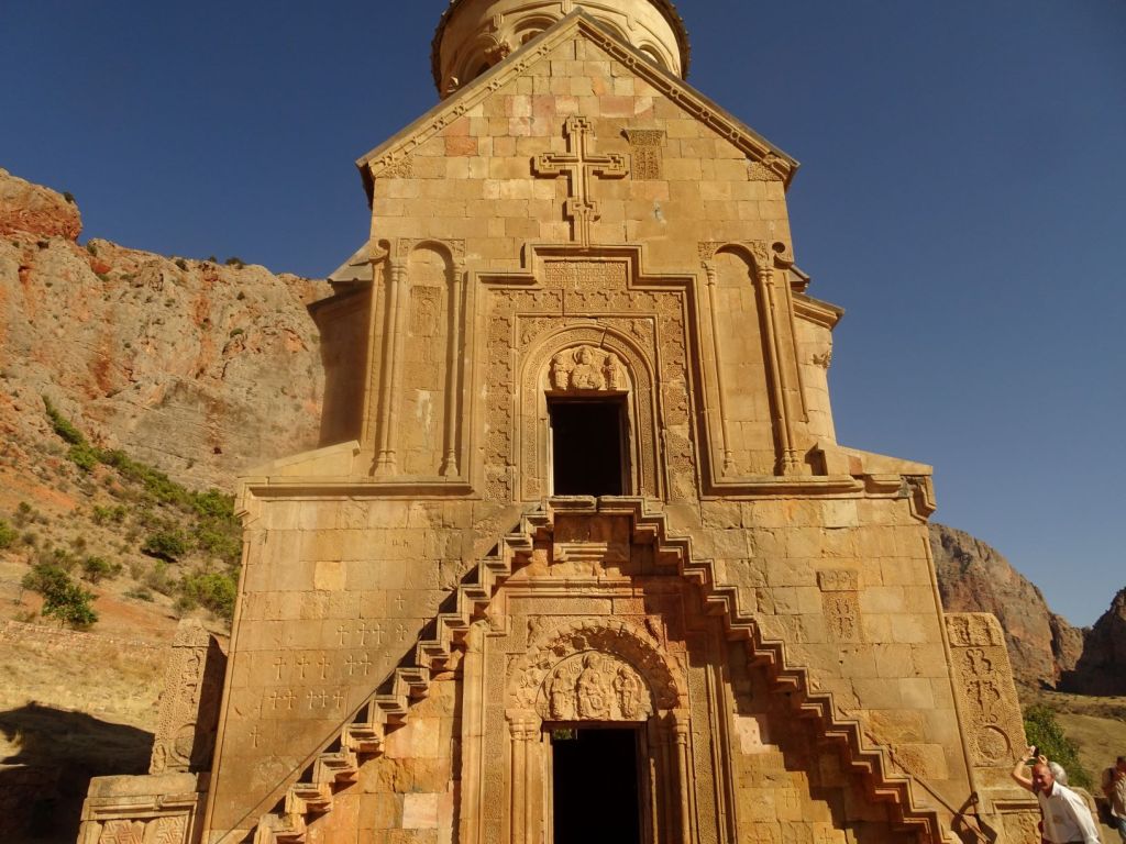
This is a good area for bird watching, walking and viewing old churches and monasteries. The Tatev Monastery we visit is being restored.
It is interesting to see how they do this: they fill in missing stonework with new, but making it clear what is original and what is new.
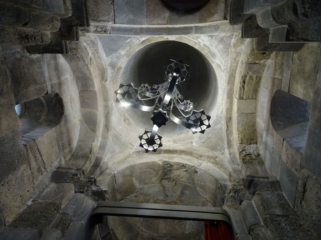
The steelwork is magnificent. Beautiful chandeliers are newly forged, and old wells are repaired.
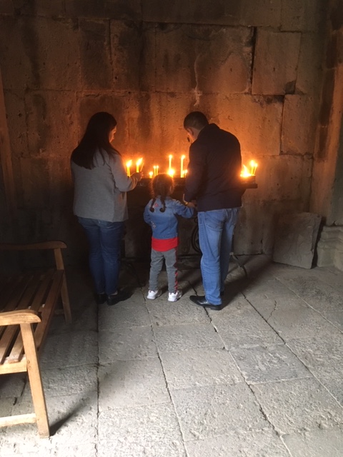
The church inside has a heavy scent of incense. People light candles and stand them upright in containers filled with sand and water on top. The wax is later collected and remade into new candles.
We take a taxi back as there was no ticket for sale for a return ‘flight’. This is common and there is no problem finding a taxi who take us back for the same fare as the cable car. We race over the windy road back up the hill where he is amazed to see our car. ‘German?’. Yes, Mercedes!
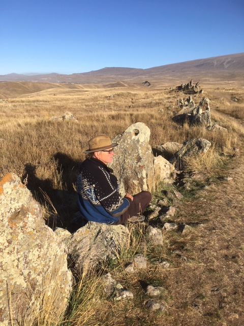
We get going, thankfully the Mog starts without problem and we drive to the next place we must see: a big stone circle called Carahunge, nicknamed the Armenian Stonehenge. It is getting dark and we just make it to the car park before the small shop there closes and the last of the bus tourists depart. Roelf buys a t-shirt and I buy the small guide to this place. The shop owner tells us it is fine to park up overnight and we have the parking spot and the whole of the stone circle all to ourselves! To top it all it is full moon!
October 14
Having read about this stone circle we go out to explore in the early morning; there is frost on the ground for the first time during this journey.
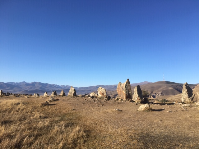
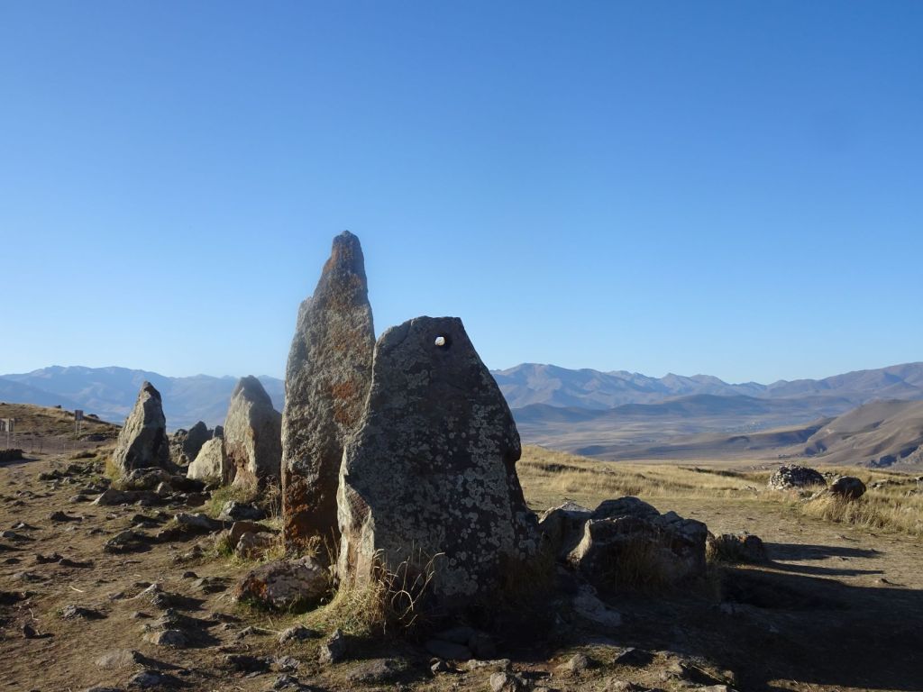
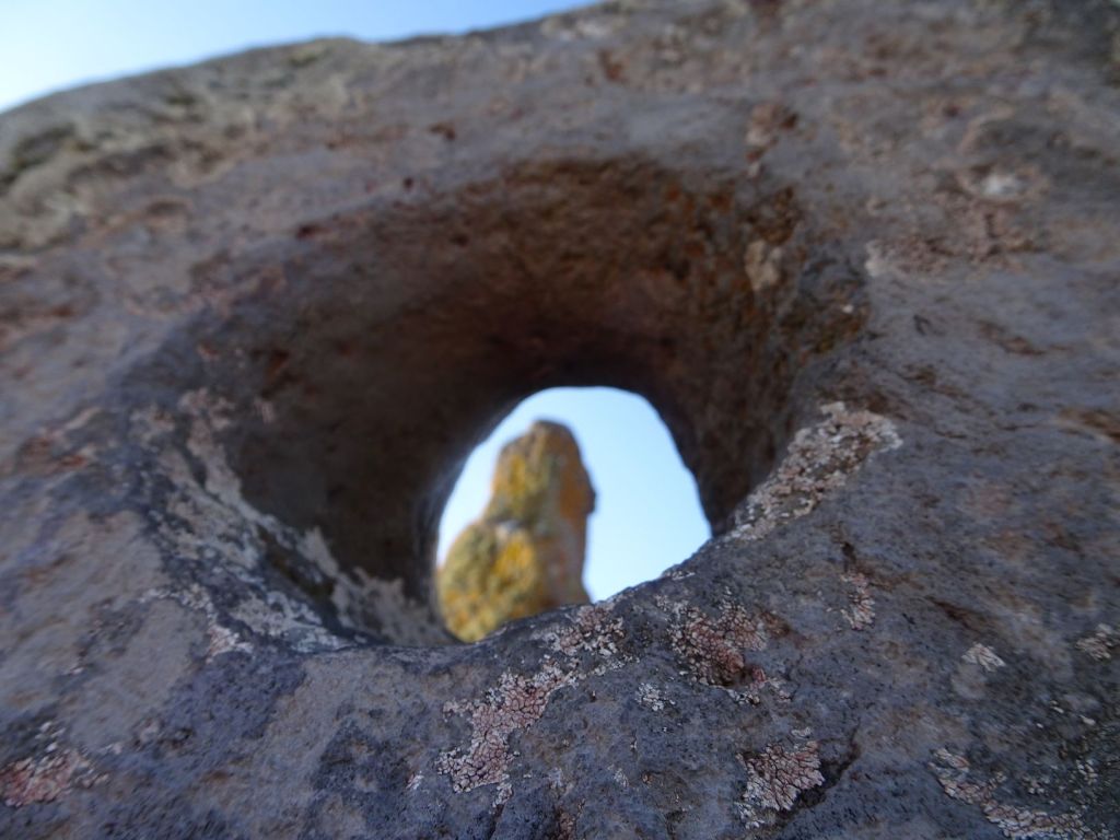
There are stones with a sharp point and others with holes. When you look through the hole and line this up with a point you will, on certain days in the year, see the sun come up, the moon rise or set and so on.
The role of Carahunge as an astronomical observatory is disputed; other explanations that have been given are that it was used for animal husbandry, a refuge for war times and even as a necropolis. Estimated dates for when the site was created vary from 5500 BCE to 2000 BCE. It seems odd that contemporary archaeology cannot make up its mind about such fundamental issues!
Found within the first sentences of the Anglo-Saxon Chronicle, a compilation of seven surviving interrelated manuscript records of the early history of England, compiled between the 10th and 12th centuries AD, a reference is made to the British people stating that they originated from Armenia. It says: “The first people were the Britons, who came from Armenia, and first peopled Britain southward”. This reference, together with the similarities between the megaliths in Stonehenge and Armenia, led clergymen and archaeologists over the centuries to conclude that the Britons are of Armenian origin.
Reluctantly, we leave this beautiful place to move on. Destination is another monastery: Khor Virab. We see more sad soviet style housing along the way; Armenia seems very poor to us.
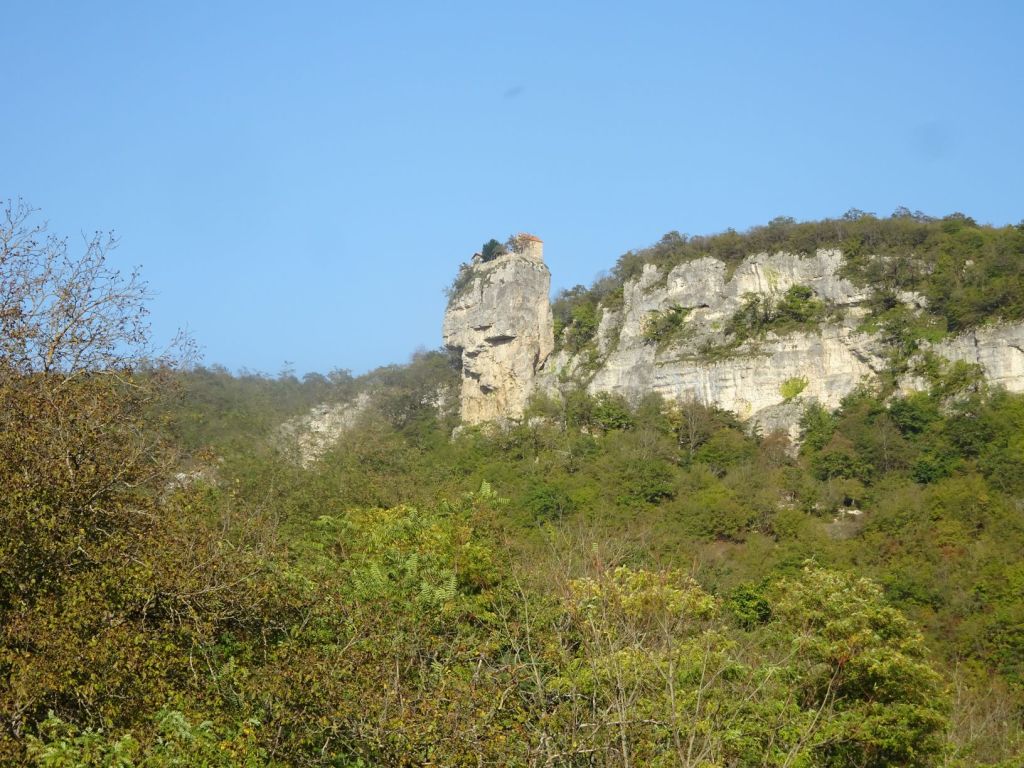
But the landscape remains stunning and we visit another beautiful monastery on our way. This one is in a valley of red rocks. Spectacular!
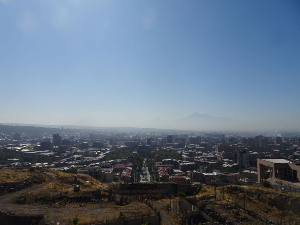
After an interim stop at the campsite where the rest of the group stayed last night and where we and our laundry get a quick wash we get our first glimpse of the Ararat.
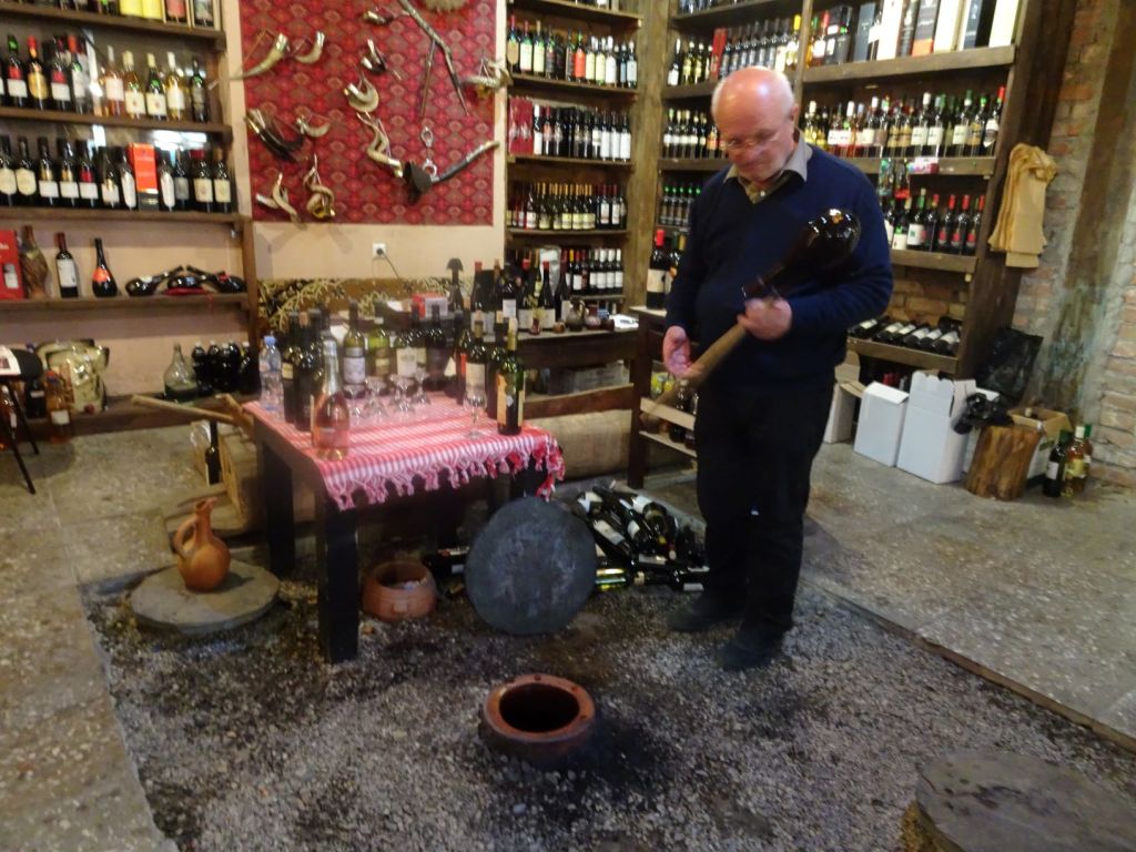
We stop at one of the many road stalls. They sell honey, all kinds of home made wine and fruit. The wine is sold in plastic coke bottles so the Iranian lorry drivers can take this back we are told. Surely the customs officers will know?
We arrive on the parking lot of Khor Virab just before dusk. There, in the middle of the parking area, we find the other members of the group having drinks and nibbles. Although this is a special place to Armenians, the location of our camping spot is horrible: right in the middle of tourist stalls, with busses parked everywhere, dirty with stray dogs searching the street for something to eat. We park the Mog next to the rubbish bins and join the party. After something to eat and a few drinks we fall asleep anyway, being bitten all night by small insects, a kind of midge, that thrives in the wetlands round the Ararat. Miep, who is very sensitive to insect bites, will remember this place for the next week for all the wrong reasons….
October 15
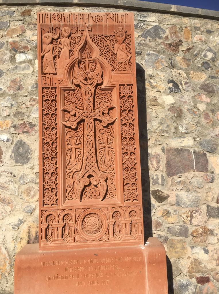
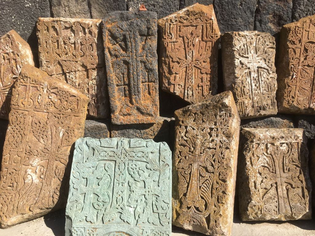
The next morning, we go up the hill to see the monastery. The name translates into ‘deep dungeon’. Prior to becoming a monastery, this site was a castle and a prison. It is where Gregorius the Illuminator was held captive by King Tiridates III for 13 years. Gregor eventually converted the king to Christianity resulting in Armenia becoming the first Christian state in 301 AD. The buildings on this site have served as chapel, education centre and monastery and been rebuild after a devastating earthquake. The Stone carvings around the doors and on the many Khachkars are impressive and probably date from the time when the large church on the site was built (1661). All in all this is a phenomenal historical site located on the edge of the current border of Armenia with beautiful views that make up for the rather miserable camping conditions.

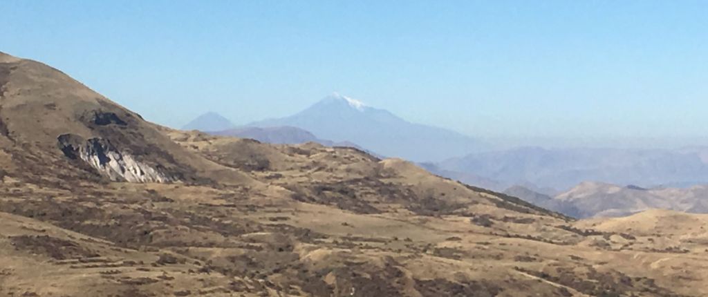
The monastery is situated close to the Turkish border and faces the Ararat plateau.
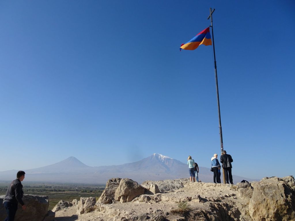
The Ararat is with 5137m the highest peak in Turkey and of the Armenian Highland. The Armenian flag is firmly planted on the hill facing the mountain. Ararat is the principal national symbol of Armenia, and has been considered a sacred mountain by Armenians. It is featured prominently in Armenian literature and art. The mountains of Ararat are widely seen in Christianity as the place where Noah’s Ark came to rest. It is depicted on the coat of arms of Armenia along with Noah’s Ark.
We were very moved by the notion that this Armenian treasure is now occupied by Turkey which has been so cruel to Armenians in the recent past.
The next overnight stay is on a campsite that is owned by a Dutch couple and situated in the hills some 20 km east of Yerevan, the capital of Armenia. Some in our group take the direct route to the site, bypassing Yerevan, but get stuck spectacularly on the very, very bad road that leads there through the mountainous countryside.
We were lucky that we had been less keen on showering and washing clothes and had decided to go to Yerevan first; the road to Yerevan is perfect and from there to the camping also very reasonable.
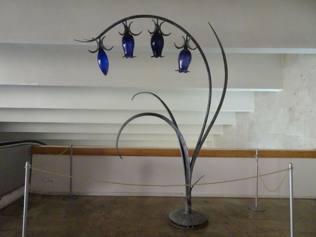
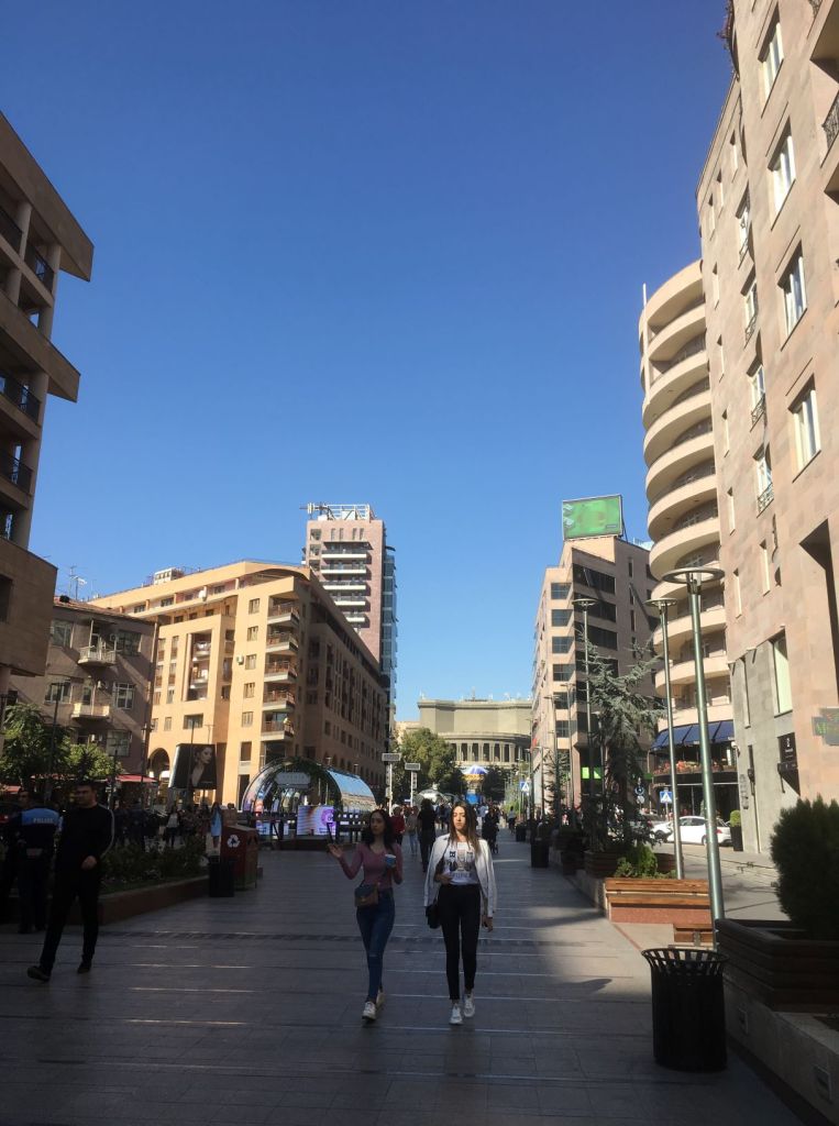
The city has very European atmosphere; there are cafés, statues, fountains and little market stalls everywhere. We park the Mog in a back street right next to the famous Yerevan cascades, a flight of stairs with water features and art works up the hill overlooking the city.
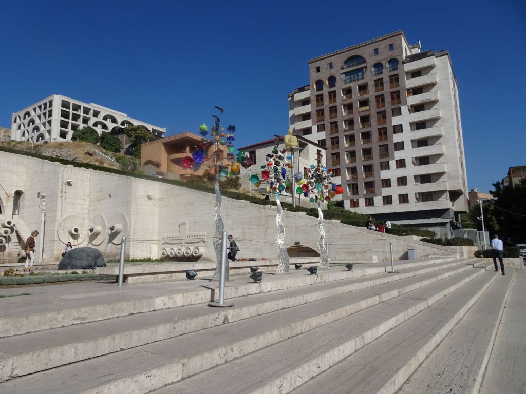
On the side of the steps is an escalator where you can look at art on your way up.
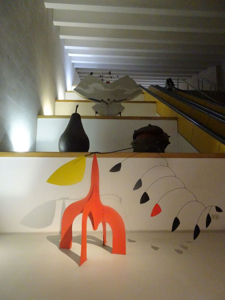
Some of the work is grand and magnificent
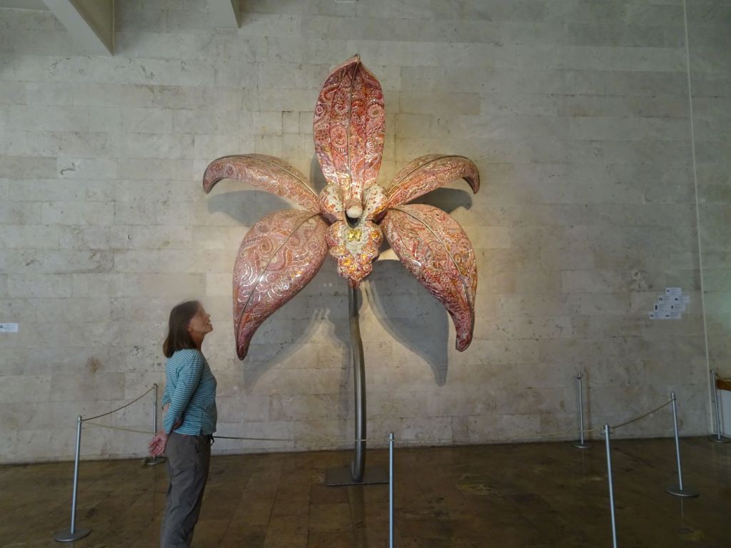
Other work is subtle and homely
We have a nice meal in one of the restaurants with a large german beer. The atmosphere is very relaxed.
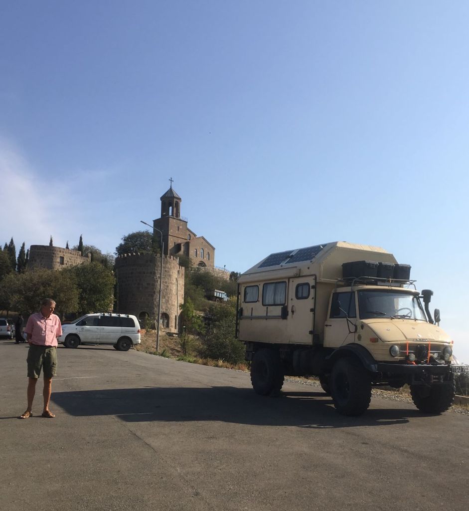
In the evening we arrive, the last ones again, on the campsite, the 3 G’s. Excellent facilities with swimming pool and laundry, beautiful view, but a campsite where space for so many large campers is tight. The Mog is surrounded by other vehicles including several overlanders, all busy to repair their vehicles, or get clean and sorted for the next stage of the trip. This camping spot is clearly ‘on the map’ and rightly so. The lack of space around the campers is completely negated by the communal facilities including wonderful covered seating and cooking areas, the best we have had on the whole trip! We are treated to a nice question and answer session with the owner of the site in a room with a roaring wood fire (it is now getting cold at night). She is Dutch and came here to build greenhouses to grow roses years ago! She has transformed an old farmhouse with outbuildings into this spectacular campsite and tells us about living and working in this country.
October 16
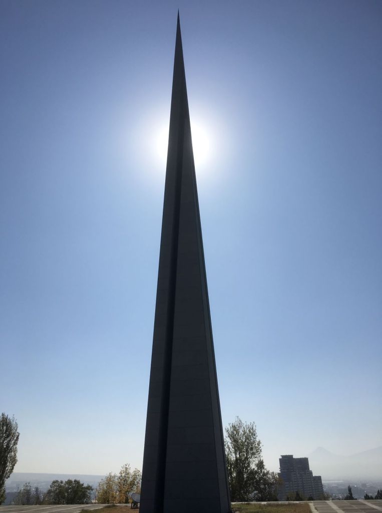
We have an excursion to the Tsitsernakaberd (nest of swallows) Armenian Genocide Memorial Complex.
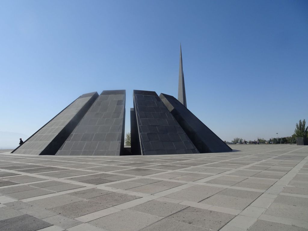
The memorial was built in 1995 to commemorate the massacre of 1.5 million Armenians during the death throws of the Ottoman Empire in World War One.
The 44-meter peak symbolises the rising of the Armenian people.
12 standing stones refer to the twelve provinces that Armenia lost to Turkey (including the Ararat which can be clearly seen from the memorial complex).
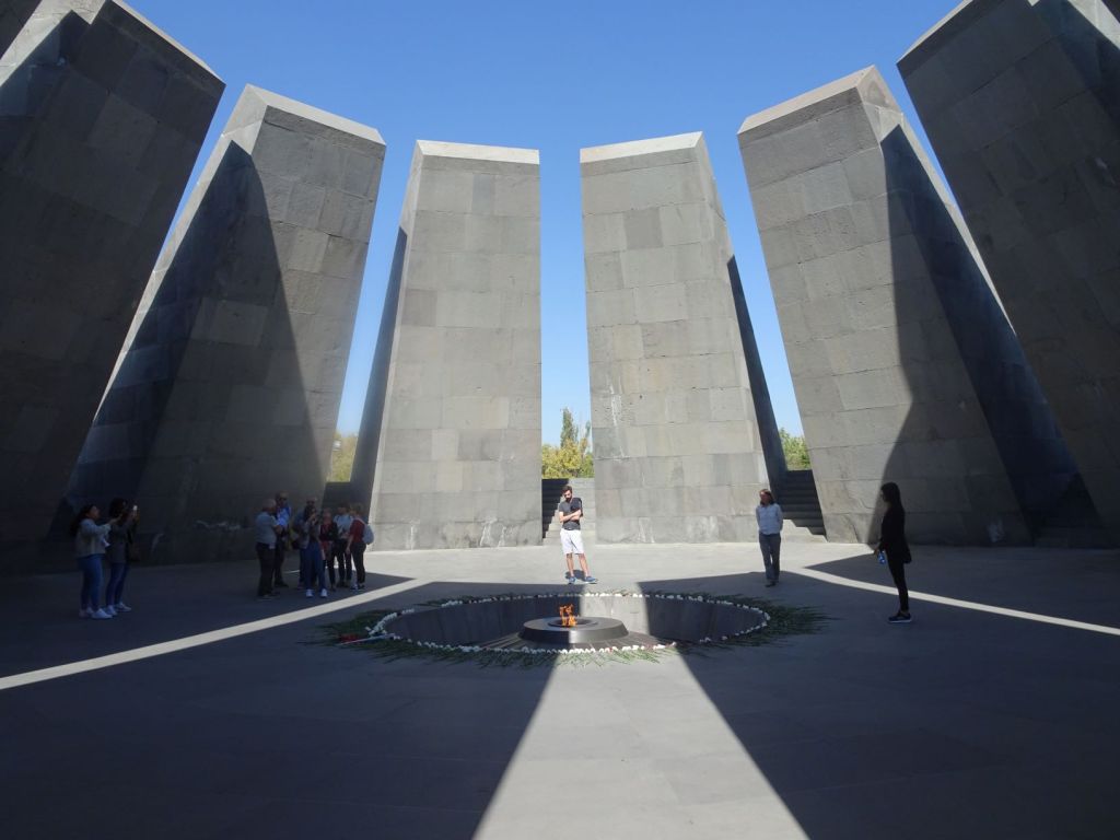
A 100-meter-long wall commemorates the people who were murdered.
The museum exhibits the run up, execution, and aftermath of the genocide. The layout takes you through the episode chronologically. There are documents containing the orders by the Ottoman regime. The definition of genocide is written out large and the way, repeated in every genocide in history, in which a group is gradually reduced to ‘unwanted’, deprived of its human rights, compared to a contagious disease, or ‘vermin’ is shown. This is a powerful reminder to always be vigilant for use of such language. The pictures and videos are horrific and moving in equal measure.
We can genuinely say that each of us in the group is stunned by the visit. In the bus on the way back into the city centre, nothing very much is said. Never seen a group of Dutch people so quiet!.
We stroll through the very modern city in the afternoon; the contrast with the poor countryside of Armenia could not be sharper…
We walk through the city, visit the craft market first. Lots of chessboards in carved wood often showing the Ararat. Not as intricate as those we saw in Iran, but we can tell Kasparov has inspired a whole industry.
We then visit the National Museum of Armenian History.
My goodness: this is a wonderful place. Filled with the most fantastically preserved pottery, bronze statues, jewellery of times very long ago and also costumes and pottery of more recent times.

It is the best museum we have seen and it helps understand the various peoples that have lived in these lands, such a crossroads between the seas and mountains. The most spectacular, and the emblem of the museum, is an interpretation of the solar system in the form of a statuette. This is the first museum where we are not allowed to take pictures, so the image below is from a postcard.

It is from the second millennium BC and was discovered as recently as 2015 after the water level in lake Sevan dropped dramatically.
Most of the archaeological finds in the museum are from around lake Sevan we will pass on our way north. There must be an endless treasure trove of beautiful bronze and earthenware under its shores yet to be uncovered.
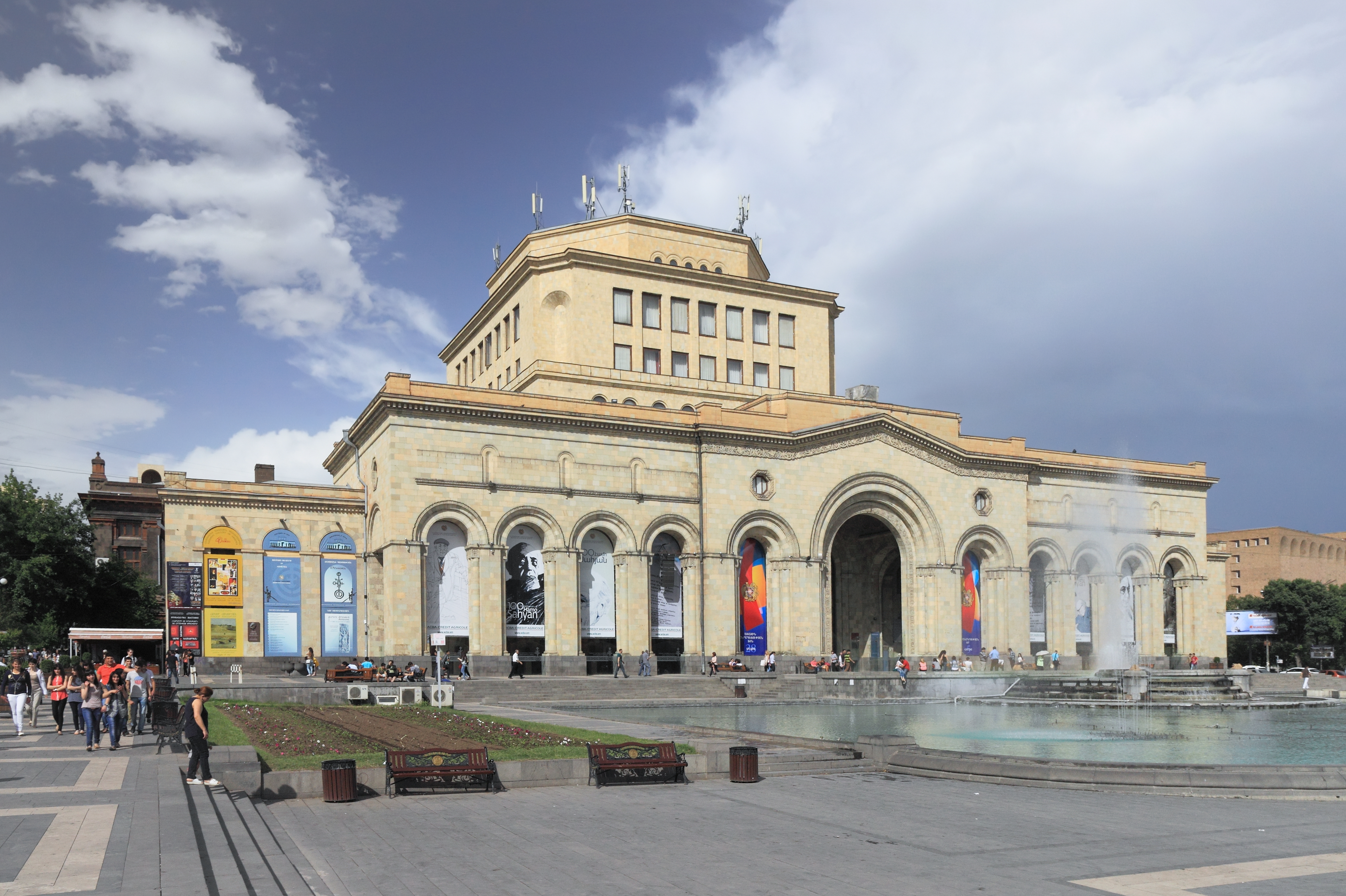
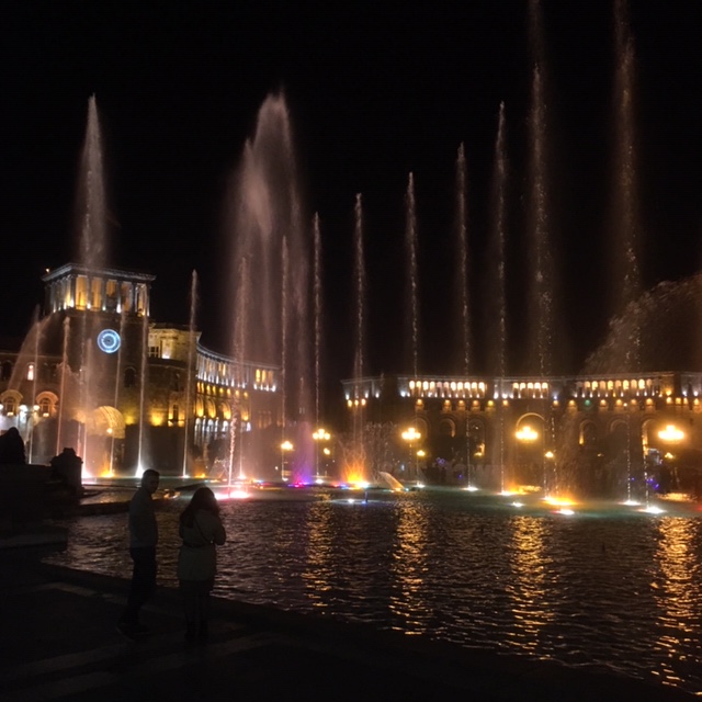
We go to a nearby café to sample some Armenian food and in the evening, are treated to a fabulous light show in the fountains of the main square right in front of the Museum.
An old Mercedes bus that is even slower than the Unimog, takes us back to the campsite. Plenty of time for nice conversation.
October 17
First thing the following morning, we visit one of the oldest monasteries in Armenia, from around the time that Christianity was declared the state religion in response to the advances of the Persian Sassanids.
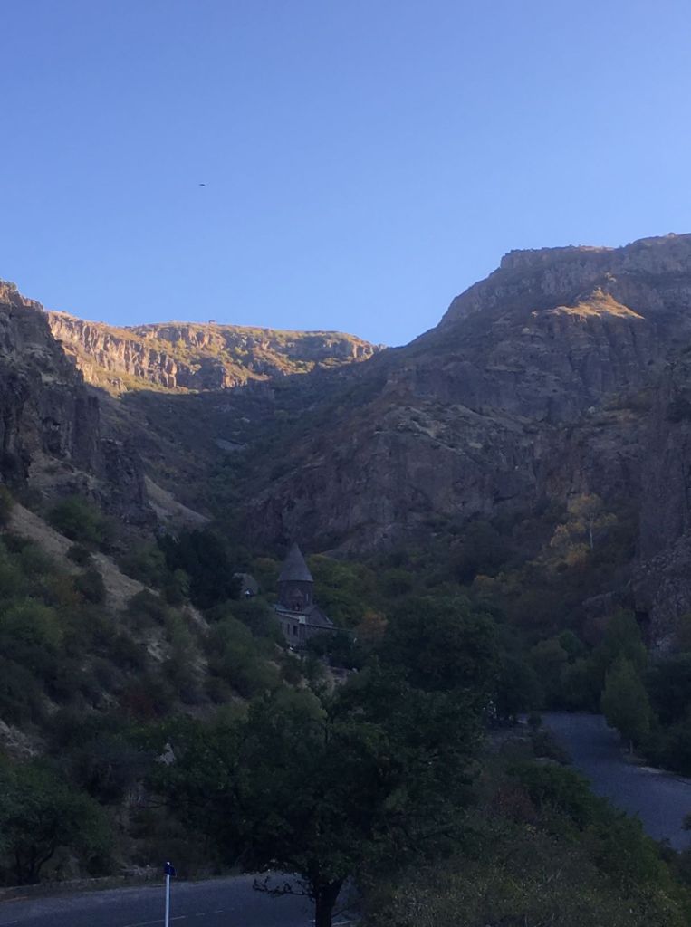
The monastery was initially known as the Monastery of Caves where St Gregory the Illuminator conducted a very ascetic lifestyle.
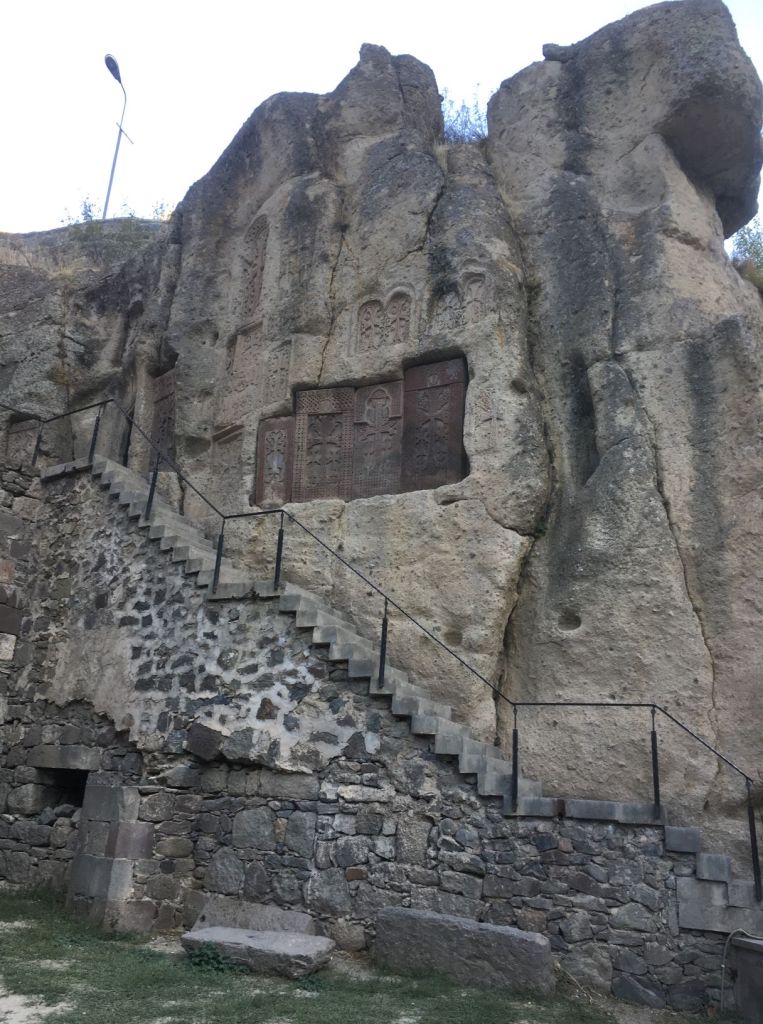
This enclave of Christianity survived in the midst of surrounding other religions, first Zoroastrianism, and later Islam. We are the first to visit today. An impressive site hacked out in the rocks. Later small groups of singers arrive to perform Gregorian music in the old chapel. Unfortunately we missed that as we have already gone on to our next visit.
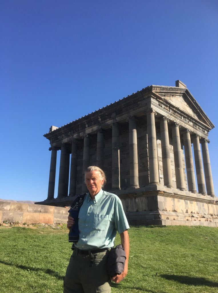
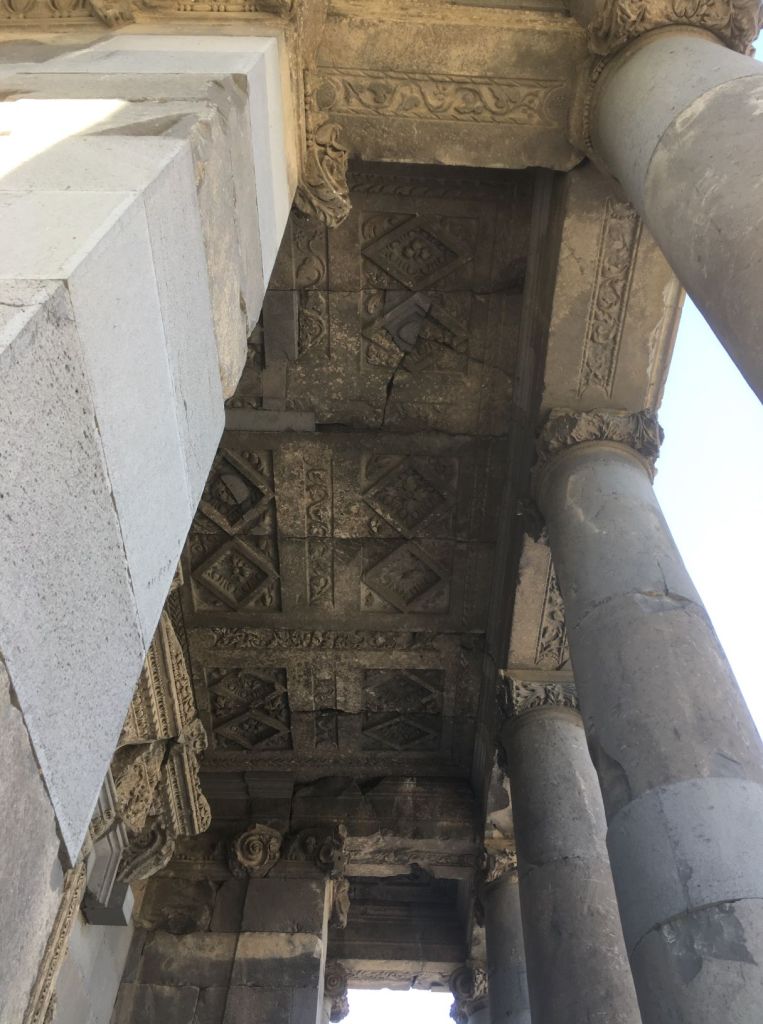
The Garni Temple, a fortified royal castle that originates from the 3rd to second millennium BC, was extended during the Hellenistic period after Alexander the Great. The temple was completely destroyed during an earthquake in the 20th century but fully restored. It is nice to see a fully intact temple rather than a partial ruin. All the newly added stone is uncarved so it is clear which ones are original, just like in the restored monasteries we visited earlier. We like the way Armenians restore their old heritage even though this may not be the way Western ‘experts’ like things to be done.
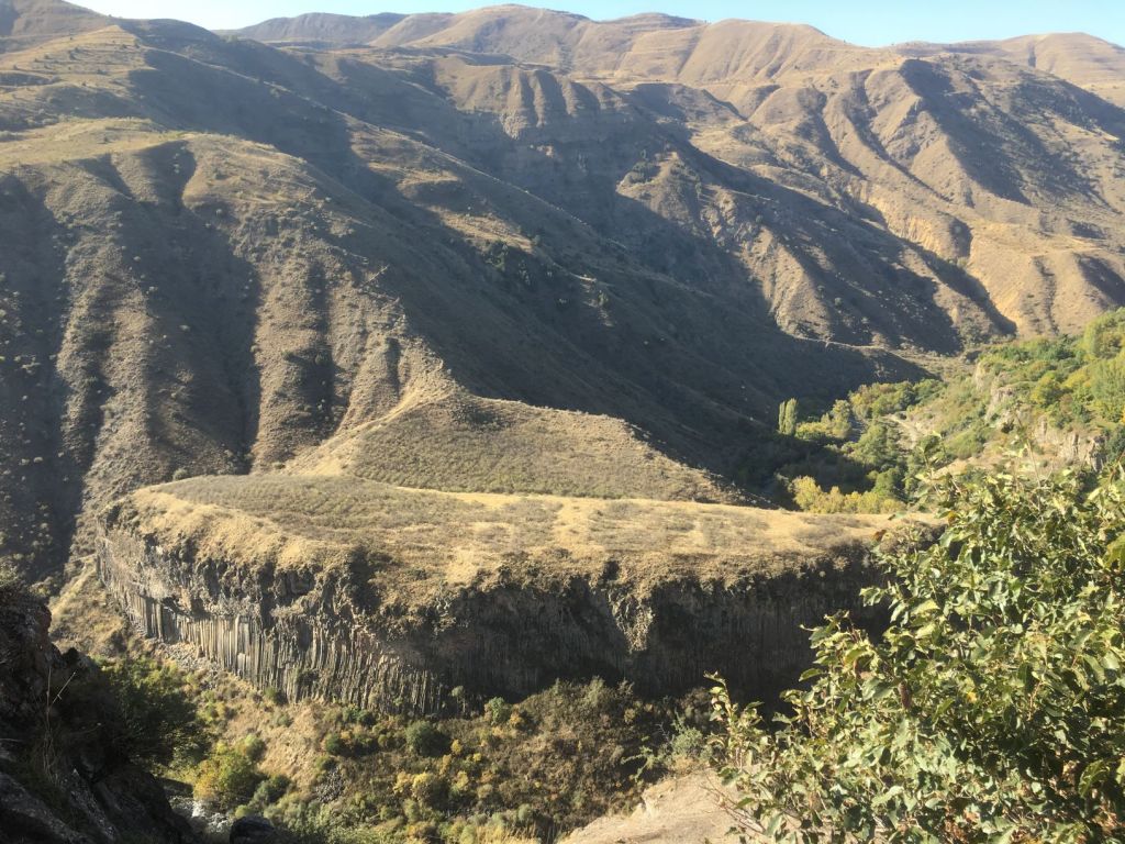
The temple is also known for the basalt formations in the valley below.
From Yerevan, we drive North towards the Georgian border. We pass the mighty Sevan Lake.
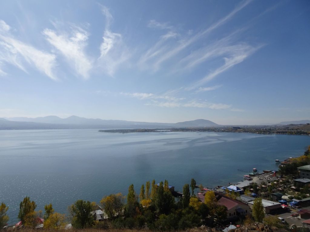
We have some coffee and visit a small church on the lake shore.
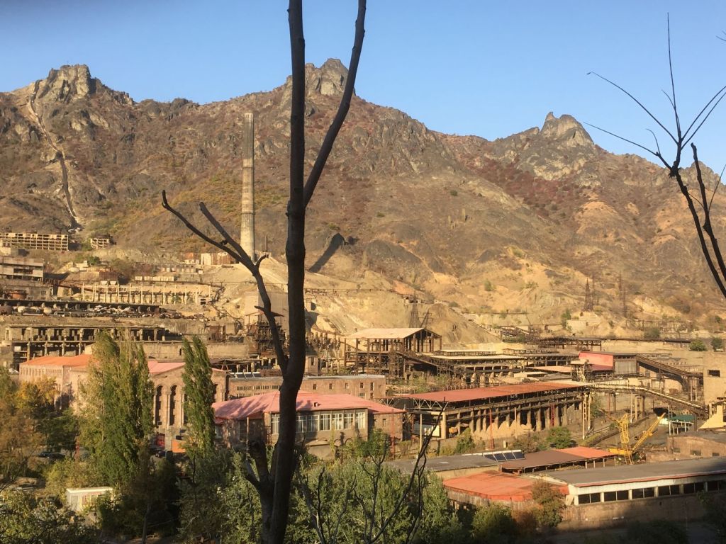
The road to the border leads past deserted industry from soviet times. It feels eerie, as if some nuclear attack has wiped out all activity.
It is getting dark
The quality of the road gets poorer as we get closer to the border.
Finally, we reach the campsite. The site is up the hill on the side of the road and lifts us above the misery down below. Kees has his newly acquired Iranian backgammon board out in the middle of the camp site. He is winning, until after 6 games he finally loses. Great excitement. This is how we have seen it played in these lands, out in the open, with whoever cares to stop by and join in.
The road conditions have caused the Mog to drop its mud guards. Thankfully we have a lot of washing line.
October 18
On the final stretch of ever worsening road to the border to Georgia, we come across a strange sign.

A highlight of the journey is the MIG airplane along the road. These jets were designed by Artem Mikoyan. His brother Anastas was a topman in Soviet Politics. Two of the most famous Soviet Armenians.

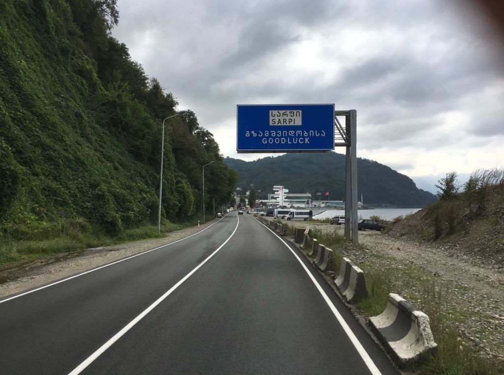
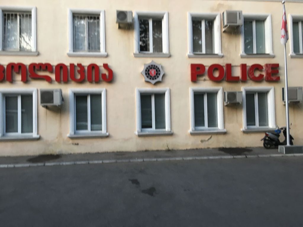
The border crossing between Armenia and Georgia provides similar scenes of pedestrians taking massive amounts of apparently cheap products from one country to another.
Whereas some definitions of Europe would have us having entering Europe when we crossed the border between Iran and Armenia, other definitions would have us entering Europe when crossing the border between Armenia and Georgia. So we enter Europe for the second time.
The area of present day Georgia, has been inhabited for at least 1.8 million years. The first evidence of organised society is from the early Colchis and Iberia kingdoms.
-en.svg)
The kingdom of Colchis, which existed from the 6th to the 1st centuries BC is regarded as the first early Georgian state formation and the term Colchians was used as the collective term for early Georgian tribes who populated the eastern coast of the Black Sea.
The ancient Greeks knew of Colchis, and it featured in the Greek legend of Jason and the Argonauts, who travelled there in search of the Golden Fleece. The myth may have been aided by the custom in the region to sift gold dust from rivers with the help of a fleece. The Greeks established many trading colonies in northwestern Colchis between 1000 and 550 BC.
The Kingdom of Kartli (known as Iberia in the Greek-Roman literature) was founded around 300 BC.
According to Herodotus, Achaemenid power extended as far as the Caucasus mountains, but the Colchians are not included in his list of the twenty Persian satrapies. Nor are they referred to in the lists of Achaemenid lands given in the Old Persian inscriptions of Darius and his successors. It is thus probable that the Achaemenids never succeeded in asserting effective rule over Colchis, though local tribal leaders seem to have acknowledged some kind of Persian suzerainty.
At the end of the fourth century BC southern Iberia witnessed the invading armies of Alexander the Great. Although neither Colchis, nor Iberia were incorporated in the Empire, both were heavily influenced by the Hellenistic period following these invasions.
Between the second century BC and the Arab invasions in the late 7th century AD, Georgia was subject to bitter rivalry between the Persian and Roman Empires. Intermittently, parts of the region gained indepence and during one of these episodes in the 4th century, Christianity was adopted as the state religion, just like in neighbouring Armenia.
Georgia struggled free from Arab domination in the ninth century AD, and resisted Seljuk domination in the eleventh century. it became a major regional power as the Georgian Empire in the 11th and 12th centuries, dominating most of the Caucasus and a strip along the south coast of the Black Sea.
The kingdom disintegrated after the invasion and subsequent domination by the Mongols. This was followed by the Timurid era.
After a short period of relative independence in the 15th century, be it as a set of principalities rather than an integrated state, Georgia again became the battleground for two rival powers. The Persian Safavids on the one hand and the Ottoman Empire on the other. The Persians gained the upper hand and Georgia was dominated by the Safavids for the following two centuries. There were a number of uprisings and continuous pressure from the Ottomans, which lead Shah Abbas I to order a massacre of the citizens of Tbilisi after they sided with the Turks. To this day, the Georgians have an intrinsic hate of the Iranians.
The harsh rule of the Iranians and the inevitability of having to convert to Islam if they sided with the Ottomans made the Georgians approach Christian Russia who dominated the region in the 18th and 19th centuries, after Persian powers declined with the death of Nader Shah in 1747.
The Russian revolution provided an opportunity for Georgia to regain independence which was achieved for a very short period between 1918 and 1921 as the Democratic Republic of Georgia, until the red army of Soviet Russia invaded and established the Georgian Soviet Socialist Republic which lasted until 1990 when Georgia regained independence which it has maintained until today.
Southern Georgia is strikingly flat compared to mountainous Armenia. Whereas only 10% of the Armenian territory is below 1000 metres, and the lowest altitude is some 840 metres, we were now cruising along a plane just 200 to 300 metres high.
We visit a monastery close to Tbilisi where we buy some home made honey and even a bottle of honey vodka! The monks don’t speak any English, but we manage to extract that they own land where they keep their bee hives. There are sausages hanging from beams, looking delicious. The monks all have mobile phones and they live in a place with spectacular views. Not quite such an ascetic lifestyle perhaps?
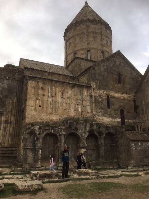
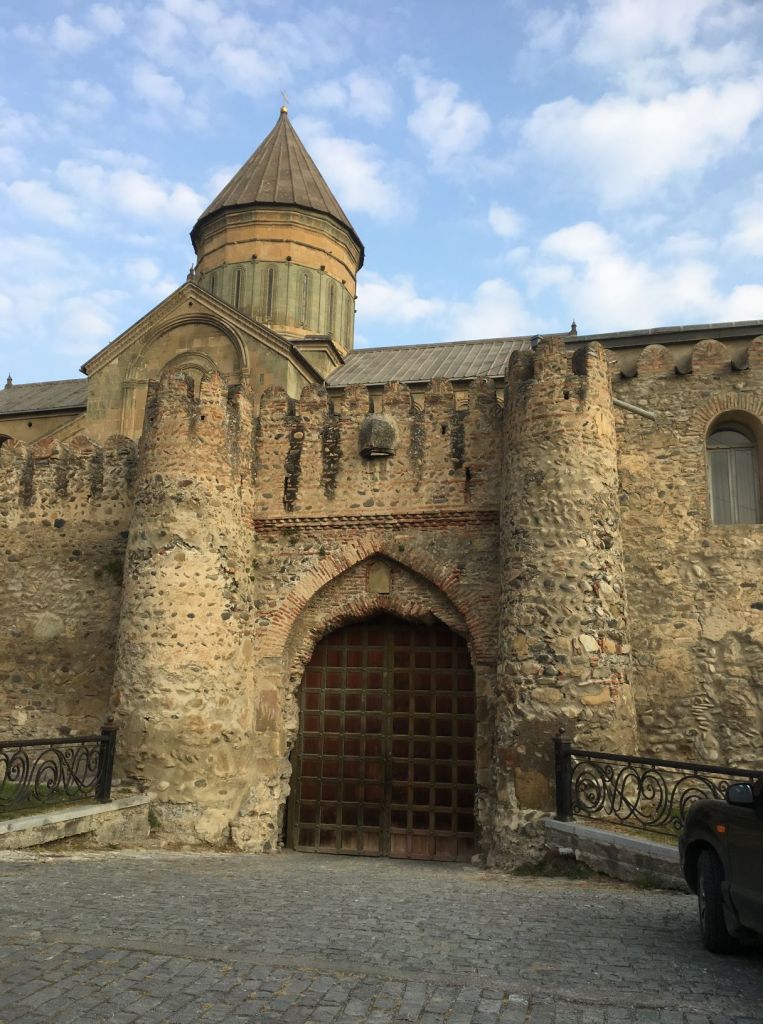
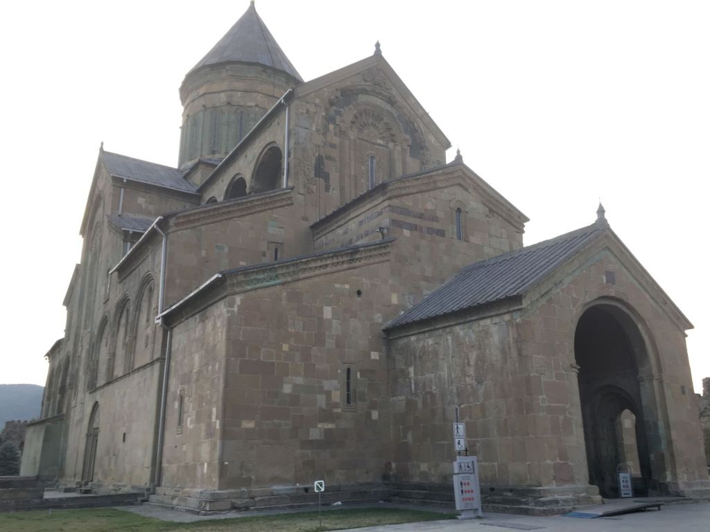
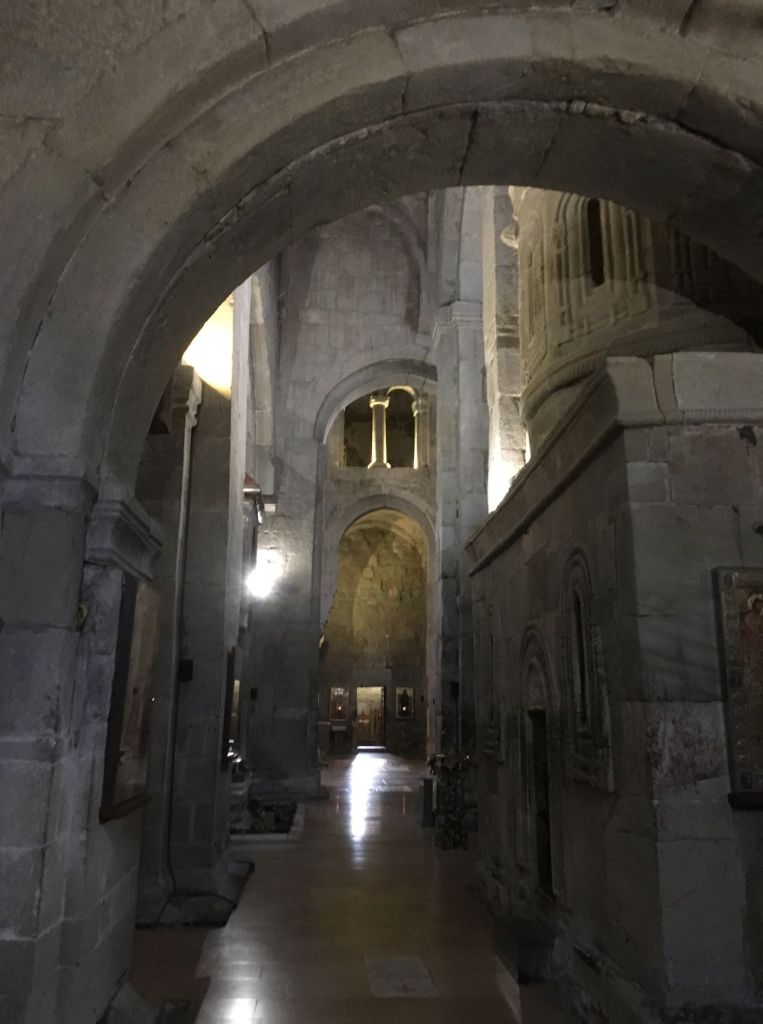
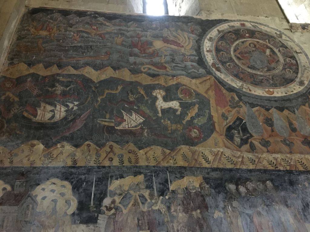
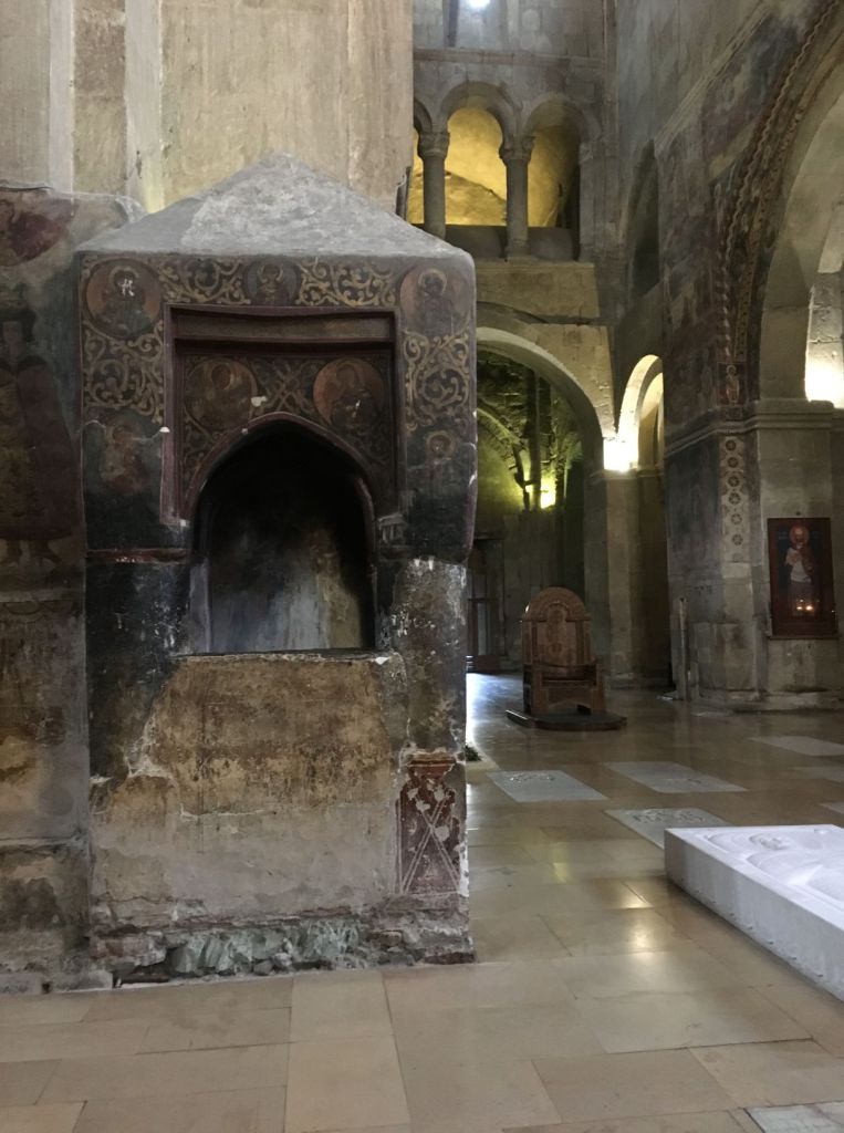
The campsite is in Mtscheta, some 20 km outside the centre of Tblisi. It is an ancient town. People have lived here for at least 3000 years. The town was the capital of the Iberia for some 1000 years up the 6th century. The whole town is one big monument with churches, forts and the magnificent Svetiskhoveli cathedral. The cathedral is surrounded by a wall and outside are rows and rows of souvenirs shops. This is a major tourist attraction, but also a site of pilgrimage for locals. There has been a church on this site since the 4th century! The current building was started in the 11th century, destroyed by Timur and rebuilt in the 15th century. Incorporated in what we can see today are parts of the earlier churches. It is a wonderful atmospheric building, the most beautiful Christian building we have seen on this trip!
Our camping spot is very closeby, near a restaurant. Against the background of the beautifully lit cathedral and an illuminated fort high up a hill across the river, we stand on the bank of a smelly side stream amongst hordes of stray dogs keeping us out of our sleep with their barking during the night. Surreal!
October 19
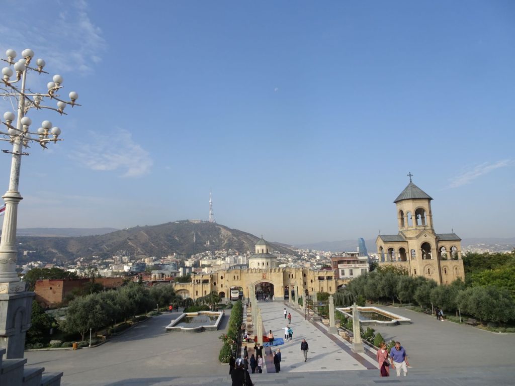
The day starts with an excursion to the enormous Tsminba Sameba Cathedral in Tbilisi city centre. This cathedral is newly built, opened in 2004, and financed entirely by donations! It is a huge space, built with beautiful natural stone, but it lacks the atmosphere of the beautiful older buildings we have seen. The most impressive are the bronze bells that hang in the separate bell tower. All cast in Germany with the biggest weighing several tons!
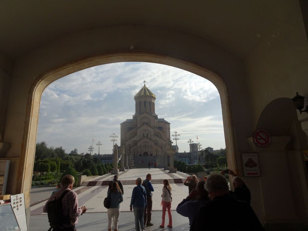
From the square of the cathedral, you have a magnificent view of Tbilisi city.
Just outside the cathedral, there is a wine shop ‘Wine Time’ with a large collection of wines. Here we are faced for the first time with the pride that Georgians have in someone who was born there and went on to become a major player in European history.
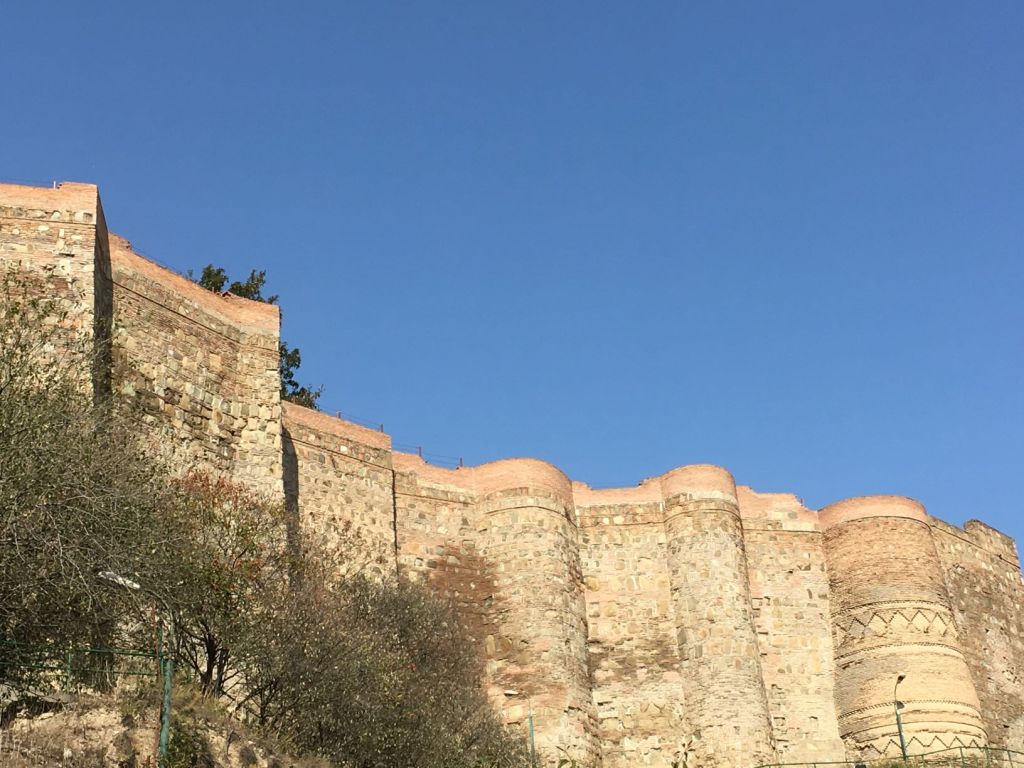
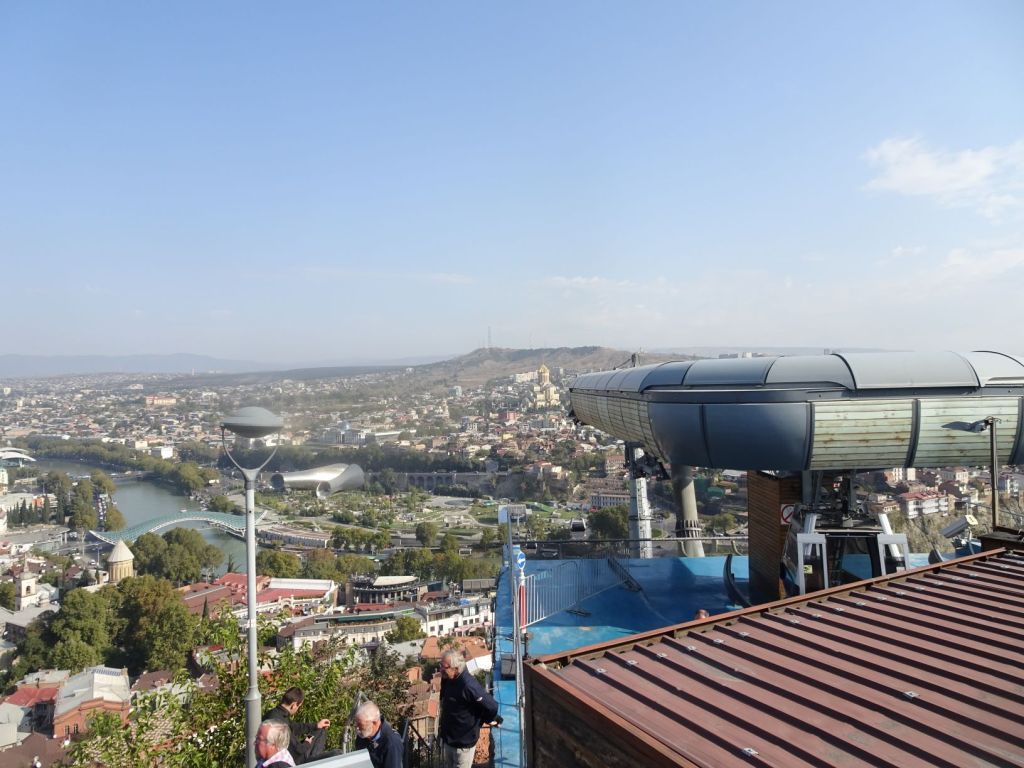
After our visit to the cathedral, we take a cable car from the centre of town to the hill side overlooking the town from the other side of the Kura river. The Narikala fort, the 4th century building that formed the start of the city, is right up the hill and has beautiful stone work.
In sharp contrast is the rather ugly steel statue of the Mother of Georgia nearby. It just exemplifies Tbilisi, a city of old and new and contrasts between modern, soviet style, early 20th century and ancient historic buildings. It is a wonderful place!
We then walk down the hill to visit the famous Tbilisi Bridge of Peace.
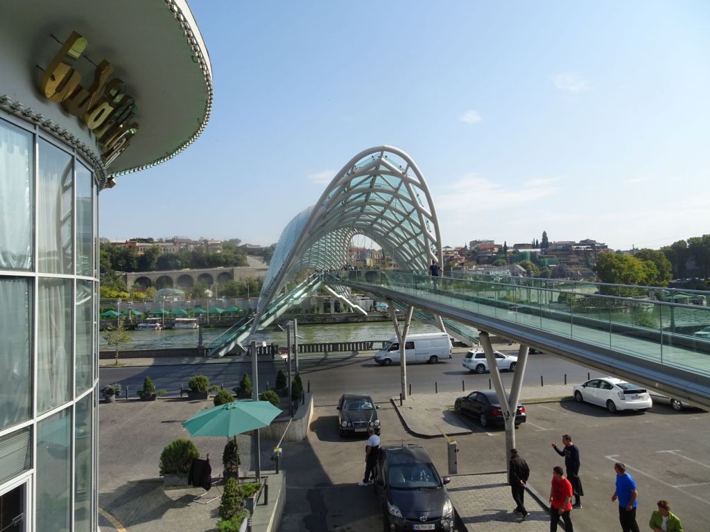
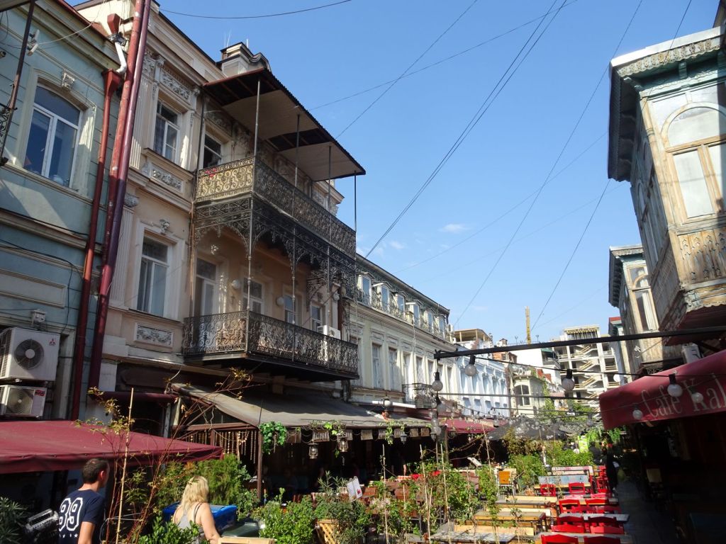
We walk through the old centre, the sulphuric baths that have given Tbilisi its name, past the only mosque in town, see the typical architecture with the hanging balconies, the small bazars, both underground and above ground, the shops selling all kinds of wares silkroad traders would have brought to town in the past (we can rehearse where the various types of carpets originate from) and the many, many wine shops.
We are dropped off for lunch in a typical Georgian restaurant and try out all kinds of hot and cold dishes and the famous wine made in big pots dug into the ground. We have free time now and decide to go back up the hill to see the arboretum in the botanical gardens. It is a truly beautiful nature safe haven high and dry above the busy city.
We take the cable car back to town and decide to buy some of these famous Georgian wines from a traditional wine merchant. He keeps his home made wine in massive vessels under his shop floor.
We buy some wine, but when we want to pay, disaster strikes; no wallet!. We cannot find our wallet anywhere and after some analysis we agree that Roelf must have left the wallet at the top station of the cable car. A frantic hunt to trace back our steps follows but it proves impossible to do a proper search because of the busy crowds in and around the cable cars.
We end up reporting the loss to the police, and find ourselves at the police station for many hours waiting for an interpreter to have a statement taken.
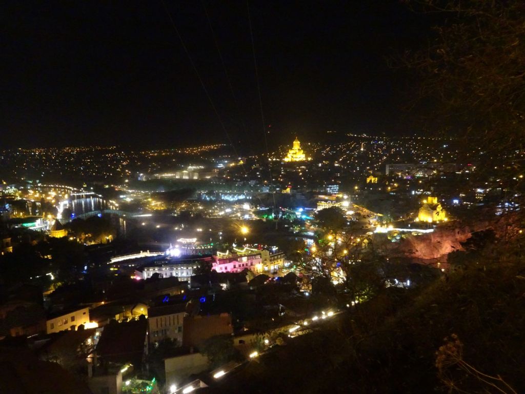
It is well and truly dark by the time we finish at the police station. The only positive point is that we get to see Tbilisi by night, quite a spectacle!
We take a taxi home to the campsite where we arrive at about 10 pm. The taxi driver has to return to the site because Roelf left his iPad on the backseat…
October 20
We decide to go back to Tbilisi to have another look for the wallet. Roelf is upset about the loss of his wallet, so upset that he leaves his iPad on the bench where we had lunch. Why did he have his iPad out? Of course because we were following the Brexit soap opera back home! We will call this a Brexit casualty.
Can you believe it; this time Roelf spends 5 hours in the same police station where he was yesterday; possibly the police keeps him waiting extra long so that he will not come back yet another time!
A terrible day; we go back to the campsite where we have a meal and much too much to drink in the adjacent restaurant. It is a strange experience; the smell of urine from the dirty site with the nicest cheese bread (Khachapuri; look up the recipe, truly wonderful!) we have ever tasted, and lots and lots of red wine.
October 21st
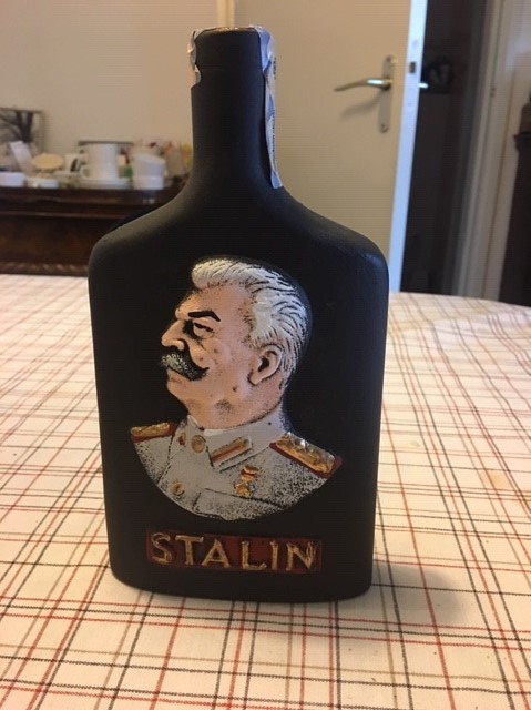
We are on the road north again. We pass the city of Gori where Joseph Stalin was born and decide to visit the Stalin museum. We are lead round by a young woman in leather suit, short black hair and bright red lipstick. In a monotone voice, she rattles off the achievements of Stalin without mentioning any of the deportations to Siberia or the famines that raged under his leadership. We go through the massive building, one gloomy room after the other. The visitors are visibly intimidated and one utters that it is the most depressing place he has ever been to.
One of our group gets embroiled in a discussion with the museum staff: he wants two thirds of his entrance fee returned because only one third of the true history was told! A gallant effort but he fails. The young guide gets the blame: ‘she has only been here for a short while’. Just imagine what the tour will be like once she has been there longer.
A highlight of the museum is parked outside behind the building; the train wagon used by Stalin to travel through the Soviet Union during WWII.

After our visit to this place of worship for Joseph Stalin, we stack up on some Georgian wine. Wine tasting is not our strong suit, and we take at least 20 sips each before we know what we want to buy; and even then we are not really sure. Anyway, we will find out when we get home.
North of Gori, the countryside becomes hilly and very beautiful. There are buildings in the strangest of places. We take a wrong turn by mistake but we are grateful as it leads of past the most glorious landscapes. The hills are only some 600-800 metres high but the autumn woodland and agricultural land in this glowing landscape glistens in the sunlight.
As the beauty of the landscape goes up, the quality of the roads goes down.
Miep is so focussed on avoiding the potholes that she takes her eye off the water thermometer and we end up with a steam engine instead of a diesel engine. The car needs some ten litres of water which constitutes the worst overheating since we had a 12 litre replacement in the mountains of Kyrgyzstan.
Our final destination for the day is the Bagrati Cathedral in Kutasi. The cathedral is on a hill top in the middle of town. The Mog climbs reluctantly through the narrow streets in fading daylight. When we eventually reach the camping place, we are welcomed by a gang of barking stray dogs, wandering over the parking lot. The ‘facilities’ for the visitors of the cathedral are closed. We just go to bed immediately after arrival and try to forget as to where we are. We won’t have time to visit Kutasi and we will remember the glorious countryside surrounding it instead.
October 22
We don’t know how to get away from this place quickly enough. The dogs have been barking all night and (unusually) continue to bark after the sun comes up. Everyone in the group seems nervous and itching to get away. Any future TME trip should seriously consider the overnight parking places and try to locate them in more quiet places outside the city centres.
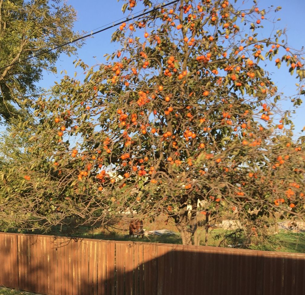
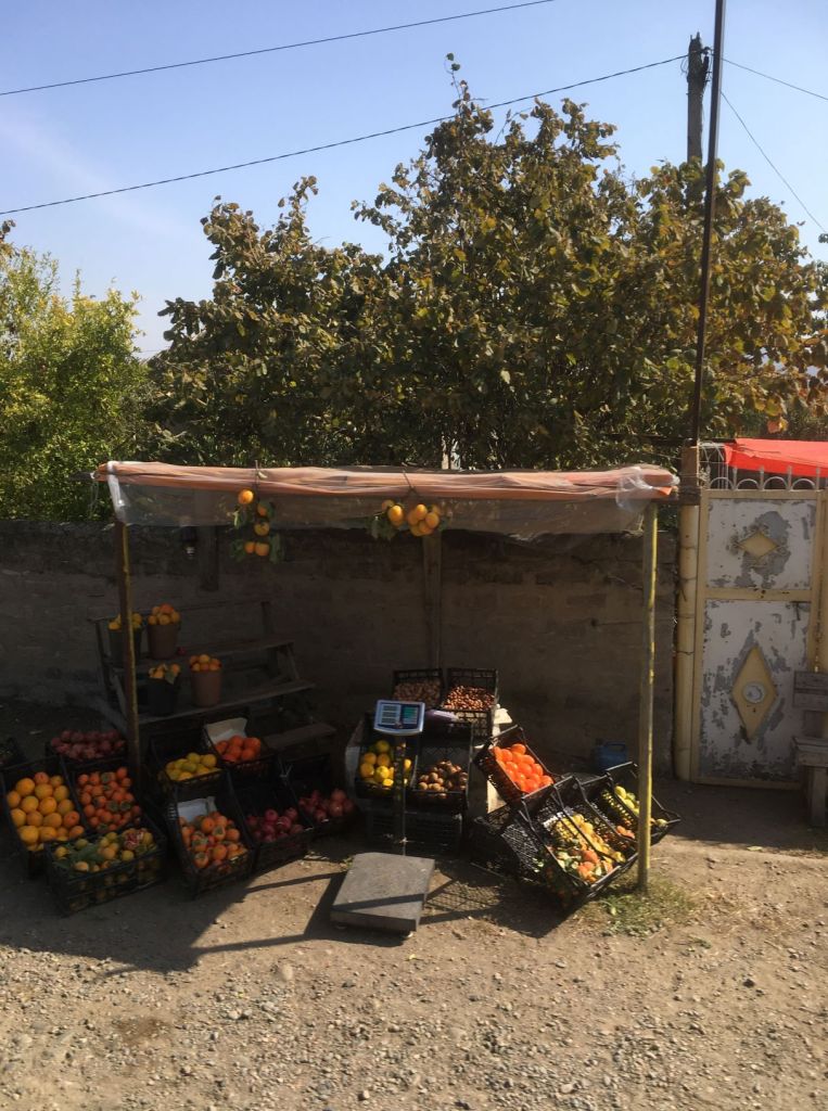
Anyway, the whether is good and we have a rather uneventful journey to the border with Turkey. The landscape is dominated by fruit trees. They stand out full of orange fruit against the blue sky. Every house has his own orchard and people sell the fruit literally by the bucket load on the road side.
We reach the border on the Black Sea coast at the agreed time of one pm. A near miss as we had another overheated engine right in the busy centre of Batumi where we were surrounded by police and interested bystanders in no time while blocking a lane. Not the best place to get the water out, the bonnet off and praying that the engine will start after refilling the radiator.
But we make it. We got some idea of the beauty of Georgia with its savannahs, mountains, and seaside, but we have not been here long enough to fully comprehend it and our visit was overshadowed a bit by the loss of wallet and iPad.