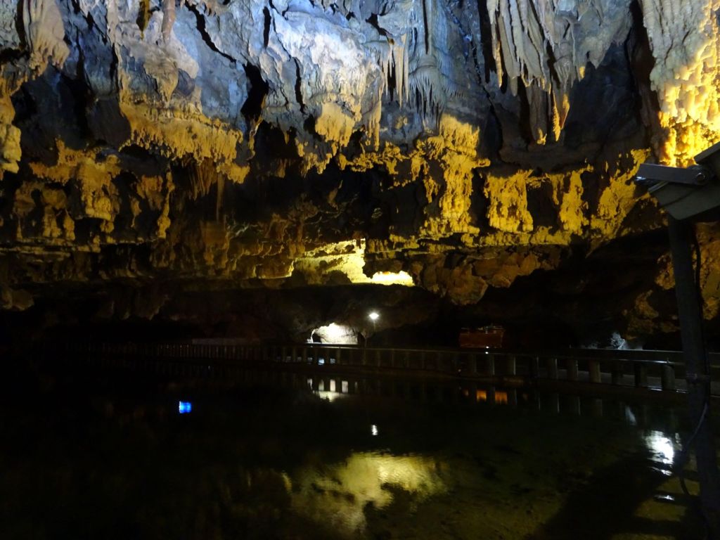
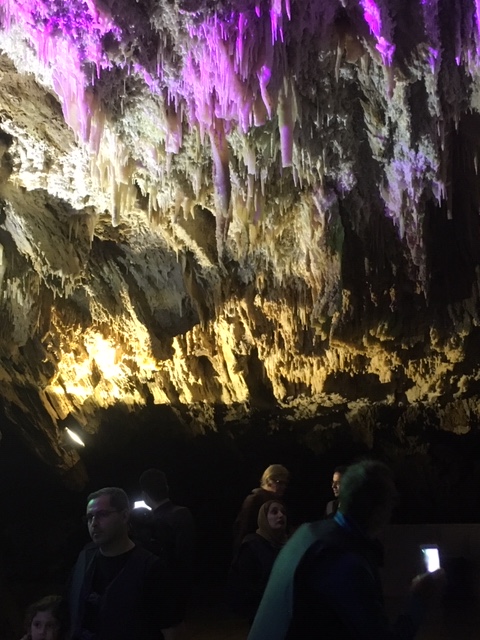
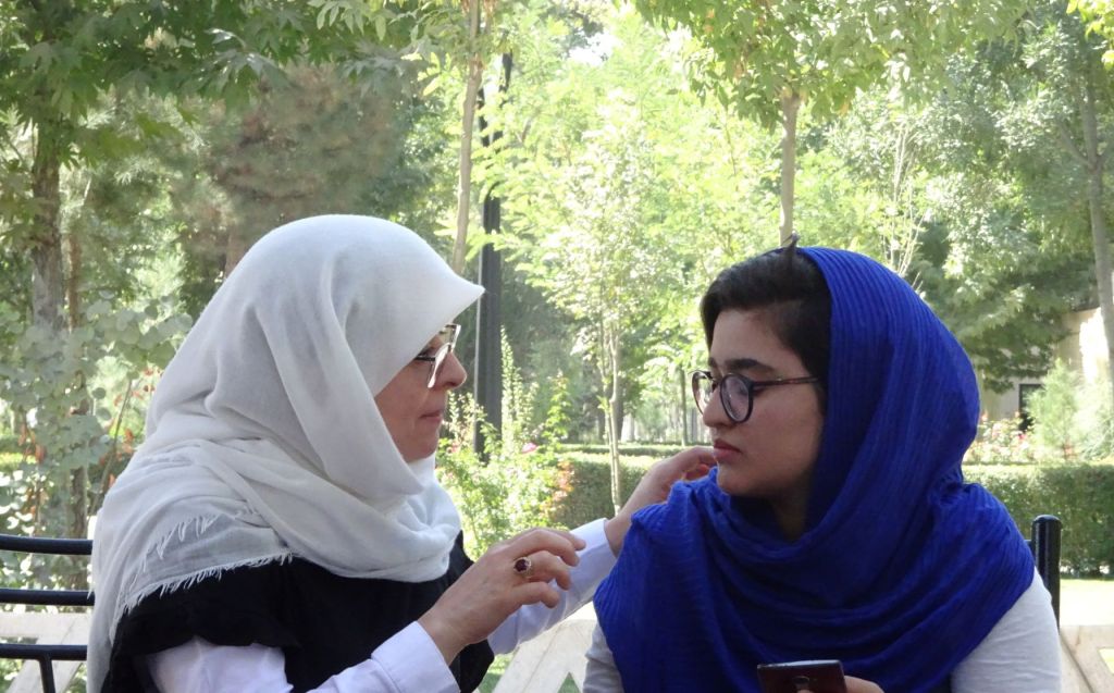
Turkey

October 22

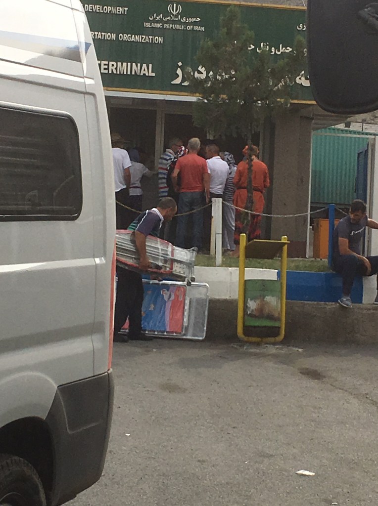
The border crossing between Georgia and Turkey is relatively uneventful. We are the only team in the group that do not have Turkey as part of our standard car insurance cover and are taken aback at the amount of money we have to pay to get temporary insurance for 30 days (168 Euros).

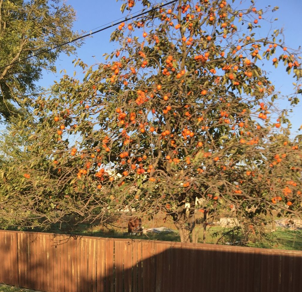
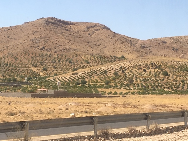
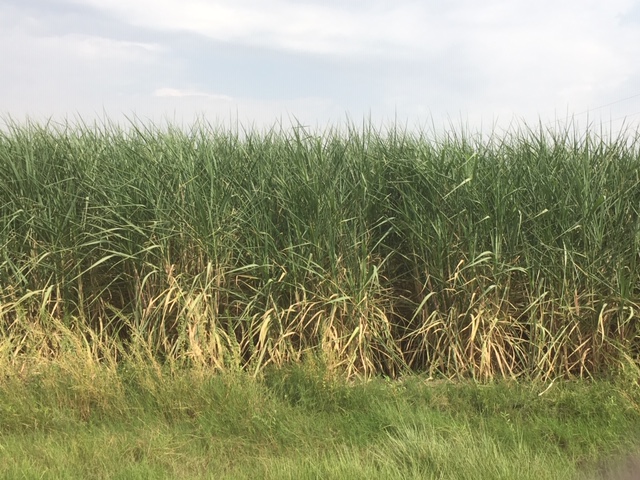
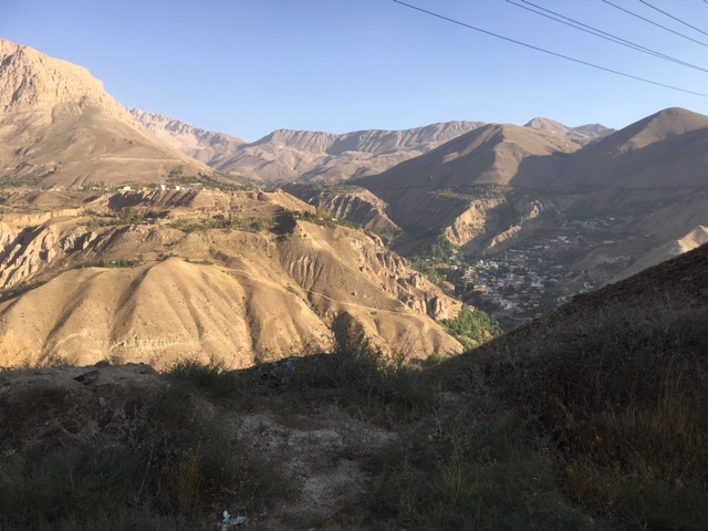
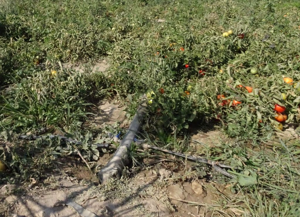
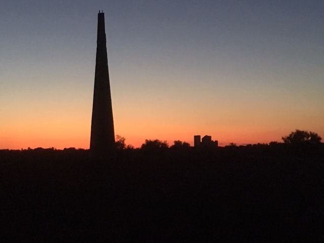
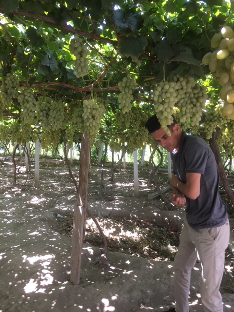
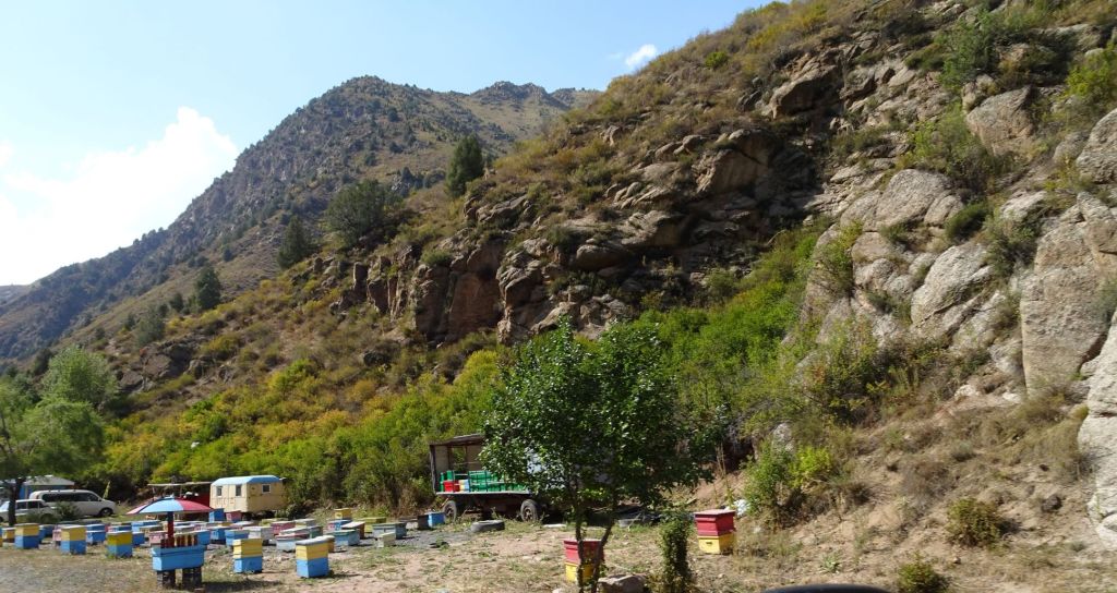
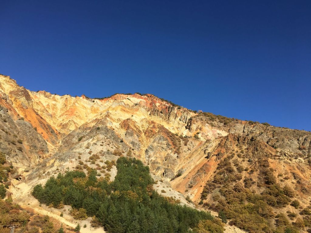
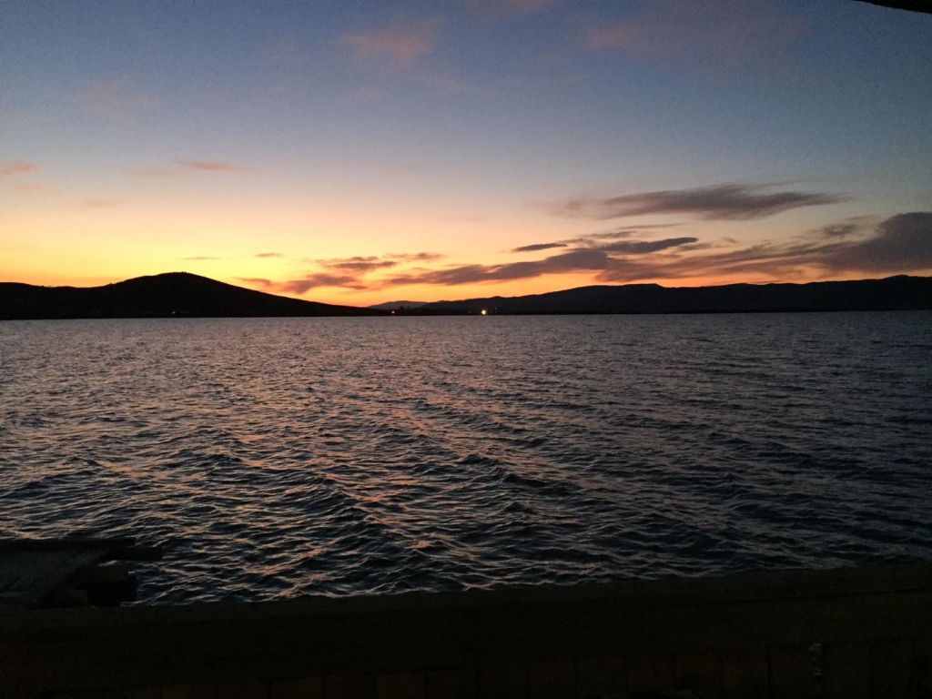
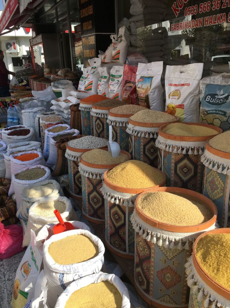
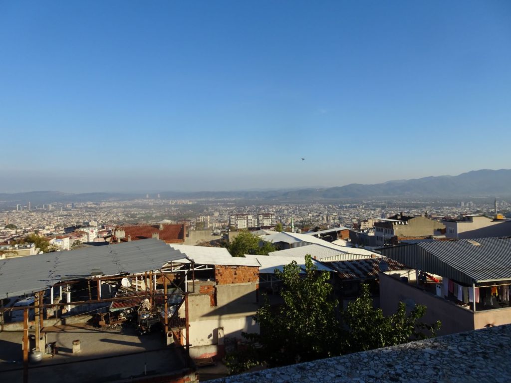
The destination is Trabzon where the last communal stop of our group is at a large hotel; on the parking lot of course. The first we notice along the coastal road are major tea plantations on the hill side. Tea is big business in North Eastern Turkey; there are stalls along the road stacked with all sorts of tea. We stop along the way to buy some.

When we arrive at our destination, it is getting dark. We clean up in the fitness centre of the hotel. For the evening, TME has organised dinner with good food and lots of wine where each team presents their highlights of our 96 day journey together. We have lots of fun; a fitting farewell…

October 23

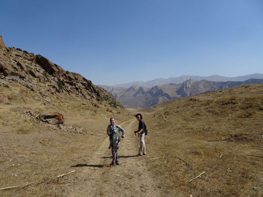
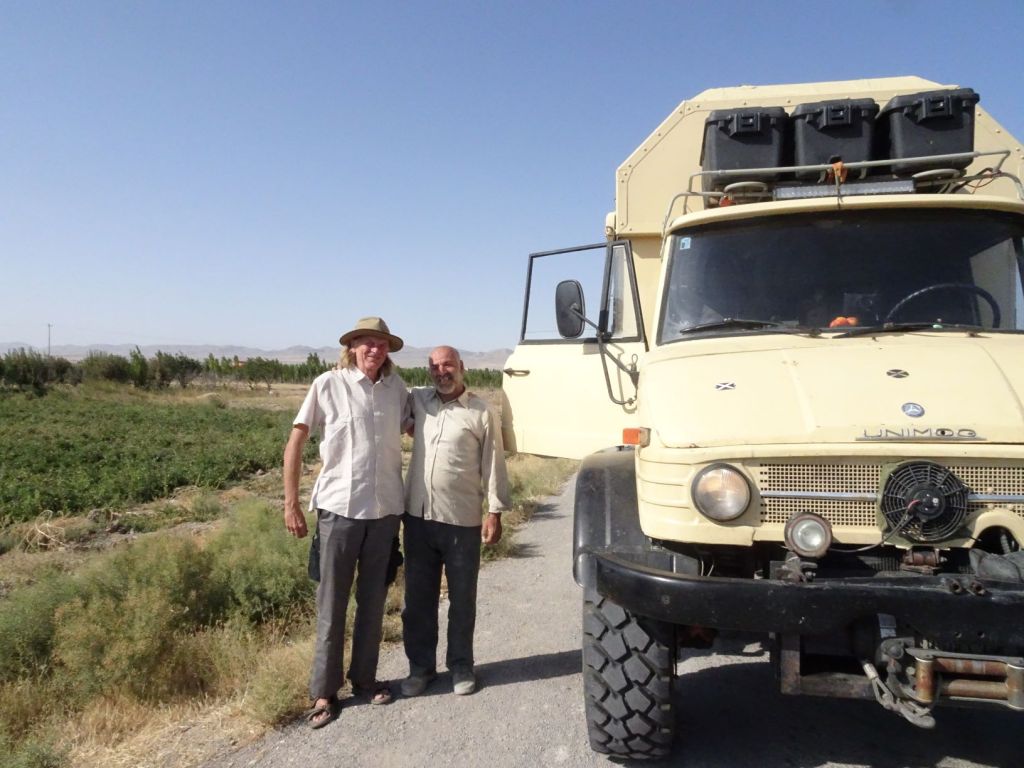
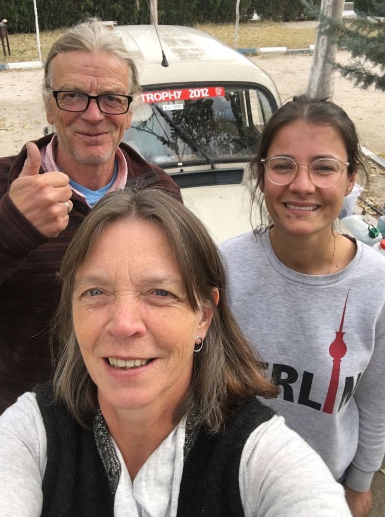
We say goodbye to the other teams, and embark on our journey through Turkey on our own schedule. Here is a bit about the country’s history which was largely unknown to us before we arrived here.

What is the history of these lands?

For times predating the Ottoman period, a distinction must be made between the history of the Turkish peoples, and the history of the territories now forming the Republic of Turkey, essentially the histories of ancient Anatolia and Trace.

From the time when parts of what is now Turkey was conquered by Turks, the history of Turkey spans the medieval history of the Seljuk Empire, the medieval to modern history of the Ottoman Empire, and the history of the Republic of Turkey since the 1920s.

The earliest organised state in the area which is now Turkey, was the Hittite Empire.

The Hittites were Anatolians who established an empire in north-central Anatolia around 1600 BC. This empire reached its height during the mid-14th century BC, when it included most of Anatolia as well as parts of the northern Levant and Upper Mesopotamia.

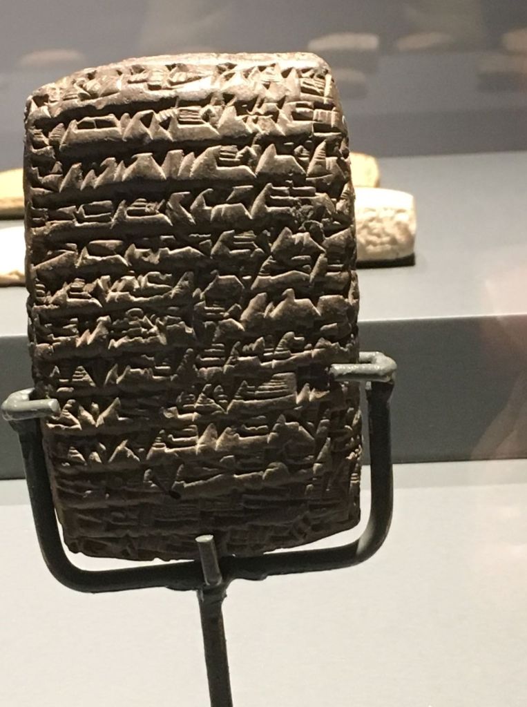
The Hittites had a very well developed administrative state using a particular cuneiform script for their bureaucracy. They were also considered masters in bronze and iron smelting, amongst the first peoples to use these advanced technologies.

After c. 1180 BC, the Hittites splintered into several independent city-states, some of which survived until the 8th century BC before succumbing to the Assyrian Empire.

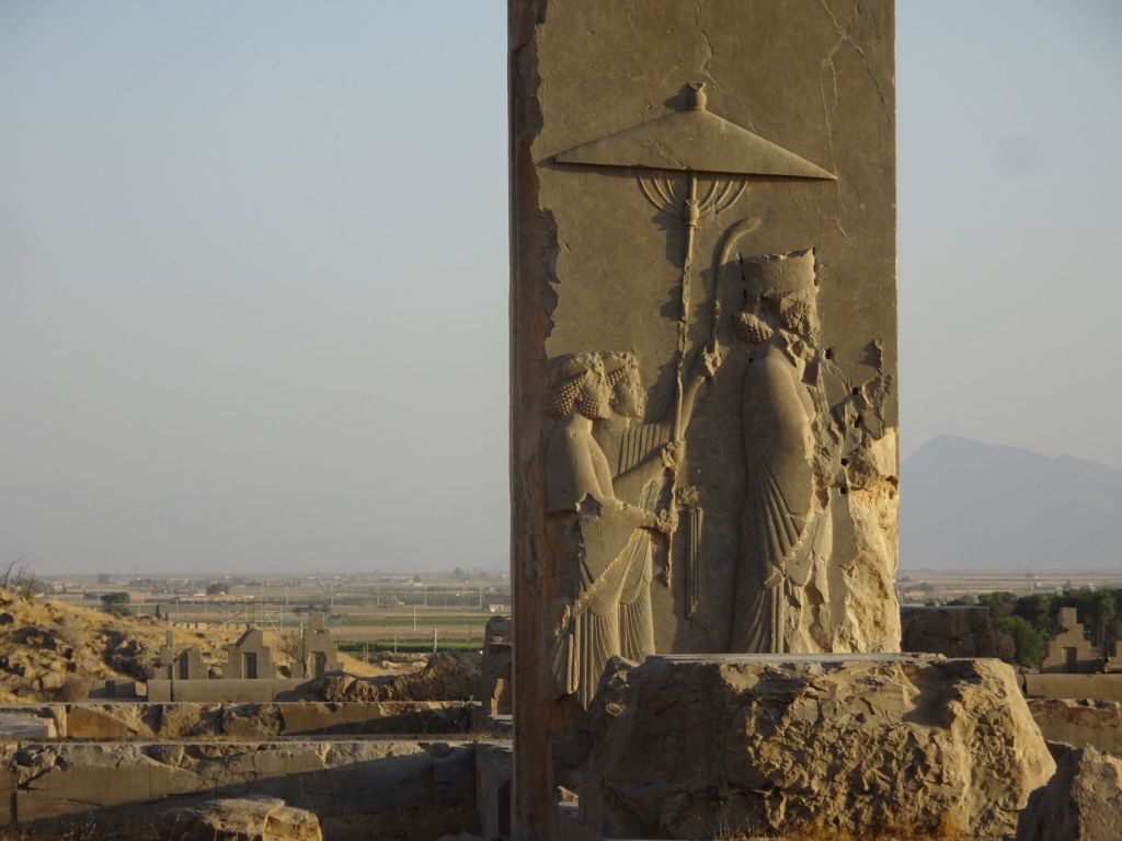
After the fall of the Hittites, the new states of Phrygia and Lydia stood strong on the western coast as Greek civilization began to flourish. They, and all the rest of Anatolia were relatively soon after incorporated into the Achaemenid Persian Empire.

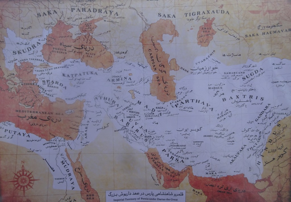
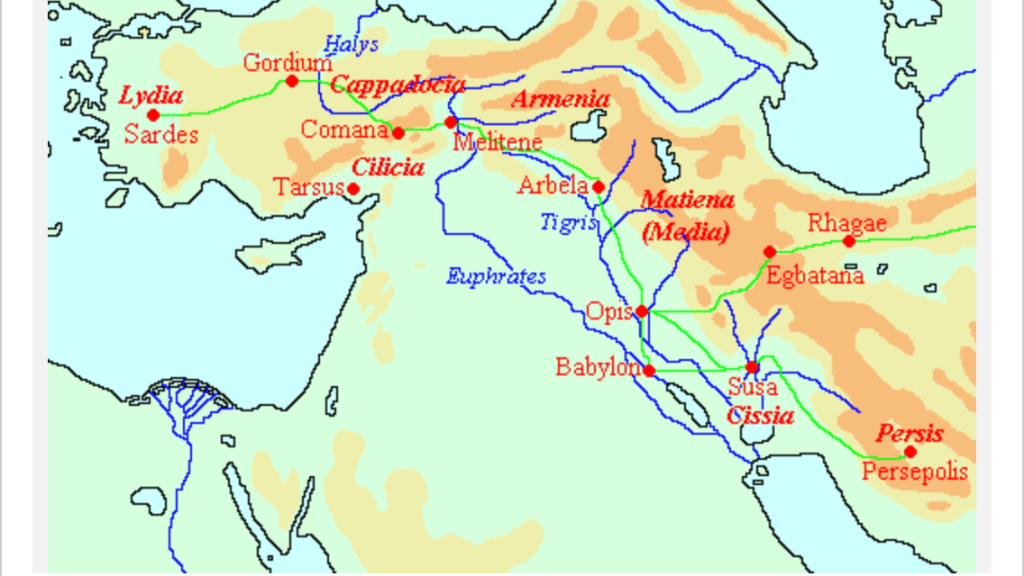
As Persia grew in strength, their system of local government in Anatolia allowed many port cities to grow and to become wealthy. Anatolia got divided into various satrapies, ruled by satraps (governors) appointed by the central Persian rulers. Some of the satraps revolted periodically but did not pose a serious threat. In the 5th century BC, Darius built the Royal Road, which linked the principal city of Susa in what is now western Iran, with the west Anatolian city of Sardis, close to the Mediterranean.

Alexander the Great finally wrested control of the region from Persia in successive battles, proving victorious over the Persian Darius III. After Alexander’s death, his conquests were split amongst several of his trusted generals, and Anatolia became part of the Seleucid Empire. The Empire became involved with wars with Rome which saw the loss of Anatolia to the Romans in 188 BC.

Roman control of Anatolia was strengthened by a ‘hands off’ approach by Rome, allowing local control to govern effectively and providing military protection.

West of Anatolia; a group of Indo-European tribes, the Thracians inhabited a large area in Central and Southeastern Europe. They were bordered by the Scythians to the north, the Celts to the west, the Ancient Greeks to the south and the Black Sea to the east.

All of Thrace, and the native Thracian peoples were conquered by Darius the Great in the late 6th century BC, but the area regained independence after the Persian defeat in Greece.

By the 5th century BC, the Thracian presence was pervasive enough to have made Herodotus call them the second-most numerous people in the part of the world known by him (after the Indians), and potentially the most powerful, if not for their lack of unity. The Thracians in classical times were broken up into a large number of groups and tribes.

Like Anatolia, Trace was overrun by Alexander the Great in the fourth century BC, and became part of the Seleucid Empire after his death. The Romans then took control in the second century BC.

In the early 4th century, Constantine the Great established a new administrative centre at Constantinople, and by the end of the 4th century AD the Roman empire split into two parts, the Eastern part became the Byzantine Empire named after the original name for Constantinople, Byzantium which had been founded by Greek colonists in 657 BC.

The Byzantine Empire ruled most of the territory of what is today Turkey until the mid fifteenth century while the other remaining territory remained in Sassanid Persian hands.

Neither the early Anatolian people, nor the Thracians were of Turkish origin. The first Turkic people lived in an area extending from Central Asia to Siberia. They were recognised as a separate ethnic group from the 6th century BC onwards. They are mentioned in a Chinese text relating to trade of Turk tribes with the Sogdians along the Silk Road.

The Hun hordes of Atilla, who invaded and conquered much of Europe in the 5th century, may have been Turkic; some scholars argue that the Huns were one of the earlier Turkic tribes, while others argue that they were of Mongolian origin.

In the 6th century, the leadership of the Turkic peoples was taken over by the Göktürks. From 552 to 745, Göktürk leadership united the nomadic Turkic tribes into a Turkic Empire. The name derives from gok, “blue” or “celestial”. The Göktürks were the first Turkic people to write in a runic script, the Orkhon script. The Khanate was also the first state known as “Turk”. The Göktürks eventually collapsed due to a series of dynastic conflicts, but the name “Turk” was later taken by many states and peoples.

Turkic peoples and related groups migrated west from Turkestan and Mongolia towards Eastern Europe, the Iranian plateau, and modern Turkey.

From their homelands near the Aral sea, the Seljuk Turkmen advanced first into Khorasan and then into mainland Persia before eventually conquering eastern Anatolia. They created a large medieval empire that from 1037 until 1194 controlled an area stretching from the Hindu Kush to eastern Anatolia and from Central Asia to the Persian Gulf.

The Sunni Seljuks played a key role in the crusades. Highly Persianised in culture and language, they exported Persian culture to Anatolia.

The Empire declined under the pressure of the emerging Georgian and Cilician empires in the late 12th and early 13th centuries, until the whole region was overrun by the Mongols in the 1260s. After the division of the Mongol Empire the area became part of the Golden Horde.

Another kingdom developed in 1326 with its capital in Bursa. The Ottoman’s first capital was replaced by Edirne after it was conquered in 1361. The empire expanded to Europe and Anatolia, and in 1453, the Ottomans sealed the fate of the Byzantine Empire by capturing its capital, Constantinople.

Constantinople was made the capital city of the Empire replacing Edirne. The Ottoman Empire would continue to expand into the Eastern Anatolia, Central Europe, the Caucasus, North and East Africa, the islands in the Mediterranean, Greater Syria, Mesopotamia, and the Arabian peninsula in the 15th, 16th and 17th centuries.

The Treaty of Karlowitz in 1699 marked the beginning of Ottoman territorial retreat; some territories were lost by the treaty: Austria received all of Hungary and Transylvania except the Banat; Venice obtained most of Dalmatia along with the Morea (the Peloponnesus peninsula in southern Greece); Poland recovered territories in the Ukraine.

Throughout the 19th and early 20th centuries, the Ottoman Empire continued losing territories, including Greece, Algeria, Tunisia, Libya, and finally the Balkans in the 1912–1913 Balkan Wars.

The Ottoman Empire entered WWI (1914–1918) on the side of the Central Powers and was ultimately defeated. During the war, major atrocities were committed such as genocide, mass murder and death marches intentionally denying food and water to the deportees by the Ottoman government against the Armenians, Assyrians, and Pontic Greeks causing millions of deaths mainly during the Armenian Genocide of 1915.

On October 30 1918, the Armistice of Mudros was signed, followed by the imposition of the Treaty of Sevres on August 10 1920. This treaty would have broken up the Ottoman Empire and force large concessions on territories of the Empire in favour of Greece, Italy, Britain and France.

The occupation of the country by the Allies in the aftermath of World War I prompted the establishment of the Turkish national movement. Under the leadership of Mustafa Kemal, a military commander who had distinguished himself during the battle of Gallipoli in WWI, the Turkish War of Independence was waged with the aim of revoking the terms of the Treaty of Sèvres.

By September 18 1922, the occupying armies were expelled. On November 1 the Sultanate was abolished, thus ending 623 years of Ottoman rule. The new Republic of Turkey was recognised internationally and officially proclaimed on October 29 1923. July 24 1923. A secular republic was founded. The fez was abolished, full political rights for women were established, and a new writing system for Turkish based upon the Latin alphabet was created.

The Turkish parliament presented Mustafa Kemal with the honorific surname “Atatürk” (Father of the Turks) in 1934.

Mustafa Kemal Ataturk (1881 – 1938)

The single party period was followed by a multiparty democracy after 1945. The Turkish democracy remained unstable with military coups in 1960, 1971, and 1980.

In 2002, the Justice and Development Party (AKP) under the leadership of Recep Tayyip Erdogan won the national elections and had two further victories in 2007 and 2015. There was another military coup in 2016 which failed and lead to major purges and restrictions in relation to press freedom.

But now back to our journey………

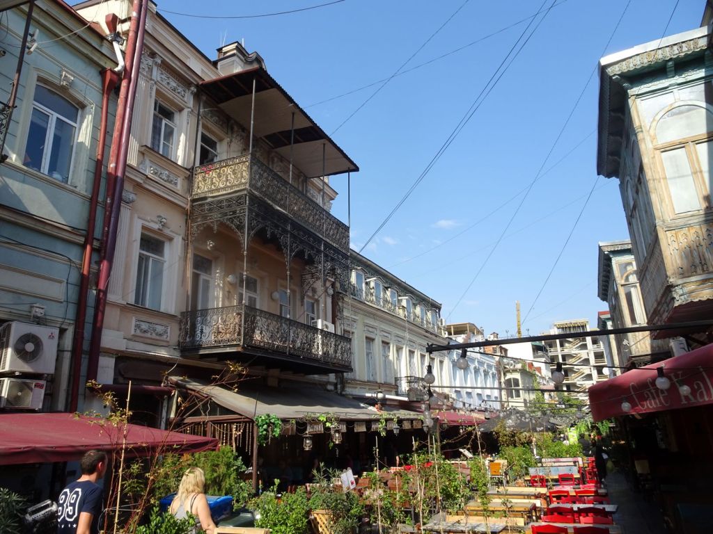
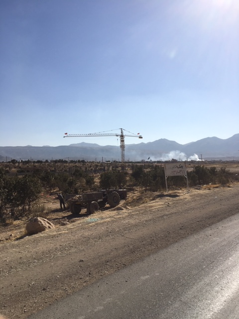
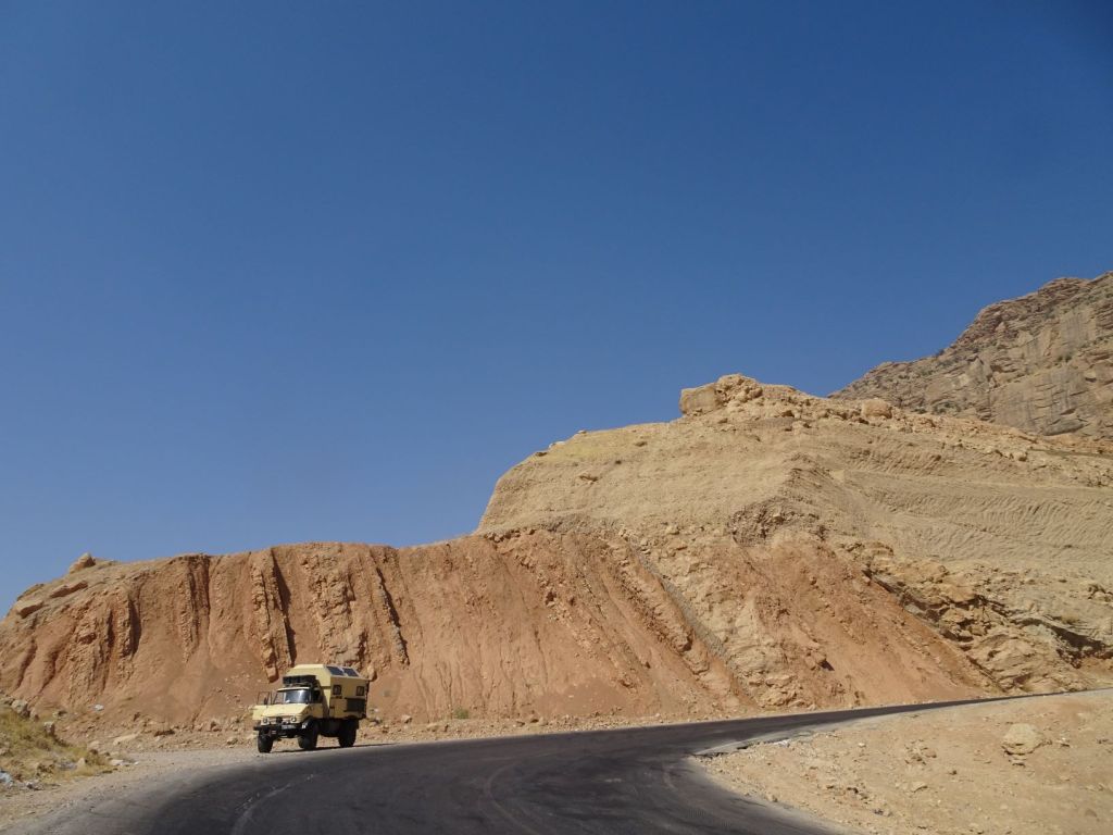
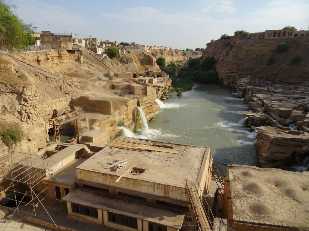
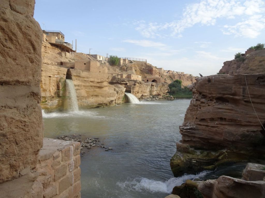
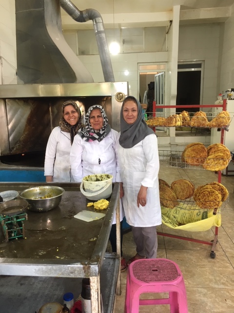
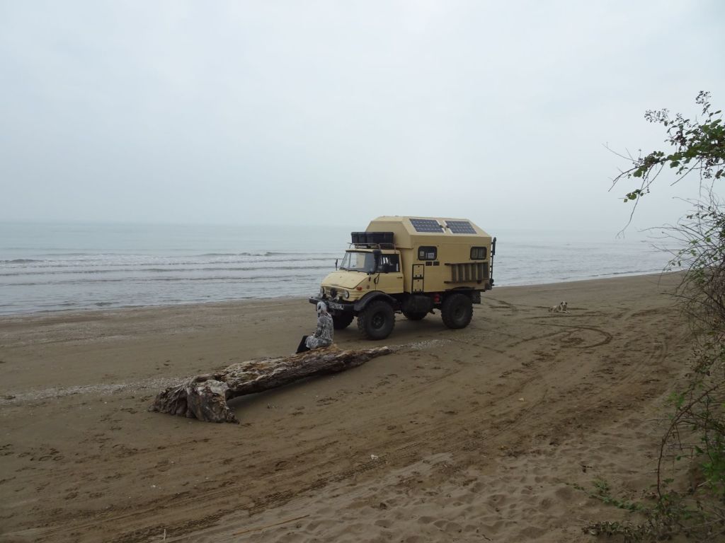
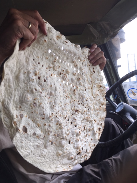
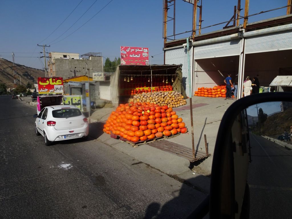
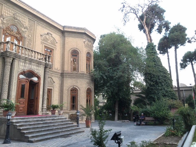
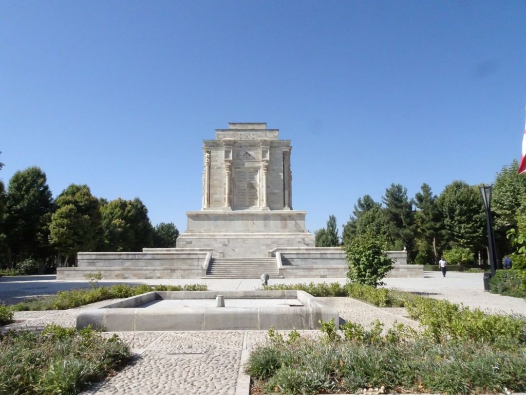
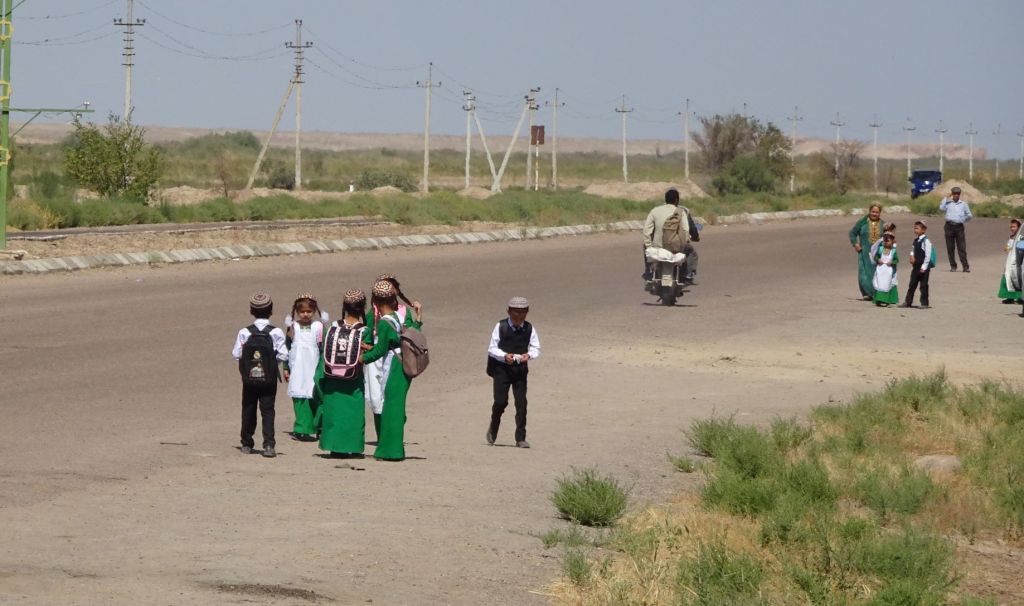
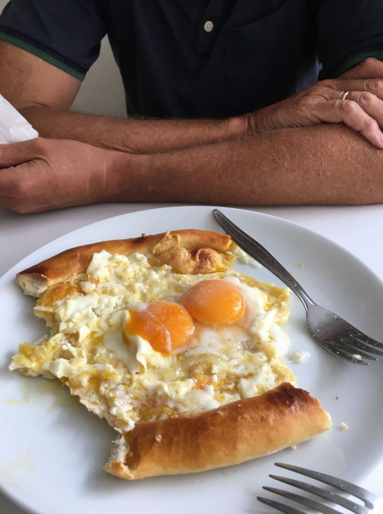
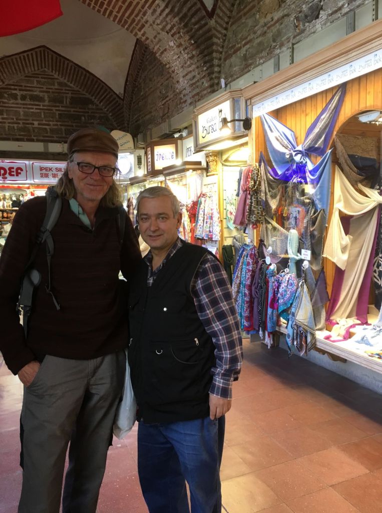
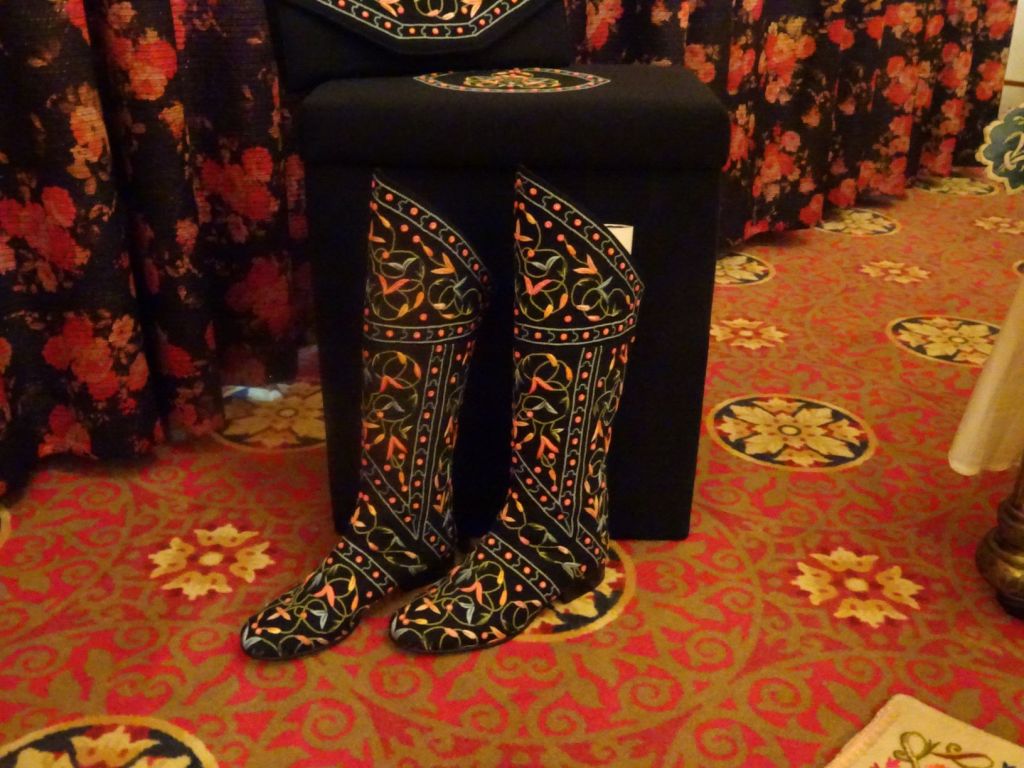
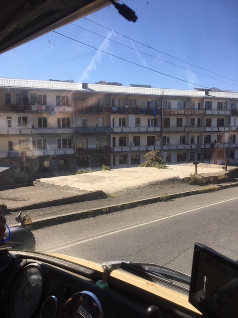
After saying our goodbyes to the other group members, we spend some time in Trabzon. This coastal tourist resort is in total upheaval; large multi-story apartments are rising up everywhere, there are road works to improve the main coastal road that runs right through the city and the old inner city is demolished. At the moment, it is a miserable place. There are few people on the street and we wonder how older people can even navigate the broken up roads. Only the tea houses are full (of men). We go into one and have our first cheese and egg ‘pide’, which is a speciality of Eastern Turkey and this makes up for the dreariness: delicious!

Very tasty and very nutritious, but not as good as the Khachapuri we had in Georgia!.

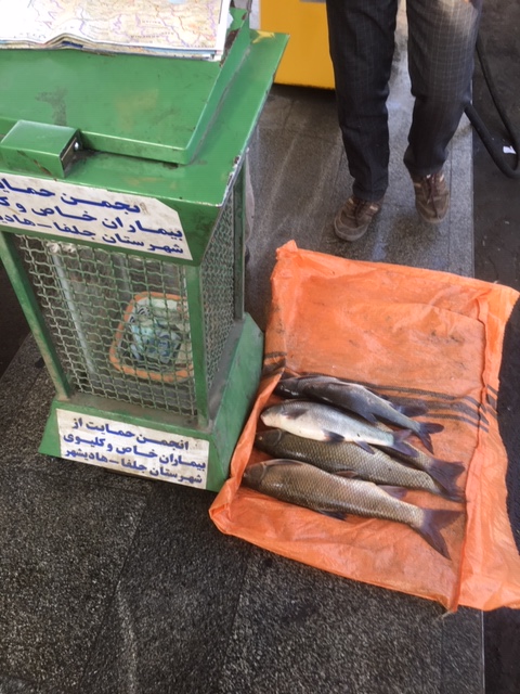
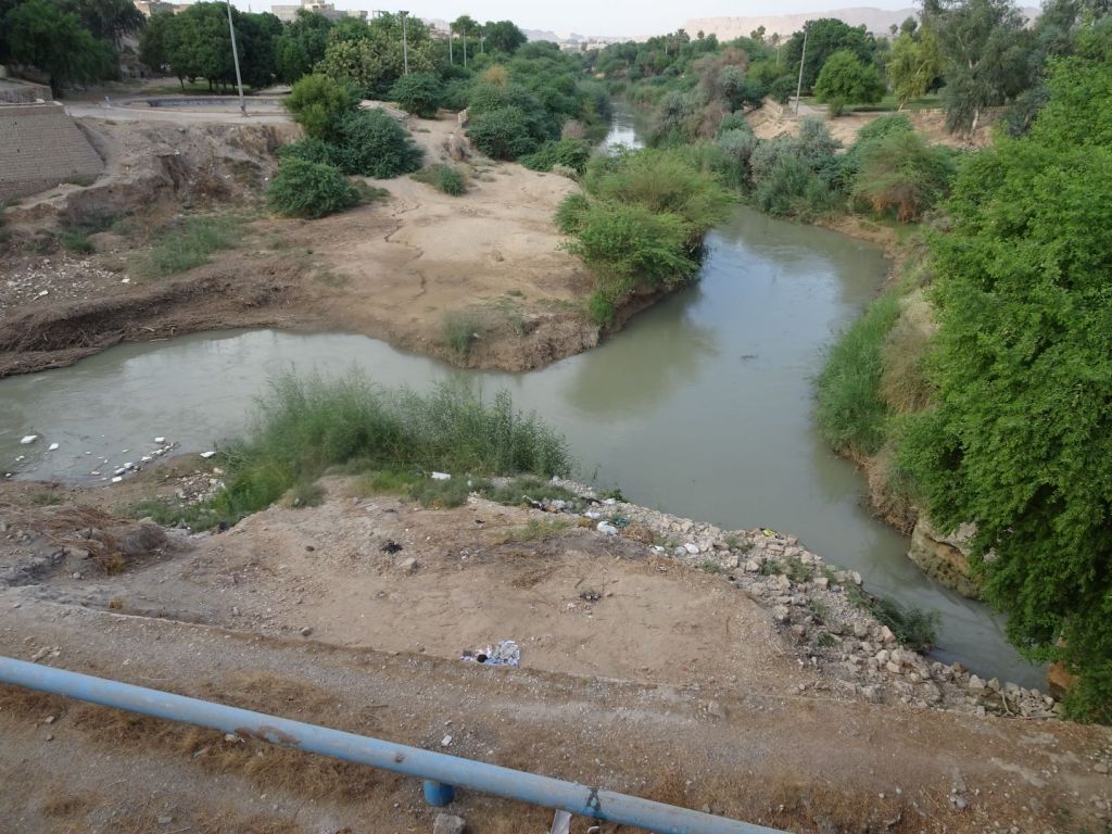
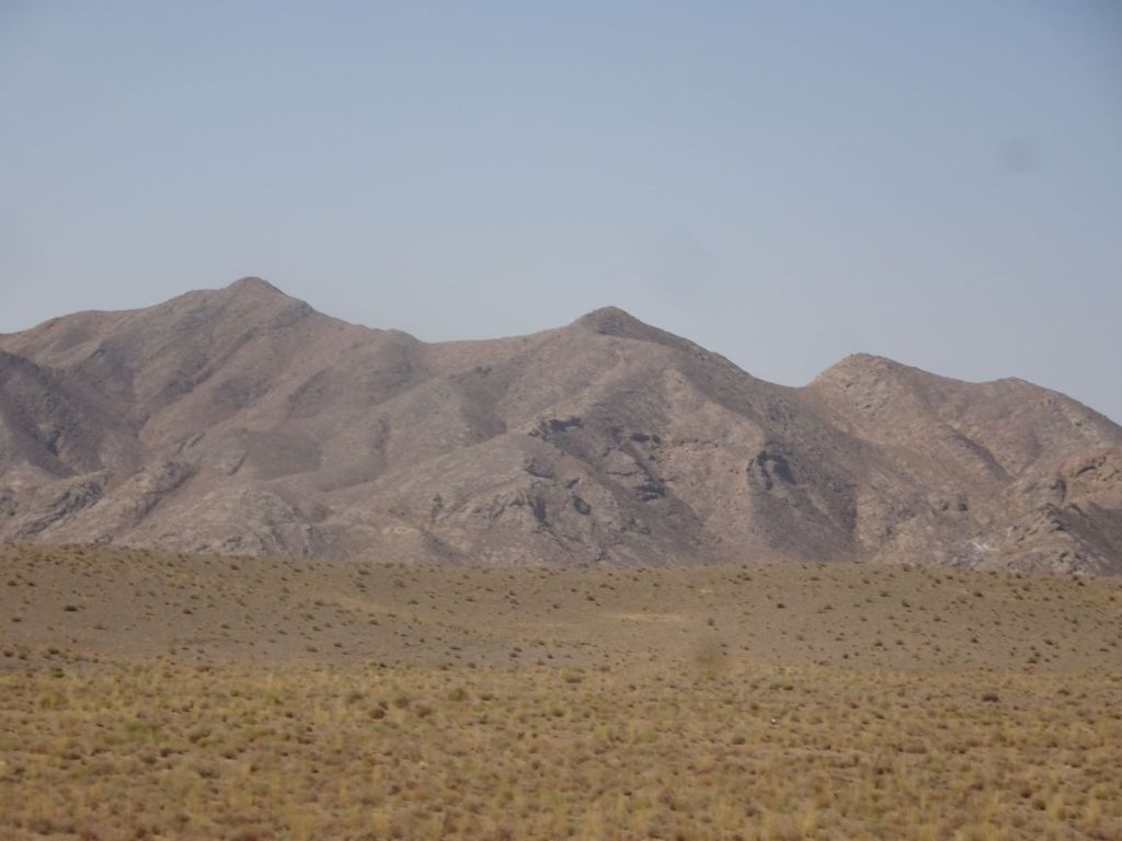
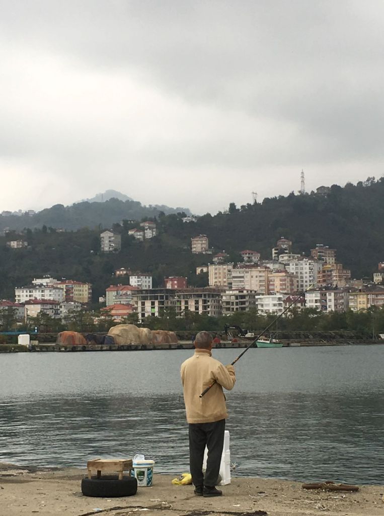
We leave Trabzon, and drive along the coast of the Black Sea. The weather is rather gloomy. We have a stop to try some fishing in a harbour but find out that although there are a lot of fishermen there, the catches are minimal. The fishermen keep some very small fish that in the North-Atlantic we would throw back because they are undersized.

Not worth it really…

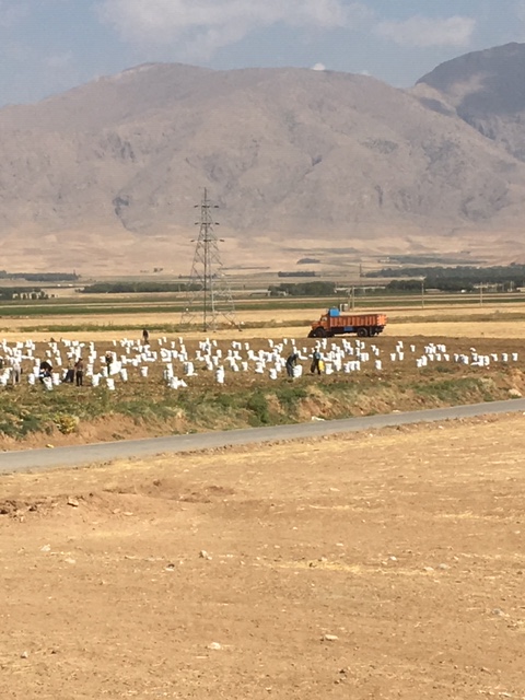
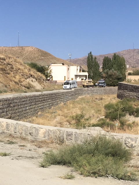
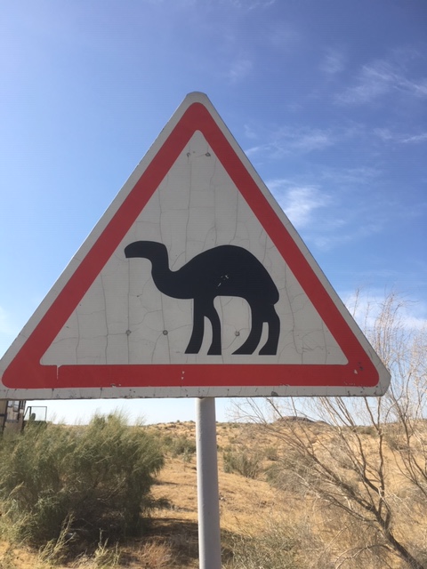
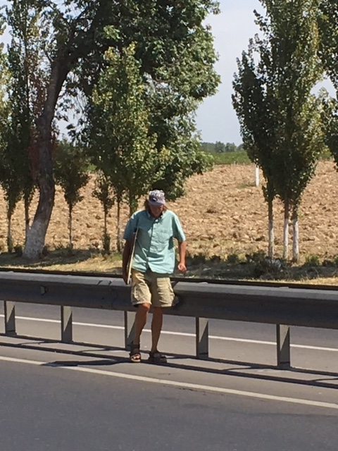
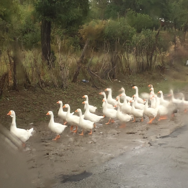
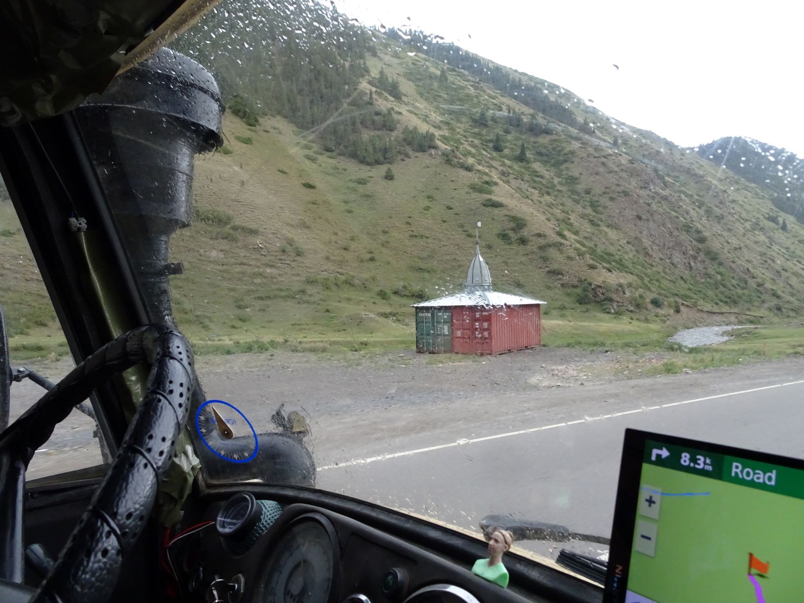
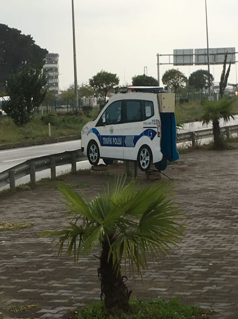
Travelling on, we come across the same deterrent we came across in Russia and the Stans, very realistic from a distance:

At night they have their warning lights on!

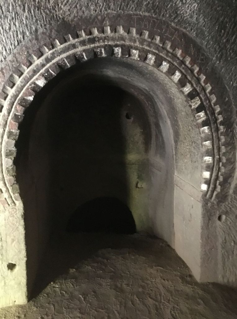
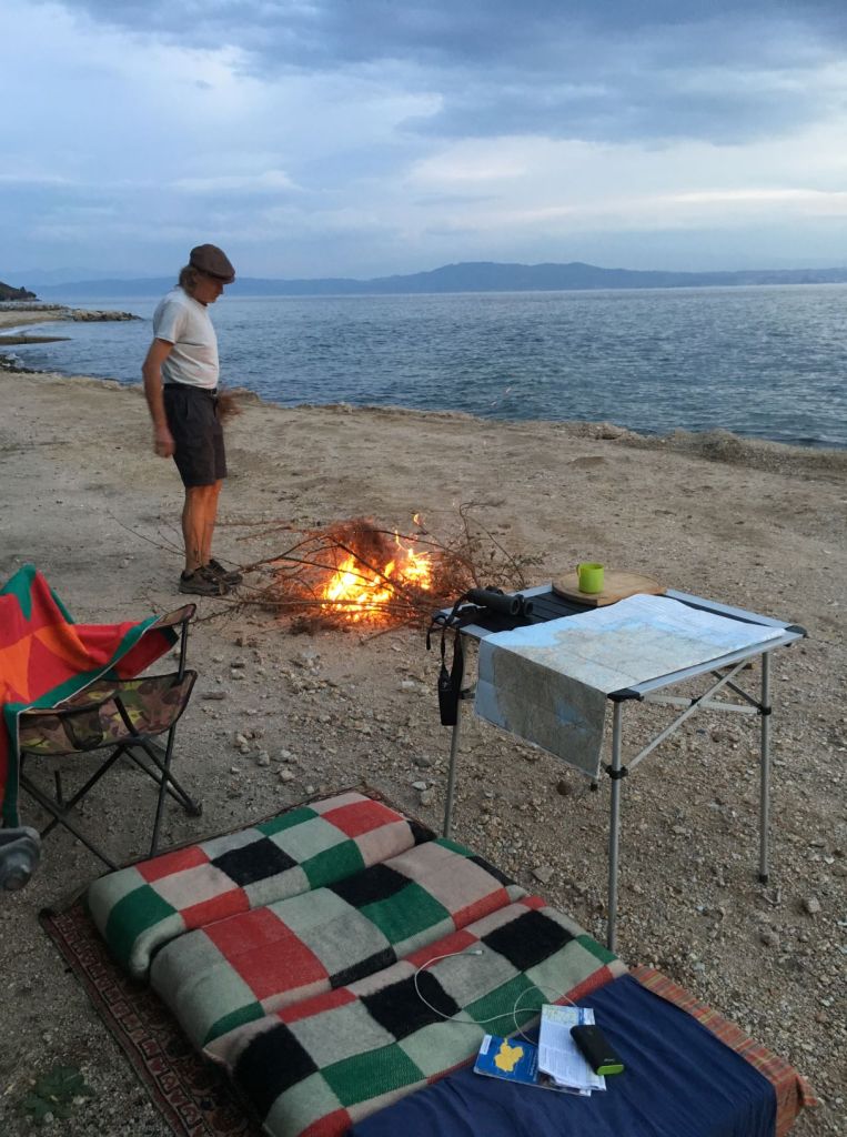
Towards the evening, the weather does improve a bit and we find a camping spot on an old part of the road which is made redundant by a tunnel. The spot is a bit messy with plastic bottles and the like, but the view is beautiful.

Sunset on the Black Sea

We have some wine, and listen to a podcast before we go to sleep.

October 24

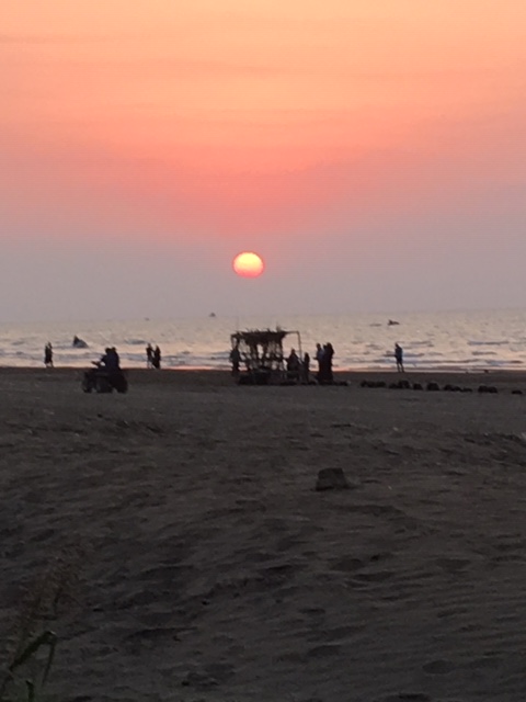
We wake up and see a pod of dophins from the Mog! The coastal road along the Black Sea is busy and leads through many holiday resorts. In between, we find endless rows of hazelnut bushes amidst autumnal deciduous forests.

Any nut trees here?

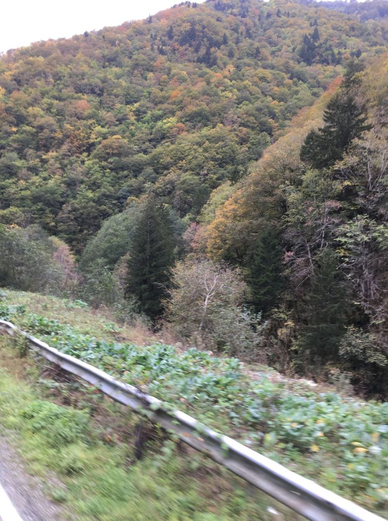
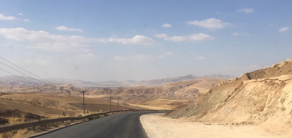
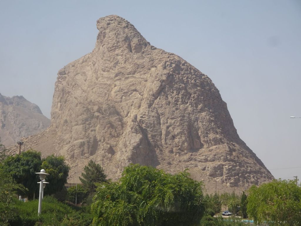
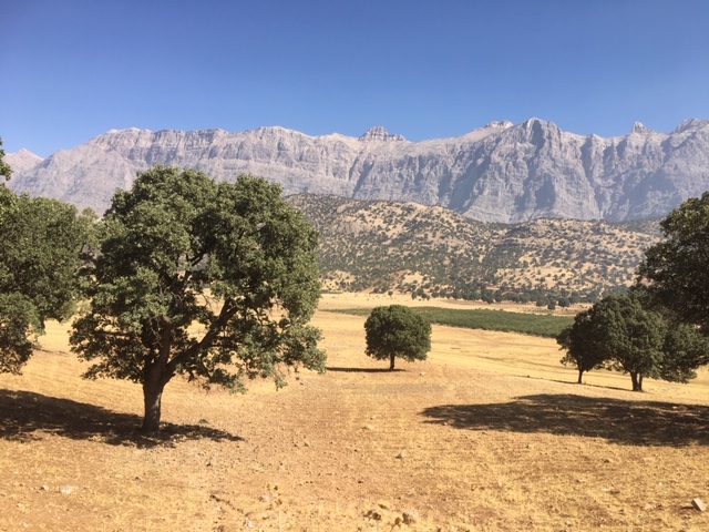
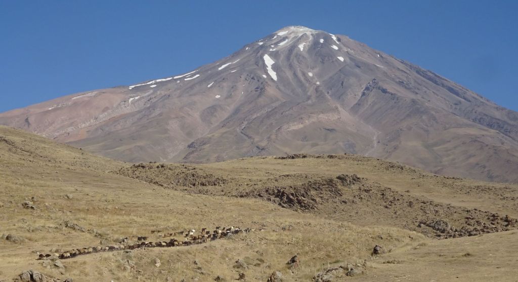
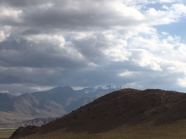
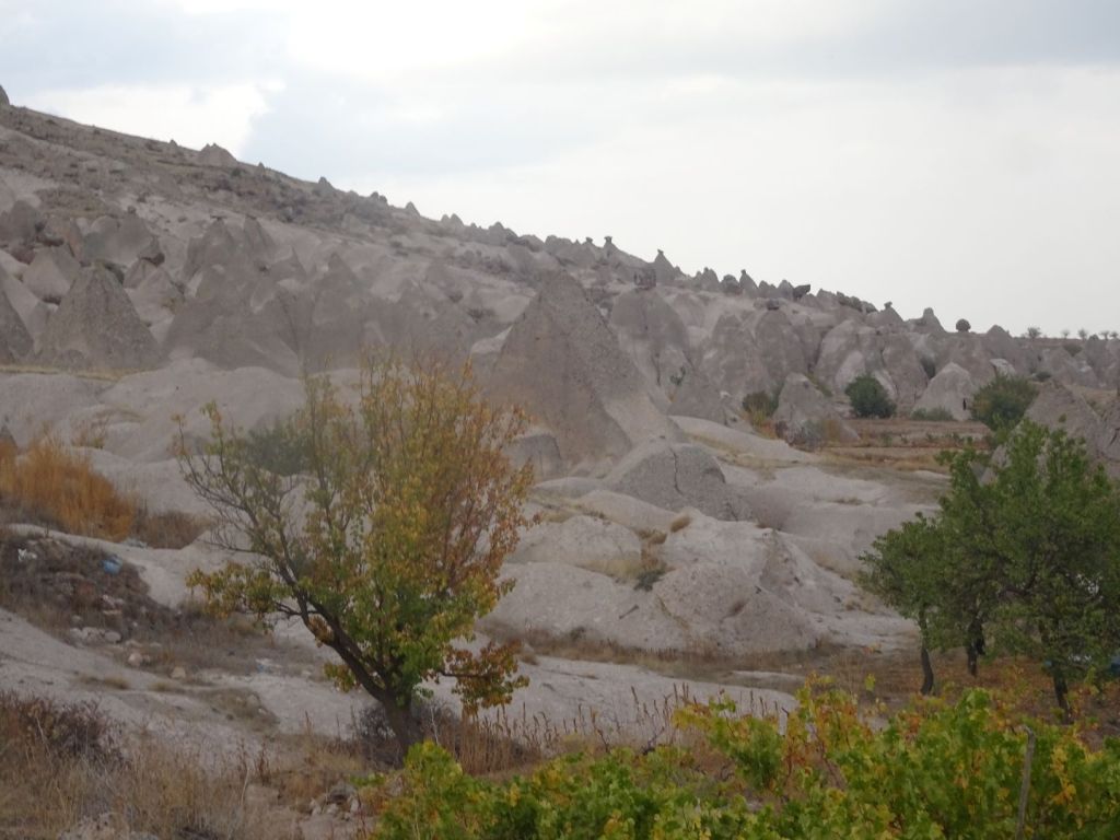
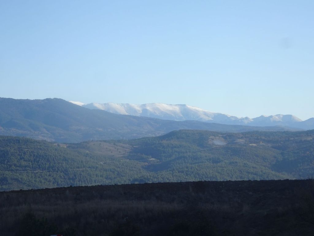
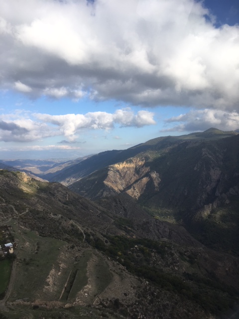
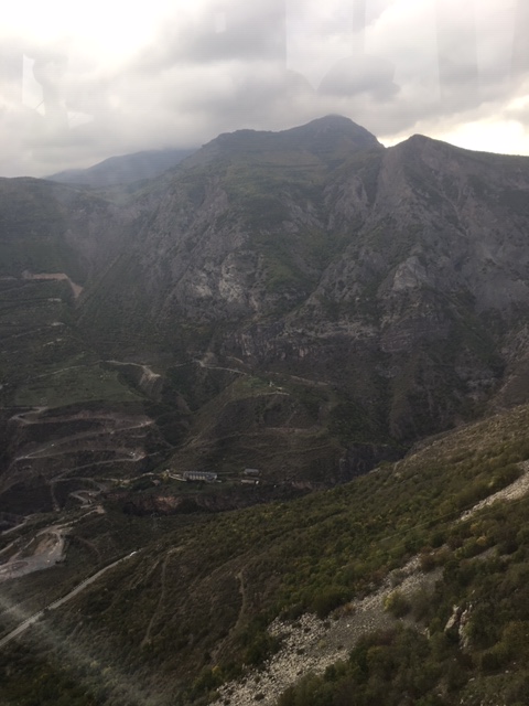
The mountains rise immediately from the coastline forming a trap for the weather with northerly winds accumulating clouds and moisture against the hillside. Not all that great so we decide to go inland in search of better weather and better views.

The weather clears promptly on the way up. The mountains are beautiful in their autumn colors.

We have another Pide with egg and cheese and buy some of these beautiful big, green tangerines in a small village.

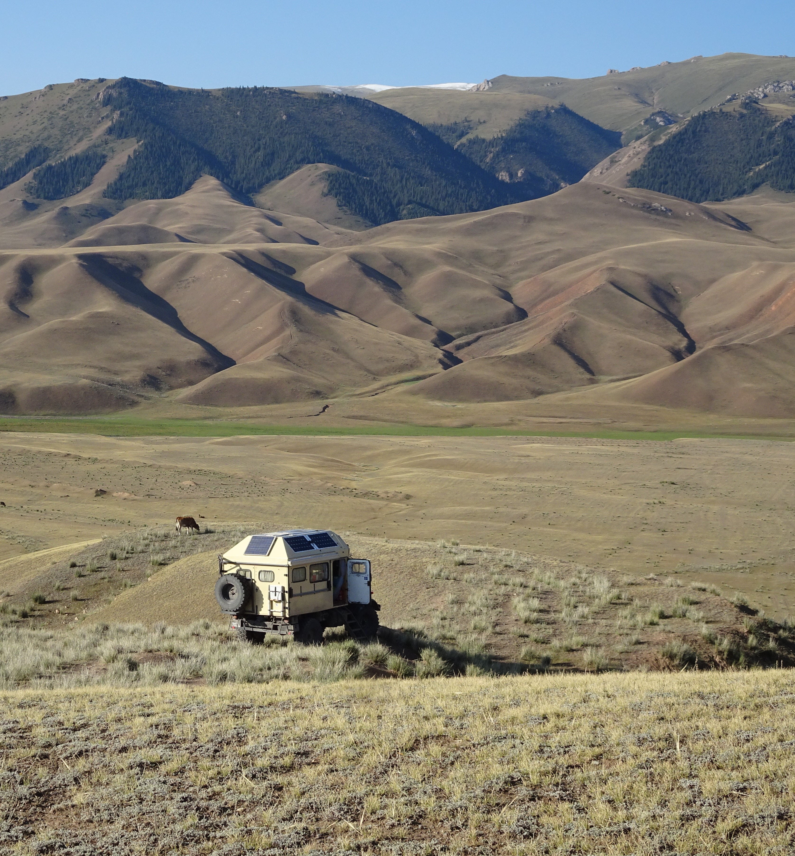
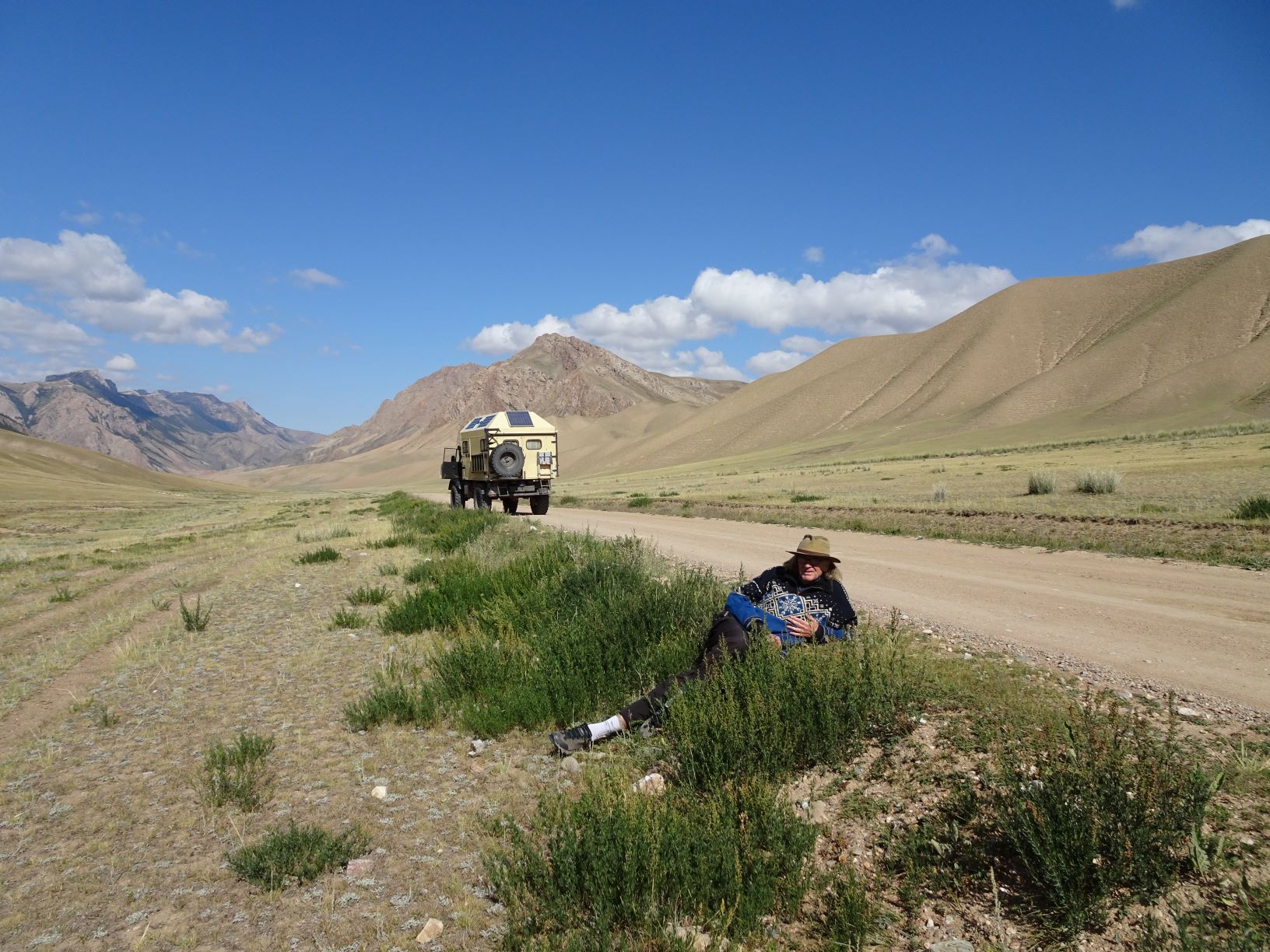
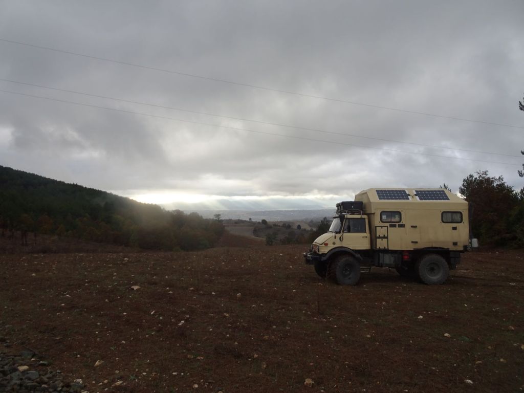
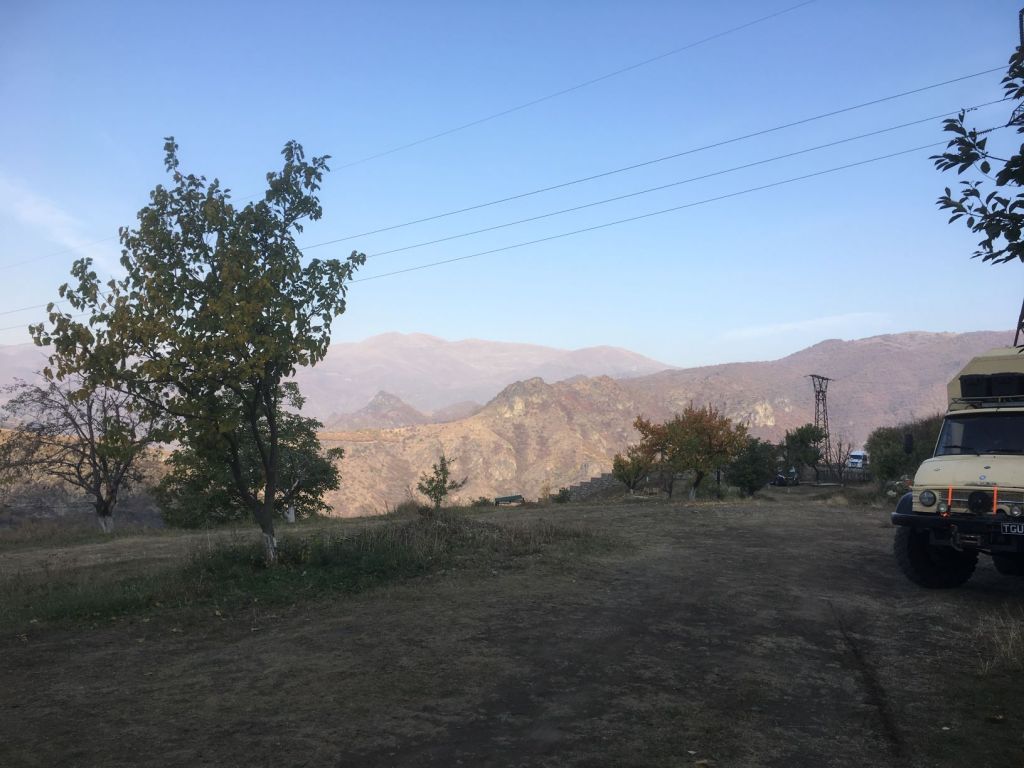
Late afternoon, we park the Mog on a stretch of old abandoned road just behind the main one. It is wonderful to stay out in a quiet place without the constant barking of dogs.

October 25

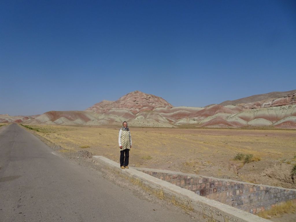
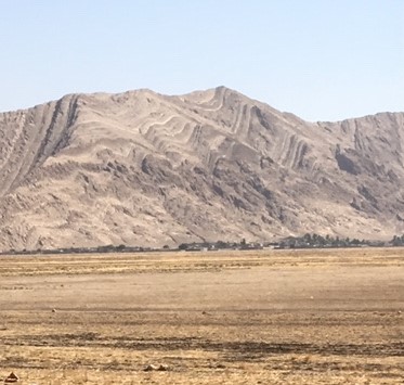
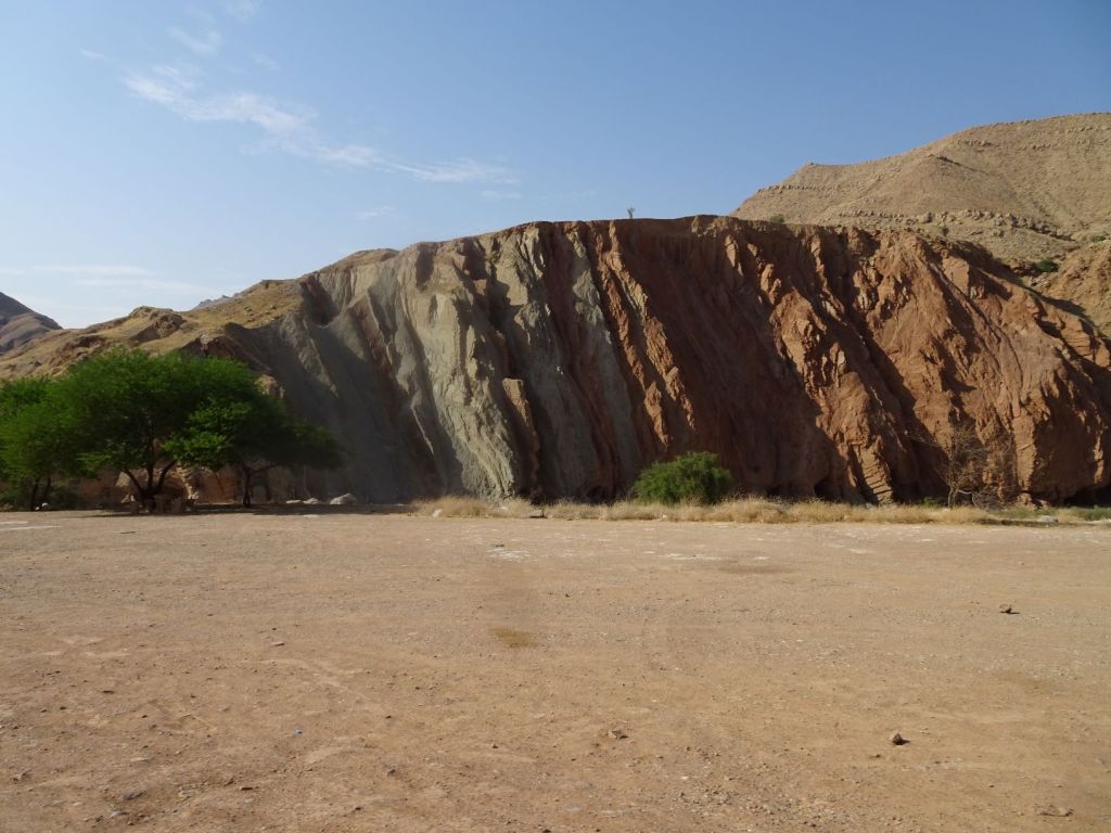
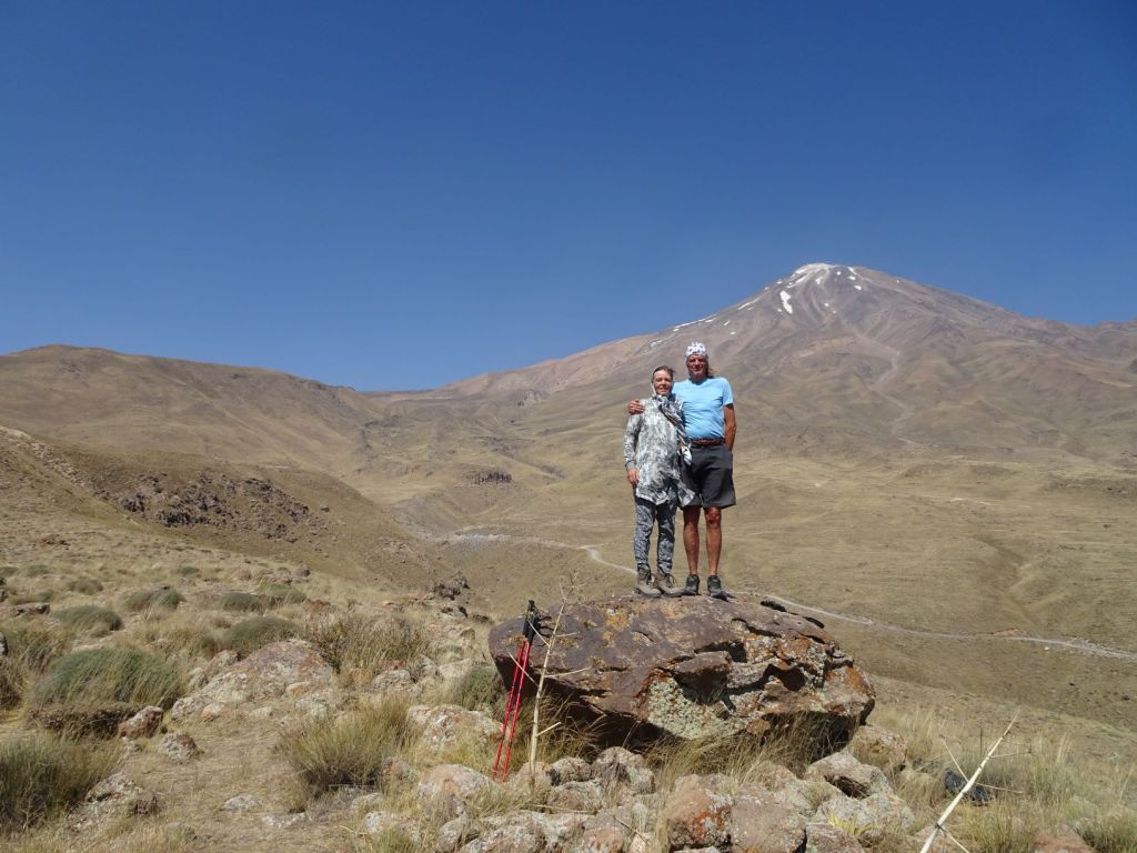
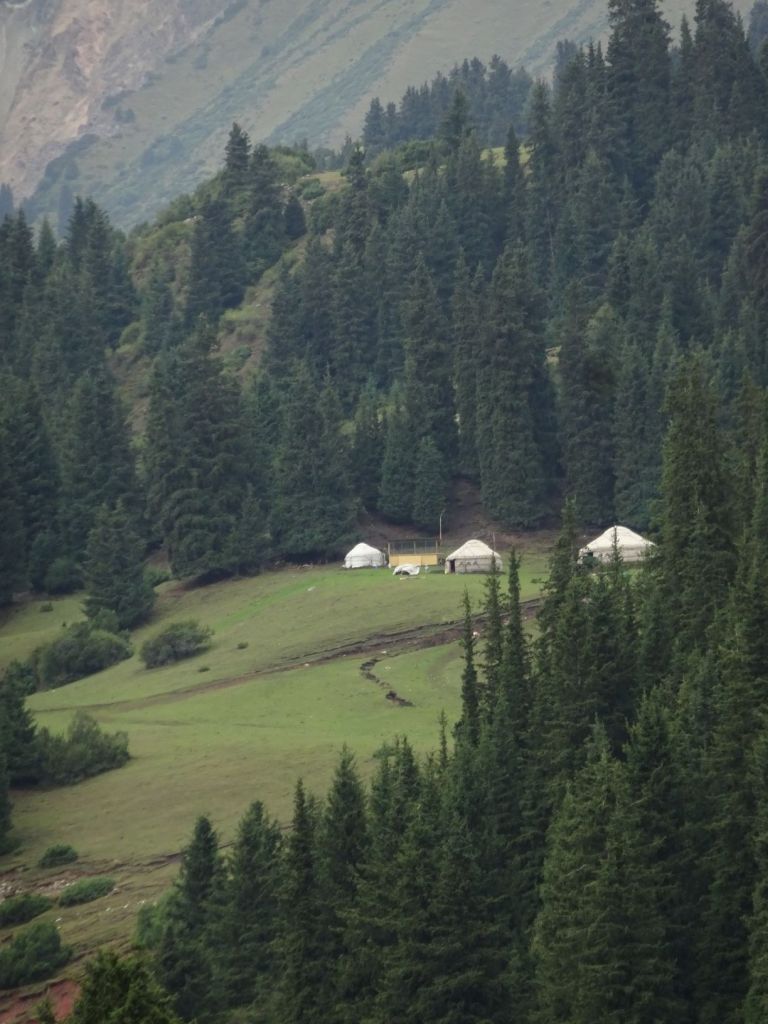
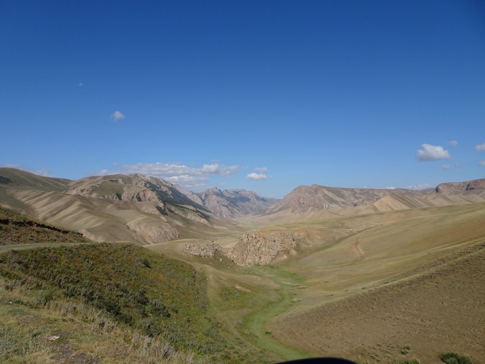
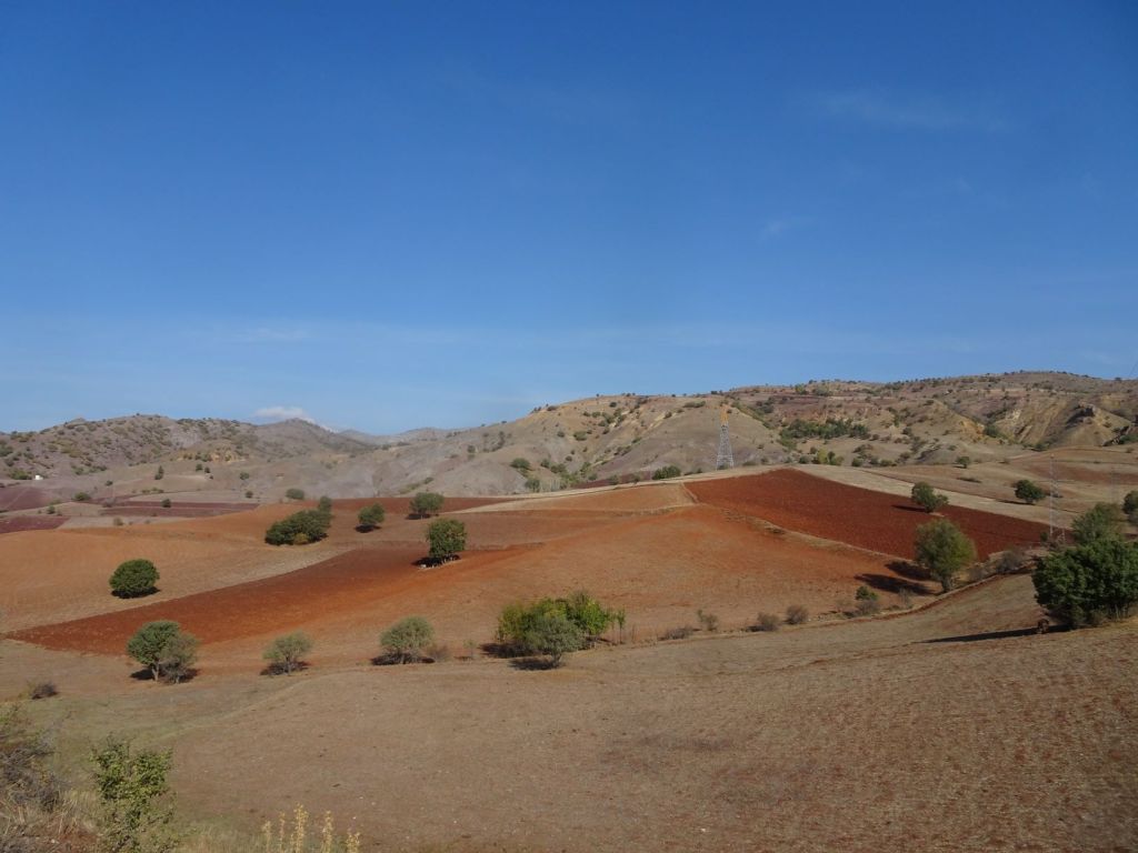
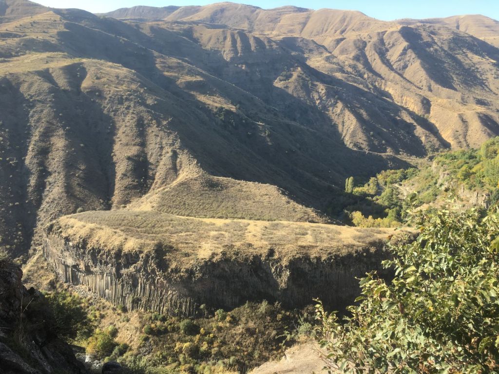
We wake up to a beautiful day in a beautiful place. We had not realised that the highlands of Turkey were so magnificent.

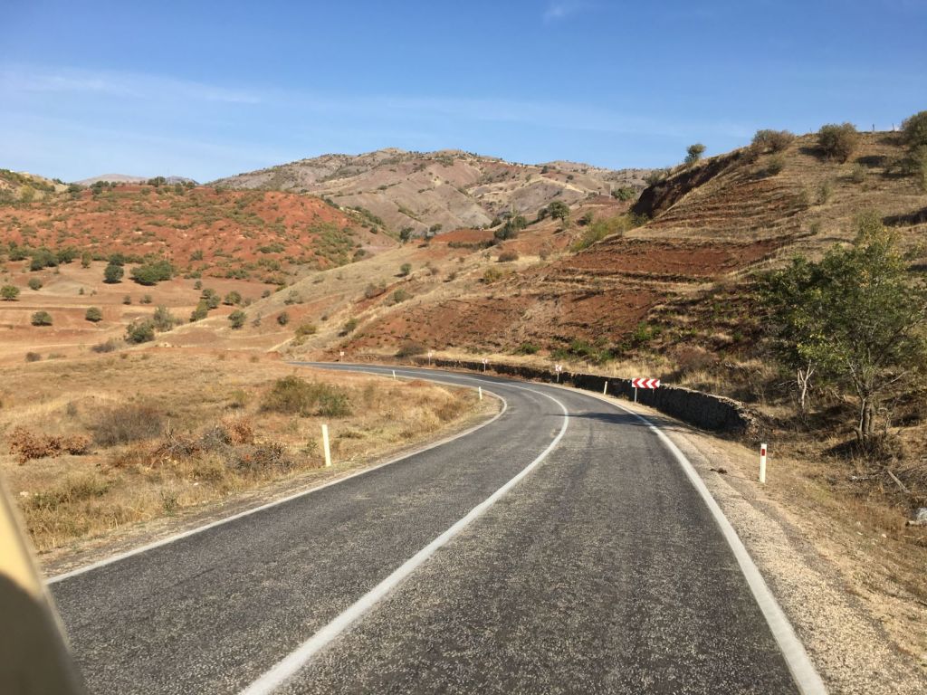
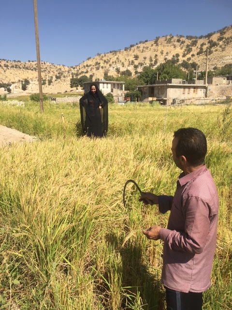
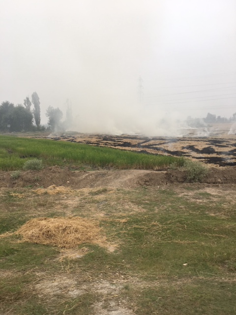
The farmers have prepared their fields for winter. The soil has lots of iron.

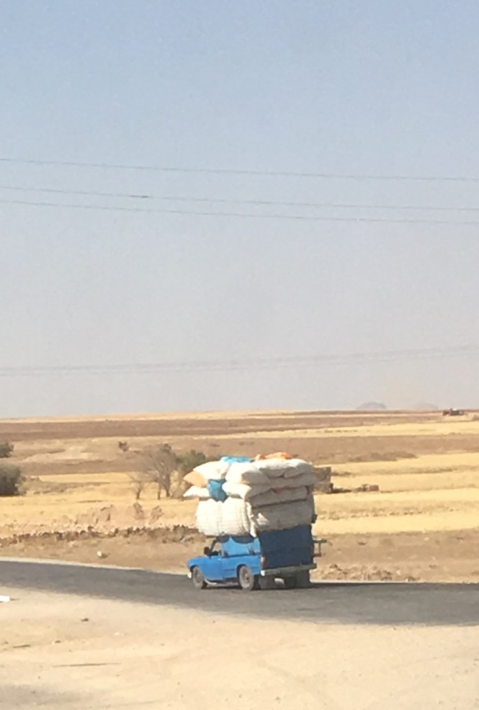
There is very little traffic.

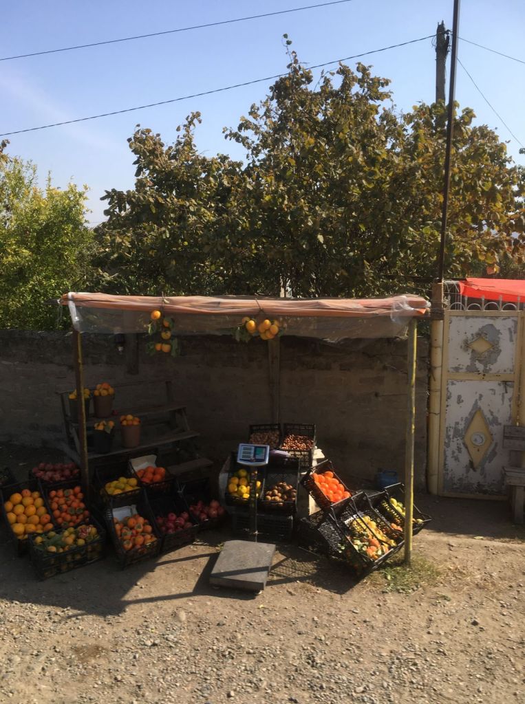
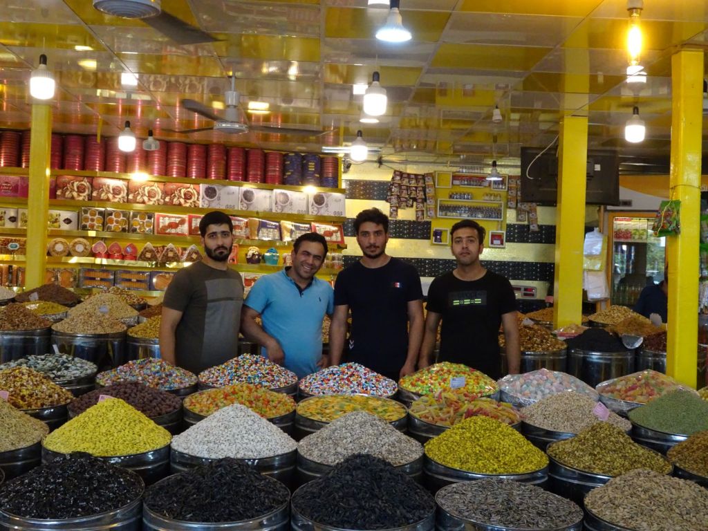
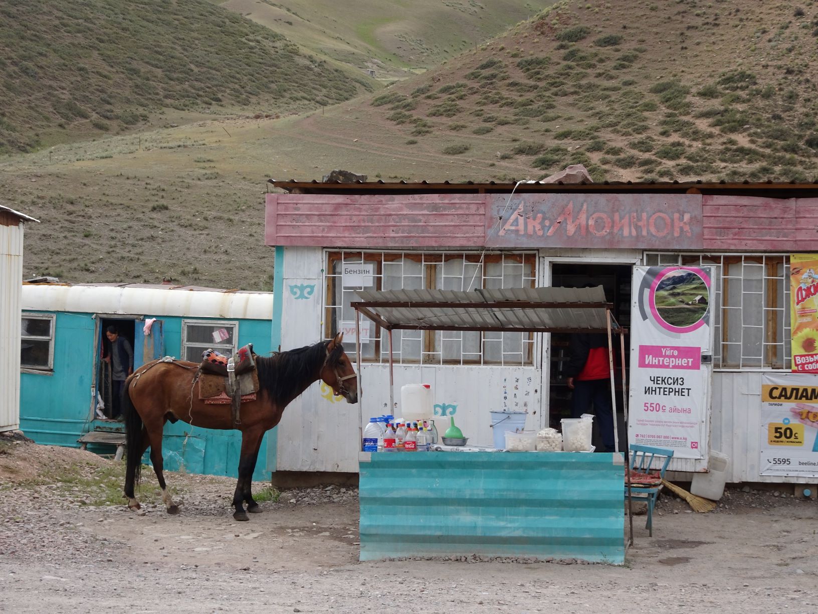
Stalls along the roadside in small towns we pass though sell spices, pulses and loads of bread flour.

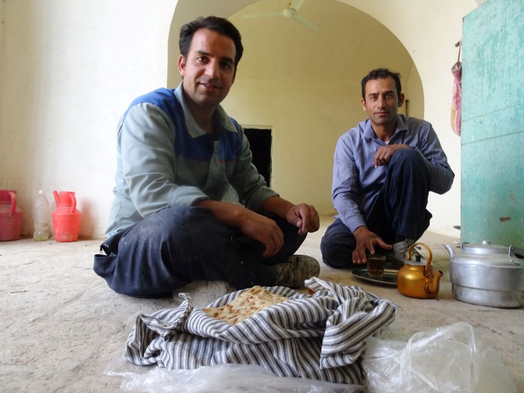
We have lunch in a traditional Turkish dining place where the locals eat also. It is a nice experience which needs no verbal communication. No choice of menu; you sit down and the food appears on the table in no time. Absolutely fabulous combination of grilled beef, salads, bread, little snacks and tea. Then you pay: 5 pounds each.

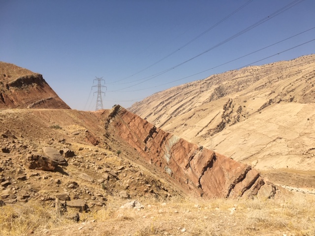
Back on the road, the pleasant scenery continues.

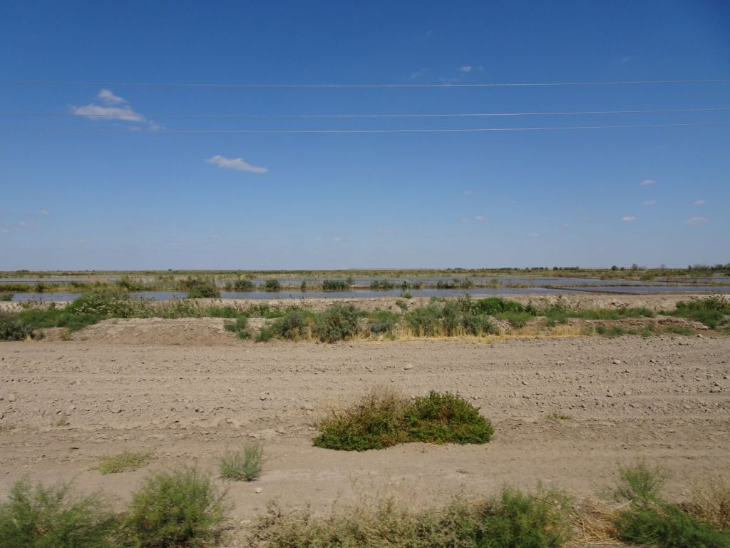
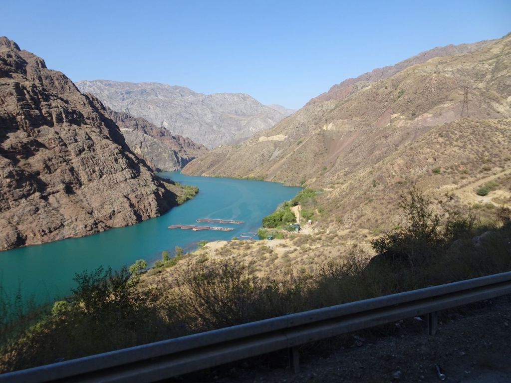
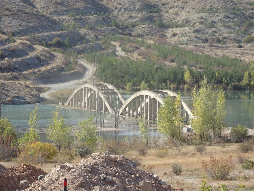
There are reservoirs

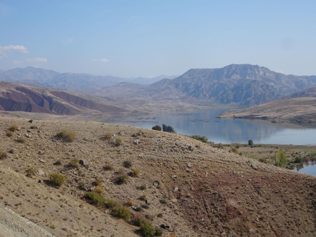
And their inevitable consequences.

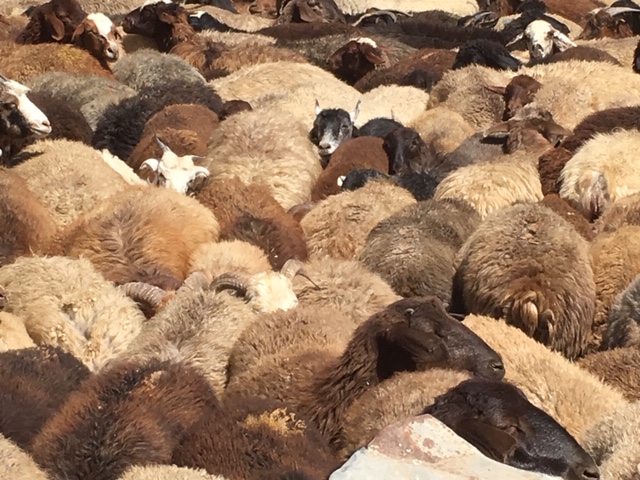
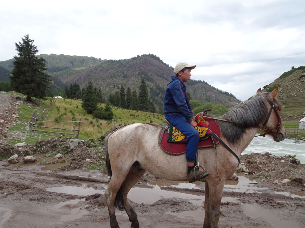
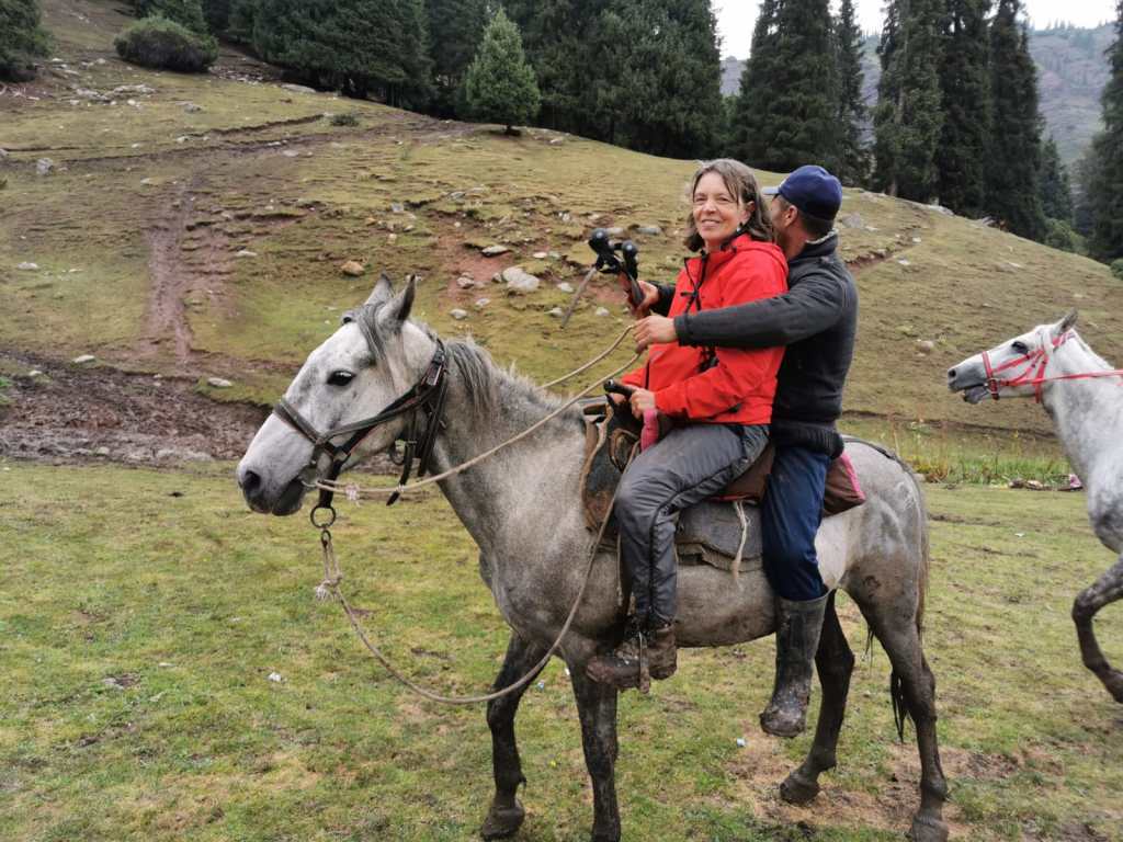
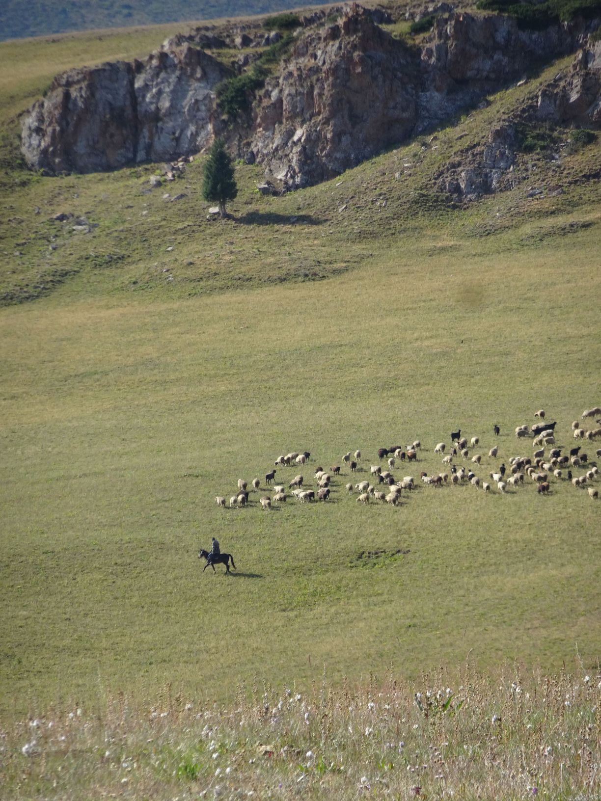
We have an unexpected visitor when we settle down to camp. A herder comes to say hello and proudly show off his horse. Communicating with hands and feet we exchange a few pleasantries. Miep wants to know if it is alright to camp where we are and he manages to get across that he is delighted with that. We try but fail for him to take some of our food or drink, but the horse and donkey are happy to eat a big chunk of our bread.

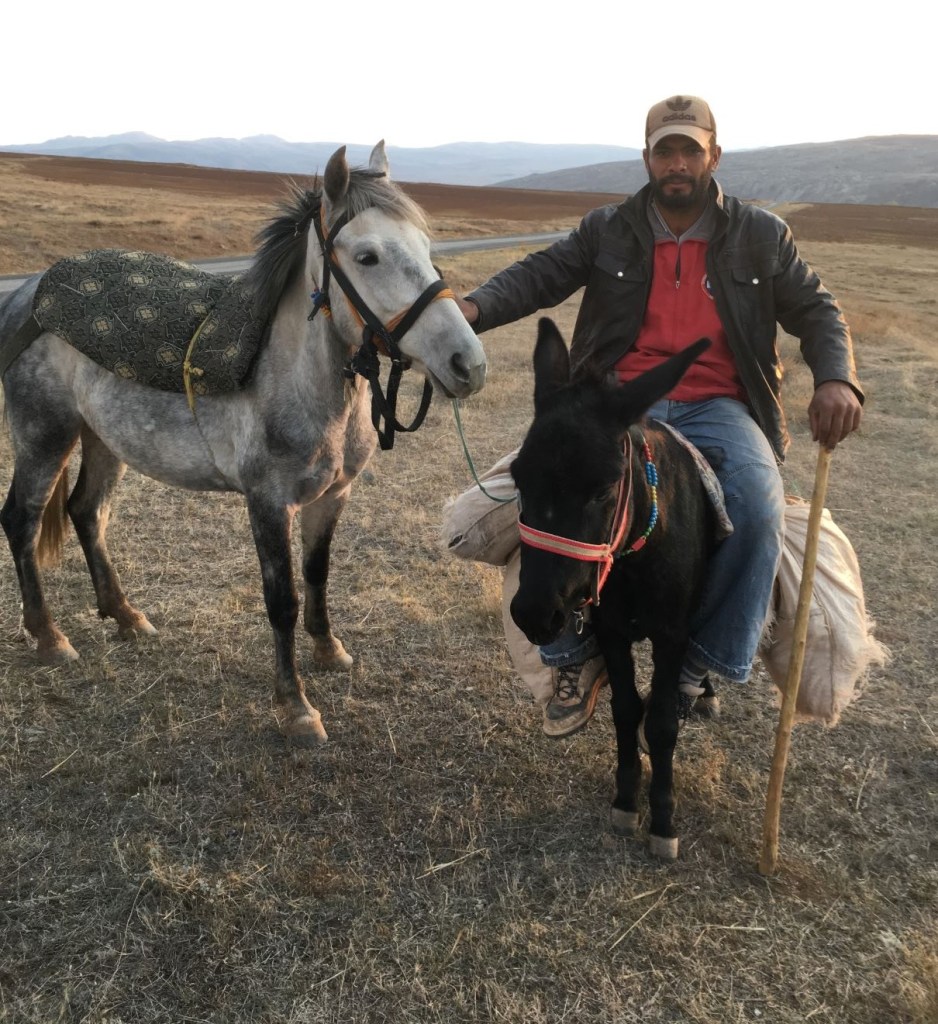
Finally he departs with his companions in to the evening sky. A lonely but beautiful existence it must be…

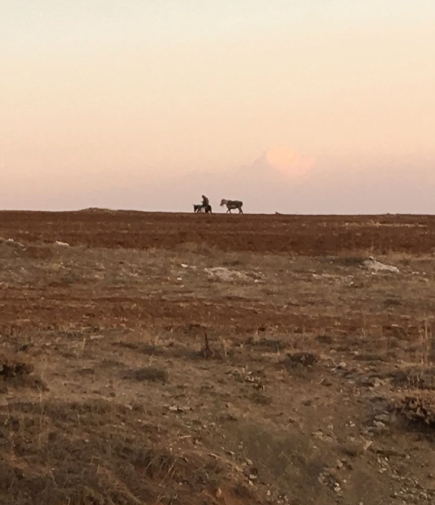
We are now the only ones here to enjoy the sunset.

October 26

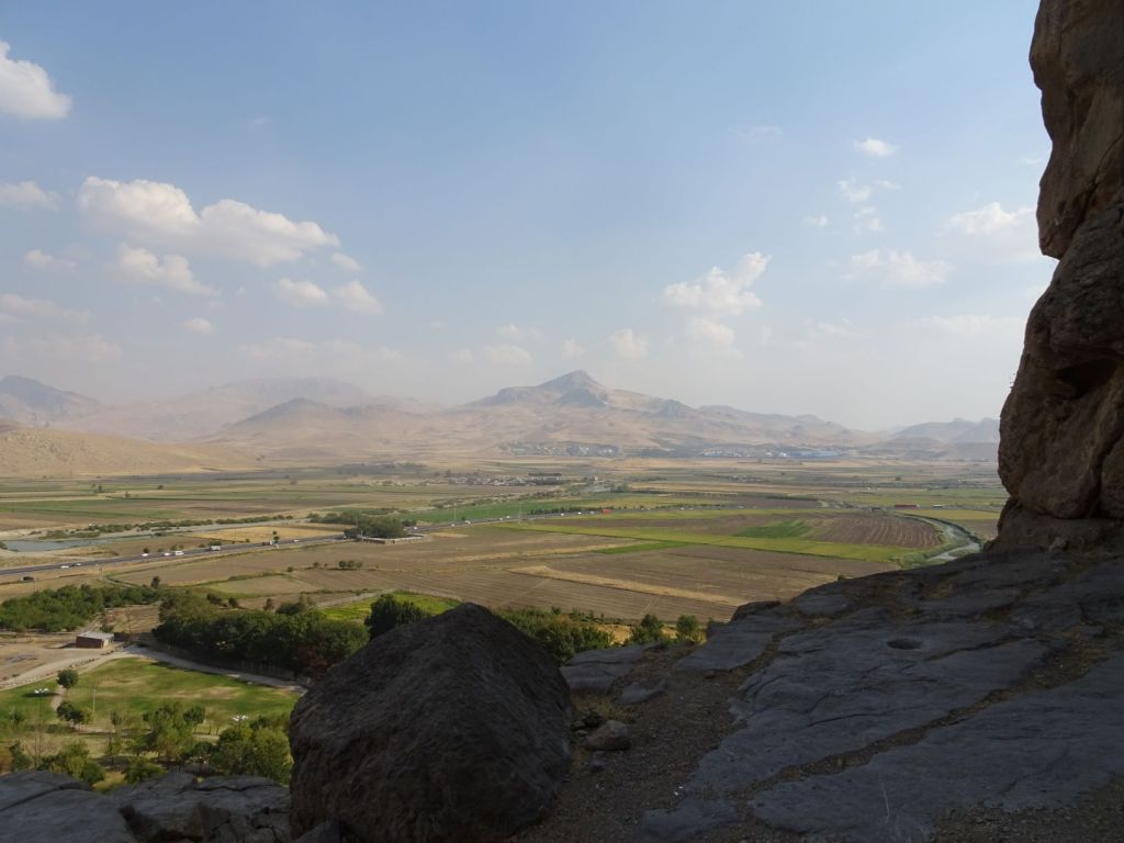
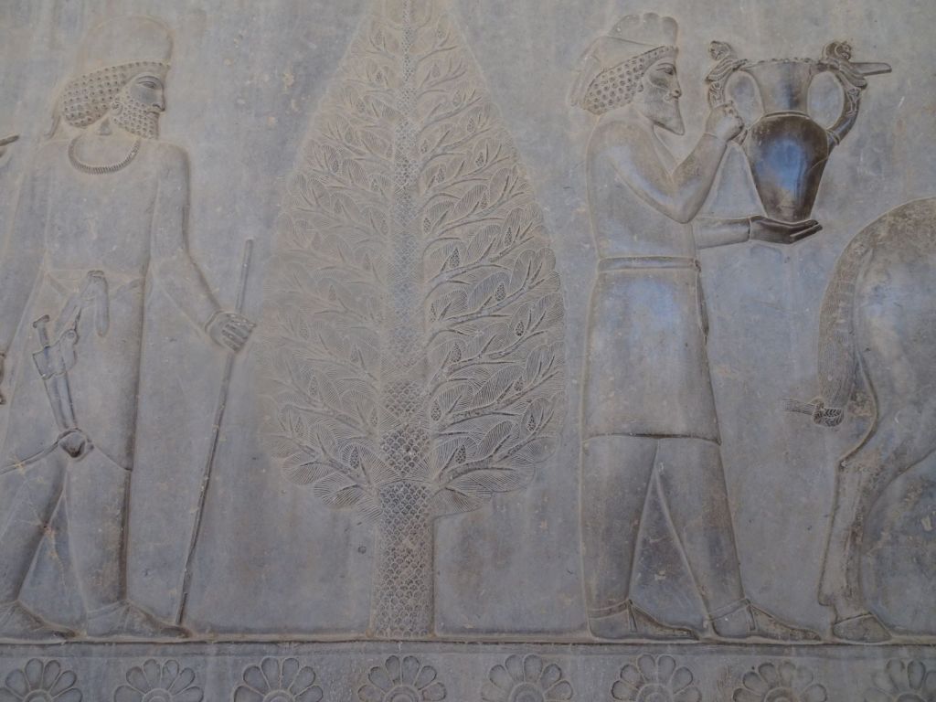
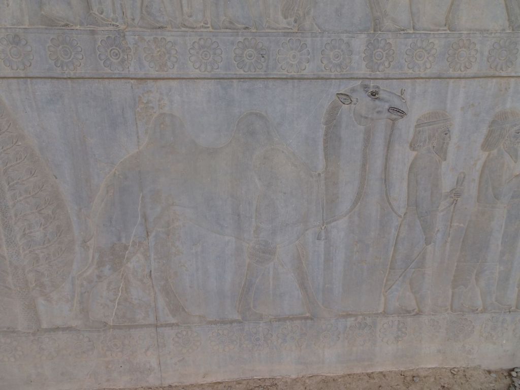
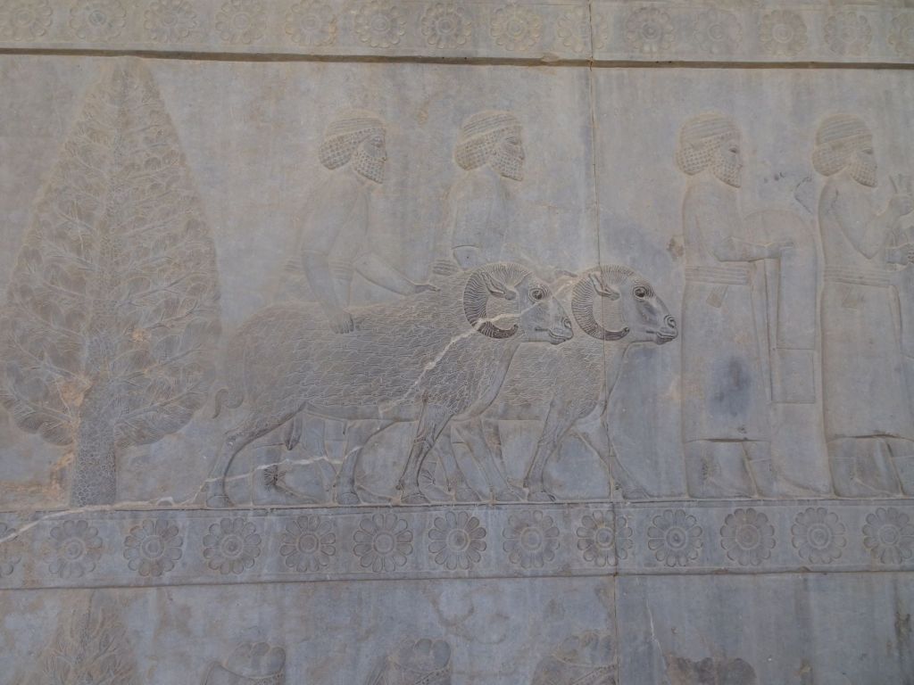
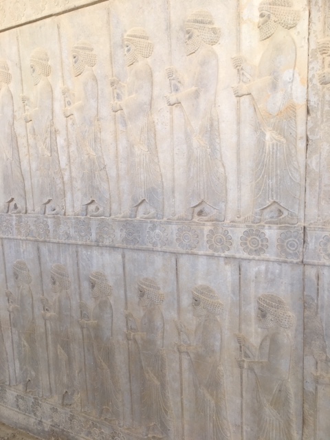
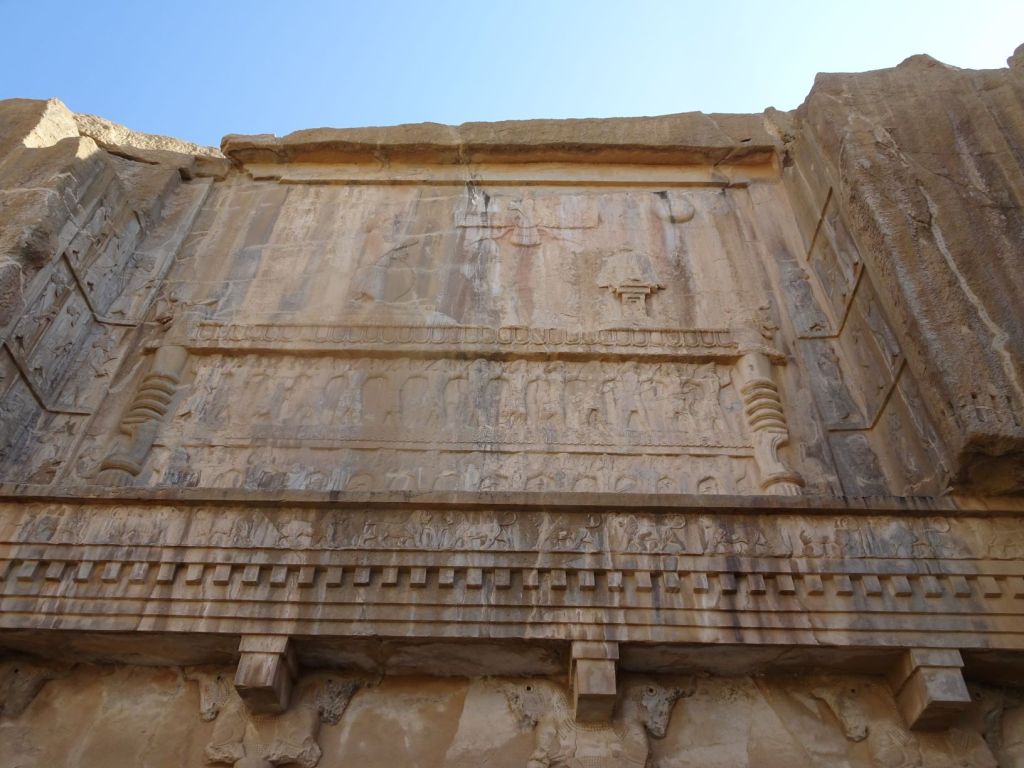
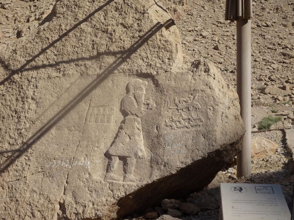
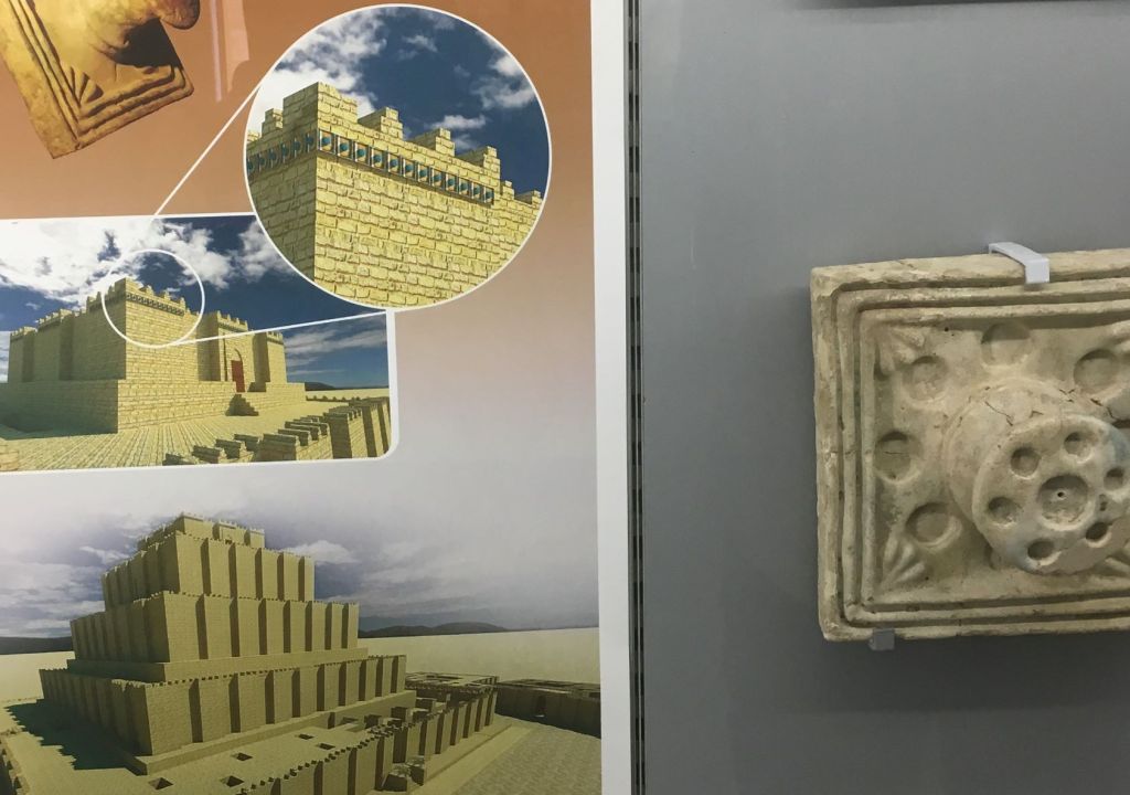
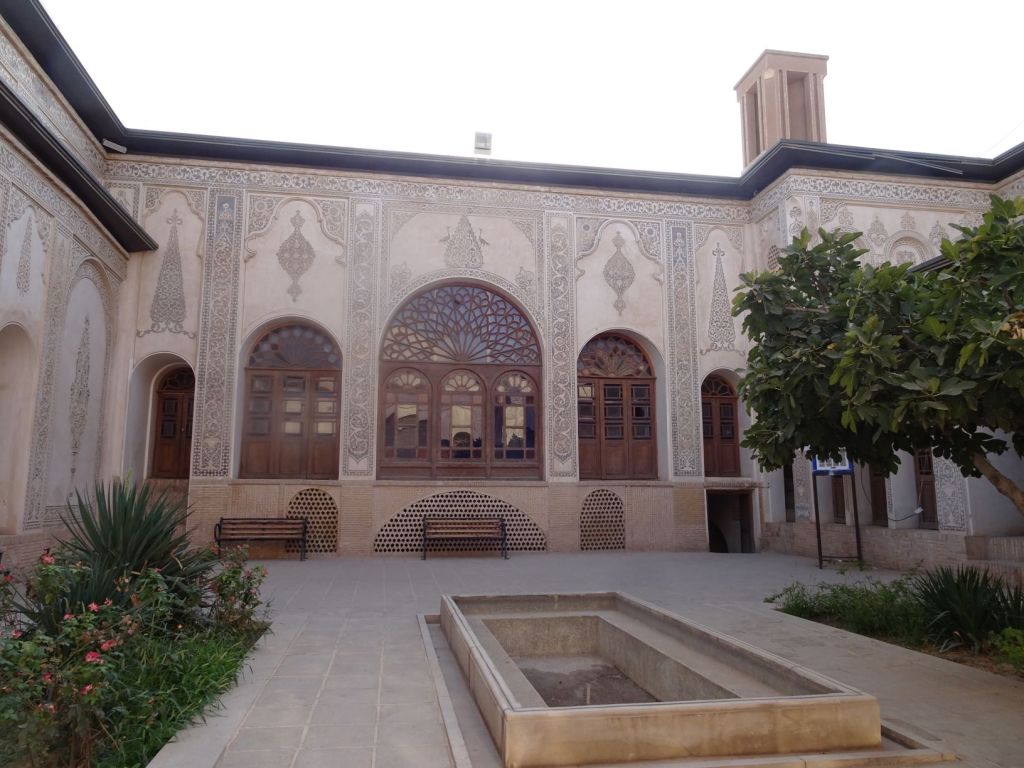
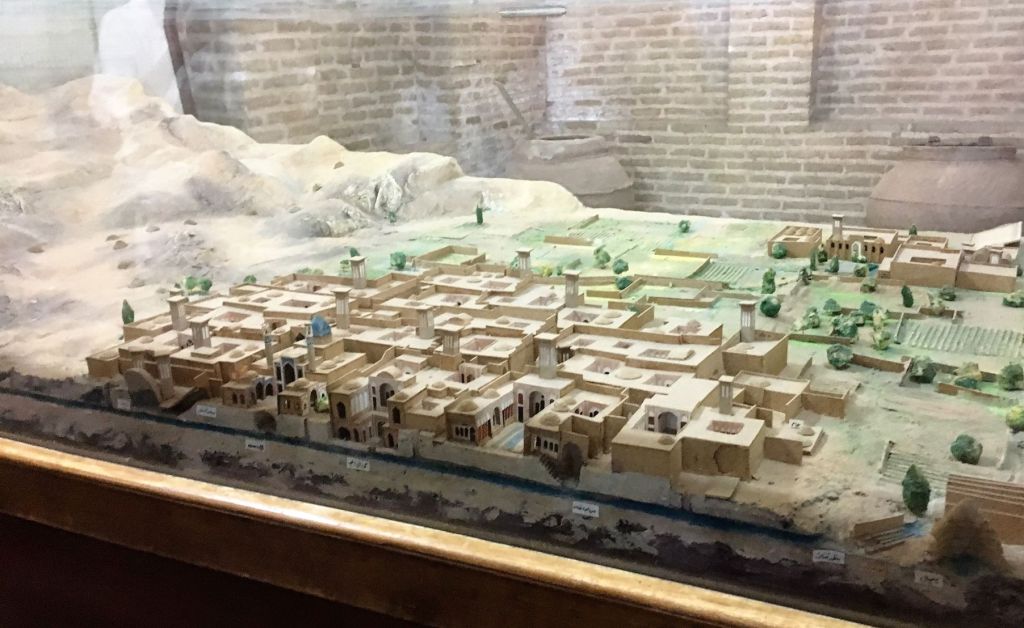
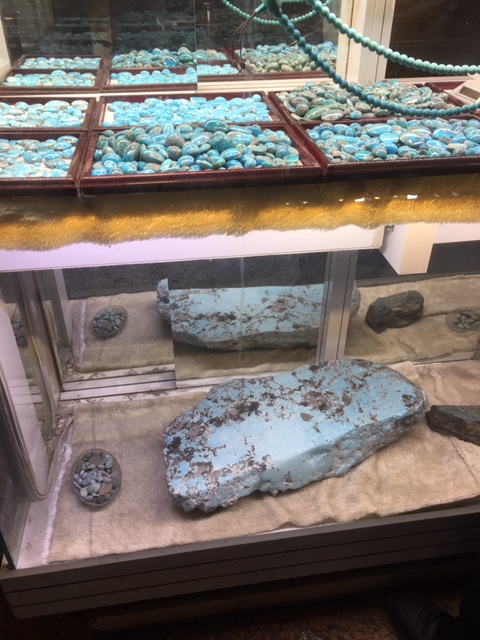
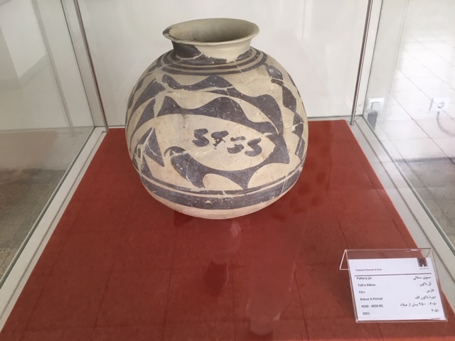
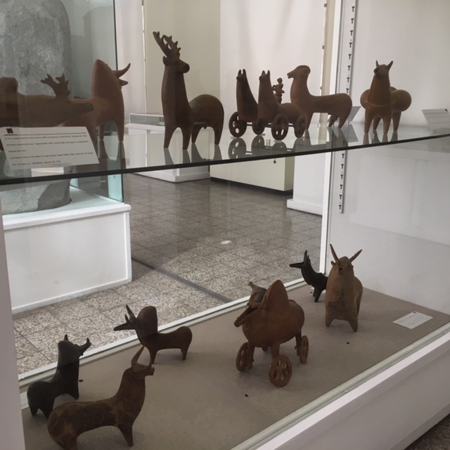
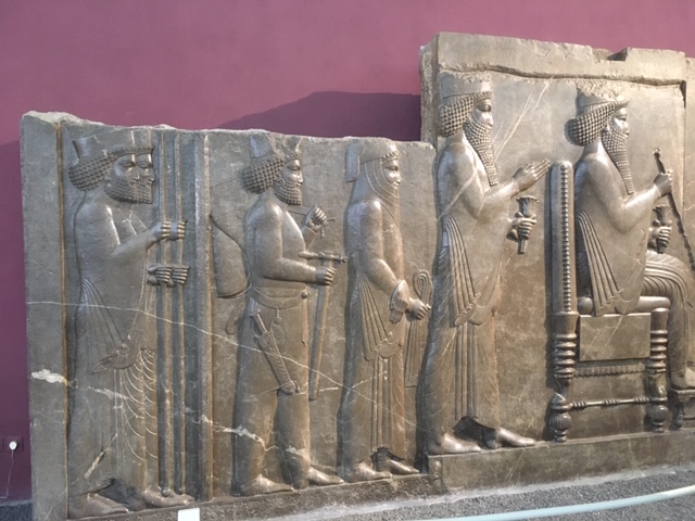
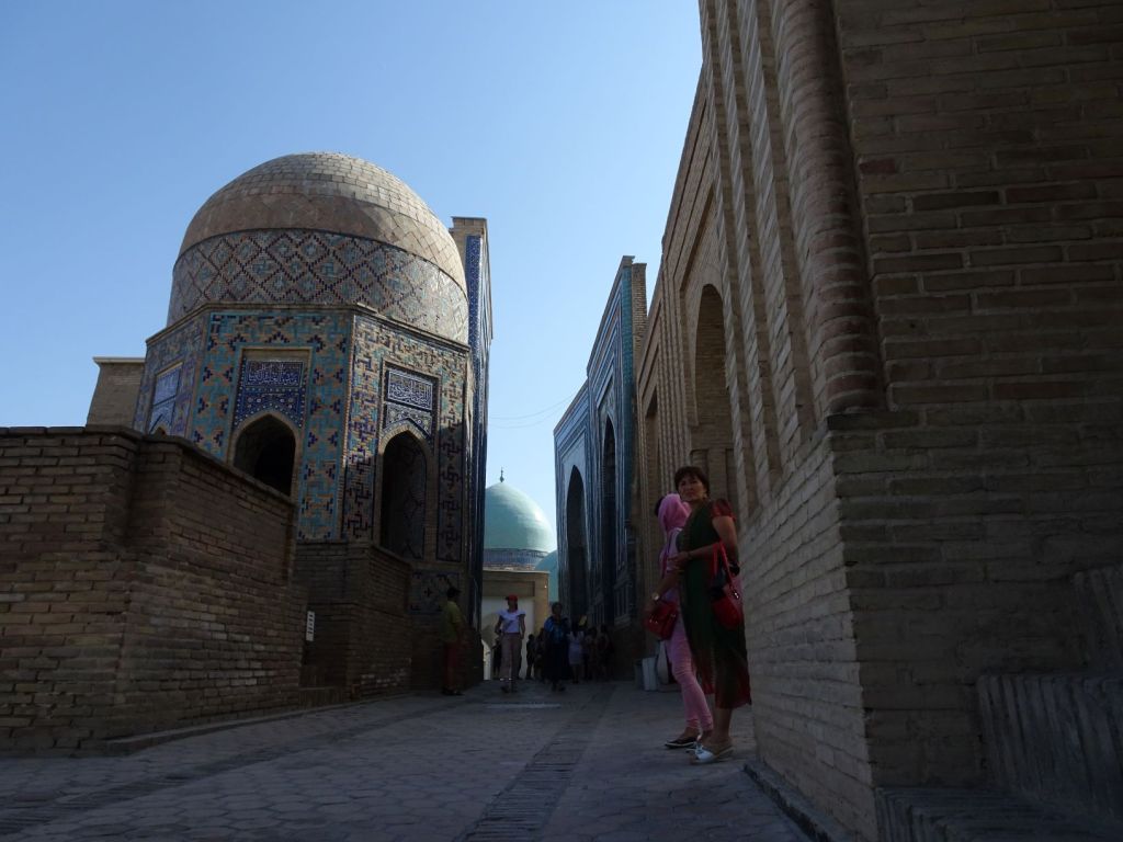
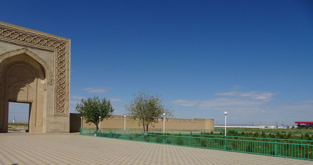
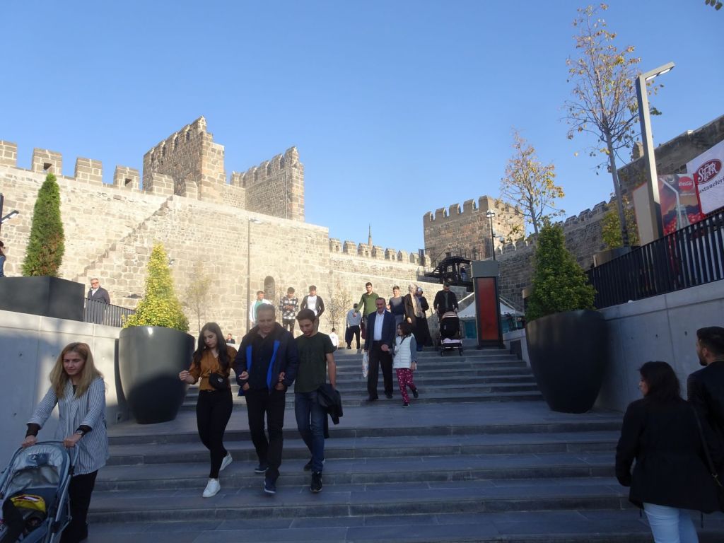
We drive to Kayseri. The city has rich heritage as a trading centre for the last 4000 years. It was the first organised commercial centre in the world and served as centre for Assyrian and Hittite trading routes for goods brought from Mesopotamia, and after the Royal Road was completed by Darius the Great in the 6th century BC, the city became an important cross road between the silk road from east to west, and the north-southt trading route between the Black Sea and the eastern Mediterranean.

Royal Road; Kayseri is located north-west of Comana, where the river Halys crosses the Silk Road for the first time

It is right in the middle of Anatolia and has historical artefacts from the Hittite, Persian, Hellenistic, Roman, Seljuk, and Ottoman times.

We park the Mog near the centre and have some nice wraps to eat on our way to the central square.

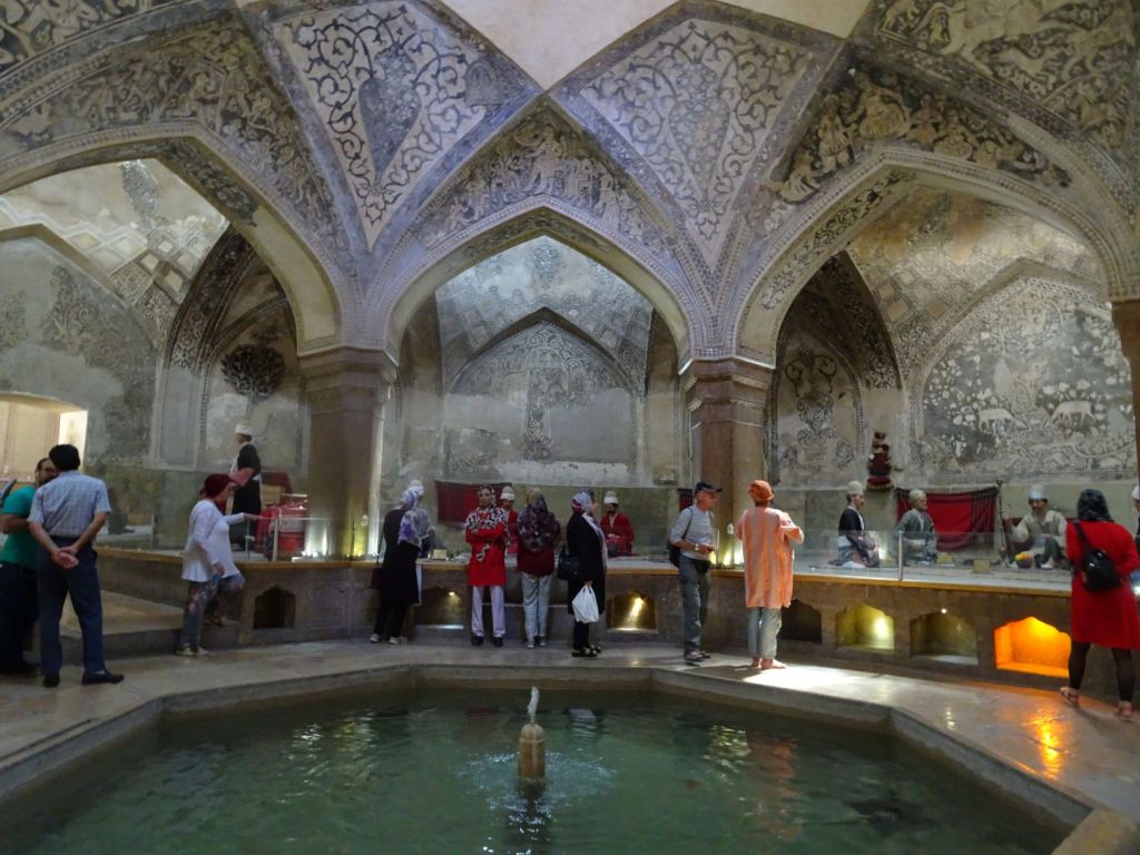
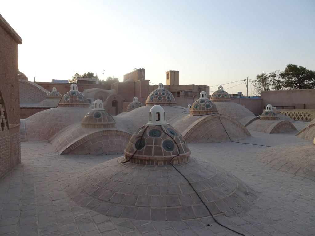
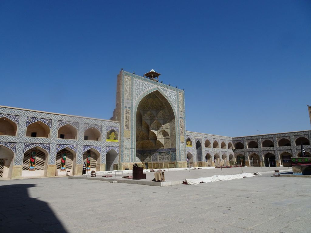
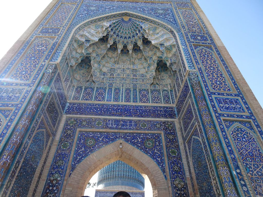
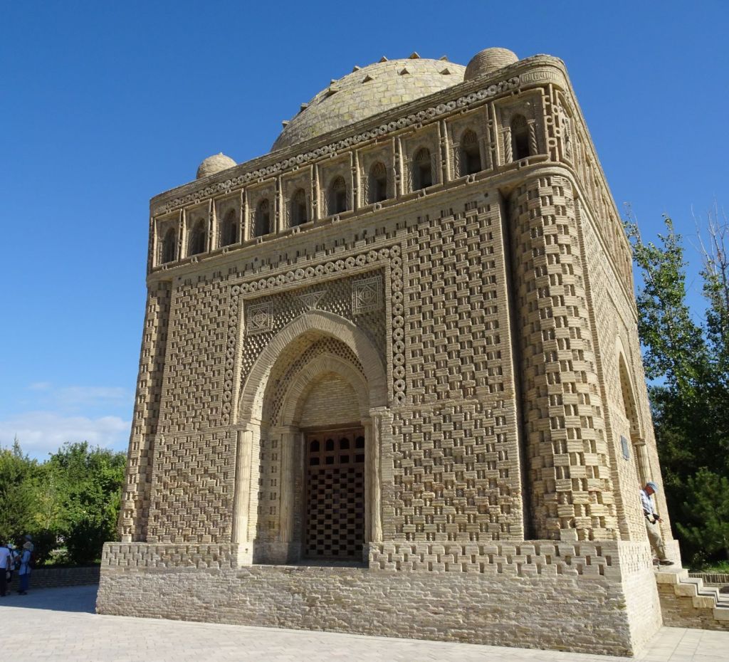
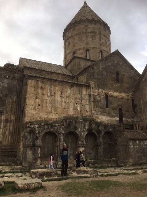
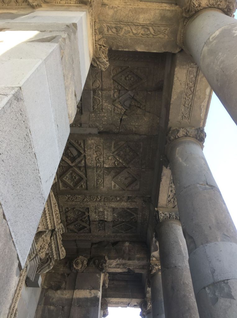
The Mahperi Hunat Hatun complex is on the central square of Kayseri and originates from the Seljuk period. Built in the 13th century it comprises a madrassa, now used as a café; a mosque (still in use), and a former bath house.

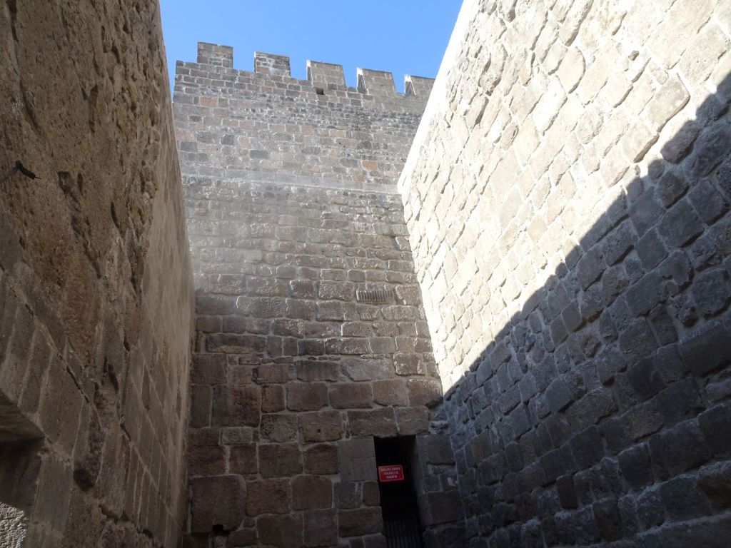
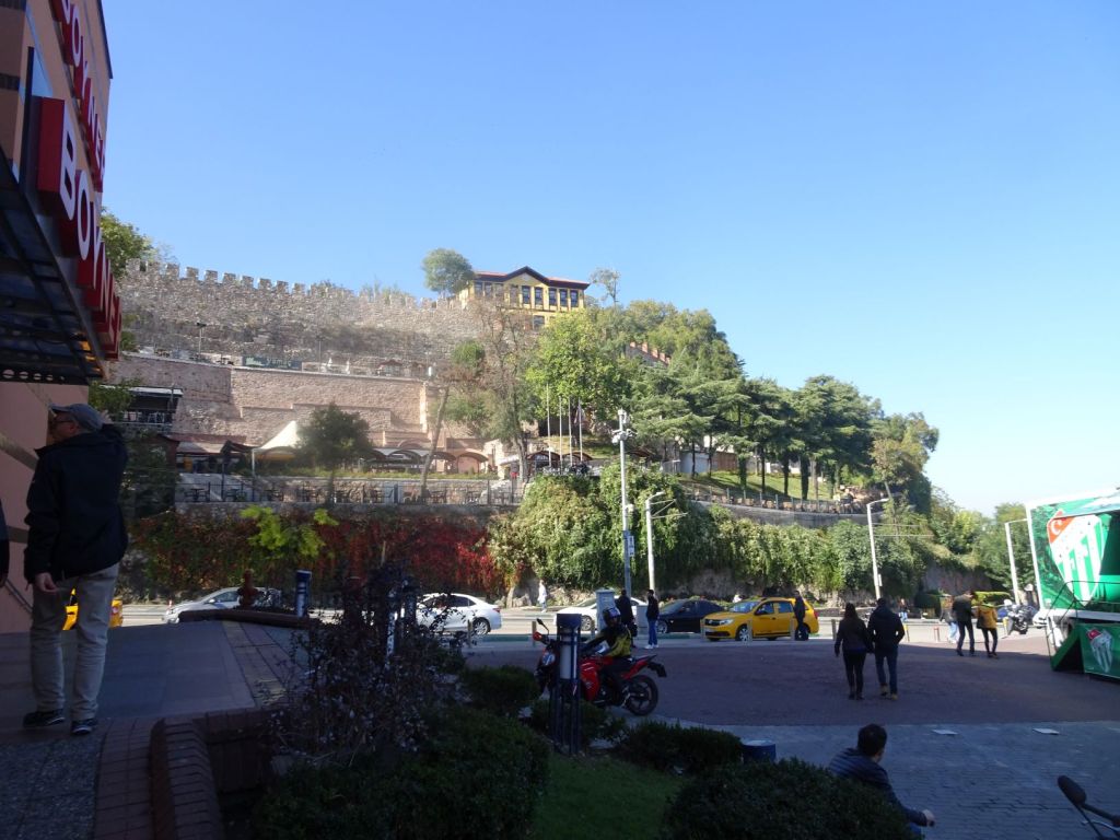
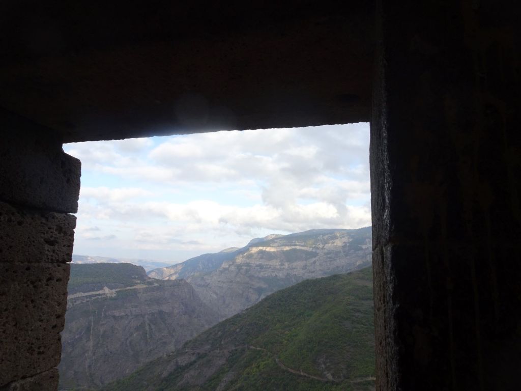
Just opposite the Hatun complex is a massive castle right in the middle of the city. The first walls were constructed 238-244 AD during the Roman period; it was reconstructed 300 years later in the Byzantine period and extended upon by a Seljuk Sultan in the 13th century, around the same time as the opposing Hatun complex. It is absolutely massive, and only just re-opened after extensive restauration.

The walls of Kayseri Castle
Inside the castle; busy with local visitors after the re-opening

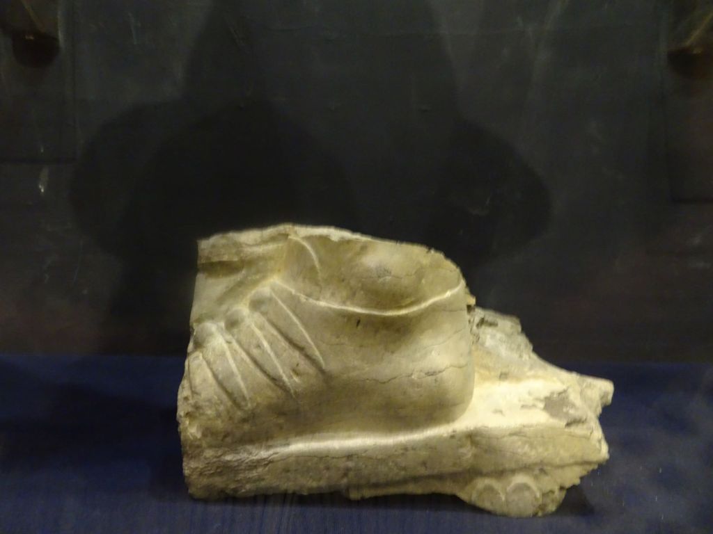
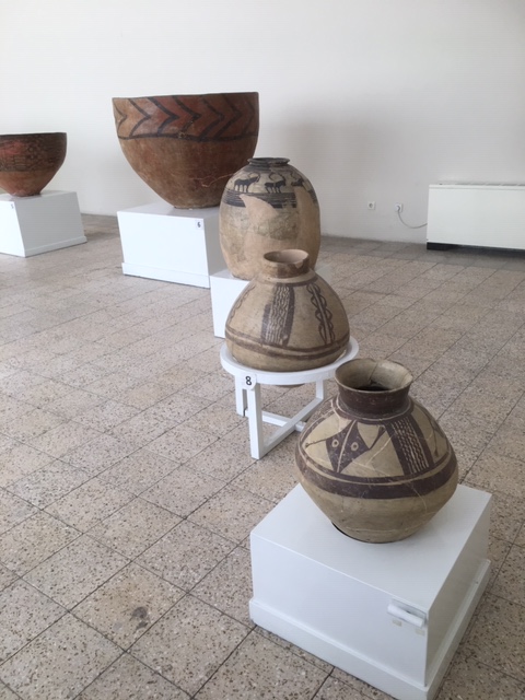
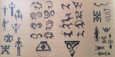
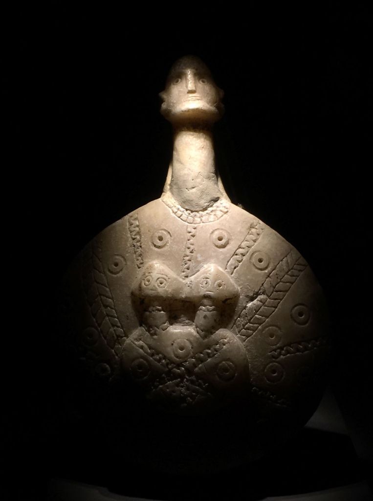
In the basement of the castle there is a history museum (entry fee 1 pound) that takes you chronologically through the history of Kayseri and the Cappadocia region:

2000 – 1700 BC Assyrian trading colony

1700 – 1200 BC Hittite Empire

1200 – 700 BC Phrygian Kingdom (the Phrygians were Thracians)

700 – 547 BC Lydian Kingdom (the Lydians were Anatolians closely related to the Hittites)

547 – 330 BC Persian Empire

300 BC – 17 AD Seleucid Empire

17 – 395 Roman Empire

395 – 1071 Byzantine Empire

1071 – 1243 Seljuk Empire

1243 – 1398 Mongol/Timurid Empires

1398 – 1920 Ottoman Empire

1920 – present Republic of Turkey

The Hittites formed the first organised state and had a cuneiform script

Cuneiform script on a clay tablet

The Hittites were called the people of the 1000 Gods, whom they took over from the people they conquered.

The Weather God was most important

The Lydians were the first people in the world to mint coins to facilitate trade.

The last Seleucid king changed the name of the capital of the region from Eusebia to Kayseri during the first decennium AD in honour of the Roman Emperor Augustus.

The region became an important center for Christianity during the Roman period in the 3rd century AD. During the Byzantine period, there were frequent raids of the region by the Persian Sassanids and later by the Arabs leading to the building of underground cities and rock cut out churches throughout Cappadocia.

We are dutifully impressed by the excellent quality of the displays in the museum which contributes to the ease with which a carpet trader lures us in to his shop. The shop is in the old bazaar of Kayseri.

Old means old here; the bazaar is due a restauration
And into the wool warehouses

Once we are in, it is difficult to get out. We have complementary characters where Miep opens up new avenues, and Roelf tries to close them down. In a shop that means that the exploration of new products is closed down by buying them! A deadly combination as far as the wallet is concerned. It is good that both know what they like and purchases are rarely regretted.

No escape

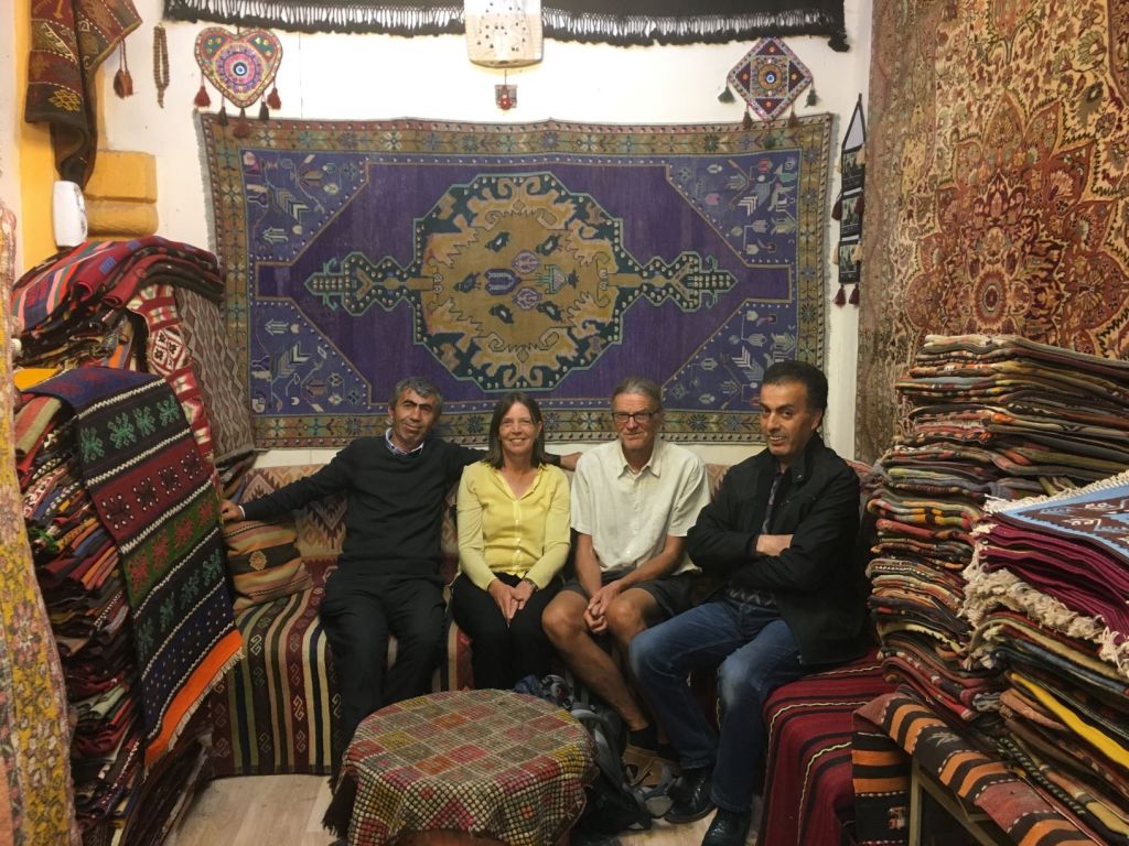
We buy three woollen pillow cases that are made from old carpets.

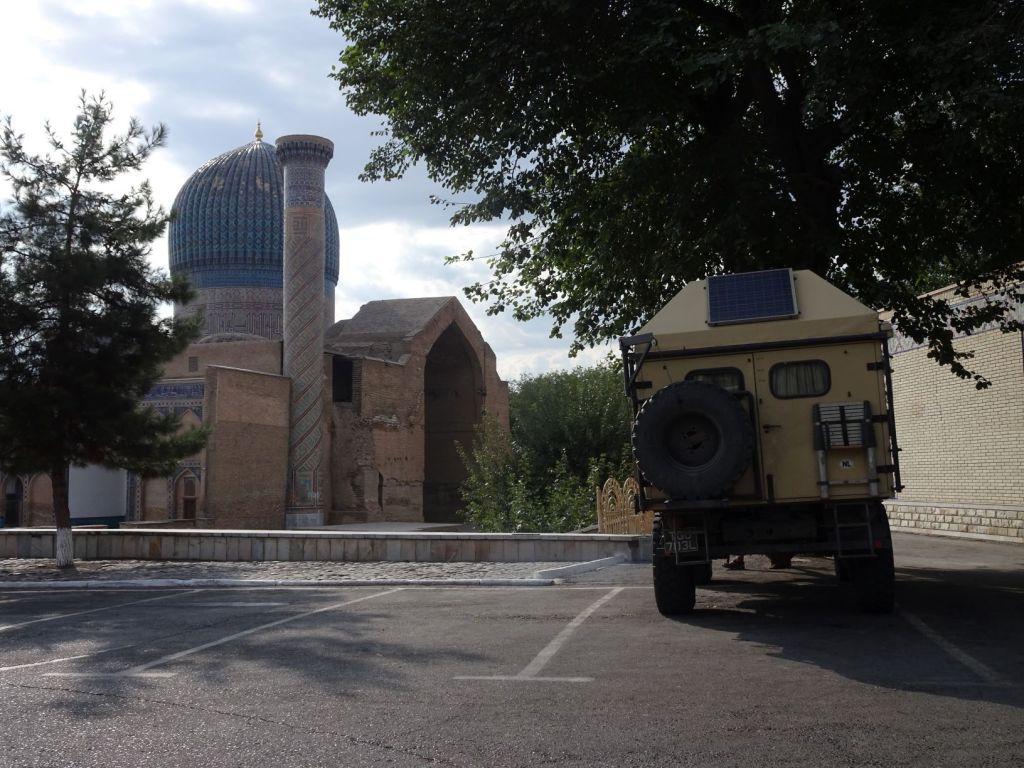
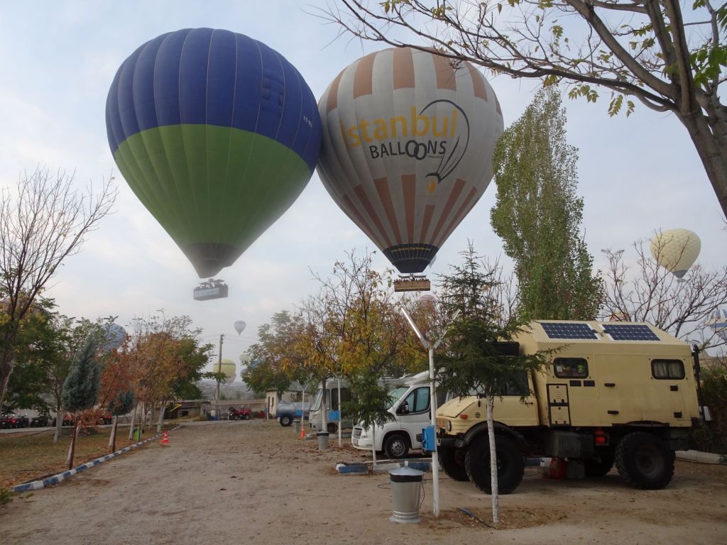
All these adventures means that we leave Kayseri after dark, and arrive late in the evening at the campsite in Goreme, the main tourist centre for Cappadocia.

October 27

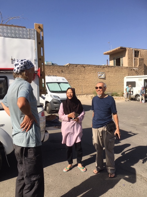
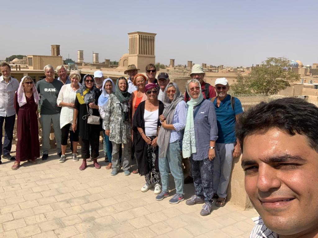
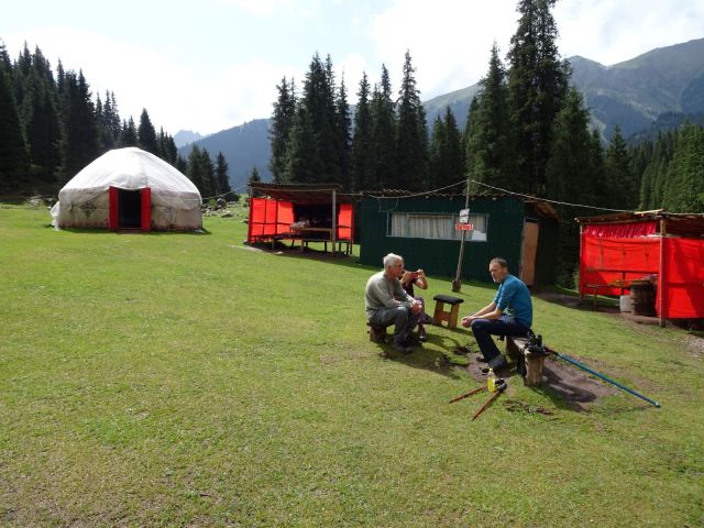
We wake up to a misty morning. There are four teams of our TME travelling group on the campsite!. It is nice to meet up again, and we gossip about the flood of tourists from the far East who seem to have travelled all the way to Cappadocia to have selfies taken; Jan tries to give an impression of a tourist posing for a selfie.

Look at me; I am in Cappadocia!

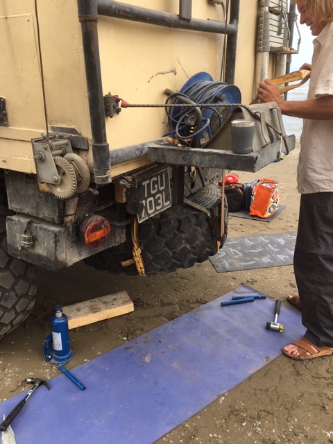
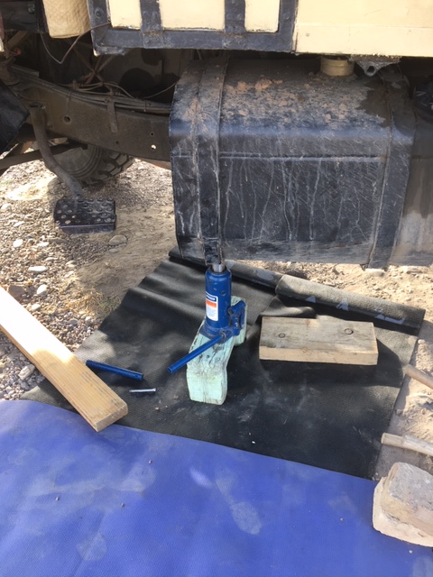
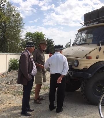
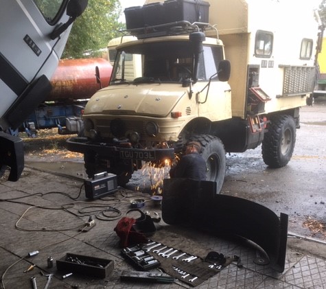
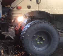
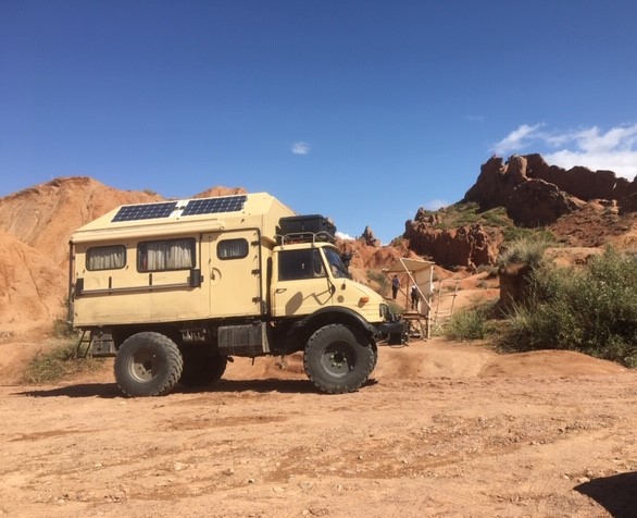
Roelf gets involved in a broken down Renault 4; the torsion spring on the right hand side is to relaxed and the car leans accordingly, causing the floor to hit the uneven roads.

Sophie’s Renault and her tent.

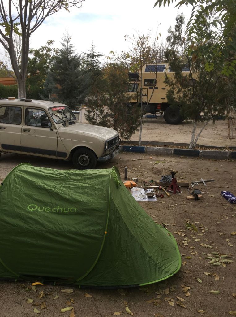
The car belongs to Sophie, a French graduate who is on her way to Mongolia. The R4 is from 1984, and she recently got it back on the road. Sophie has promised the car to her godson who is 2 years old. She is determined to present it to him in pristine condition when he turns 18.

Sophie is quite inspirational; she has a vast amount of tools and spare parts tucked away in her car, and she treats every bolt with loving tenderness. Most importantly, she knows the car very well. However, tensioning a torsion spring is not easy to carry out on your own, and Roelf is happy to help.

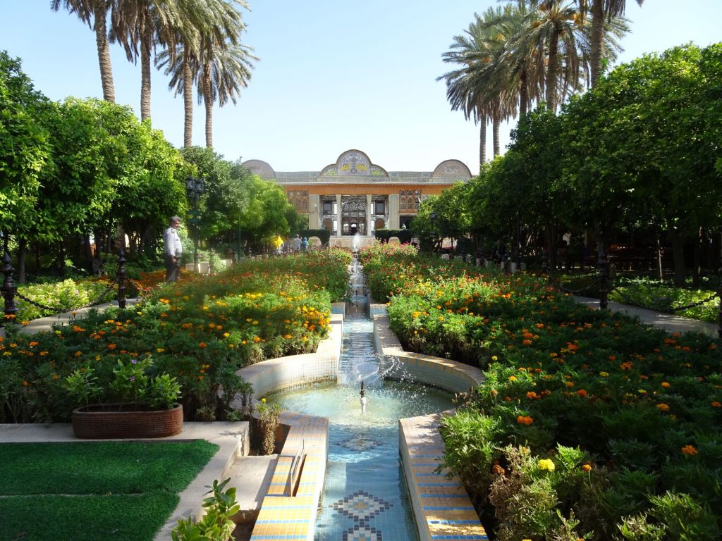
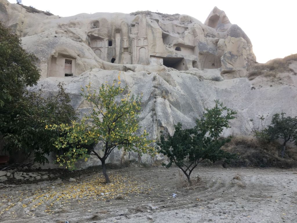
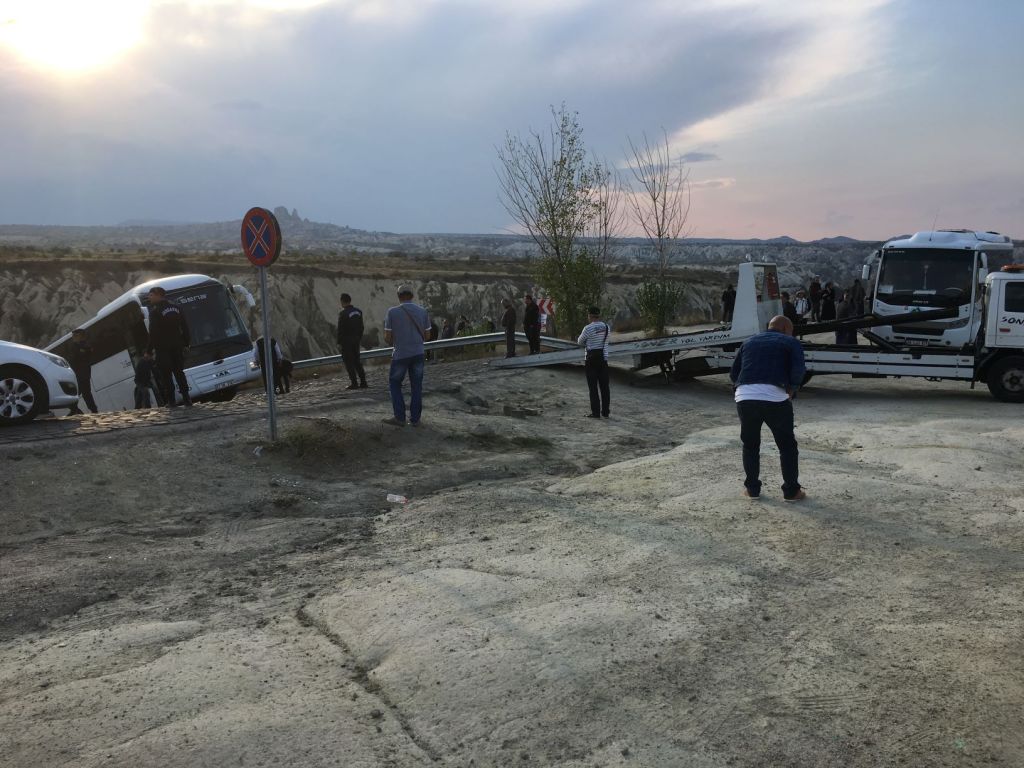
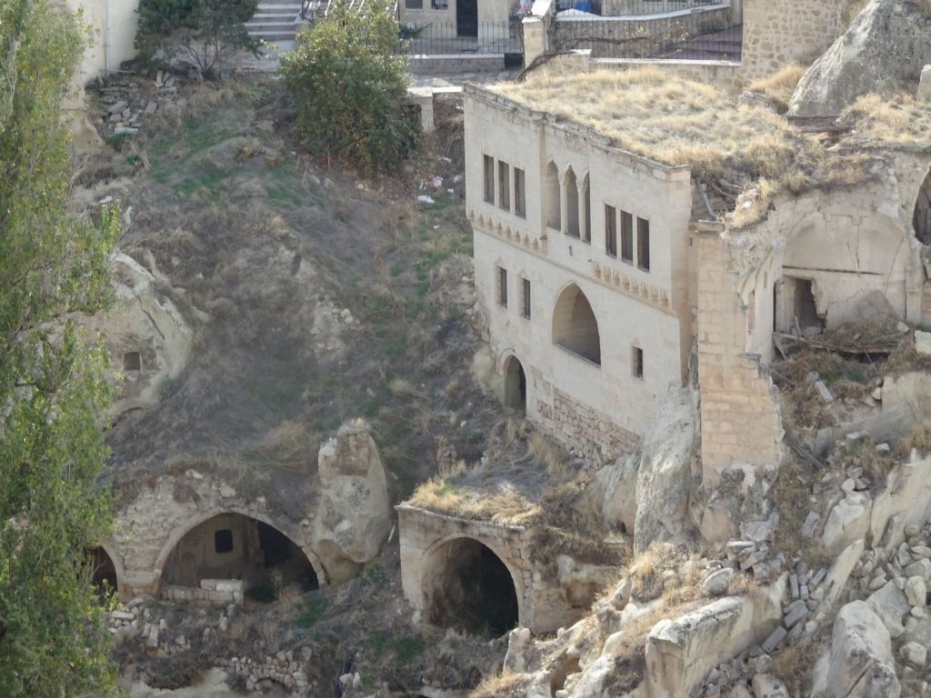
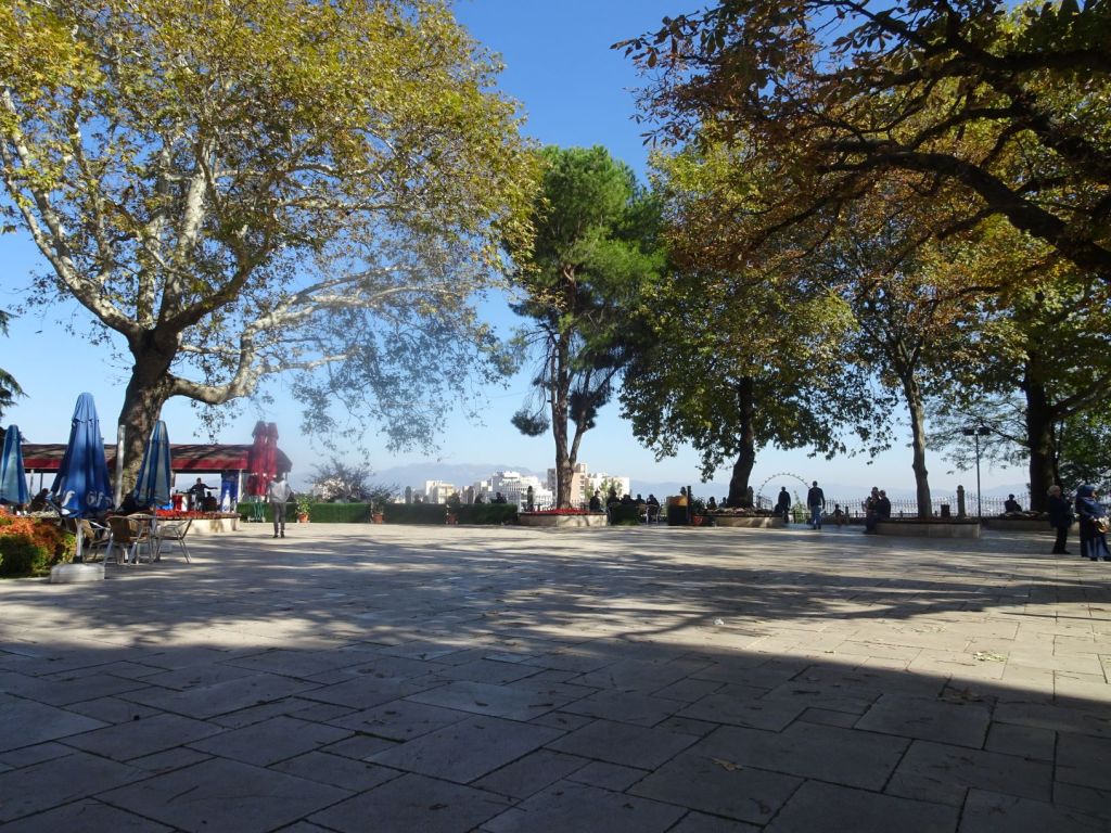
Miep sees it coming that Roelf will be working on the car all day, and goes out to Goreme on her own. The place is totally spoilt by tourism; every foreigner is besieged with people with want sell bus tours, balloon flights, and of course, carpets. The landscape is quite spectacular however.

Miep enjoys her walk in the eroded landscape.

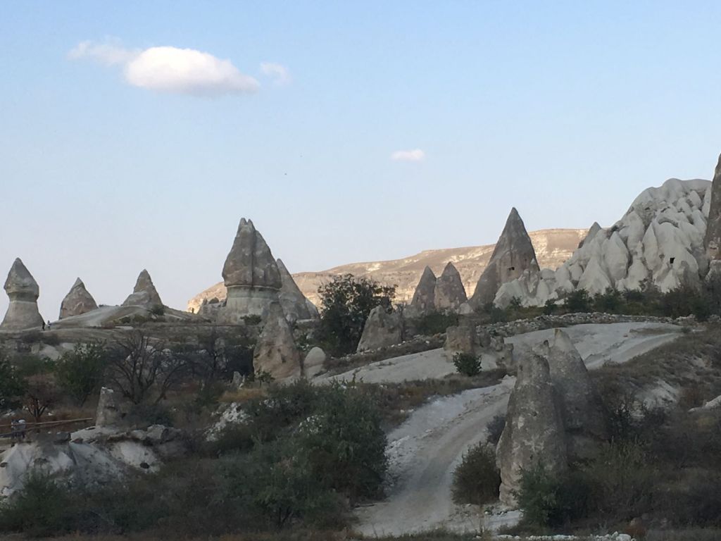
Rock cut out dwellings with towers and chimneys are everywhere.

Churches in the hill side

The narrow roads are busy with tourists in massive buses; for some the steep and narrow corners are a bit too tight. She finds one that has only two wheels left on the road. The driver has to stay in while it is being pulled up, looks very scary.

Where is the Mog to pull it out?

The day ends in a bit of disappointment because after a lot of deconstructing and putting back together again, Roelf and Sophie have left the torsion spring too slack. The whole thing has to be done all over again tomorrow. The good thing is that the finishing touches for the North West Iran section of the blog are completed and the post is published.
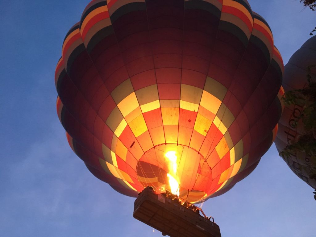
October 28

At sunrise, we are treated to a fantastic spectacle; hundreds of air balloons are filled up (with hot air and tourists) and released to the air to witness sunrise in Cappadocia.

Lighting up the early morning sky.

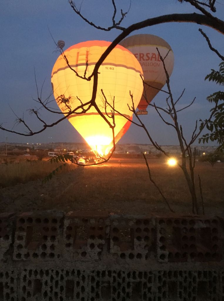
A ride sets you back £250

Quite a few takers

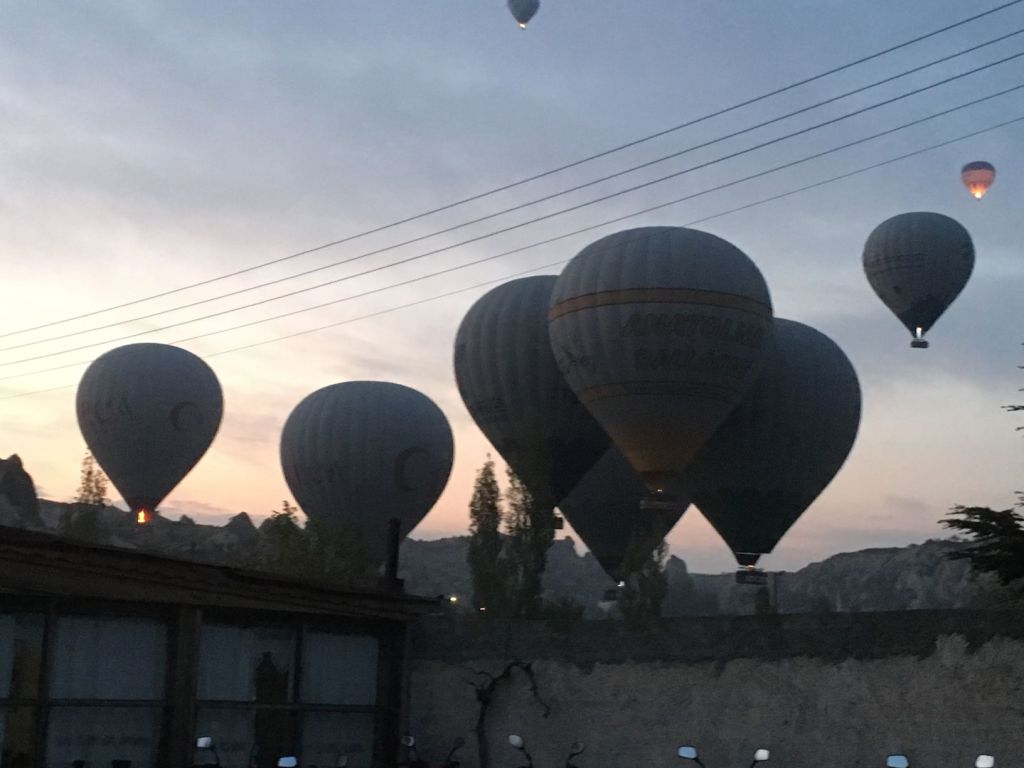
The experience lasts for about one hour.

We think there may be about one hundred in total; they are visible in all directions.

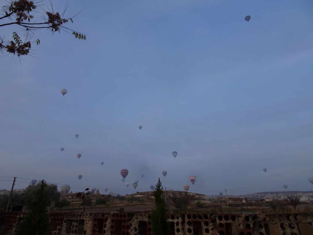
We somehow feel that we get the best of the spectacle for free.

Could they lift the Mog?

Some of the balloons go very close over the Mog.

We could see the people in the basket and they looked down into the Unimog

After the practice of the previous day, Roelf and Sophie get the torsion spring fitted at the right tension.

Celebrations all around

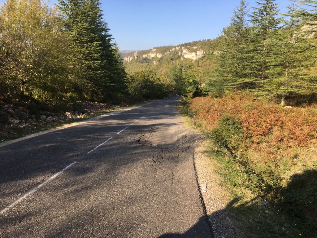
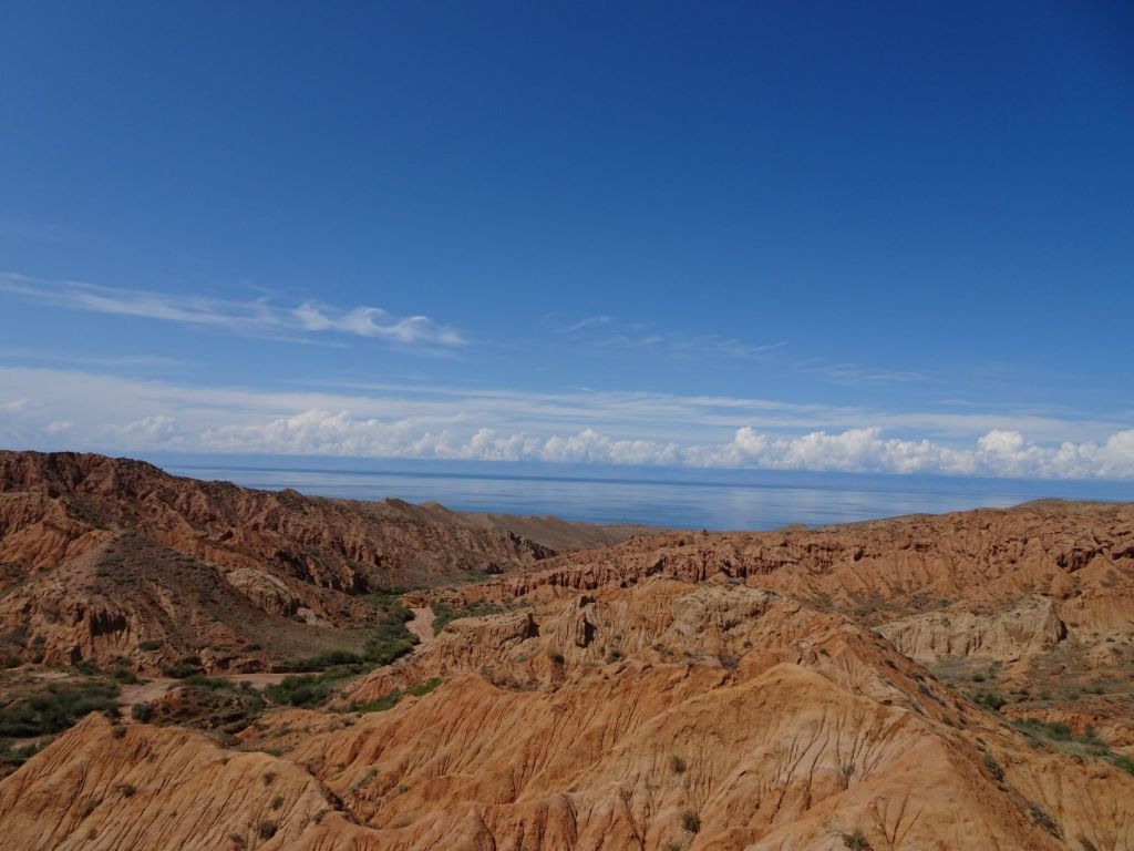
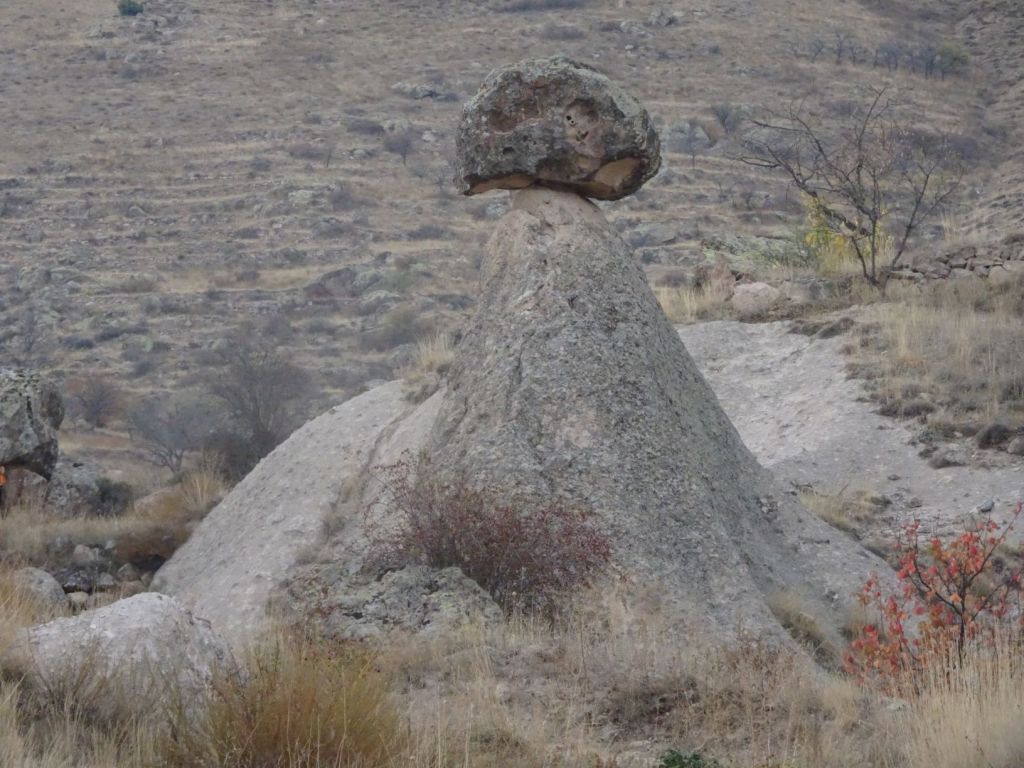
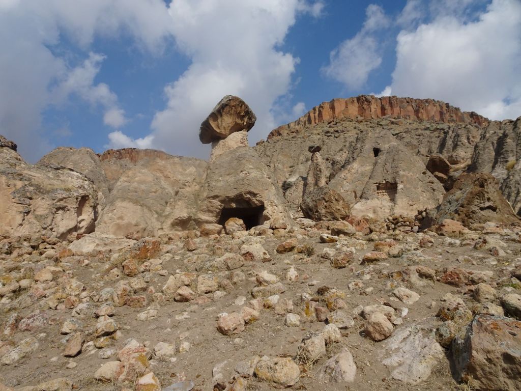
Way say goodbye and move on to other parts of Cappadocia. The landscape is dominated by the erosion of lime stone away from more hard forms of rock.

This can lead to exciting balancing acts.

Old rock cut out dwellings are intermixed with more modern buildings.

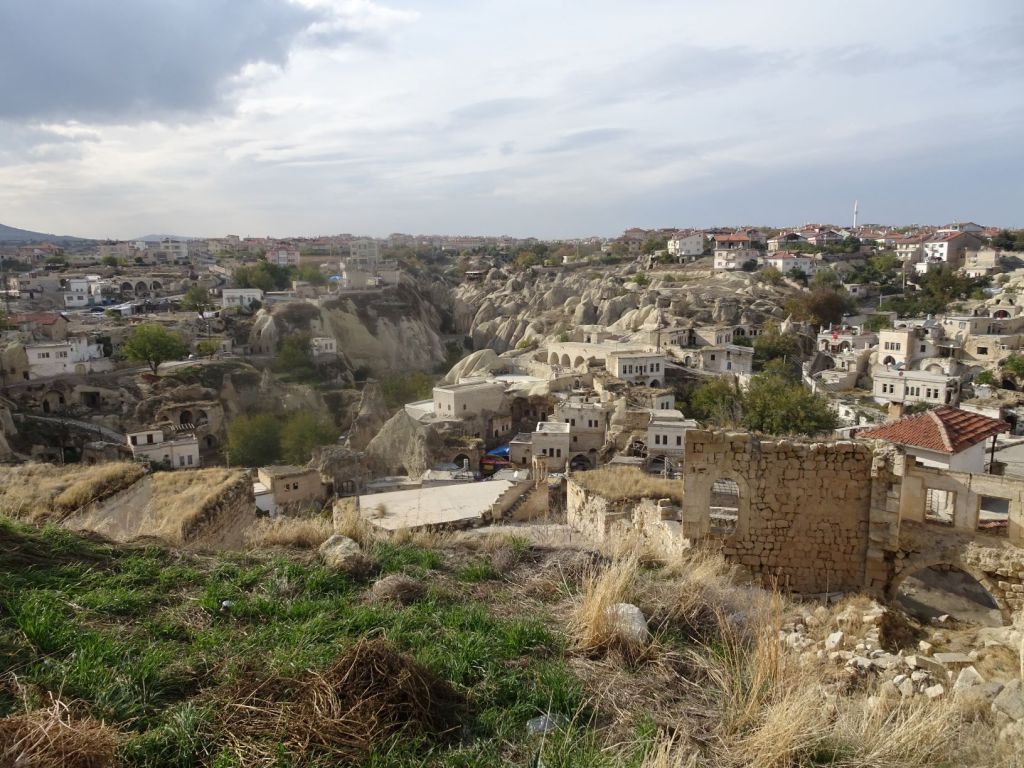
Clearly many of the cave houses are still in use. We see some cave houses with modern facades, and some still in their original shape.

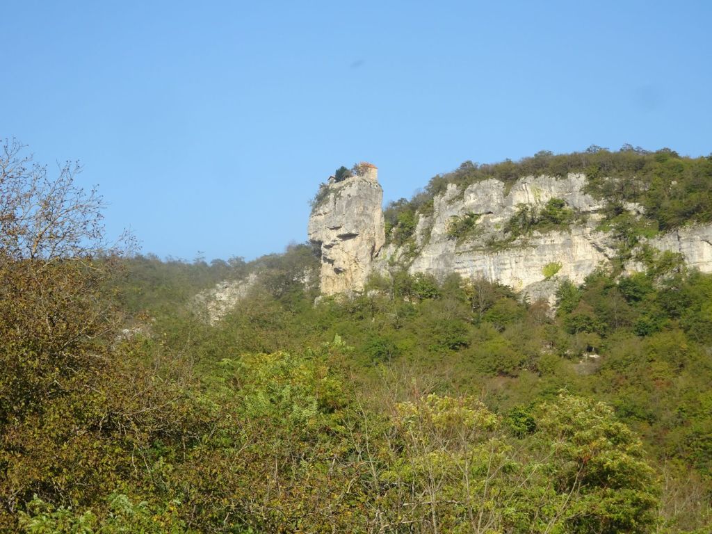
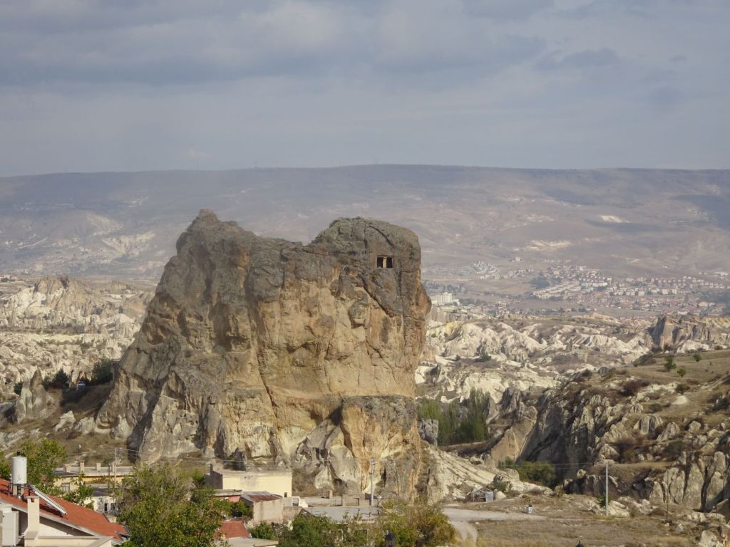
The bizarre effects of erosion have also been put to use in medieval times to create fortifications.

At some point in the early evening, we veer off the road and find a quiet camping spot near the village of Soganli. Miep makes a nice salad and dip for bread.

We literally did not see anyone during our stay here

October 29

What a wonderful night; totally quiet. All we hear are the birds singing. We have missed our private wild camping so much during the TME journey.

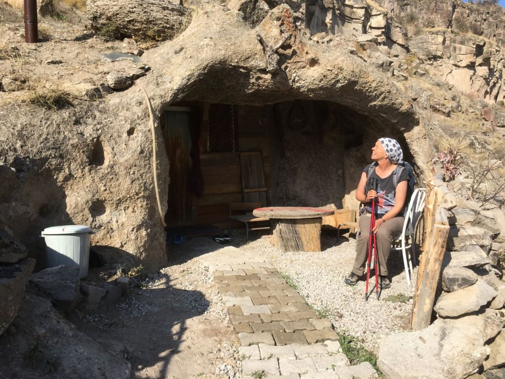
Just outside our camping spot we find a large cave with a stone balancing on top. The cave is used for storage by a farmer.

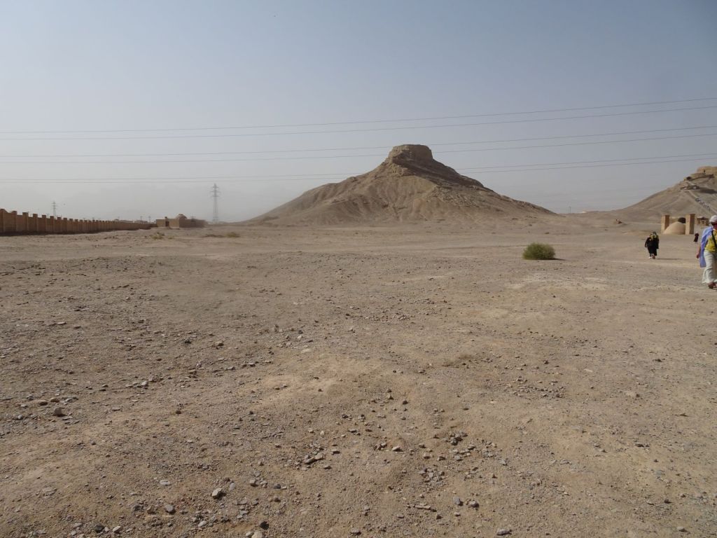
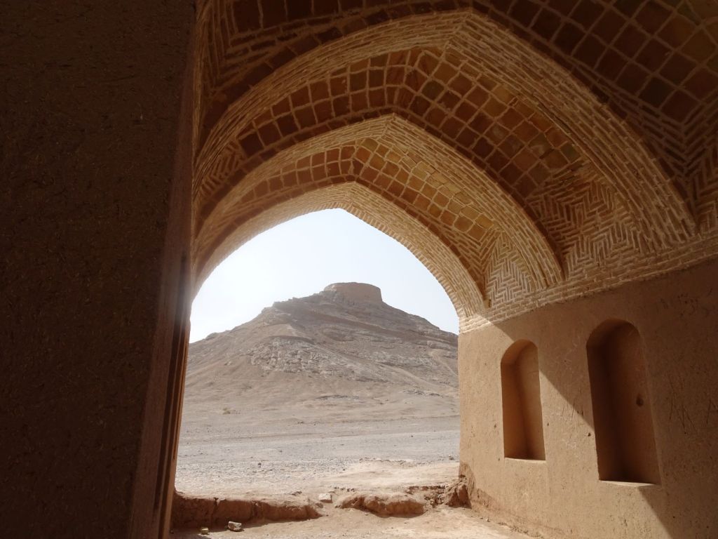
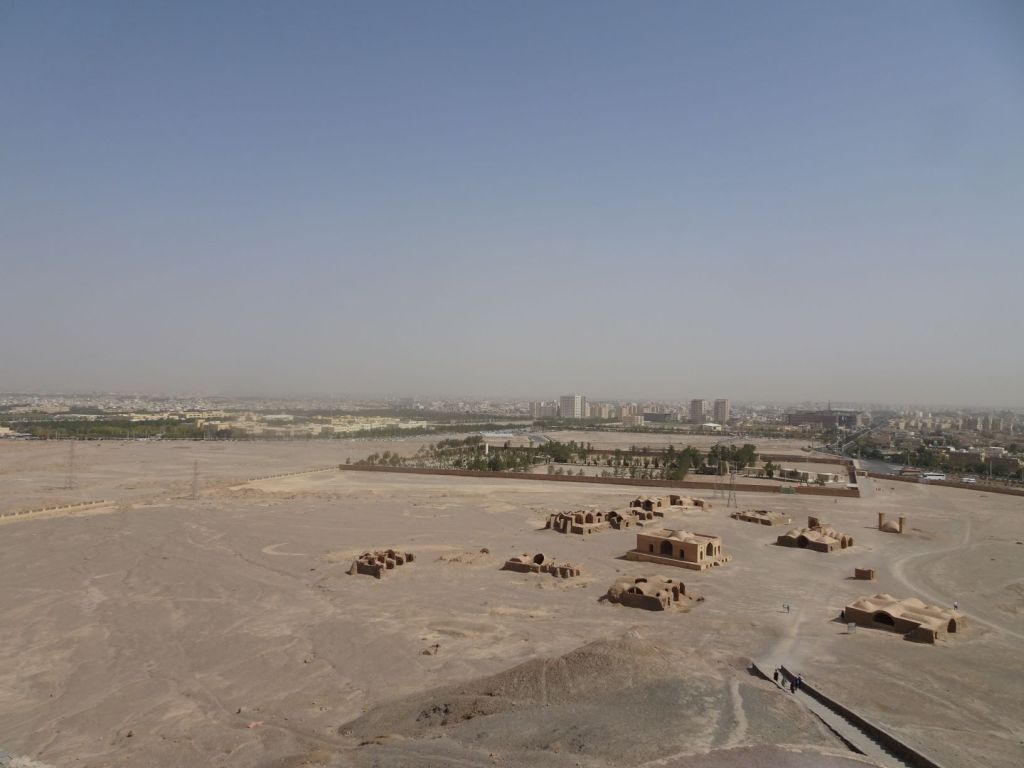
There is widespread use of the caves as storage space, or sometimes stables.

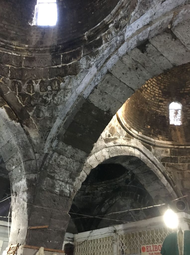
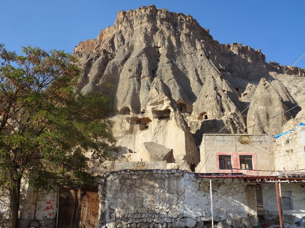
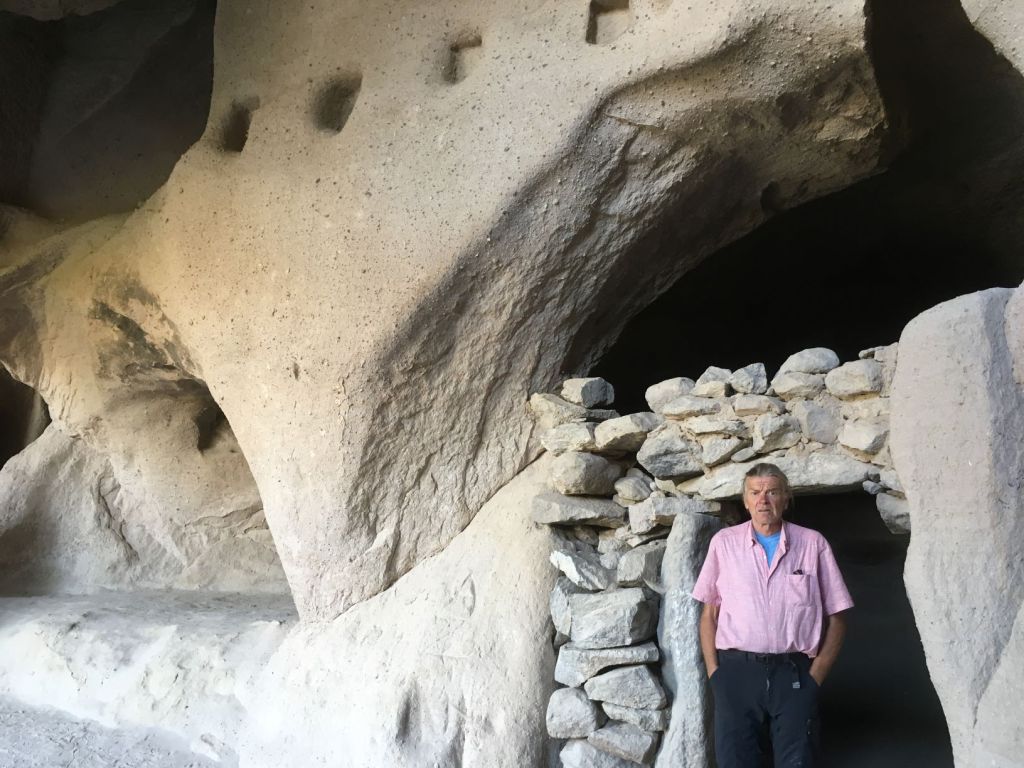
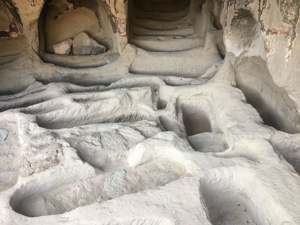
We visit one of the underground cities in the region. There are some 150 – 200 underground cities spread out over Cappadocia. They vary from what could better be named a village to true cities that could accommodate 30.000 people. These cities provided shelter from Persian and Arab raids during Roman and Byzantine times in the first millennium AD.

The houses were connected by hidden passages and traps were laid in strategic places. Communication channels 10 to 15 cm wide allowed communication between floor levels. Ventilation shafts and wells were bored down; some of the wells did not pass the ground level to avoid poisoning of the water by raiding troops. Animals were kept at the highest level. Kitchens, and wineries were at the lowest level.

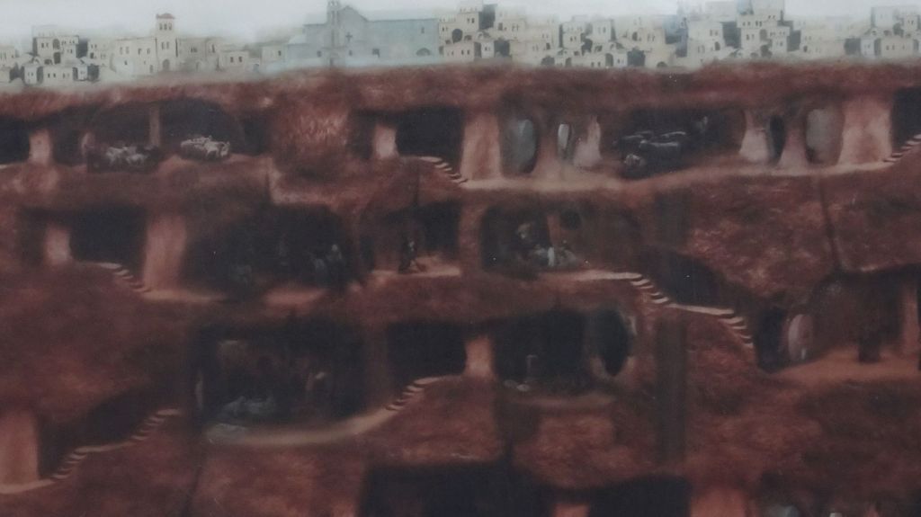
We visit one and wonder about how it would have been to live in these dark places with cattle and all during troublesome times.

We travel over a plateau to the famous Ihlara Valley. There is still some farming activity with potato harvest and the harvest of melons.

Sacks of tatties and the last of the irrigation pipes

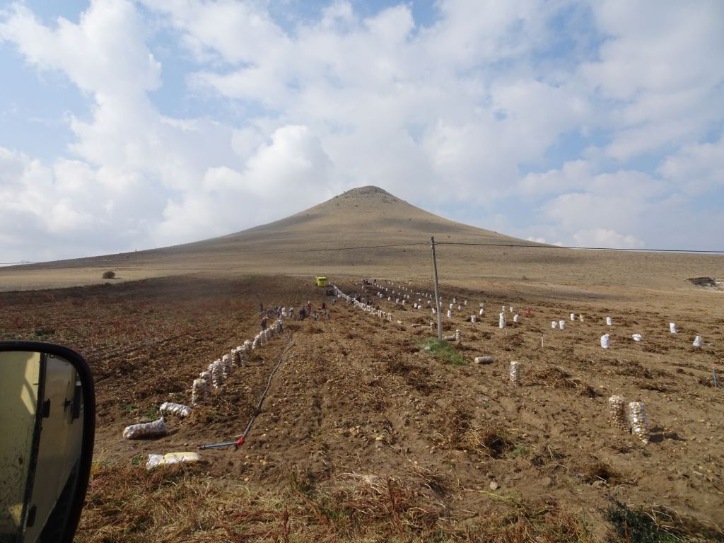
It continues to amaze us how these seemingly arid soils can produce so many goodies. Probably a lot of moisture comes down during winter and early spring, but we also see the endless irrigation pipes. They are now collected and stored for winter. Every village has a huge mountain of these black pipes.

Fields with melons

We reach Ihlara Village late afternoon. It is dead quiet apart from some elderly men playing dominos. A short walk to sample the valley and then we move on to find a camping spot.

The valley is a walking paradise with a number of entrances and bridges to make the gorge more accessible.

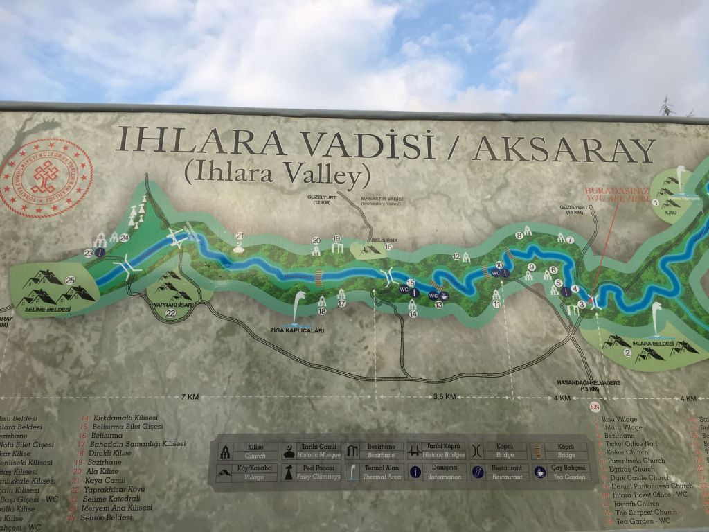
We find a really nice spot on a cliff edge overseeing the village of Belhisma.

Cliffs near Belhisma

October 30

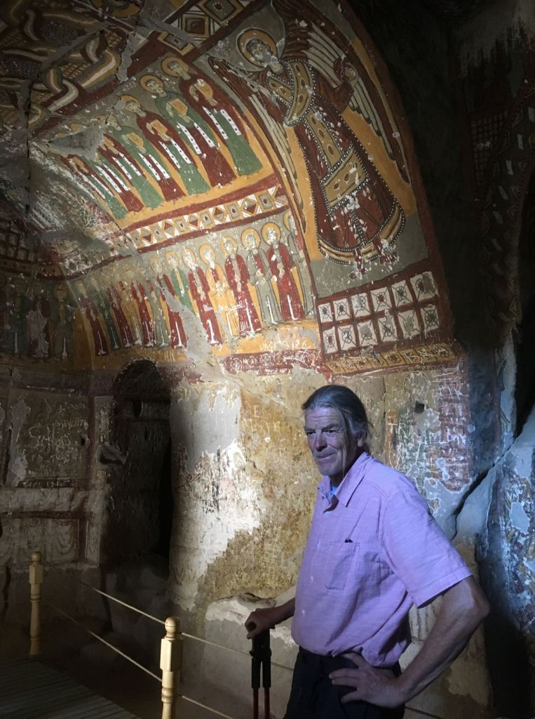
Another quiet night we wake up to the noises of the village down below; cow bells and a cockerel. We are going to do a walk today. Hopefully 10k plus. The valley is famous for its flora and rock cut out churches.

We set out early in this beautiful gorge

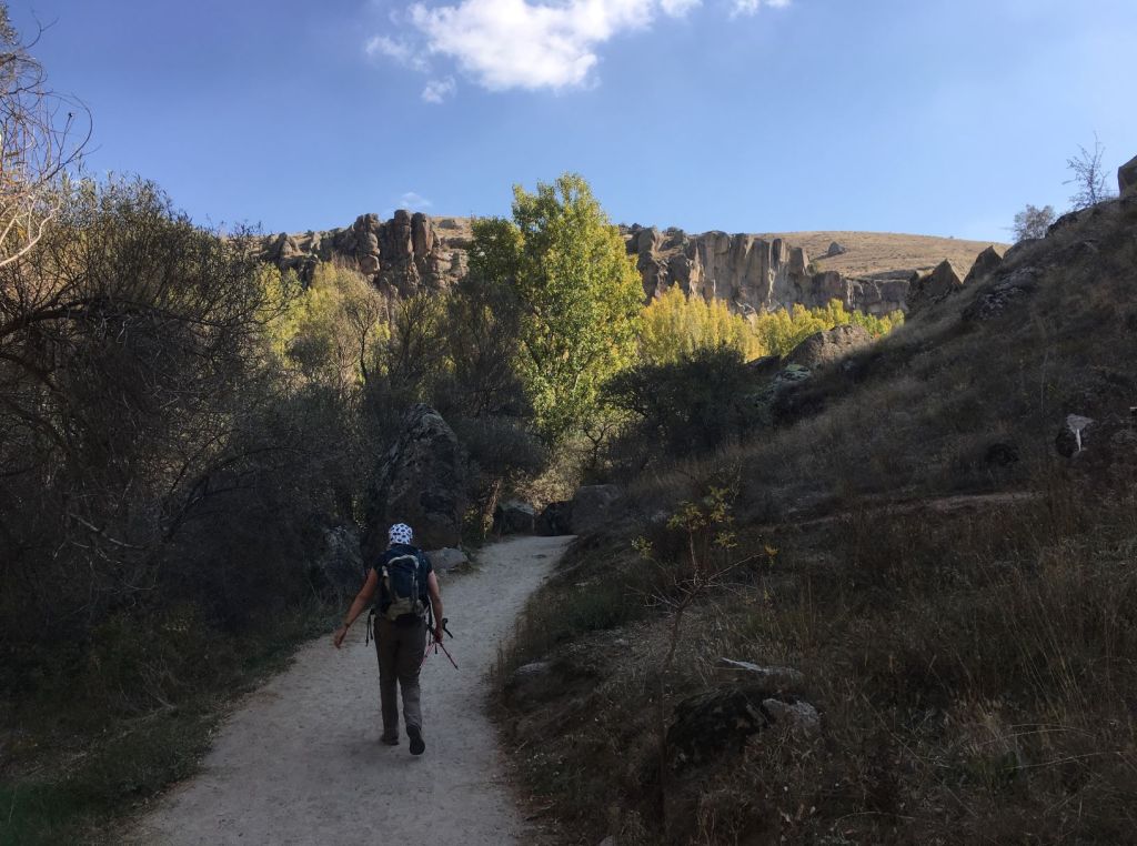
Autumn colours below, blue sky above.

The churches are everywhere.

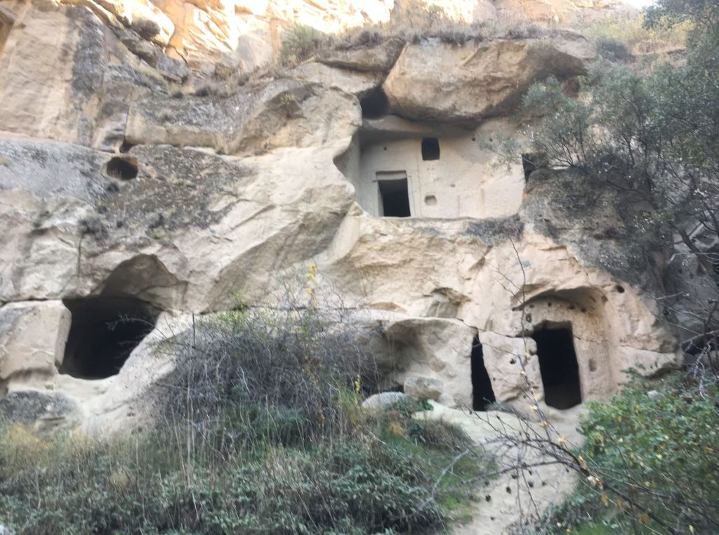
Some of the entrances are quite grand.

Others less so…

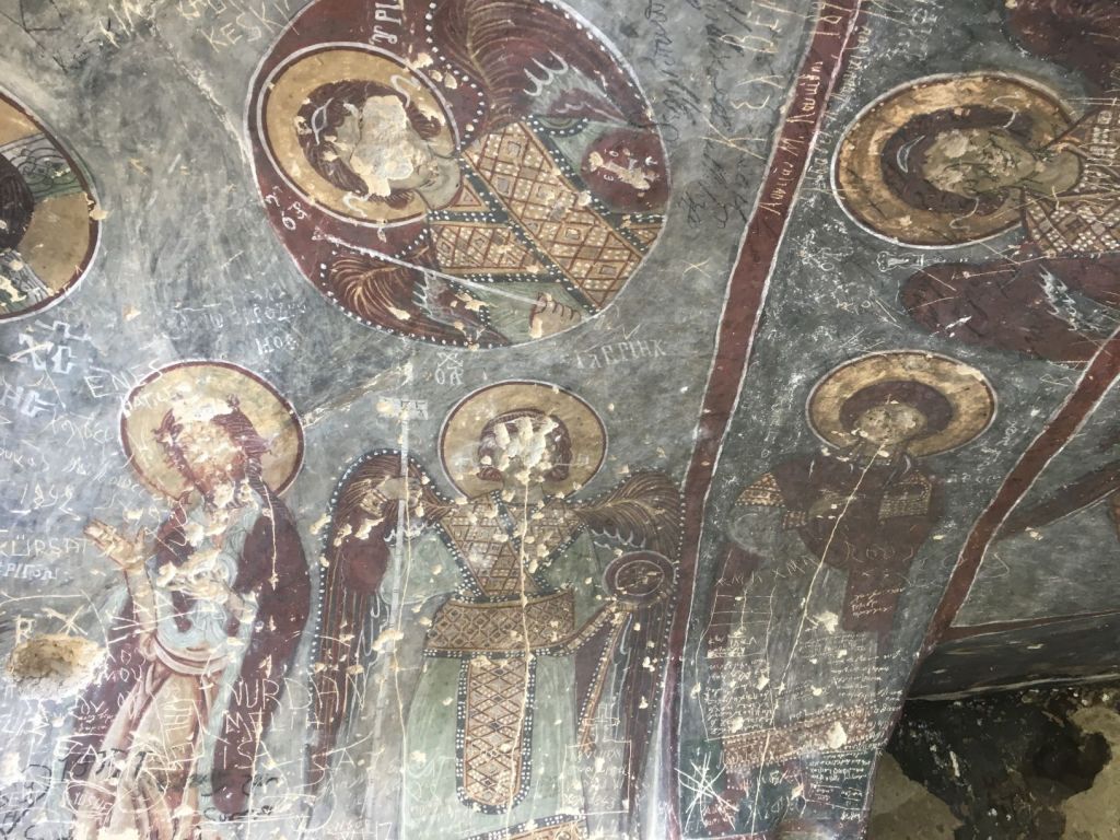
The frescos are awesome; to imagine that they have been around for more than a thousand years…

But it is rather disturbing to see extensive defacing, probably by overzealous Islamists.

Some of the churches have a graveyard inside

There is also the occasional dwelling place still in use.

We are quite hungry after the walk and are lured in to a restaurant at one of the entrances. Something Roelf absolutely does not like: “Come in to my place to eat”. But we did it anyway.

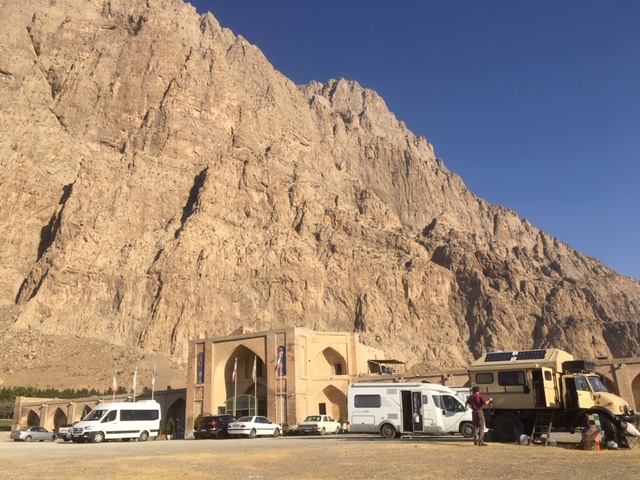
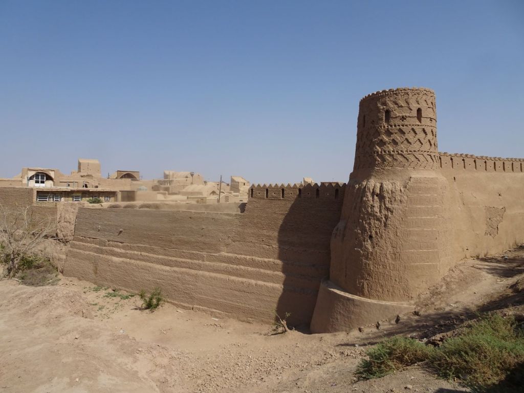
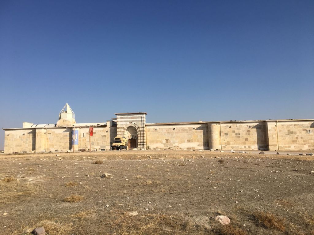
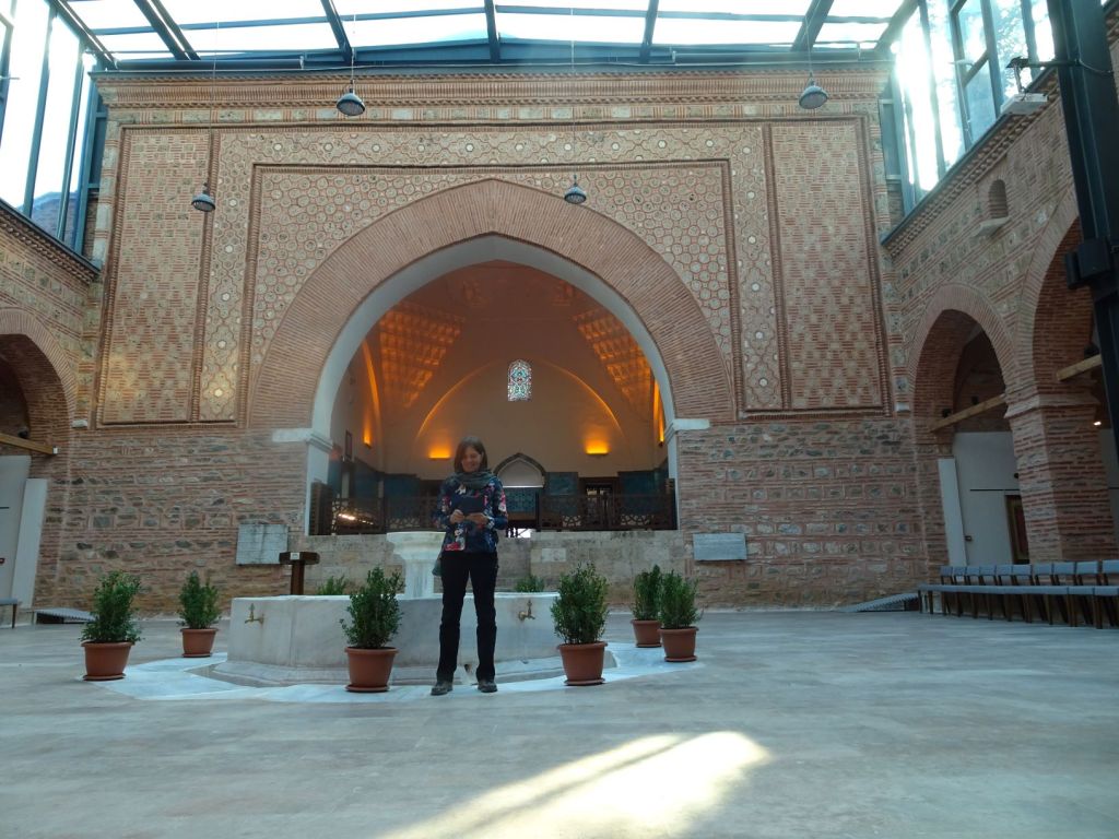
After the meal we drive a bit further in the direction of Konya. We camp at a caravanserai; very fitting!

The Zazadin Han was built in 1236 and is massive. It is no longer in use and birds have taken over the brick walls for nesting. The sign at the entrance explains the many services on offer in the past: water, food and shelter for man and beast, a mosque, laundry, bath house, shoemaker, barber, tailor, medic and vet and so on. Would be perfect now as well for any motorised traveller especially if a garage service were included. These services were for free for the first 3 nights in this Hani and in some they were free full stop! There was a Hani every 40-50 km along the major trade routes. A bit like the inns you see in the British Isles every 10 miles or so. All this infrastructure was built to encourage trade during Seljuk times.

October 31

We hear a strange noise in the car. Are there birds in the cabin? Yes, several have got in along the engine block because we left the cover off overnight to help get some heat into our sleeping quarters. They are delighted to be let out and no damage done to bird or car.

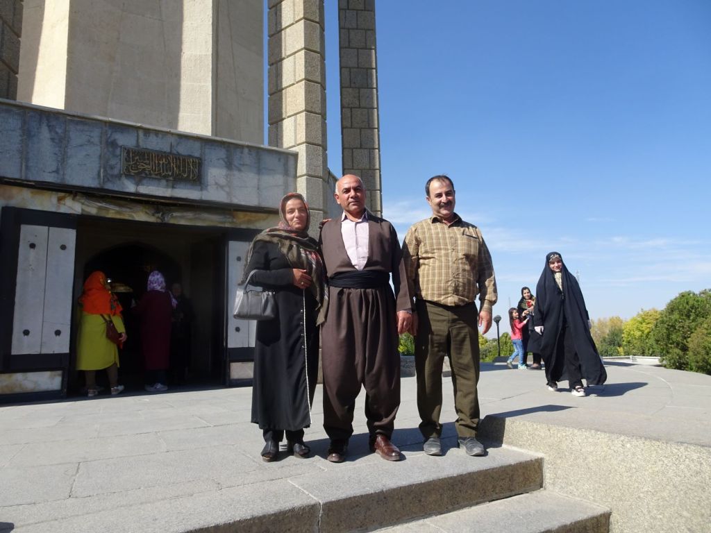
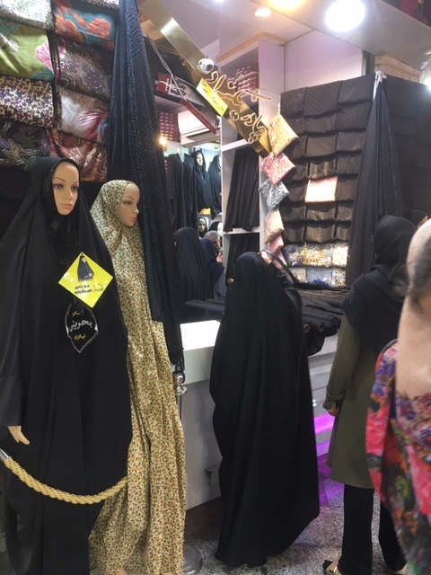
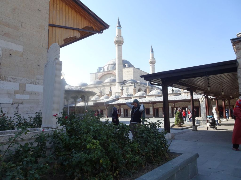
We drive the short distance to Konya. it is a lovely day and we park a km or so away from the centre of town to walk in. Interesting to see who live here. There are many women here wearing black and some have everything covered except their eyes. We have not seen this strict Islamic dress code for some time.

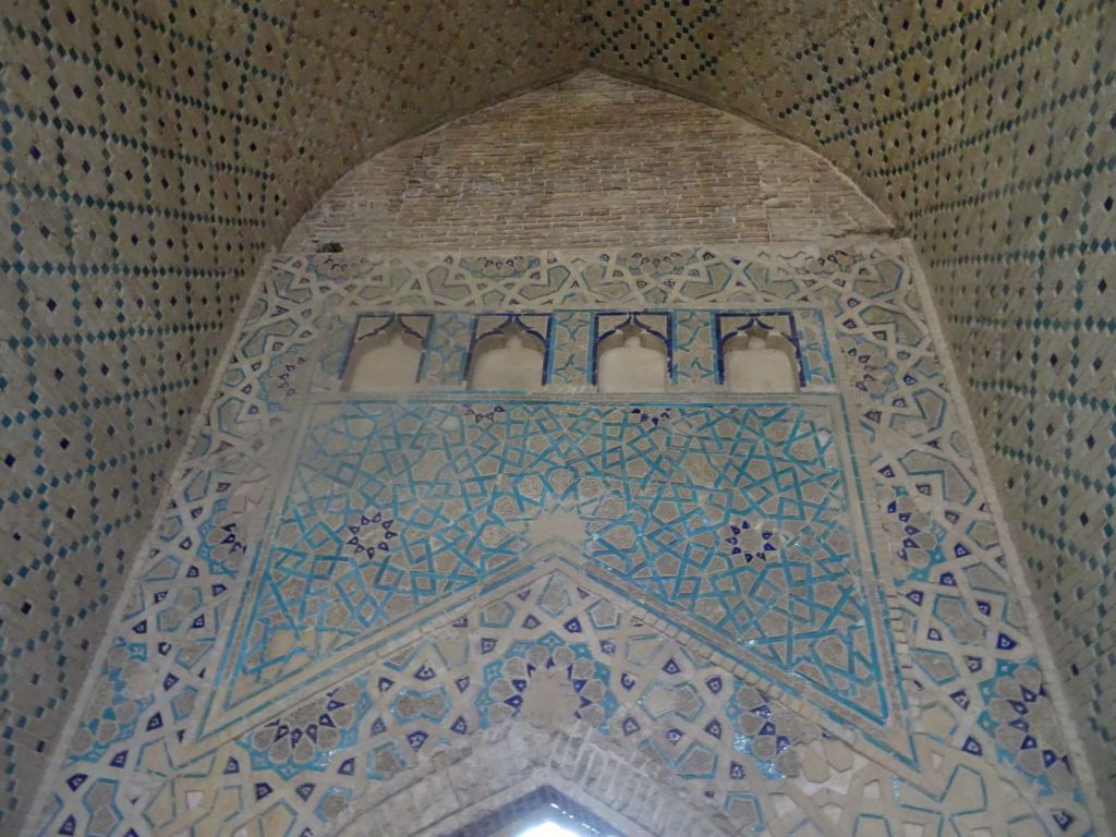
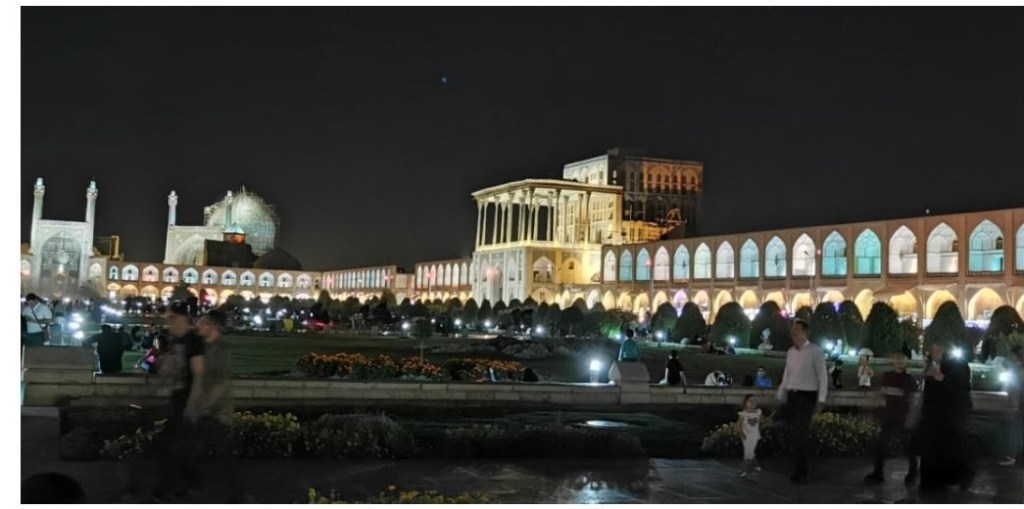
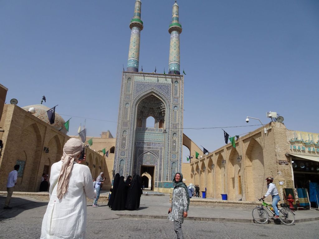
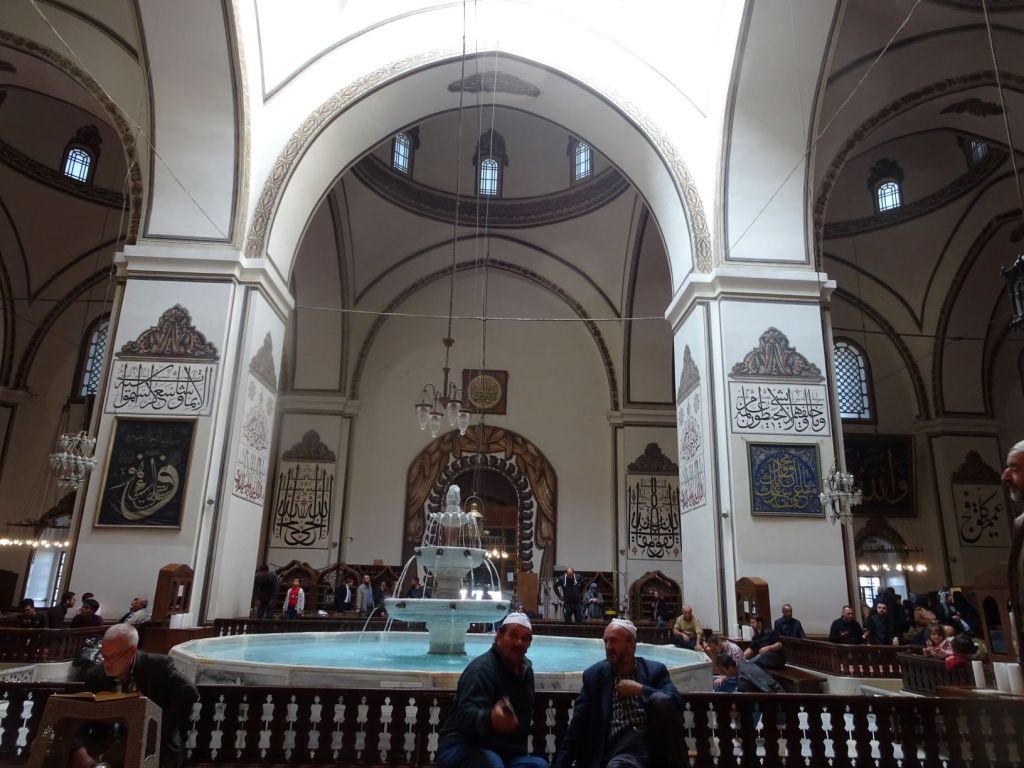
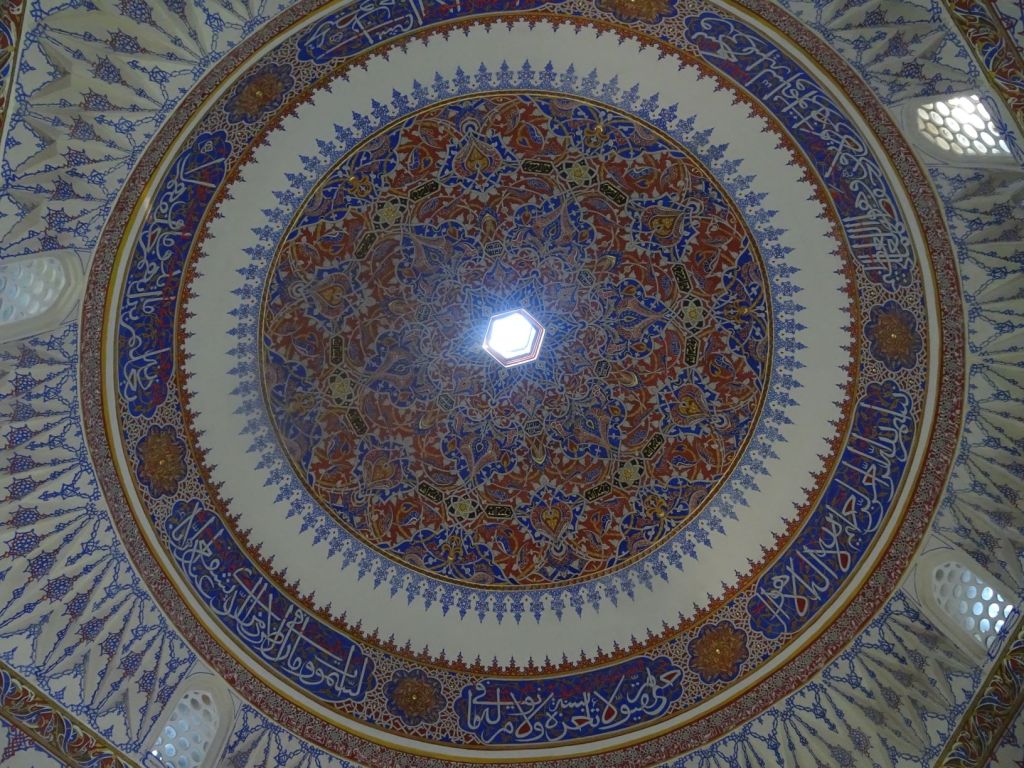
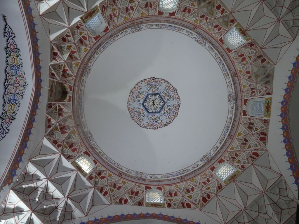
In the central square in town we see what people come here for: the mosque but especially the mausoleum and the place of learning for the Sufis.

The madrassa complex in Konya

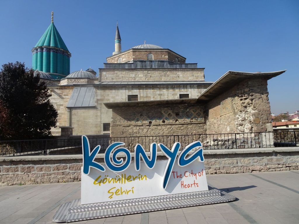
Sufism became a branch of Islam not long after Muhammed’s death. Some believers felt that the muslim teachings were too worldly and did not keep to the strict principles of Islam. Most Sufis are Sunnis. They were called the ascetics initially, but were named Sufis later after their dress. ‘Suf’ means wool and Sufi’s are those who dress themselves in wool. Sufism has had a number of prominent thinkers, and one of the greatest was Jalal ad-Din Muhammad Balkhi Rumi, popularly known as ‘Rumi’. He was a Persian poet who was born in Balkhi, Khorasan (present day Afghanistan) but spent his working life in Konya where he died in 1273. He was given the title ‘Mevlana’; Mevla means God (Allah), and Mevlana is ‘he who thinks about God all the time’. The title is given only to someone very highly regarded in terms of religious influence. Rumi is hugely influential, even today, in Central and Eastern Asia, but also in the United States where he was declared best selling poet at some point in the recent past.

Many quotes are attributed to Rumi; the one we like is: “Sell your cleverness and buy bewilderment”

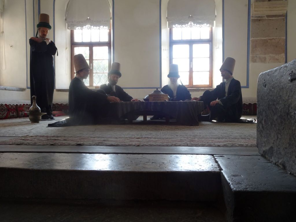
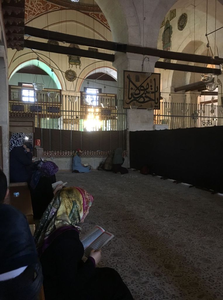
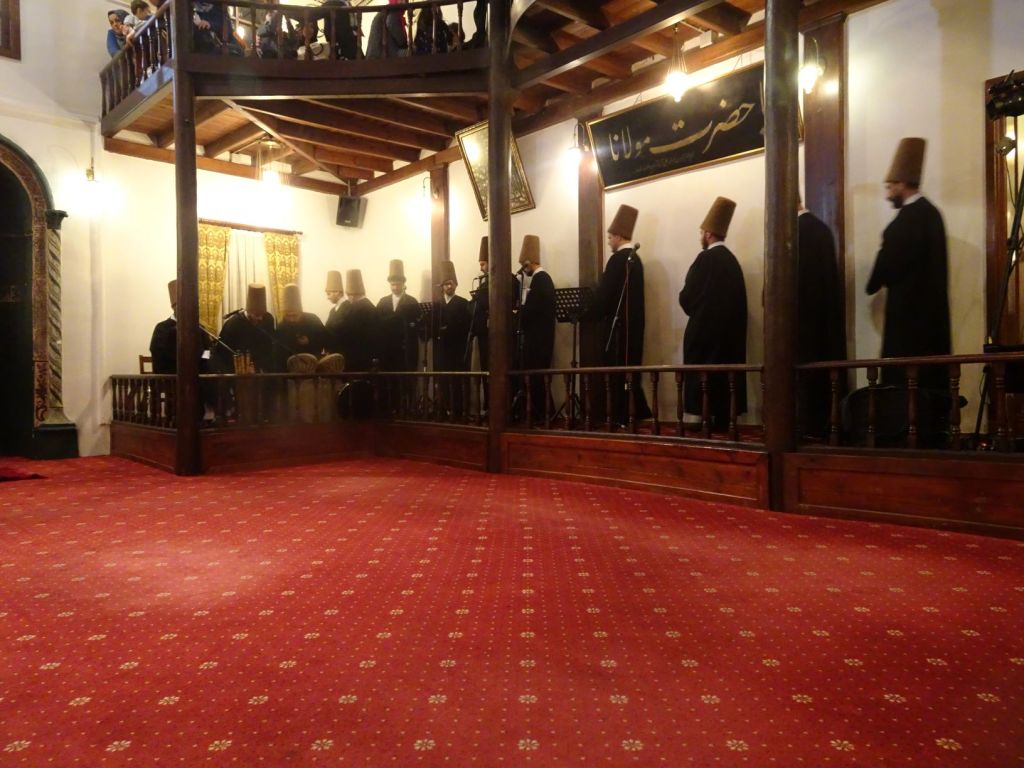
We first visit the museum housed in what used to be the ‘cells’ for apprentice Sufis.

Inside the complex

Here they would be trained in the skills of meditation, the dancing that is so special with the Mevlana Sufis, and in the music and singing that accompanies their dance. We see the clothes they would wear, distinguishing those who have just entered the madrassa and those who have qualified to wear the dervish tall hat.

Representation of senior Sufis having tea

We see the books they would read and study, the calligraphy, the musical instruments. These cells are around a courtyard with beautiful fountains and places to wash hands and feet as part of the prayers, five times a day.

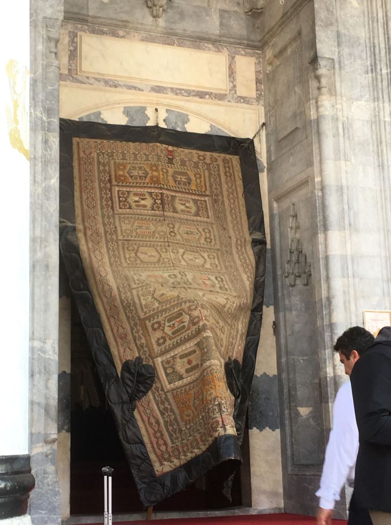
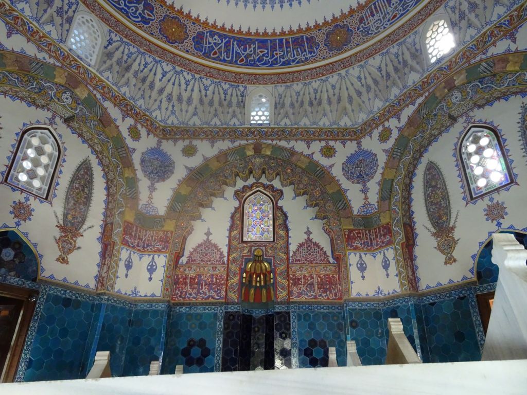
Then we enter the mausolem. It is huge and it takes your breadth away.

Inside the mausoleum

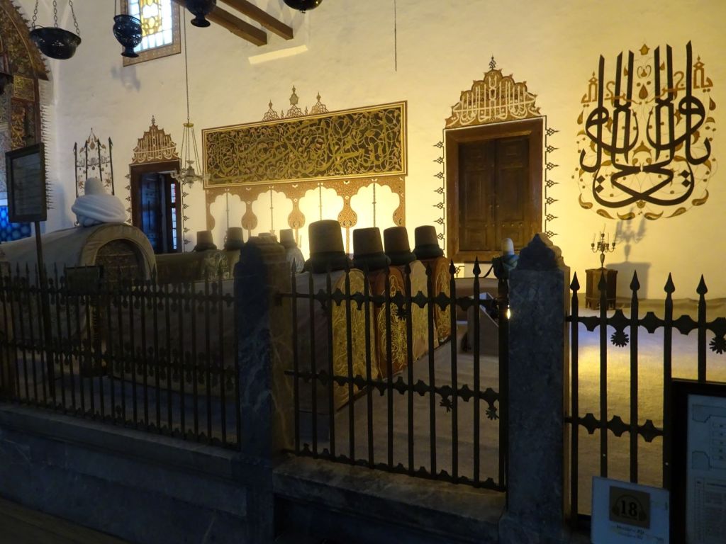
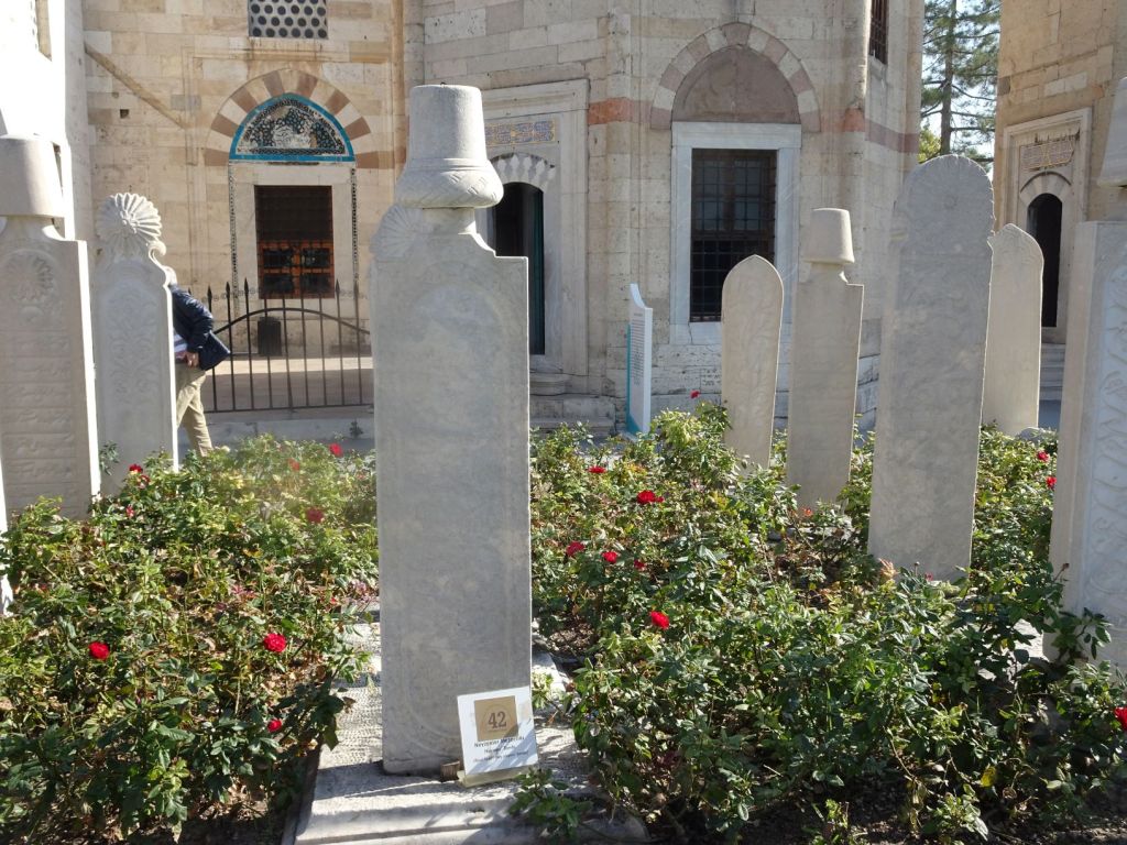
We had not expected the tombs of so many important Sufis. And for these to be so prominently displayed. Most prominent amongst them all is the tomb of Rumi.

Rumi’s tomb

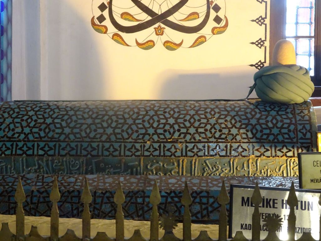
The tombs are covered in embroidered cloth and on top is the typical headdress of the person, commensurate with his rank. The one of Rumi is the highest of all. We later learn that the hats represent the male generative organ, hence only tombs of men have these headdresses on top, women don’t have them nor young boys.

Tombs of other Sufi dignitaries

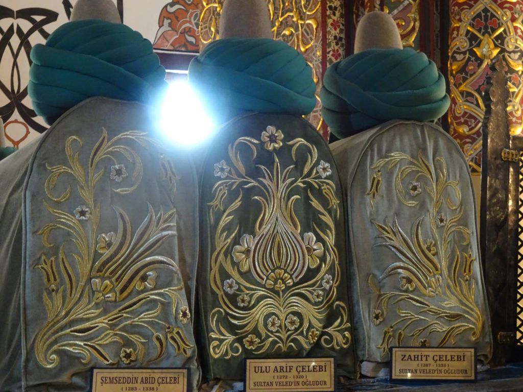
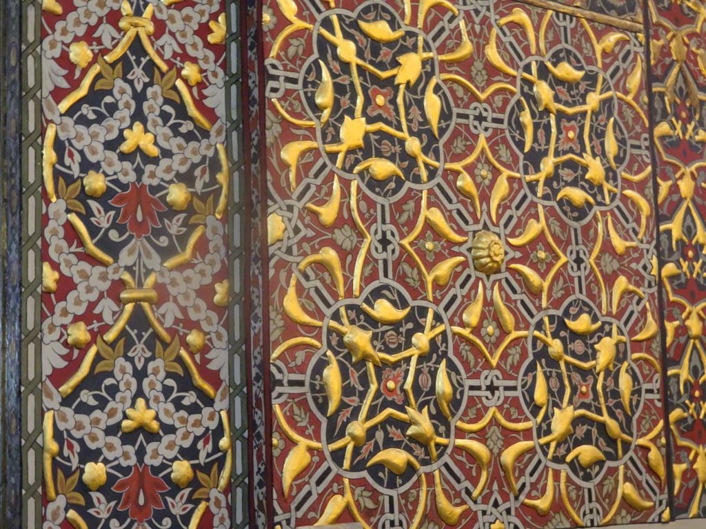
The building is decorated with scripts ad also beautiful gold and coloured patterns on columns and the domes.

Lots of bling

There are incence burners and glass containers for candles (lighting candles was another important role you could have in this sect). It is quite busy, many Turkish families have come to visit this site of pilgrimage.

Busy with tourists and worshippers

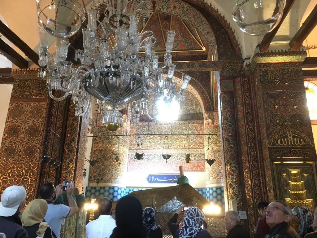
Not only is this a shrine for Sufi muslims, it also houses inside a gilded box hairs from Mohammed himself making this a site of pilgrimage for all muslims.

Is it true, is Muhammad’s hair in this box? She certainly thinks so.

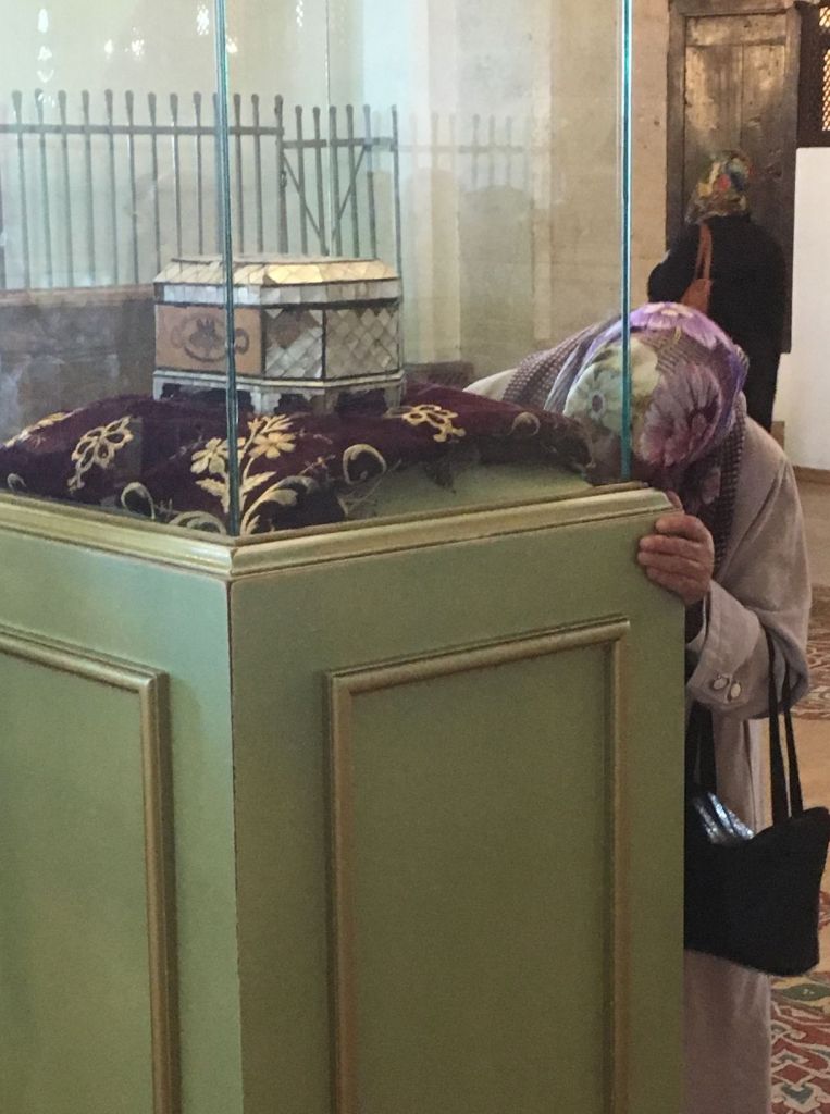
Those who visit pray in front of the tombs or circle the cabinet that houses the gilded box. They are often very emotional. On exit we come pass another place of worship, here the women are separated from the men. Many younger women sit and read saying the words aloud. Religion is clearly very important in this era as well.

There is very tolerant atmosphere in Islamic holy places; believers of different sects of the religion are welcome, but also believers of others faiths and even non-believers as long as the respect some basic rules of behaviour.

Outside in the courtyard there are the graves of prominent Ney players.

The Ney is an end-blown reed flute. Ney players are very highly regarded as they have a crucial role in the music that accompanies Dervish dancing that is performed by Mevlevi Sufis to get closer to God

Konya is a world away from the blatant commercialism we have seen in Cappadocia. We find it all very moving and the place quite wonderful.

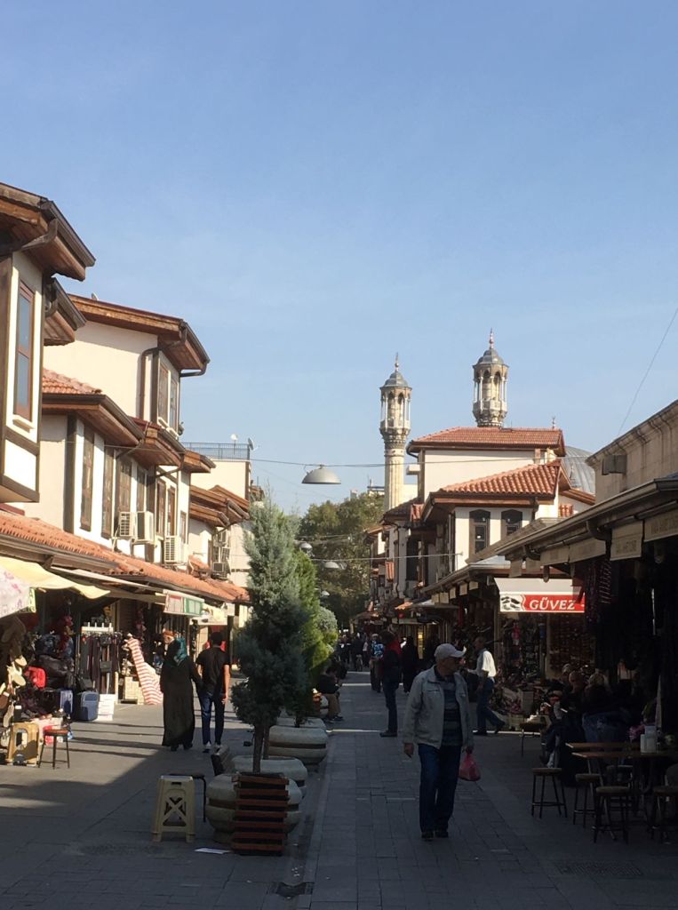
Then it is time to eat. The square is adjacent to the bazar and there are bakeries, shops that sell Turkish sweets, leather goods, textiles and so on.

Peaceful town

We eat bread with cheese, quite salty, and go to find a bankomat and see some more sights. It is time for prayers again; the men (and some women) hurry to the mosque 5 times per day!.

For praying only…

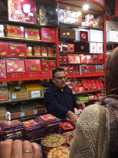
We keep walking along the bazaar and then a rose-covered hill that offers some panoramic views and where tens of men and women are working as gardeners. We buy Roelf a leather cap and a new wallet, some of those typical tea glasses they use here and things to eat including honey.

Paradise!

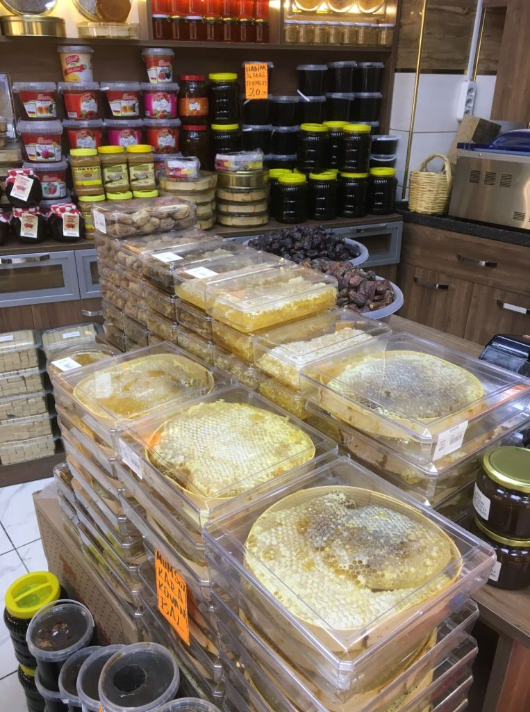
We visit a shop full of goods that Roelf likes: honey, cheese, dates, sausages, and more. We taste many types of honey and end up buying chestnut honey a chunk of cheese, and a large sausage.

When we get back to the car, a young family gives us a melon and a bread. The mother gives us the warmest, and the young girl the happiest, smile you have ever seen. You can easily imagine you are a bit of an imposition, with a big car and clearly not part of their religion and culture, but then suddenly someone comes forward and welcomes you so sincerely. It feels good, but also embarrassing: all these welcomes when we visit them, but in the UK we are too afraid to welcome foreigners into our own country.

This has been a good day. Konya has a great atmosphere and it was a very honest place. No harassment, just people going about their normal business and allowing us to be amongst them as their guest.

November 1

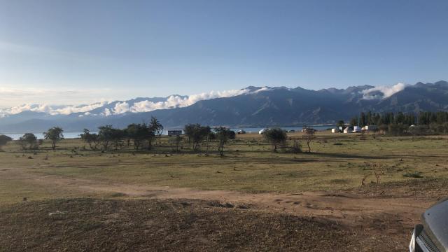
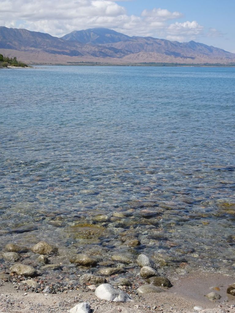
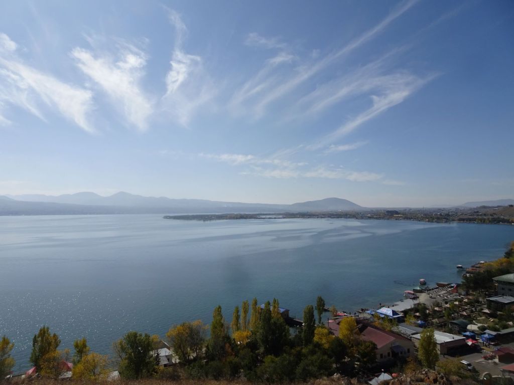
Yesterday we drove out of Konya and found a place to camp on the shore of Lake Aksehir. The lake is quite significant in size but only 7m deep at it’s deepest point. It is fed by a number of streams but also underground springs.

Lake Aksehir

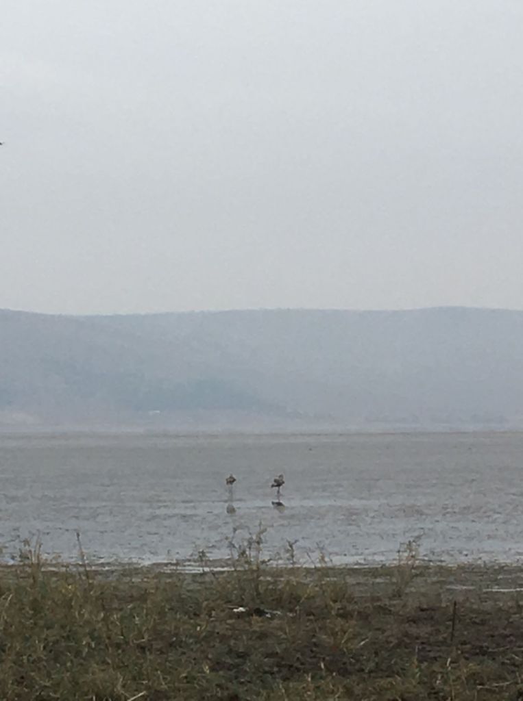
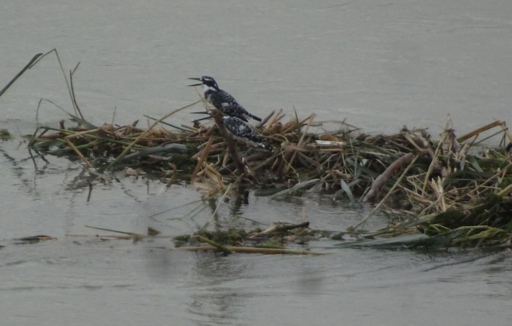
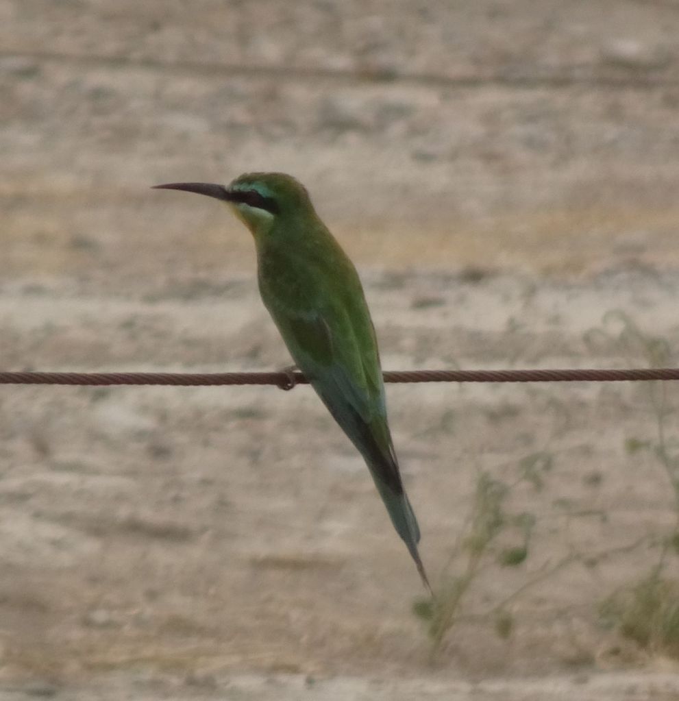
The lake is full of birds. We think we see Egrets more towards the middle, and close to us there some flamingos wading for food.

Flamingos

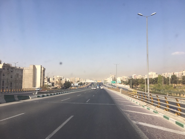
Today we will try to get as close to Bursa as we can, a relatively long drive of 200+ km. There is not much to see. This is the first rainy day we have in 2 months!. The town signs tell you their altitude and the number of inhabitants. We are surprised that the total population of Turkey is ‘only’ 80 million as we see so many cities with a population of >250 thousand and Istanbul alone has 17 million.

Closer to Bursa the terrain becomes hilly and the weather clears up a bit. We go off the road at around 5 pm at a spot with nice views towards the west and the east to camp. We are welcomed by two hunters and their dog. They carry not only shotguns but also a pistol!. All demonstrated to us with great pride. We do not feel uneasy about this at all, as they are incredibly friendly.

The spot is very muddy and we leave our shoes on the steps of the Mog. We have a good meal and look forward to tomorrow as the forecast says the sun will return.

Room with a view (we hope)

November 2

When waking up yesterday morning, we had two flamingos outside the Mog; today we have two diggers!. They are digging trenches right where we are. Well, it is a change from barking dogs we suppose.

Diggers!

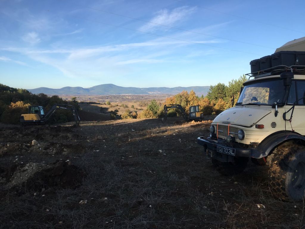
We hurry to get away from the spot before we get boxed in. the drivers are laughing at us, we think it is funny also.

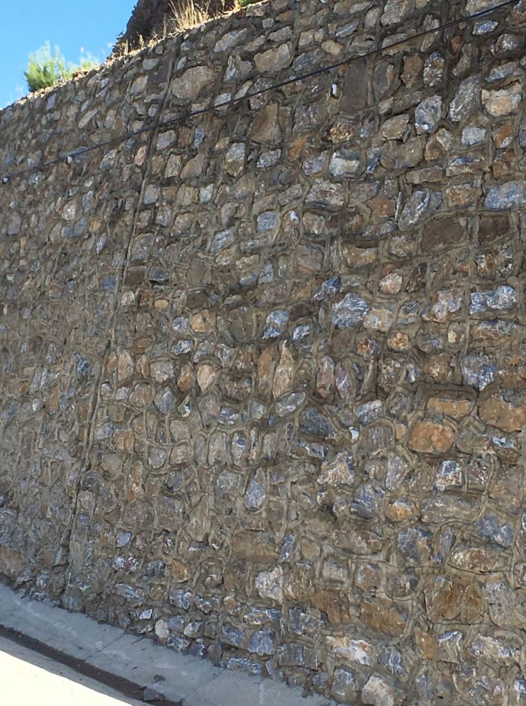
The weather is good and the drive to Bursa very nice. It is all downhill from the Turkish Highlands to the Aegean coast. We admire the roadworks; the retaining walls in particular are very tasteful.

Stronger and nicer than Roelf’s walls in Braemar

With a population of almost 2 million, Bursa has parks and gardens located across its well organised urban fabric and is surrounded by hills and forests on all sides. One of them, Mount Uludag is high enough at 2543 m to provide skiing in winter.

Approaching Bursa; first snow on Mount Uludag

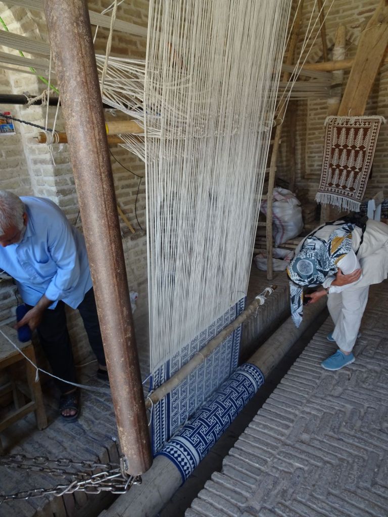
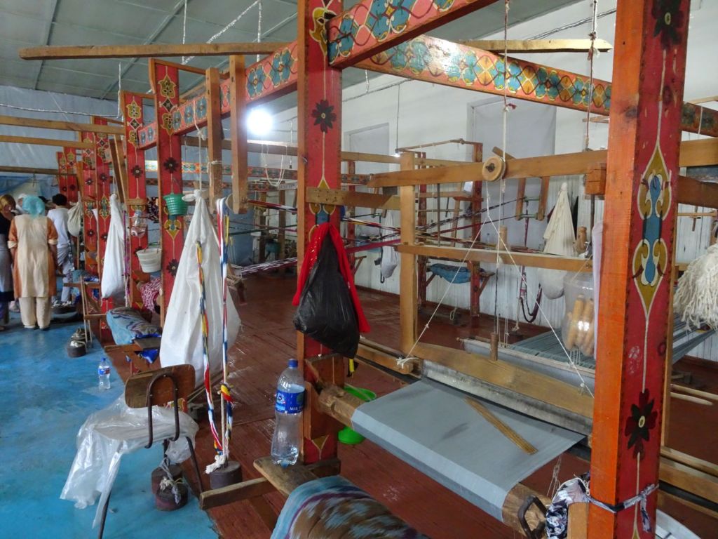
The city has been a settlement since 5200 BC. It was the capital of the Ottoman Empire between 1335 and 1363, and the mausoleums of the early Sultans are located here. Bursa is located on the western edge of the Silk Road and was the source of most royal silk products during the Ottoman period. During the 20th century, silk production has been in decline, but most recently there seems to be revival with new silk factories opening their doors.

We do not know where to park when we enter the city, and keep going towards the city center. It is very busy and the streets are cute but narrow; we feel a bit embarrassed driving through this in our big truck. Everything is well kept with new buildings mixed in with the old. No patches of barren waste ground like in previous cities where we can park the Mog.

We drive right through the center a bit up hill in to a residential area. At last we see a parking spot on a steep road. We need blocks to stop the Mog running back down the hill. We worry that we are a nuisance where we are parking and it seems that a local man has been watching us parking the car. But he is just very nice, welcomes us, and wants to know where we are going.

Miep knows she wants to go to the famous Bursa bazaar Koza Han. The man gives his name as Husseyn, but he speaks no English at all and we do not speak Turkish, so communication is very difficult. Husseyn has worked for 35 years the Fiat factory in Bursa and pointing to the Fiat Doblo’s we see on the road, indicates to us that he has had a hand in each and every one of them!. He is now retired, and unfortunately, his health does not appears brilliant.

Husseyn waves his hand and says “come, come” and we follow him. He takes us to the tram and pays for our tickets. The tram takes us to Koza Han.

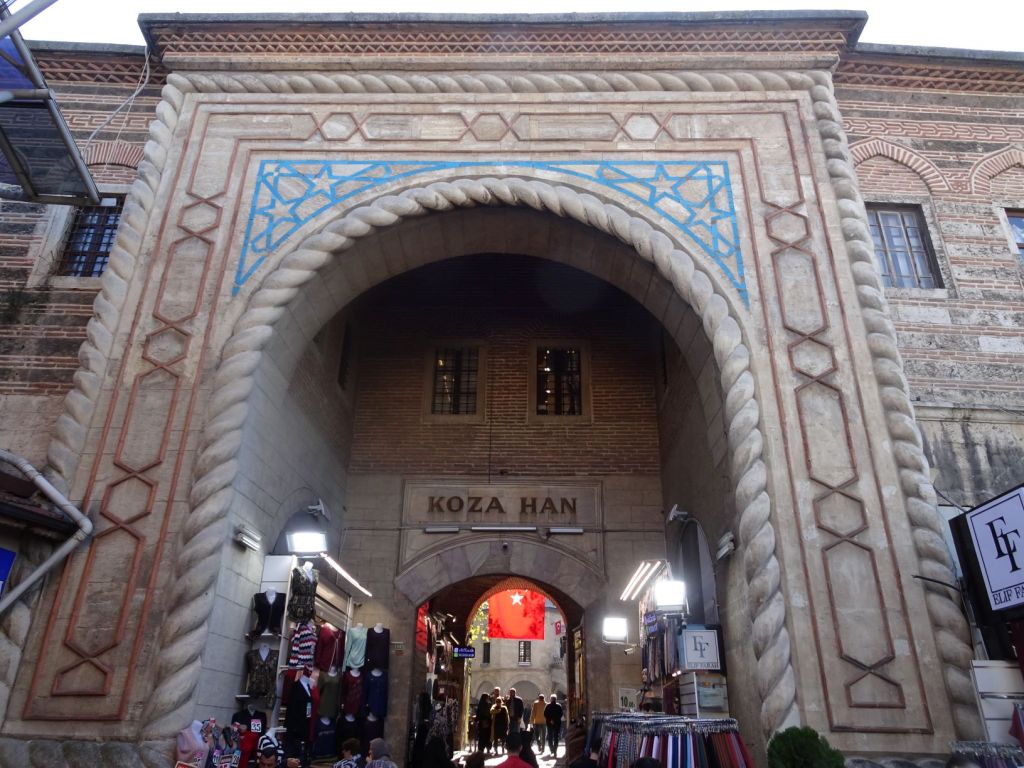
“come, come” Husseyn takes us inside.

Bazaar inside Koza Han

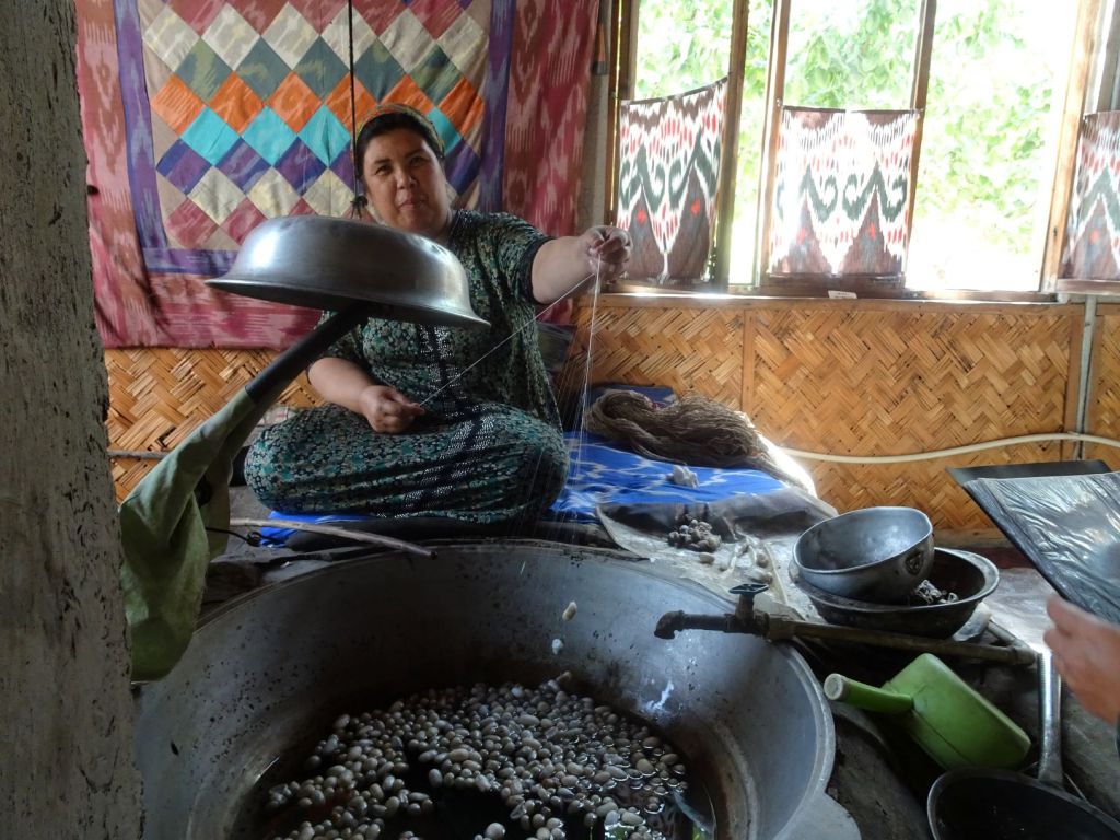
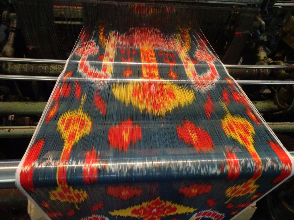
“come, come” Inside the bazaar, there is a demonstration of how silk is spun from unravelling cocoons.

Pulling the cocoons from the hot water; a single cocoon can deliver a thread of up to 3 km!
Unravelling and winding the thread
No reward for the silkmoth…

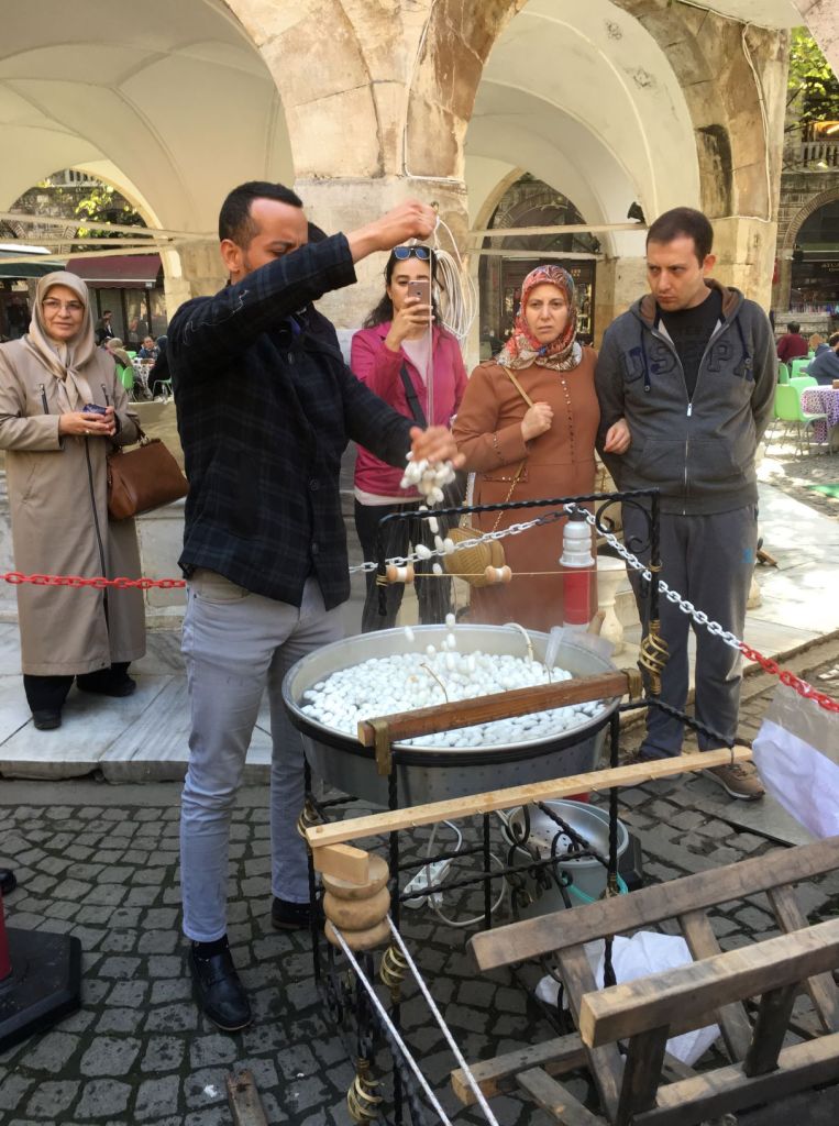
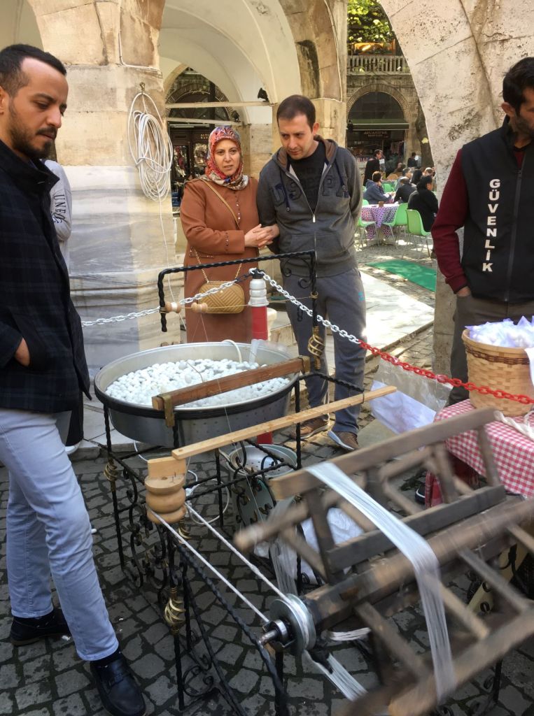
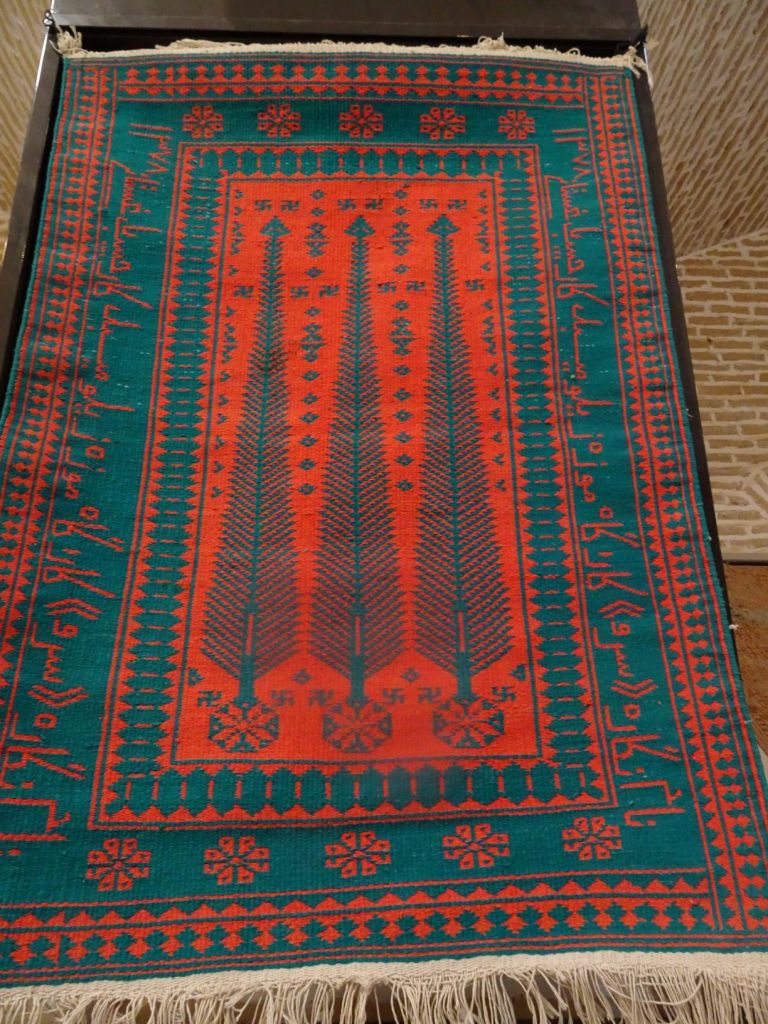
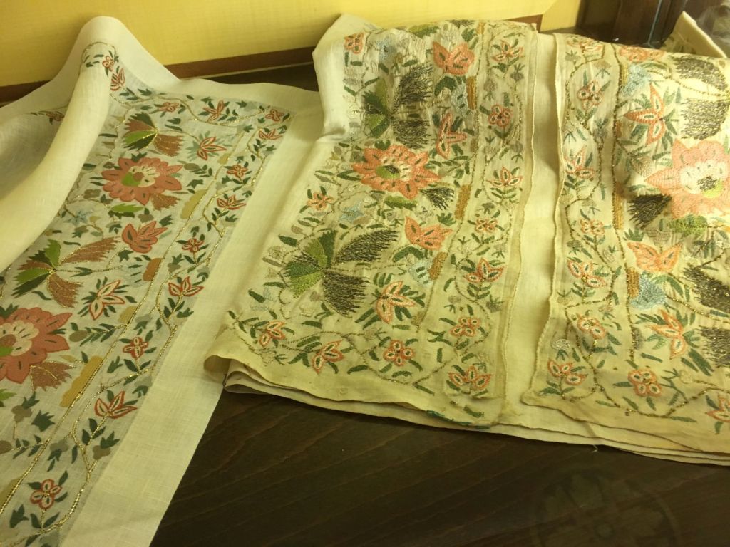
“come, come” Husseyn takes us to a shop which is total paradise for Miep. The silk thread she has been looking for all the way on the Silk Road.

The shop had more than 300 colors of silk thread.

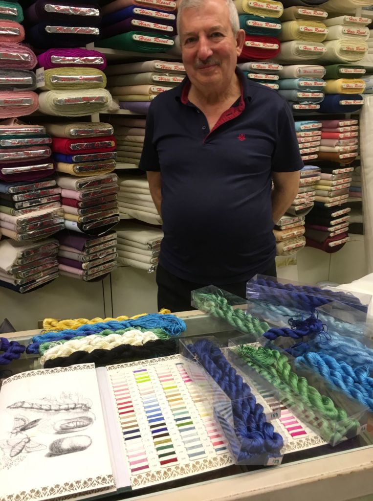
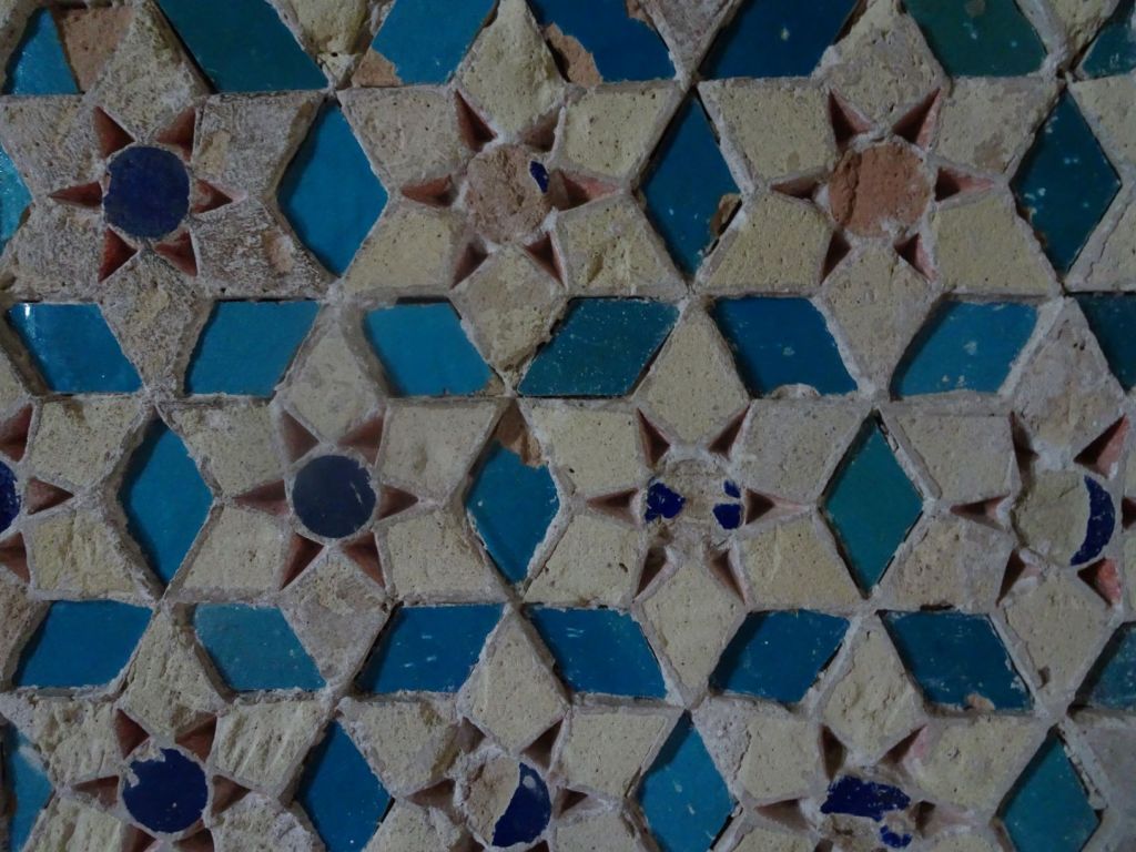
Miep tries to match the colors of the tiles she saw in Uzbekistan with the colors of thread in the shop. Husseyn and Roelf wait patiently outside.

Roelf and Husseyn

Miep buys 8 colors of the silk thread matching the tiles from Uzbekistan. The Persian colors will have to wait (those yellows, reds, and pinks).

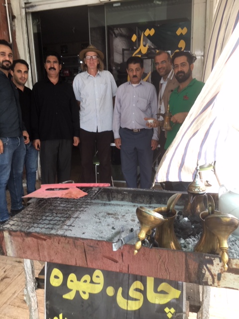
“come, come” Husseyn takes us to a number of food stores; each of these would have been a highly specialised delicatessen shop in Western Europe.

Rightly proud

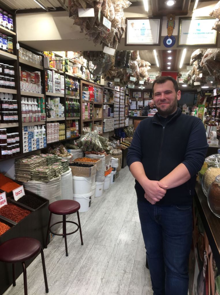
Husseyn leads us to the best places to buy spices and tea.

“come, come” Husseyn leads us to a traditional kebab restaurant. Another one of these where you do not place an order, but just sit down and get your meal served. Husseyn’s timing is impeccable because when we leave, there is a queue of at least 30 people outside. Husseyn himself refused to come in and insisted on waiting for us outside. Such a shame, we would have loved to share our meal with him.

“come, come” Husseyn takes us to the Grand Mosque.

Inside the Grand Mosque Bursa

We are a bit at a loss to understand the exhibits because there is no explanation in English. We meet a retired teacher who speaks good English and very good German. His name is Mustafa. Now we have two guides!.

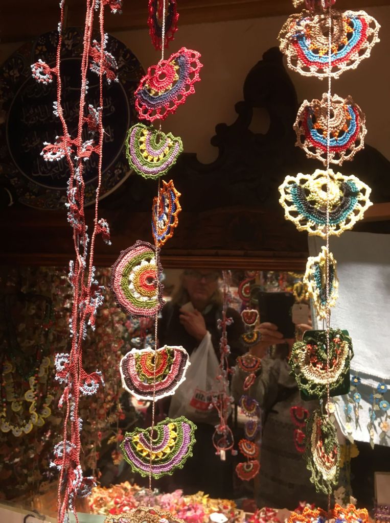
Mustafa is very keen to take us back to the craft shop at Koza Han. When we do so, it appears that we have been to the best shop to buy silk thread (well done Husseyn!). We see a bit more in the form of very intricate crochet work for jewellery.

A feast for the eye
What about this for a necklace made from pure silk…

We say goodbye to Husseyn, who finds it a bit difficult to keep up with the speed that we are now taken round the highlights of Bursa. We visit two small but wonderful musea; old ottoman houses.

Living room
Bedroom
Folding screen
These boots are made for walking?
Games table
Backgammon or chess?
Games table detail
Beautiful embroidery
The famous tulips that originate from Turkey and are used in so many designs

Quite overwhelmed by everything we have seen, we say goodbye to the museum staff; we have not payed a single entry fee.

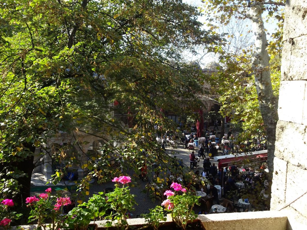
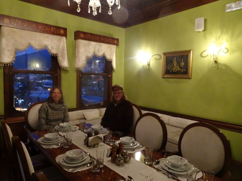
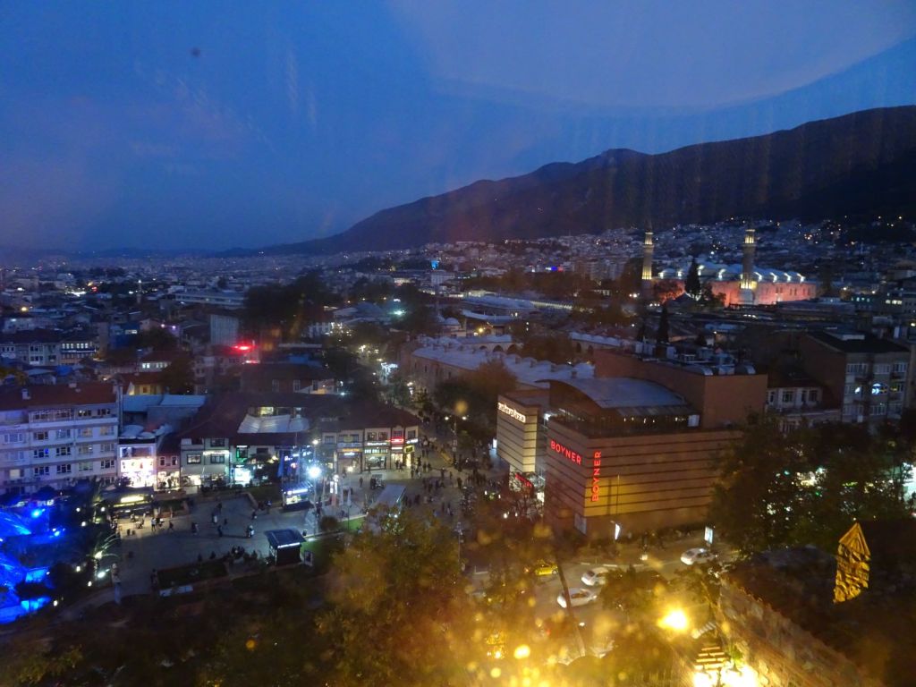
Mustafa now takes us to the Sultan’s Palace which is normally not open to tourists but he seems to know the people there, and they open the doors for us. There is a restaurant with an incredible view over Bursa. The restaurant is still used by dignitaries to receive foreign guest for a meal there.

Dining in the Sultan’s Palace
View from the Palace

Mustafa invites us to a Dervishes dance for 10 pm that evening. Before that we go to Husseyn to say hello to his family. A warm welcome awaits us; food has been prepared and they have arranged for a place for the Mog on level ground. This will certainly make for a better night’s sleep.

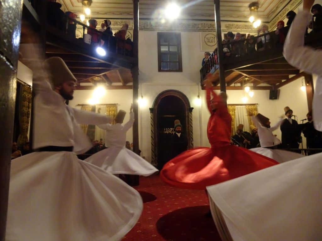
We leave the family and hurry to our appointment with Mustafa. The venue for the dance is a steep walk up the hill. When we arrive, some hundred people are listening to a lecture in life science by a senior dervish cleric inside the dance hall, with another 100 people watching on a big screen outside. This is a live stream and apparently watched by many all over the world. We are served with tea and sweets for free, and when we have finished, a little boy is sent to give us second servings. Hospitality everywhere we go.

Then we go inside to see the show. The room is packed to the rafters. Women upstairs, men downstairs. The musicians, ney players up front, enter first.

The dance is truly mesmerising. The dancers turn round for about 35 minutes to the rhythmic songs of the little orchestra. People pray and sing along with the music. We wonder how close the dancers feel to God.

Totally exhausted we make our way back to the Mog. This has been the longest and the best day of our journey. We fall into a deep but happy sleep.

November 3

In the middle of the night, Miep realises that she has left her phone in the last museum we visited. We have breakfast in Husseyn’s home. Very extensive and we must try everything. It is all home made, even the honey!.

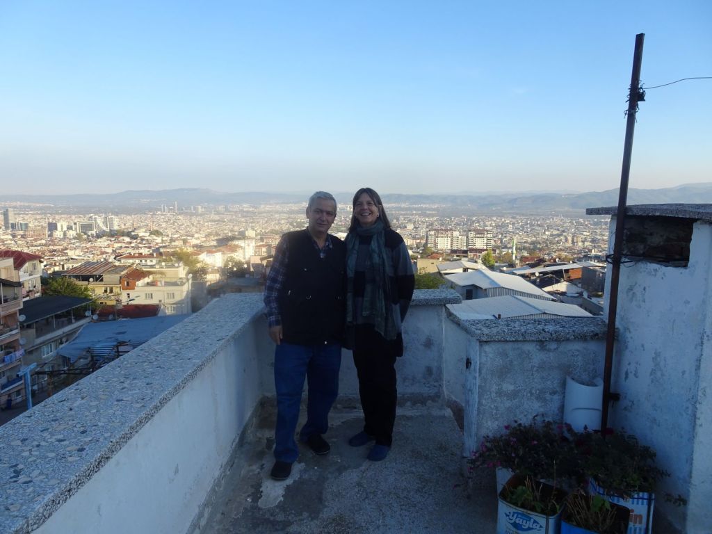
“come, come”, Husseyn takes us up three flights of stairs in his home to show us his roof terrace. A big surprise; this very modest home on a busy street has a magnificent view over Bursa; better even than the one we have seen from the Sultan’s Palace!.

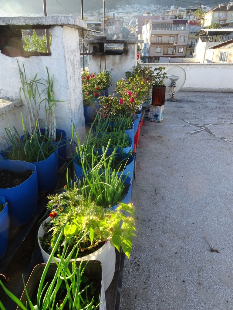
Some of the food we had for breakfast, comes from the roof terrace.

Husseyn even kept a goat on his roof!

The morning sun was shining over Bursa.

View from the roof terrace

Miep leaves a bit too soon because she wants to get to the museum early to ask about her phone. Roelf stays behind, not to embarrass the situation.

The museum did find the phone but has, dutifully, handed it in to the police station. There it appears that the officer who has the key to the lost property drawer is not on duty, so we have to come back in the evening to collect the phone.

We go on another tour of Bursa with Mustafa.

Start of another beautiful day
Bursa is nicknamed ‘The green city’ because of its parks and squares full of flowers

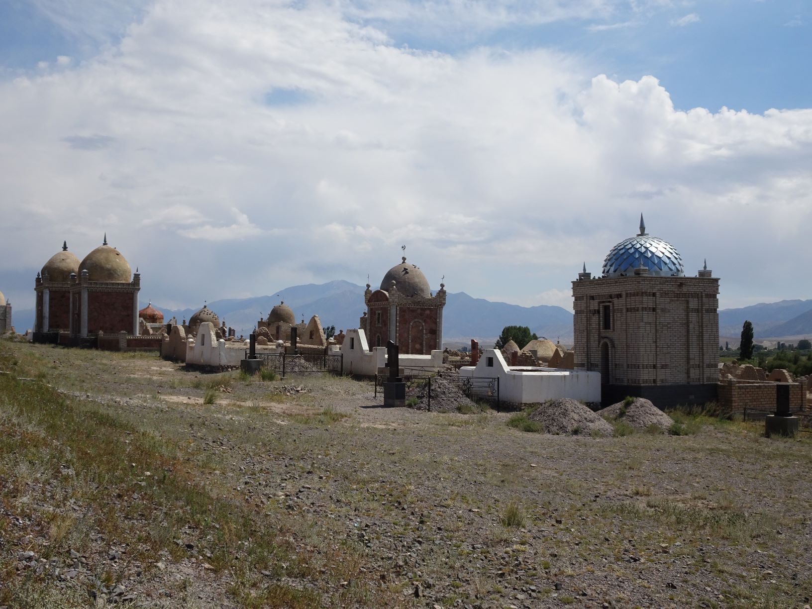
More embroidered silks, pottery and massive mausoleums for the early Sultans of the Ottoman Empire.

But they are grand inside
Relatively simple but beautiful

After visiting a number of mausoleums for former sultans, we visit a former hospital that has been turned in to a calligraphy museum.

Some building for a museum…
How nice wine can get a conversation going

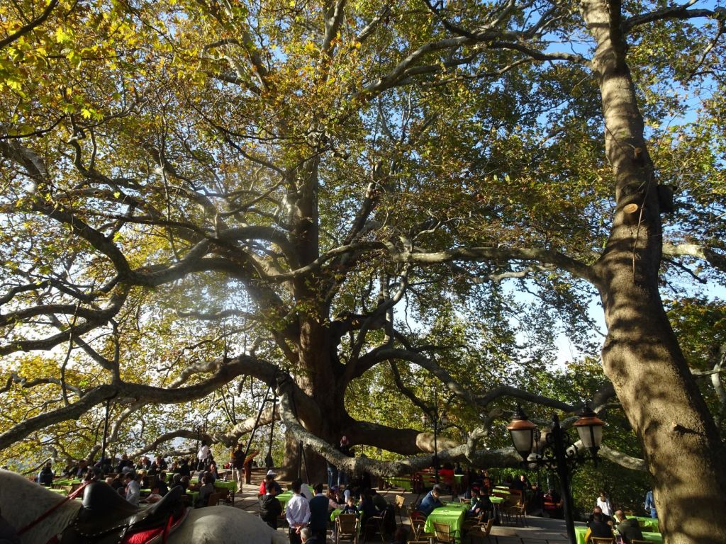
For lunch, Mustafa takes us up the hill on the flanks of Mount Uludag where there is a restaurant around a 600 year old Plane.

The tree creates a real warren where the tables of the restaurant are placed

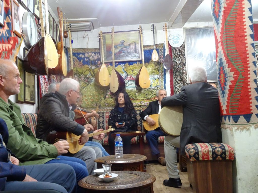
In the afternoon he takes us to a little café where people can play folk music. You choose your fellow musicians from the people who are there and the instruments are provided.

If you do not have an instrument, you can borrow one from the café.

We visit the Green Mosque, the Turquoise Mausoleum, and several other buildings; we can hardly take it all in. Mustafa takes us round at such an enormous pace! He knows all the short cuts, all the buses to take, and all nice places to visit, big and small.

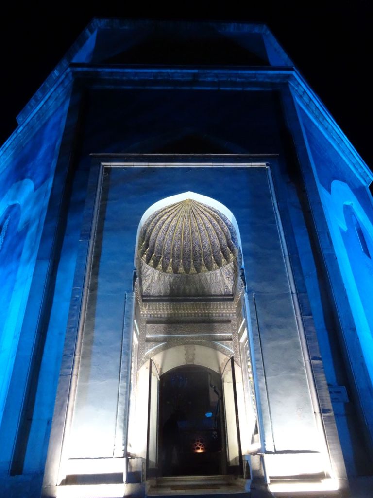
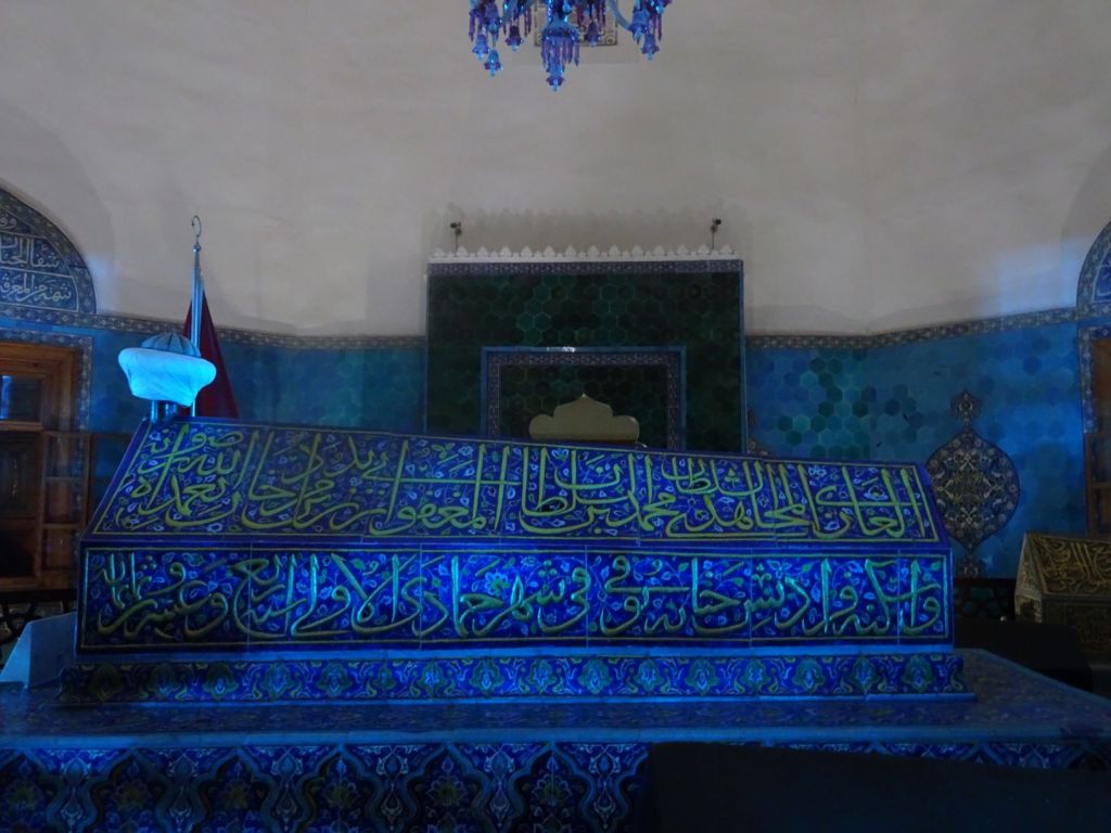
After dark, Mustafa takes us to the ‘Blue Mausoleum’. We thought we had seen it all, but are overawed yet again by the spectacle.

Blue Mausoleum entrance
The inevitable tomb

We find our way to the police station to collect Miep’s phone and go back home to the Mog.

On our way home.

When we get back to the Mog, it is surrounded by people who live in the small street where it is parked. They want to see inside, and want us to visit their homes to have tea and nibbles. We get a pair of slippers as a present from one family. Husseyn is beaming: “We are all friends!” he exclaims.

Totally exhausted, we finally go to sleep.

November 4

We wake up in the small street opposite Husseyn’s garden.

Husseyn is around already, to make breakfast again but now in his back garden!

The national flag is out in celebration

Husseyn makes tea on an improvised stove in his garden. It is amazing what comes out of his garage. We are treated to endless cups of sweet tea and all kinds of biscuits. Proudly he shows us his Fiat Doblo in his garage. He shows us the potatoes, onions, mint and peppers that still are to be harvested.

This is a happy place; it is amazing to see how much you can do with so little.

Reluctantly, we say goodbye to this lovely man and his family. More presents. Just before we get in to the car Husseyn shows us his last message to us on his phone with help of Google translate:

‘WE HOPE YOU COME BACK’

It is a short drive to the Sea of Marmara where we find ourselves a nice spot to camp. Roelf does a bit of fishing and lights the first campfire on this long trip: freedom at last!

We eat bread and cheese and drink wine we bought in a small shop nearby.

November 5

It was on the cards for a couple of days; Miep’s mother is increasingly unwell, and at the age of 94, we should seriously consider going home quickly if we want to see her before she passes away.

We therefore decide to go home in one single swoop. The drive around the Armutlu Peninsula is beautiful with fantastic views over the Sea of Marmara.

To get past Istanbul, it seems inevitable that we have to pay toll, and toll will be required on the bridge across the Bosporus also. It says on the internet that a vignette is needed for vehicles > 3500 kg. Therefore, we turn off in Yelova to get a vignette at the post office as it says on the government website you should do. It turns out that the only post office that sells vignettes is right in the centre of town. Roelf stays in the Mog while Miep goes out to the post office. It does not take long before Roelf is approached by police; cars of > 3500 kg are not allowed in the city centre!. Whilst Roelf is being interrogated and asked for his papers, Miep is stuck in an endless queue in the post office. And Miep has all the papers. Finally a policeman decides to go and find Miep in the post office and with the help of an interpreter the situation is explained. The police can see the odd site of having to go in to a town centre where cars of > 3500 kg are not allowed, to get a vignette for cars of > 3500 kg!. We are advised to avoid the Istanbul bottle neck by taking the ferry from Yelova across the Bosporus. Normally this ferry is for cars < 3500 kg only, but the police escorts us to the ferry terminal and negotiates our place on the ferry. Another example of hospitality, this time by an official agency.

Waiting for the ferry across the Bosporus

It is a wonderful day and a very enjoyable ferry crossing to what would be called Europe by any of the existing definitions for the border between Asia and Europe. We see dolphins, pretty little islands, and all the while, Istanbul in the distance.

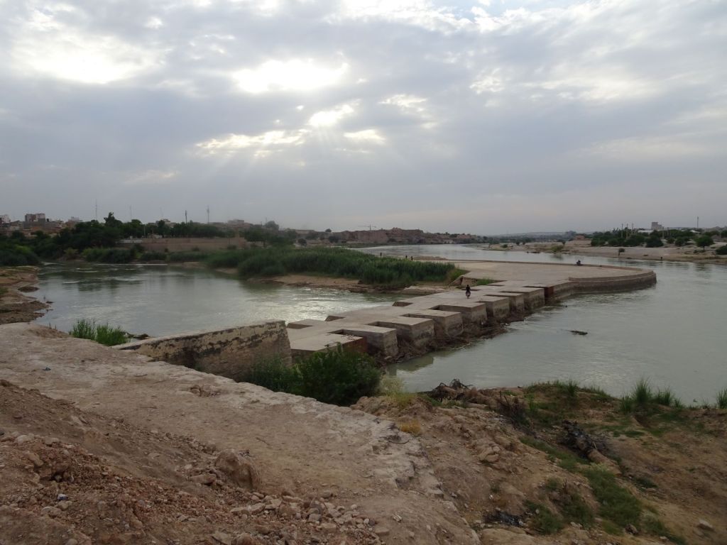
The ferry docks well west of the Bosporus bridge which saves us a lot of time. We are now in Thrace. It is easy to find the road north to Edirne but it takes two hours before we are beyond the suburbs of Istanbul (total population 17 million equal to the population of the whole of the Netherlands!).

We reach Edirne at about 8pm, and park up next to a supermarket. We spend out last Turkish lira in a wonderful sweet shop called ‘Mevlana’, ‘he who always thinks about God’ (Rumi again).

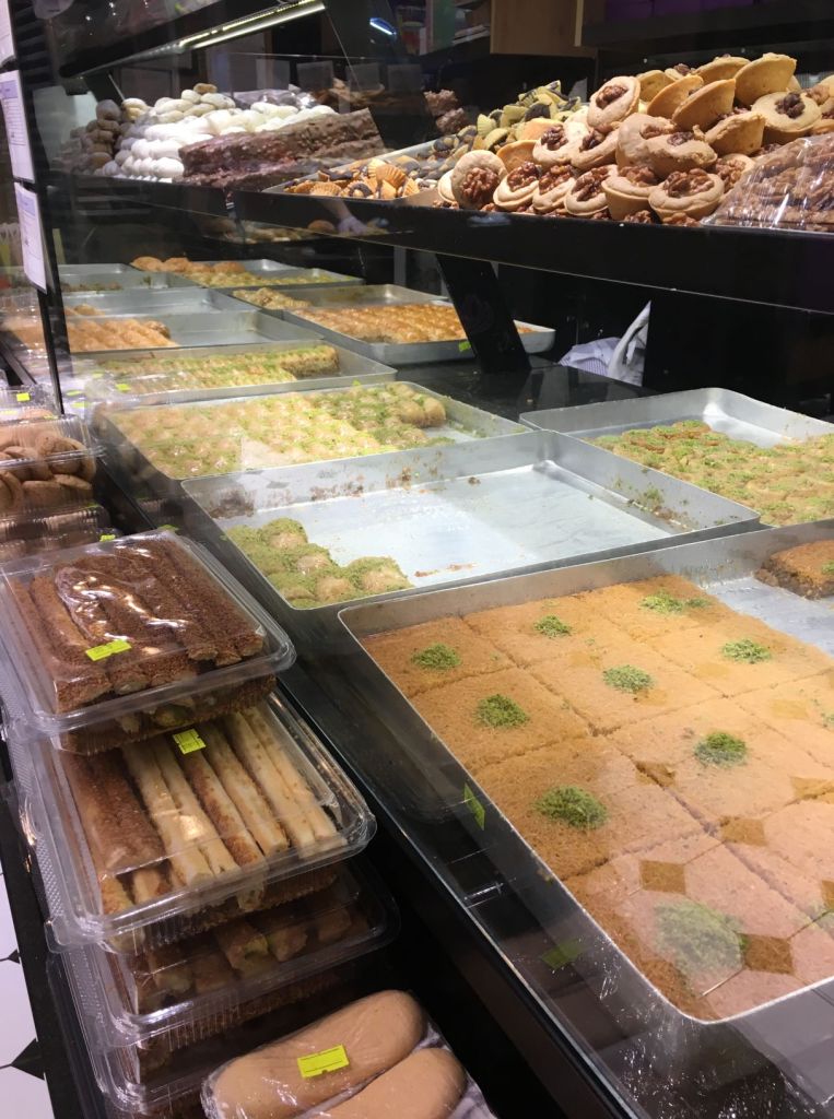
After extensive tasting, we choose the biggest box and ask it to be filled with a mix of Baklava sweets. They are impressed with our purchase and give us free tea and more sweets to enjoy. The owner is gleaming!

November 6

We wake up to a damp cold morning, but the sun comes through and burns the moisture away. We watch two women sorting piles of rubbish, separating wood, plastic and glass. When the bin lorry arrives to empty the container at the supermarket, it has already been ‘raided’ by these ladies and is half empty. An old truck arrives to take the bags of assorted junk. Several people seem to make a living out of this. It reminds us of the scene at Harwich at the very beginning of our trip when we witnessed trucks full of plastic waiting to board the ferry and dump our British waste elsewhere. Waste, in particular plastic bottles has been a returning theme wherever we went on our journey.

Driving out of Edirne, we see some beautiful old Ottoman buildings. Edirne served as the capital of the Ottoman Empire from 1369 to 1453 after Bursa and before Constantinople which was the empire’s final capital between 1453 and 1922. This certainly looks like a city we should come back to one day.

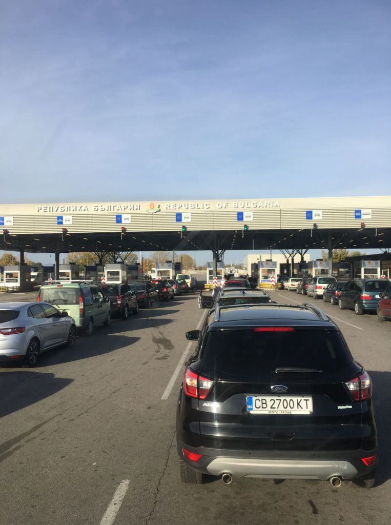
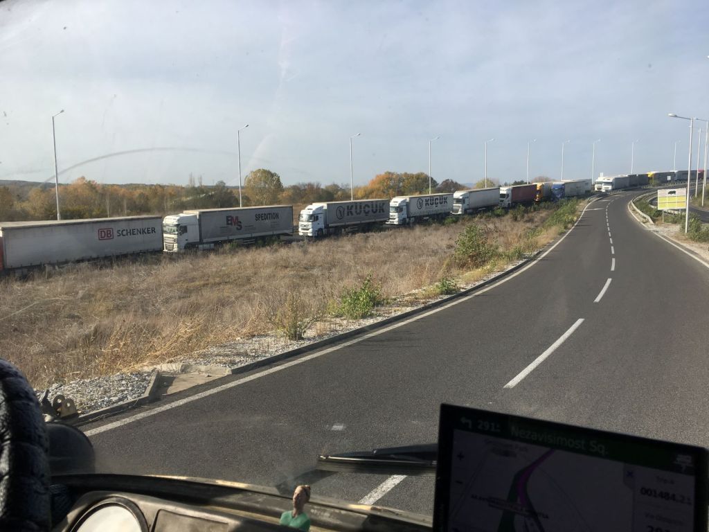
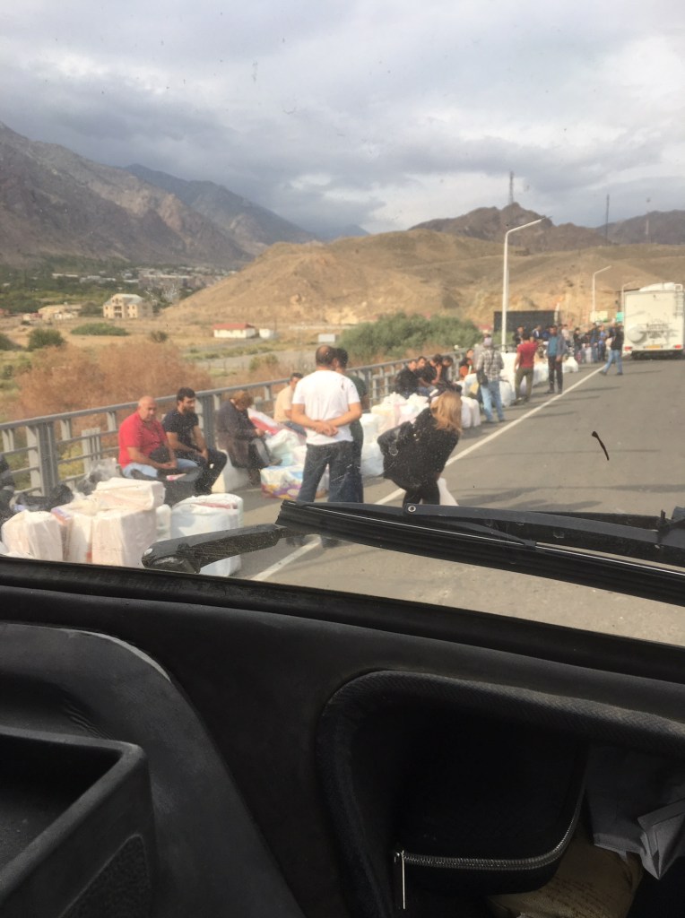
At the border with Bulgaria, we wonder if this will be the first time we have to unpack the Unimog. After all, we are now entering the European Union and there is plenty of space in the Mog to hide migrants. But yet again, as soon as the custom officer looks inside, he decides to leave it and wave us through. This is in sharp contrast with the trucks waiting to cross; we once counted a queue of 8 kilometers long; maybe that is what we will see in Dover soon.

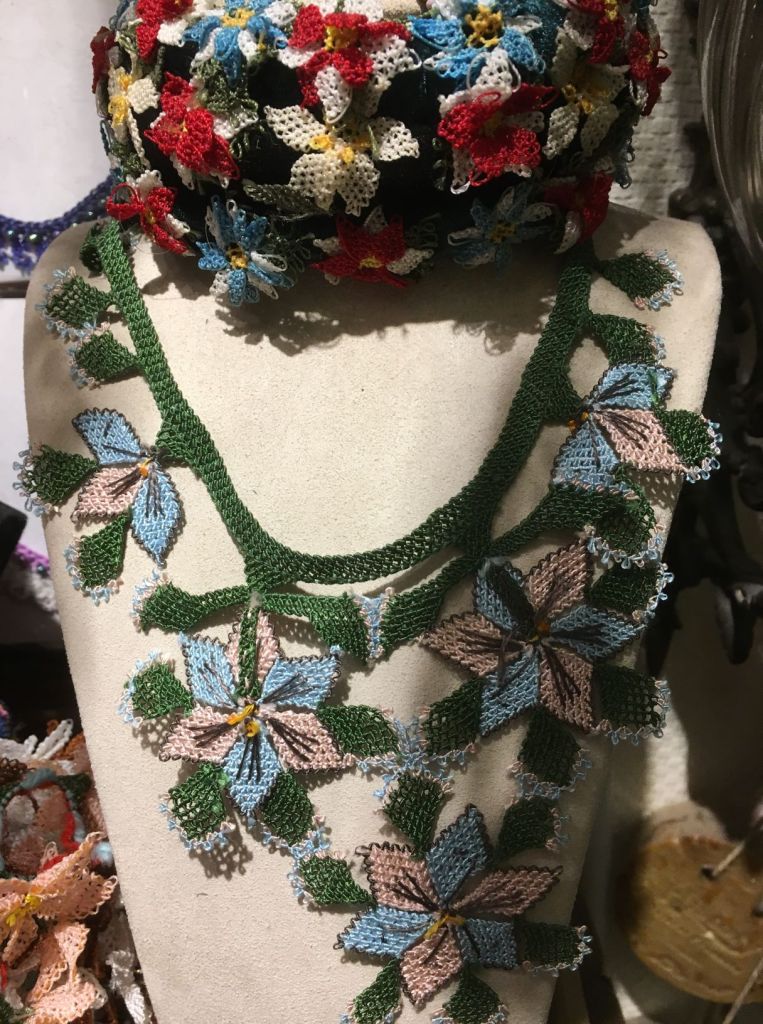
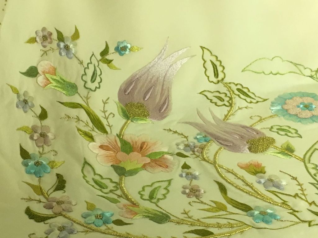
We drive day and night and pass through Bulgaria, Serbia, Hungary, Slovakia, the Czech Republic and Germany to reach Miep’s mother’s home in Zuidlaren, the Netherlands at noon on 9/11/2019. The Mog is starting to creak and it later turns out we had broken several bearings in the hub of the right front wheel hub. But we made it back and we are able to be with Miep’s mum and care for her until she passed away exactly two weeks later. We thankfully were able to show her, a master in embroidery herself, some of the wonderful things we had seen and brought back from our journey. When we left on this trip she told us that this trip would fill our heads with memories and inspiration for life. How right she was!

The Caucasus

The Caucasus is situated between the Black Sea and the Caspian Sea and is mainly occupied by Armenia, Azerbaijan, Georgia and Russia.

The Caucasus Mountains include the Greater Caucasus in the north and Lesser Caucasus in the south. The Greater Caucasus runs west-northwest to east-southeast, from the Caucasian Natural Reserve in the vicinity of Sochi on the northeastern shore of the Black Sea, nearly to Baku (the lowest capital in the world at some -60m below sea-level) on the Caspian Sea.

The most widely accepted border between Asia and Europe runs along the crest of the Greater Caucasus. It is home to Mount Elbrus. With an elevation of 18,510 feet (5,642 meters), it is part of the Caucasus Range that straddles Asia and Europe, although most geographers place it in Europe.

The Lesser Caucasus is a range of folded mountains that runs through Georgia, Armenia, and Azerbaijan.

Lesser Caucasus in southern Armenia

To the south, the Aras river forms the border between Iran and Armenia, and Azerbaijan. It is said the Garden of Eden was in the valley of the Aras river. The river runs west to east and is 1070 km long before it joins the Kura river in Azerbaijan 121km before it ends in the Caspian sea. It is by some, in combination with the Turkish border, considered to be the border between Europe and Asia, placing Armenia, Georgia and Azerbaijan in Europe.

Garden of Eden?
Right at the border crossing of Iran with Armenia shepherds lead their flocks across the road filled with lorries and diesel trucks.

The Caucasian race (also Caucasoid or Europid) is a grouping of human beings which includes ancient and modern populations from Europe, Western Asia, Central Asia, South Asia, North Africa, and the United States.

The grouping was proposed by a German physician Johan Friedrich Blumenbach(1752-1840) who was a prominent anatomist and early anthropologist. His dissertation ‘On the Unity of Mankind’ (1795) is considered a starting point for the study of anthropology.

Blumenbach classifies the human race in to the categories of Caucasian, Malaysian, Ethiopian, American, and Mongolian. The term Caucasian was coined by Blumenbach in recognition of the notion of the Caucasus as a pivotal crossroads for the migration of Indo-European people across Asia and Europe.

There is no evidence that Blumenbach considered any of the races superior to others, but his classification has been misused by political leaders to suggest that “Caucasians” were created in God’s image as an ideal form of humanity.

In any case, Blumenbach’s classification was a valiant effort to bring logic to the hitherto random denomination of ethnicity. His theory was formulated without any technological means (such as DNA profiles), more than 200 years ago, and it is understandable that the theory has been shown to be flawed on genetic grounds. It seems very odd that nations still make distinctions along the Blumenbach racial lines. We still have to fill out forms that ask us to tick whether we are ‘Caucasian’ or ‘other’…

The Caucasus was subject to foreign imperial domination for the great majority of its history during which it experienced long periods of incorporation in the Persian, Arabian, Mongol, Ottoman, Russian and Soviet empires. In cultural terms, the post-Soviet Caucasus (Armenia, Azerbaijan, Georgia and the autonomous North-Caucasian entities within the Russian Federation) is a multiethnic, heterogeneous region in which the followers of a number of religions (Shiite and Sunni Islam, Russian and Georgian Orthodoxy, the Armenian-Gregorian Church, Judaism) practice their faith. The region acts as a transition between East and West, Europe and the Middle East.

October 12

The border of Iran with Armenia runs along the famous Aras river referred to above. Our search for the Garden of Eden is hampered by border fences on each side of the river.

If the definition of this river as the border between Asia and Europe is adhered to, we are entering Europe today.

map
The Armenian border with Iran is limited by the presence of Azerbaijan on the west and east.

The border crossing takes an age. We spent a lot of time on the Iranian side where it is important to get all the right stamps in our carnet de passage. This document is worth £8000 for us, but for some in the group with more expensive campers it is as much as £45000!! So patience is the name of the game here, patience and politeness. Everything is written in the “big book” by the customs officers by hand. Finally we are officially out of Iran.

But this is not the end of the border: now we have to enter Armenia. A large crowd of people carrying all kinds of domestic items such as ironing boards, pots and pans, drying racks for clothes, and food such as bananas, have assembled in front of the passport control. An officer in charge keeps shouting instructions. We have no clue what we should do, but try to stay in the ever moving sea of people towards the place where we can get our passport stamped. Our car is unlocked, but it is difficult to leave the queue now. It feels less safe than earlier border posts, but perhaps this is just because of the shouting officers and the cheap goods that are trafficked across. How can there be any profit in bringing these into Armenia?

Getting your stuff across

Later we learn that Armenia imports pretty much everything and has hardly any manufacturing left. We get our passports stamped and Miep wants to return to the car while Roelf works on importing the car at the next desk. Pffff, everything is still in place and Miep can get to work on the blog while our Iranian sim card is still working. Some hours later Roelf and all the group are done and we can move the car into Armenia. Lots of shouting again and discussion on which cars need to go through the Xray machine. Not us, but Miep is not allowed, as passenger, to sit in the car as it drives across the imaginary line that is the border. So she has to walk back through the immigration office where all the people are still waiting. It turns out it has now closed the doors. Is it closed for the day? Or is it closed because there are too many people inside? How will she get through and back into the Unimog? Paul from our group is also there and getting quite anxious. He manages to interest a female officer who understands our plight and she gets someone to unlock the door. We squeeze through while the many Armenians have to wait. We hope they will get through today because it has now started to rain. It is a sorry sight, all these people, trying to make some money by importing any goods they can carry. Two big bags per person.

We are now all through and in Armenia. Immediately the road is of desperate quality and it is now getting dark and it rains heavily.

We have to get car insurance and we are longing for our first alcoholic drink since entering Iran. The small shop next to the insurance office has nearly sold out of beers with all those thirsty Dutch travellers! Finally we have all our paperwork and we can move to our agreed camping spot. Avoiding potholes we make it to Meghri, but there, in the rain we find our tour guides giving us new coordinates: the original parking lot was too small and it looks to us also rather steeply up the hill. We drive on and get to a good camping spot on level ground. We are ready for a drink and we all sit in the usual big circle trying not to get drunk on one beer.

Armenia is one of the oldest countries in the world with a recorded history of 3500 years. The oldest known ancestors of modern Armenians, also known as Proto-Armenians, were indigenous to the Armenian Highland in Eastern Anatolia. These tribes formed the Nairi tribal union, which existed until late 13th century BC. The words ‘Nairi’ and ‘Nairian’ are still used by Armenians as poetic synonyms of the words ‘Armenia’ and ‘Armenian’.

At the end of the second millennium BC, another Indo-European ethnic group, referred to by the Greeks as Armens, migrated to the Armenian Highland from the Northern Balkans. According to Greek mythology, which actually reflects this tribal migration, the forefather of Armenians – Armenios – was one of the Argonauts.

The first significant state of the Armenian Highland was the Kingdom of Ararat with its capital on the shore of lake Van. This state was formed in the XI century BC and existed until VII century BC. In 782 BC king Argishti I founded the city of Erebuni, which is today’s Yerevan, the capital of Armenia.

In the late VII century BC, the Kingdom of Ararat fell to Scythian invasions but was resurrected several decades later. In the tri-lingual Bisotun inscription of Persian king Darius the Great (see this blog’s Iran North-West section) the country is referred to as ‘Armenia’ in the Persian and Elamite versions.

Armenia became a satrapy of Achaemenid Persia, and later part of the Seleucid Empire. It restored its full independence in 190 BC under the king Artashes I.

During its peak during the reign of Tigran the Great (95-55 BC), Armenia stretched from the Caspian Sea in the East to the Mediterranean Sea in West, and from Mesopotamia in the South to the river Kura in North.

In the middle of the first century AD a new royal dynasty – the Arshakuni (the Arsacids) – came to power in Armenia. This dynasty was related to the royal family of Persia, with the same family name. At this time Armenia and Persia enjoyed a long period of peace and cooperation, until in 251 AD the Sassanid dynasty came to power in Persia. The Sassanids tried to assimilate the Armenian nation. The Sassanids justified their advances on the basis that the Armenian religion was Zoroastrianism like the main religion in Persia.

Resisting the Persian efforts, the Armenian king Trdat III in 301 AD, created the Armenian Apostolic Church, with Gregory the Illuminator as its first bishop, and declared Christianity the state religion of Armenia, thus making Armenia the first Christian state in the world.

The Arshakuni dynasty was dissolved in the year 428 AD, when the eastern part of Armenia was annexed to Persia, while the western part was put under Byzantine rule.

The Arab caliphate conquered Armenia in 658AD. After more than two centuries of struggle with the Arab Caliphate, Armenia regained its independence as the Bagratuni kingdom in 886. However, the country was annexed by the Byzantine Empire in 1045.

Before the fall of the Bagratuni kingdom a number of Armenian princes managed to escape from Armenia and found refuge in Cilicia, a region at the north-eastern corner of the Mediterranean Sea, where Armenians formed the majority of the population. In 1080 their leader, prince Ruben, founded in Cilicia a new kingdom, which became known as Cilician Armenia, or Armenia Minor (Little Armenia). The new Armenian state established close relations with European countries and played an important role during the Crusades, providing a safe haven for the Christian armies. Cilician Armenia survived for three centuries before it fell to Egyptian Mameluks in 1375.

Around the time of the fall of the Cilician Armenia, the historical Armenian homeland was divided between the Ottoman Empire (Western Armenia) and Persia (Eastern Armenia).

Despite being ruled by and surrounded by countries with a different religion and culture for more than five centuries, Armenians managed to preserve their own language, and their national, religious and cultural identity.

In 1828 the Russian Empire captured Eastern Armenia from Persia during the Russo-Iranian wars. The Ottomans retained control of Western Armenia where the living conditions of Armenians gradually deteriorated despite some token gestures by the Ottoman government such as the recognition of a special Armenian constitution in 1863.

The so-called “Armenian Question” emerged in the relations between the Ottoman Empire and other European superpowers. After the Russo-Turkish War of 1877-78, Russia insisted in the Treaty of San Stefano that the Sultan’s Armenian subjects be protected against Ottoman discrimination and aggression from the Kurds. This demand was later softened by the British at the Congress of Berlin.

Despite the ‘concerns’ of other western nations, massacres became a common phenomenon in the Armenian provinces and in Cilicia which had a large Armenian population.

After coming to power in the Ottoman Empire in the beginning of the 19 hundreds, the Young Turks coined the phrase “No Armenians – no Armenian Question”. Under cover of the complex political situation of World War I, hundreds of Armenian intellectuals of Constantinople were executed without trial on April 24th, 1915. The Ottomans feared that the Armenians would see the war as an opportunity to escape from Islamic domination and be supportive of the allied forces. They conscripted, disarmed and executed all Armenian males aged 15-62. Armenian women, children and the elderly were deported to the Syrian desert Der-el-Zor. Most of them were brutally murdered on the way by Turkish soldiers and Kurdish nomads, or died of starvation. More than one and half million Armenians, i.e. 80% of the Armenian population of Western Armenia, perished in this Genocide, which is still not being formally recognised by many countries including Great Britain and the Netherlands out of fear of spoiling relationships with Turkey who even today deny all events despite written and photographic evidence of these terrible crimes.

After World War I, Armenia came under the rule of the Soviet Union. During the 71 years of Soviet rule, the Soviet Republic of Armenia experienced a period of relative security, and of economic and cultural development. However the relationship with the neighbouring Soviet Republic of Azerbaijan was very tense because of Armenia’s desire to be reunited with Nagorno-Karabakh in Azerbaijan, where Armenians form the majority of the population.

Armenia was restored to full independence on September 21, 1991, and became a member of the United Nations on March 2, 1992. On January 25, 2001, Armenia also became a member of the Council of Europe.

The turbulent and sometimes violent history of the Armenians has resulted in a strong and vibrant diaspora. Of the total of 11 million Armenians only 3 million live in Armenia itself. Some 8 million live across 85 countries all across the world.

October 13

We are away early. The roads are steep here and we do not want to stay behind. On steep roads we cannot drive faster than 40 km/hr in third gear and 25 km/hr in second gear. So 200 km can be a very long drive. Here we even have to go up in first gear in part. Wow, this is mountainous terrain indeed. We cannot understand how this road, which we imagine is the only one into Armenia from the south, can be in such poor condition. How do the lorries that take oil into Armenia manage? But spectacular it is too. The road winds up a valley higher and higher and new vistas appear all the time. Here we see trees again; it has been some time since we saw continuous forest. The autumn colours are on display. And the sky is a dark blue, the kind we know so well from Scotland in September. It is stunning.

Southern Armenia; this is the Lesser Caucasus, just imagine the Greater Caucasus!

But driver beware: potholes, missing asphalt, stones on the road from the rockfalls that must happen all the time. They are working on the road too. But it is not in an organised fashion. There are bits of road works and then nothing and then a clutch of machinery again. Occasionally someone is controlling the traffic, but most of the time we just have to make it up ourselves. Drive over on the wrong side, zigzag around oncoming traffic, wait until cars behind get annoyed and decide it is time to just go and urge us on. Remarkably no accidents seem to happen.

We stop at the first larger town. The bad influences of the Soviet times on infrastructure  are everywhere.

Terrible housing blocks, balconies nearly falling off, the ubiquitous gas pipes running overground, we have seen it everywhere and here it is in even poorer state than in the Stans it seems.

Energy supply; What if a car were to veer off the road and crash into it?

But the people are cheerful and when we find the shop that sells sim cards, the young man who helps us is mightily proud of his town. He is efficient and we are sorted with cards in our phone, iPad and computer! Then coffee in a modern café that seems to have just opened, they are still working on some of the toilets, but they are operational and it is nice to be back to western style of plumbing and flushing. On the wall hang pictures of famous Armenians. We try to guess, but we only know Charles Aznavour.

Charles on the wall of the café.

He is a total hero here, his picture is everywhere and there is a museum about him in the capital. Khachaturian, the composer, is another famous Armenian and of course Gary Kasparov, the former chess world champion.

We move on and now drive up another valley, further north towards a monastery that can be reached with a long cable car. We are keen to see the landscape from the air, but it is taking a long time to find the right road towards the cable car. Apps from the group are beginning to come in, campers have got stuck on minor roads, having to turn back. We get to a point where several of our group have assembled. Some have now given up on the cable car and move on. Others, like us, want to give it another go. It becomes clear that the best way to get there is from the north, a little detour but suddenly the road is good. This is a road built for visitors who fly into Yerevan, the capital. Those coming up from the south….well… few tourists would come that way anyway!

We get to the ticket office of the “wings over Europe” cable car to find the first available ‘flight’ for us is 1.5 hours later. Now it is getting tricky to make our rendezvous, but Miep is keen and buys the tickets anyway. We have a nice meal with Armenian specialties to fill in some time and Lida and Kees joins us. They want to move on and we tell them, and the group, that we will not make the campsite, but join them again the next day. It is a shame to race on and miss out on properly viewing things on the way.

The flight is only some 15 minutes (5 km), but the views are wonderful.

View from the wings of Europe

This is a good area for bird watching, walking and viewing old churches and monasteries. The Tatev Monastery we visit is being restored.

It is interesting to see how they do this: they fill in missing stonework with new, but making it clear what is original and what is new.

View from a monastery window

The steelwork is magnificent. Beautiful chandeliers are newly forged, and old wells are repaired.

Chandelier

The church inside has a heavy scent of incense. People light candles and stand them upright  in containers filled with sand and water on top. The wax is later collected and remade into new candles.

Lighting a candle…

We take a taxi back as there was no ticket for sale for a return ‘flight’. This is common and there is no problem finding a taxi who take us back for the same fare as the cable car. We race over the windy road back up the hill where he is amazed to see our car. ‘German?’. Yes, Mercedes!

We get going, thankfully the Mog starts without problem and we drive to the next place we must see: a big stone circle called Carahunge, nicknamed the Armenian Stonehenge. It is getting dark and we just make it to the car park before the small shop there closes and the last of the bus tourists depart. Roelf buys a t-shirt and I buy the small guide to this place. The shop owner tells us it is fine to park up overnight and we have the parking spot and the whole of the stone circle all to ourselves! To top it all it is full moon!

October 14

Having read about this stone circle we go out to explore in the early morning; there is frost on the ground for the first time during this journey.

The Armenian Stonehenge…
The stones

There are stones with a sharp point and others with holes. When you look through the hole and line this up with a point you will, on certain days in the year, see the sun come up, the moon rise or set and so on.

Lining up the holes with the peaks

The role of Carahunge as an astronomical observatory is disputed; other explanations that have been given are that it was used for animal husbandry, a refuge for war times and even as a necropolis. Estimated dates for when the site was created vary from 5500 BCE to 2000 BCE. It seems odd that contemporary archaeology cannot make up its mind about such fundamental issues!

The hopeful astronomer

Found within the first sentences of the Anglo-Saxon Chronicle, a compilation of seven surviving interrelated manuscript records of the early history of England, compiled between the 10th and 12th centuries AD, a reference is made to the British people stating that they originated from Armenia. It says: “The first people were the Britons, who came from Armenia, and first peopled Britain southward”. This reference, together with the similarities between the megaliths in Stonehenge and Armenia, led clergymen and archaeologists over the centuries to conclude that the Britons are of Armenian origin.

Reluctantly, we leave this beautiful place to move on. Destination is another monastery: Khor Virab. We see more sad soviet style housing along the way; Armenia seems very poor to us.

But the landscape remains stunning and we visit another beautiful monastery on our way. This one is in a valley of red rocks. Spectacular!

Stairs into the chapel without any bannisters

After an interim stop at the campsite where the rest of the group stayed last night and where we and our laundry get a quick wash we get our first glimpse of the Ararat.

The glorious mountain Ararat from afar

We stop at one of the many road stalls. They sell honey, all kinds of home made wine and fruit. The wine is sold in plastic coke bottles so the Iranian lorry drivers can take this back we are told. Surely the customs officers will know?

We arrive on the parking lot of Khor Virab just before dusk. There, in the middle of the parking area, we find the other members of the group having drinks and nibbles. Although this is a special place to Armenians, the location of our camping spot is horrible: right in the middle of tourist stalls, with busses parked everywhere, dirty with stray dogs searching the street for something to eat. We park the Mog next to the rubbish bins and join the party. After something to eat and a few drinks we fall asleep anyway, being bitten all night by small insects, a kind of midge, that thrives in the wetlands round the Ararat. Miep, who is very sensitive to insect bites, will remember this place for the next week for all the wrong reasons….

October 15

The next morning, we go up the hill to see the monastery. The name translates into ‘deep dungeon’. Prior to becoming a monastery, this site was a castle and a prison. It is where Gregorius the Illuminator was held captive by King Tiridates III for 13 years. Gregor eventually converted the king to Christianity resulting in Armenia becoming the first Christian state in 301 AD. The buildings on this site have served as chapel, education centre and monastery and been rebuild after a devastating earthquake. The Stone carvings around the doors and on the many Khachkars are impressive and probably date from the time when the large church on the site was built (1661). All in all this is a phenomenal historical site located on the edge of the current border of Armenia with beautiful views that make up for the rather miserable camping conditions.

Khor Virab monastry

The monastery is situated close to the Turkish border and faces the Ararat plateau.

Armenia signals to Turkey!

The Ararat is with 5137m the highest peak in Turkey and of the Armenian Highland. The Armenian flag is firmly planted on the hill facing the mountain. Ararat is the principal national symbol of Armenia, and has been considered a sacred mountain by Armenians. It is featured prominently in Armenian literature and art. The mountains of Ararat are widely seen in Christianity as the place where Noah’s Ark came to rest. It is depicted on the coat of arms of Armenia along with Noah’s Ark.

We were very moved by the notion that this Armenian treasure is now occupied by Turkey which has been so cruel to Armenians in the recent past.  

The next overnight stay is on a campsite that is owned by a Dutch couple and situated in the hills some 20 km east of Yerevan, the capital of Armenia. Some in our group take the direct route to the site, bypassing Yerevan, but get stuck spectacularly on the very, very bad road that leads there through the mountainous countryside.

View of Yerevan from the surrounding hills

We were lucky that we had been less keen on showering and washing clothes and had decided to go to Yerevan first; the road to Yerevan is perfect and from there to the camping also very reasonable.

The city has very European atmosphere; there are cafés, statues, fountains and little market stalls everywhere. We park the Mog in a back street right next to the famous Yerevan cascades, a flight of stairs with water features and art works up the hill overlooking the city.

The cascades in Yerevan

On the side of the steps is an escalator where you can look at art on your way up.

Some of the work is grand and magnificent

Miep enjoys this!

Other work is subtle and homely

We have a nice meal in one of the restaurants with a large german beer. The atmosphere is very relaxed.

In the evening we arrive, the last ones again, on the campsite, the 3 G’s. Excellent facilities with swimming pool and laundry, beautiful view, but a campsite where space for so many large campers is tight. The Mog is surrounded by other vehicles including several overlanders, all busy to repair their vehicles, or get clean and sorted for the next stage of the trip. This camping spot is clearly ‘on the map’ and rightly so. The lack of space around the campers is completely negated by the communal facilities including wonderful covered seating and cooking areas, the best we have had on the whole trip! We are treated to a nice question and answer session with the owner of the site in a room with a roaring wood fire (it is now getting cold at night). She is Dutch and came here to build greenhouses to grow roses years ago! She has transformed an old farmhouse with outbuildings into this spectacular campsite and tells us about living and working in this country.

October 16

We have an excursion to the Tsitsernakaberd (nest of swallows) Armenian Genocide Memorial Complex.

The memorial was built in 1995 to commemorate the massacre of 1.5 million Armenians during the death throws of the Ottoman Empire in World War One.

The 44-meter peak symbolises the rising of the Armenian people.

12 standing stones refer to the twelve provinces that Armenia lost to Turkey (including the Ararat which can be clearly seen from the memorial complex).

Standing stones with flame in the middle to commemorate the Armenian victims

A 100-meter-long wall commemorates the people who were murdered.

The museum exhibits the run up, execution, and aftermath of the genocide. The layout takes you through the episode chronologically. There are documents containing the orders by the Ottoman regime. The definition of genocide is written out large and the way, repeated in every genocide in history, in which a group is gradually reduced to ‘unwanted’, deprived of its human rights, compared to a contagious disease, or ‘vermin’ is shown. This is a powerful reminder to always be vigilant for use of such language. The pictures and videos are horrific and moving in equal measure.

We can genuinely say that each of us in the group is stunned by the visit. In the bus on the way back into the city centre, nothing very much is said. Never seen a group of Dutch people so quiet!.

We stroll through the very modern city in the afternoon; the contrast with the poor countryside of Armenia could not be sharper…

City people in Yerevan

We walk through the city, visit the craft market first. Lots of chessboards in carved wood often showing the Ararat. Not as intricate as those we saw in Iran, but we can tell Kasparov has inspired a whole industry.

We then visit the National Museum of Armenian History.

Since 1920

My goodness: this is a wonderful place. Filled with the most fantastically preserved pottery, bronze statues, jewellery of times very long ago and also costumes and pottery of more recent times.

Bronze deer statue, more than 4000 years old

It is the best museum we have seen and it helps understand the various peoples that have lived in these lands, such a crossroads between the seas and mountains. The most spectacular, and the emblem of the museum, is an interpretation of the solar system in the form of a statuette. This is the first museum where we are not allowed to take pictures, so the image below is from a postcard.

The solar system as Earth is at the lower end surrounded by two rings; one for water and one for the atmosphere. At the top, we find the Sun. In between are the planets Mercury, Venus, Mars, Jupiter, Saturn, and the Moon.

It is from the second millennium BC and was discovered as recently as 2015 after the water level in lake Sevan dropped dramatically.

Most of the archaeological finds in the museum are from around lake Sevan we will pass on our way north. There must be an endless treasure trove of beautiful bronze and earthenware under its shores yet to be uncovered.

We go to a nearby café to sample some Armenian food and in the evening, are treated to a fabulous light show in the fountains of the main square right in front of the Museum.

Here he fountains dance to the sounds of Queen!

An old Mercedes bus that is even slower than the Unimog, takes us back to the campsite. Plenty of time for nice conversation.

October 17

First thing the following morning, we visit one of the oldest monasteries in Armenia, from around the time that Christianity was declared the state religion in response to the advances of the Persian Sassanids.

Geghard Monastery outside Yerevan. Can you spot it in the shadows of the mountains at the end of the road?

The monastery was initially known as the Monastery of Caves where St Gregory the Illuminator conducted a very ascetic lifestyle.

Monastery of the caves

This enclave of Christianity survived in the midst of surrounding other religions, first Zoroastrianism, and later Islam. We are the first to visit today. An impressive site hacked out in the rocks. Later small groups of singers arrive to perform Gregorian music in the old chapel. Unfortunately we missed that as we have already gone on to our next visit.

The Garni Temple, a fortified royal castle that originates from the 3rd to second millennium BC, was extended during the Hellenistic period after Alexander the Great. The temple was completely destroyed during an earthquake in the 20th century but fully restored. It is nice to see a fully intact temple rather than a partial ruin. All the newly added stone is uncarved so it is clear which ones are original, just like in the restored monasteries we visited earlier. We like the way Armenians restore their old heritage even though this may not be the way Western ‘experts’ like things to be done.

Garni temple with ‘Roelf the Great’
The beautifully carved stone roof structure of the temple is largely intact, but newly added stone in the walls and columns is obvious

The temple is also known for the basalt formations in the valley below.

Lava reaching the surface has cooled down and shrunk to form these hexagonal basalt structures. This area has hardly any roads and is a beautiful wilderness.

From Yerevan, we drive North towards the Georgian border. We pass the mighty Sevan Lake.

Lake Sevan is the biggest lake in the Caucasus measuring 1400 square km and at 1914m above sea level is one of the biggest mountain lakes in the world. Recently the water levels have dropped revealing archaeological sites with the unimaginable treasures from the bronze age that we saw in the museum in Yerevan.

We have some coffee and visit a small church on the lake shore.

Sevanavank monastery dates from 874 AD.
Carved stones, Khachkars, are a special feature along roads, in graveyards, and even in the centre of Yerevan. These were seen near the churches on the Lake Sevan peninsula.

The road to the border leads past deserted industry from soviet times. It feels eerie, as if some nuclear attack has wiped out all activity.

Ambitious times came to naught

It is getting dark

Cable car hanging in the air going nowhere…

The quality of the road gets poorer as we get closer to the border.

Main road out of Armenia?

Finally, we reach the campsite. The site is up the hill on the side of the road and lifts us above the misery down below. Kees has his newly acquired Iranian backgammon board out in the middle of the camp site. He is winning, until after 6 games he finally loses. Great excitement. This is how we have seen it played in these lands, out in the open, with whoever cares to stop by and join in.

Serene view above the devastation in the valley

The road conditions have caused the Mog to drop its mud guards. Thankfully we have a lot of washing line.

Keeping up appearances

October 18

On the final stretch of ever worsening road to the border to Georgia, we come across a strange sign.

Have we been cheated?

A highlight of the journey is the MIG airplane along the road. These jets were designed by Artem Mikoyan. His brother Anastas was a topman in Soviet Politics. Two of the most famous Soviet Armenians.

The MIG airoplane was designed by an Armenian called Artem Mikoyan. This one is on display near the border with Georgia.

The border crossing between Armenia and Georgia provides similar scenes of pedestrians taking massive amounts of apparently cheap products from one country to another.

Waiting to cross

Whereas some definitions of Europe would have us having entering Europe when we crossed the border between Iran and Armenia, other definitions would have us entering Europe when crossing the border between Armenia and Georgia. So we enter Europe for the second time.

The area of present day Georgia, has been inhabited for at least 1.8 million years. The first evidence of organised society is from the early Colchis and Iberia kingdoms.

Early

The kingdom of Colchis, which existed from the 6th to the 1st centuries BC is regarded as the first early Georgian state formation and the term Colchians was used as the collective term for early Georgian tribes who populated the eastern coast of the Black Sea.

The ancient Greeks knew of Colchis, and it featured in the Greek legend of Jason and the Argonauts, who travelled there in search of the Golden Fleece. The myth may have been aided by the custom in the region to sift gold dust from rivers with the help of a fleece. The Greeks established many trading colonies in northwestern Colchis between 1000 and 550 BC.

The Kingdom of Kartli (known as Iberia in the Greek-Roman literature) was founded around 300 BC.

According to Herodotus, Achaemenid power extended as far as the Caucasus mountains, but the Colchians are not included in his list of the twenty Persian satrapies. Nor are they referred to in the lists of Achaemenid lands given in the Old Persian inscriptions of Darius and his successors. It is thus probable that the Achaemenids never succeeded in asserting effective rule over Colchis, though local tribal leaders seem to have acknowledged some kind of Persian suzerainty.

At the end of the fourth century BC southern Iberia witnessed the invading armies of Alexander the Great. Although neither Colchis, nor Iberia were incorporated in the Empire, both were heavily influenced by the Hellenistic period following these invasions.

Between the second century BC and the Arab invasions in the late 7th century AD, Georgia was subject to bitter rivalry between the Persian and Roman Empires. Intermittently, parts of the region gained indepence and during one of these episodes in the 4th century, Christianity was adopted as the state religion, just like in neighbouring Armenia.

Georgia struggled free from Arab domination in the ninth century AD, and resisted Seljuk domination in the eleventh century. it became a major regional power as the Georgian Empire in the 11th and 12th centuries, dominating most of the Caucasus and a strip along the south coast of the Black Sea.

The kingdom disintegrated after the invasion and subsequent domination by the Mongols. This was followed by the Timurid era.

After a short period of relative independence in the 15th century, be it as a set of principalities rather than an integrated state, Georgia again became the battleground for two rival powers. The Persian Safavids on the one hand and the Ottoman Empire on the other. The Persians gained the upper hand and Georgia was dominated by the Safavids for the following two centuries. There were a number of uprisings and continuous pressure from the Ottomans, which lead Shah Abbas I to order a massacre of the citizens of Tbilisi after they sided with the Turks. To this day, the Georgians have an intrinsic hate of the Iranians.

The harsh rule of the Iranians and the inevitability of having to convert to Islam if they sided with the Ottomans made the Georgians approach Christian Russia who dominated the region in the 18th and 19th centuries, after Persian powers declined with the death of Nader Shah in 1747.

The Russian revolution provided an opportunity for Georgia to regain independence which was achieved for a very short period between 1918 and 1921 as the Democratic Republic of Georgia, until the red army of Soviet Russia invaded and established the Georgian Soviet Socialist Republic which lasted until 1990 when Georgia regained independence which it has maintained until today.

Southern Georgia is strikingly flat compared to mountainous Armenia. Whereas only 10% of the Armenian territory is below 1000 metres, and the lowest altitude is some 840 metres, we were now cruising along a plane just 200 to 300 metres high.

We visit a monastery close to Tbilisi where we buy some home made honey and even a bottle of honey vodka! The monks don’t speak any English, but we manage to extract that they own land where they keep their bee hives. There are sausages hanging from beams, looking delicious. The monks all have mobile phones and they live in a place with spectacular views. Not quite such an ascetic lifestyle perhaps?

The campsite is in Mtscheta, some 20 km outside the centre of Tblisi. It is an ancient town. People have lived here for at least 3000 years. The town was the capital of the Iberia for some 1000 years up the 6th century. The whole town is one big monument with churches, forts and the magnificent Svetiskhoveli cathedral. The cathedral is surrounded by a wall and outside are rows and rows of souvenirs shops. This is a major tourist attraction, but also a site of pilgrimage for locals. There has been a church on this site since the 4th century! The current building was started in the 11th century, destroyed by Timur and rebuilt in the 15th century. Incorporated in what we can see today are parts of the earlier churches. It is a wonderful atmospheric building, the most beautiful Christian building we have seen on this trip!

The entrance to the Svetitskhoveli Cathedral with the ancient stonework, all ‘fieldstones’.
The typical structure of the Svetitskhoveli Cathedral is mimicked in the modern Cathedral we visited in Tbilisi. This one is however from the early Middle Ages, the 11th century!
Church within church: the current structure (from the 11th century) of the Cathedral incorporates parts of earlier buildings on the site. Many kings are buried here.
One of the superb frescos in the Svetshoveli Cathedral. Does this depict the Great Flood?
Another view of this holy site for Georgian Orthodox Christians

Our camping spot is very closeby, near a restaurant. Against the background of the beautifully lit cathedral and an illuminated fort high up a hill across the river, we stand on the bank of a smelly side stream amongst hordes of stray dogs keeping us out of our sleep with their barking during the night. Surreal!

October 19

The day starts with an excursion to the enormous Tsminba Sameba Cathedral in Tbilisi city centre. This cathedral is newly built, opened in 2004, and financed entirely by donations! It is a huge space, built with beautiful natural stone, but it lacks the atmosphere of the beautiful older buildings we have seen. The most impressive are the bronze bells that hang in the separate bell tower. All cast in Germany with the biggest weighing several tons!

The gigantic Tsminda Sameba Cathedral, the largest religious building in Georgia

From the square of the cathedral, you have a magnificent view of Tbilisi city.

Wide open space around the cathedral. Gardeners are working to keep the flowerbeds nicely stocked. The impressive bell tower stands on the right.

Just outside the cathedral, there is a wine shop ‘Wine Time’ with a large collection of wines. Here we are faced for the first time with the pride that Georgians have in someone who was born there and went on to become a major player in European history.

Strong vodka

After our visit to the cathedral, we take a cable car from the centre of town to the hill side overlooking the town from the other side of the Kura river. The Narikala fort, the 4th century building that formed the start of the city, is right up the hill and has beautiful stone work.

In sharp contrast is the rather ugly steel statue of the Mother of Georgia nearby. It just exemplifies Tbilisi, a city of old and new and contrasts between modern, soviet style, early 20th century and ancient historic buildings. It is a wonderful place!

View of Tbilisi from the top of the cable car

We then walk down the hill to visit the famous Tbilisi Bridge of Peace.

Bridge of Peace over the Kura river. Not just a beautiful structure but also functional, facilitating access to both sides of the Kura river for pedestrians.

We walk through the old centre, the sulphuric baths that have given Tbilisi its name, past the only mosque in town, see the typical architecture with the hanging balconies, the small bazars, both underground and above ground, the shops selling all kinds of wares silkroad traders would have brought to town in the past (we can rehearse where the various types of carpets originate from) and the many, many wine shops.

Typical balconies in Tbilisi
Rehearsing the Silk Road in Tbilisi: embroidered bed covers from Uzbekistan, carpets from Iran, Turkmenistan and from Turkey. Tbilisi was an important trade point on the Silk Road via the Black Sea and it is still a hub for the trader and traveller in Central Asia.

We are dropped off for lunch in a typical Georgian restaurant and try out all kinds of hot and cold dishes and the famous wine made in big pots dug into the ground. We have free time now and decide to go back up the hill to see the arboretum in the botanical gardens. It is a truly beautiful nature safe haven high and dry above the busy city.

View of Tbilisi from the Botanical Gardens

We take the cable car back to town and decide to buy some of these famous Georgian wines from a traditional wine merchant. He keeps his home made wine in massive vessels under his shop floor.

Wine seller pulling a sample from the vessel under his shop floor

We buy some wine, but when we want to pay, disaster strikes; no wallet!. We cannot find our wallet anywhere and after some analysis we agree that Roelf must have left the wallet at the top station of the cable car. A frantic hunt to trace back our steps follows but it proves impossible to do a proper search because of the busy crowds in and around the cable cars.

We end up reporting the loss to the police, and find ourselves at the police station for many hours waiting for an interpreter to have a statement taken.

Roelf’s home for the day

It is well and truly dark by the time we finish at the police station. The only positive point is that we get to see Tbilisi by night, quite a spectacle!

The colours of Tbilisi by night

We take a taxi home to the campsite where we arrive at about 10 pm. The taxi driver has to return to the site because Roelf left his iPad on the backseat…

October 20

We decide to go back to Tbilisi to have another look for the wallet. Roelf is upset about the loss of his wallet, so upset that he leaves his iPad on the bench where we had lunch. Why did he have his iPad out? Of course because we were following the Brexit soap opera back home! We will call this a Brexit casualty.

Can you believe it; this time Roelf spends 5 hours in the same police station where he was yesterday; possibly the police keeps him waiting extra long so that he will not come back yet another time!

A terrible day; we go back to the campsite where we have a meal and much too much to drink in the adjacent restaurant. It is a strange experience; the smell of urine from the dirty site with the nicest cheese bread (Khachapuri; look up the recipe, truly wonderful!) we have ever tasted, and lots and lots of red wine.

The theme of this journey; a miserable campsite against a beautiful backdrop, close to the most magnificent ancient cathedral. The bins were noisily emptied every morning, just when the stray dogs stopped barking.

October 21st

We are on the road north again. We pass the city of Gori where Joseph Stalin was born and decide to visit the Stalin museum. We are lead round by a young woman in leather suit, short black hair and bright red lipstick. In a monotone voice, she rattles off the achievements of Stalin without mentioning any of the deportations to Siberia or the famines that raged under his leadership. We go through the massive building, one gloomy room after the other. The visitors are visibly intimidated and one utters that it is the most depressing place he has ever been to.

One of our group gets embroiled in a discussion with the museum staff: he wants two thirds of his entrance fee returned because only one third of the true history was told! A gallant effort but he fails. The young guide gets the blame: ‘she has only been here for a short while’. Just imagine what the tour will be like once she has been there longer.

The only mention of deportations and imprisonment in the Stalin museum are those of Stalin himself as a young revolutionary as shown on this map!
More reasons to become depressed in the wine shop that also acts as a bookseller. What is the connection between these two?

A highlight of the museum is parked outside behind the building; the train wagon used by Stalin to travel through the Soviet Union during WWII.

Bullet free and weighing 83 tonnes

After our visit to this place of worship for Joseph Stalin, we stack up on some Georgian wine. Wine tasting is not our strong suit, and we take at least 20 sips each before we know what we want to buy; and even then we are not really sure. Anyway, we will find out when we get home.

After the tasting…

North of Gori, the countryside becomes hilly and very beautiful. There are buildings in the strangest of places. We take a wrong turn by mistake but we are grateful as it leads of past the most glorious landscapes. The hills are only some 600-800 metres high but the autumn woodland and agricultural land in this glowing landscape glistens in the sunlight.

How to get in to this little church?

As the beauty of the landscape goes up, the quality of the roads goes down.

Thankfully the potholes are large enough to see them in time

Miep is so focussed on avoiding the potholes that she takes her eye off the water thermometer and we end up with a steam engine instead of a diesel engine. The car needs some ten litres of water which constitutes the worst overheating since we had a 12 litre replacement in the mountains of Kyrgyzstan.

Our final destination for the day is the Bagrati Cathedral in Kutasi. The cathedral is on a hill top in the middle of town. The Mog climbs reluctantly through the narrow streets in fading daylight. When we eventually reach the camping place, we are welcomed by a gang of barking stray dogs, wandering over the parking lot. The ‘facilities’ for the visitors of the cathedral are closed. We just go to bed immediately after arrival and try to forget as to where we are. We won’t have time to visit Kutasi and we will remember the glorious countryside surrounding it instead.

October 22

We don’t know how to get away from this place quickly enough. The dogs have been barking all night and (unusually) continue to bark after the sun comes up. Everyone in the group seems nervous and itching to get away. Any future TME trip should seriously consider the overnight parking places and try to locate them in more quiet places outside the city centres.

Anyway, the whether is good and we have a rather uneventful journey to the border with Turkey. The landscape is dominated by fruit trees. They stand out full of orange fruit against the blue sky. Every house has his own orchard and people sell the fruit literally by the bucket load on the road side.

The Asian Persimmon; very sweet and brilliant with morning yoghurt and muesli
Every fruit stall is full of orange produce, they must have known the Dutch were coming?

We reach the border on the Black Sea coast at the agreed time of one pm. A near miss as we had another overheated engine right in the busy centre of Batumi where we were surrounded by police and interested bystanders in no time while blocking a lane. Not the best place to get the water out, the bonnet off and praying that the engine will start after refilling the radiator.

But we make it. We got some idea of the beauty of Georgia with its savannahs, mountains, and seaside, but we have not been here long enough to fully comprehend it and our visit was overshadowed a bit by the loss of wallet and iPad.

The Kartuli language is the official Georgian language and has its own (beautiful) script. It was developed around the time that Christianity became the state religion in Georgia in the 4th century AD. It has survived the domination of foreign powers over many centuries, despite the fact that it is only spoken by 3.7 million people today!

Iran; the North West

The North West of Iran is the most ethnically diverse region of the country. Whereas the Persian or Fars people are the largest ethnic group within the 86 million Iranian population as a whole with 51%, the majority of people in the North West are Azeri people. The North West of Iran has been a passageway and a residential region from the age of primitive humans and the Azeri people are among the oldest of the Aryan race. Other people in the North West are Kurds, Arabs, as well as the Persians of course.

Kurdish family in Hamadan. Ethnic diversity is reflected in the costumes people wear.

The region was much affected by the Iran-Iraq war which started when Saddam Hussein invaded the Iranian prince of Khuzestan in search of a corridor to the Persian Gulf. The war lasted for almost eight years between 1980 and 1988.

The province of Azerbaijan in the far North West borders with the republic of Azerbaijan, Armenia, Turkey and Iraq. The original province included the whole of the Republic of Azerbaijan, and areas now in Turkey, but territory was lost during the Qajar dynasty to Russia during the Iranian – Russian wars in the 19th century.

Hamadan is an ancient city in the North West, and is one of the oldest in Iran. It was the summer capital of the Achaemenid Empire between 520 and 330 BC.

October 8

We set off early because we have received messages to say we must hand in our passports in Hamadan for a visa extension before 2 pm. No time to visit the castle in Khorammabad we pass. This, we hear later, is a very old structure that has been continuously extended and still is. A kind of ‘living monument’. The road is good and the views amazing. There are mountains on both sides and now and again we cross a range over a pass. The potato harvest is in full swing.

Potato harvest

We drive without stop until we get to Bisotun. We have to persuade a guard to let us through the gates (does he want money?) to get to the Caravanserai Hotel where the others are parked up.

The Caravanserai Hotel in front of the rocky outcrops of Bisotun. The old road that runs just in front is closed to traffic. Just those staying at the caravanserai are allowed through (when the guard feels like it…).

The rocky outcrops of Bisotun had to be passed by every trader on the Silk Road who travelled towards the passageway in the North West. King Darius passed there when he moved his residency every year from his spring palace in Persepolis after the Nowruz celebrations to his summer palace in Hamadan, and passed again in the Autumn when he moved south from Hamadan to Susa.

View of the passageway from the rock face.

Bisotun has an extraordinary rock relief which was not accessible close up at the time of our visit and we therefore do not have a photograph. However, it is worth describing what the relief is about. The following is taken from the book ‘Iran; Empire of the mind’ by Michael Axworthy which we would warmly recommend to anybody who wants to understand Iran culturally and politically:

” Cyrus was succeeded by his son Cambyses, who extended the empire by conquering Egypt, but in a short time gained a reputation for harshness. He died unexpectedly in 522 BCE, according to one source by suicide, after he had been given news of a revolt in the Persian heartlands of the empire.

An account of what happened next appears on a extraordinary rock relief carving at Bisotun, in western Iran, about twenty miles from Kermanshah, above the main road to Hamadan. According to the text of the carving (executed in old Persian, Elamite and Babylonian) the revolt was led by a Magian priest, Gaumata, who claimed falsely to be Cambyses’s younger brother Bardiya. Herodotus gives a similar version, saying that Cambyses had murdered the true Bardiya some years earlier. The revolt led by Gaumata seems to have drawn force from social and fiscal grievances, because one of his measures to gain popularity was to order a three-year remission of taxes, and another to end military conscription. Pressure had built up over the decades of costly foreign wars under Cyrus and Cambyses. But Gaumata also showed strong religious enthusiasm or intolerance, because he destroyed the temples of sects he did not approve of.

An Iranian revolution, led by a charismatic cleric, seizing power from an oppressive monarch, asserting religious orthodoxy, attacking false believers, and drawing support from economic grievances – in the sixth century BCE.

How modern that sounds.”

The rock carving depicts Darius standing on his opponent Gautama. In front of Darius is a line of eight vanquished rulers paying homage. The winged symbol of Ahura-Mazda hovers above the figures and is surrounded by 1200 lines of text in three languages. The text was copied and distributed to all the provinces in the Achaemenid Empire.

Underneath this magnificent relief is a statue of Hercules. It dates from 153 BC late in the Seleucid period around the time of the Parthian uprising. When you think of Hercules as a giant strong man, the statue comes over as rather dwarf-like, and looks rather pathetic. Hercules lying down, only 1.47 metres long, his head a copy and glued on ( the original was stolen but recovered and is now in a museum), and he has been robbed of his penis after the revolution of 1979….

“Hercules”

When we arrive at the Caravansarai the group has just finished a guided tour and are having tea with the guide in another building behind. We are unsure whether we can join and how our decision to go to Susa against advice has gone down. But we have no choice, we must hand in our passports. There is little small talk with us, things are still a little frosty it seems, but Paul kindly takes us back to the sculptures and reliefs on the rock face. They are not as impressive as the ones we saw earlier, but this is just a sign of how spoiled we have been on this trip. Surely the relief of Darius and Gautama would have been of the same quality if only we could have seen it close up.

Then it is time for a nice shower in the hotel room we have at our disposal and we have dinner with the group outside from a ‘take away’. We are surprised nobody is asking us about our experiences in Susa. But dinner is good, we engage in conversation and we do feel part of the group again.

October 9

We are off to Hamadan today, the summer capital of the Achaemenid Empire. There is a temple to visit on the way, but just as we are parking up we get a message that we need to hurry up to get to the visa office in Hamadan where we all have to sign our documents. What a shame, just when we thought we could take it a little easier. A mad dash drive to get to the visa office in time is the result and we cannot park there and worry about our start problem so we have to find a downward sloping streets. One of us stays in the car, double parked, with foot on brake and then we change over. All this stress for one day extra in Iran. It is a shame, because in the end it has taken our guides Hannie and Theo a full day to get the extension. But we are all done, just in time before the office closes and off to our camping spot we go.

But this is even stranger. We thought we would be camping near a hotel and indeed we do, but the hotel is at a crazily busy and complex intersection of roads and has no proper parking place. So we are camping a little further along on a public parking space with picnic places. It all sounds good, but we do not understand why this park is so busy. Police is directing traffic and there are people everywhere in cars and on foot carrying a lot of luggage and setting up camp.

They are pilgrims. It is the time of Arba’een Pilgrimage. Buses depart from this very spot continuously to take people to Karbala, south west of Baghdad in Iraq some 725km away. The Arba’een is the largest annual gathering in the world, and is held at the end of the 40 day morning period following Ashura, the religious ritual for he commemoration of martyrdom of the grandson of Prophet Mohammad and the third Shia Muslim Imam, Husein Ibn Ali’s in 680.

The Mog is surrounded by old and young who want to see inside. A young woman and her husband want to know all about it. It is a strnage experience to see such a brilliant smile with beautiful eyes and perfect white teeth radiating out of a figure in black clothing, head covered in black chador. Very confusing…

How on earth are we going to manage to sleep here? Something to worry about later as first we go on our guided tour. The female guide has helped all morning getting our visa extensions sorted and now she is showing us some of the sights of the city. Unfortunately we have to stay close to the visa office as not all documents have been returned to us and we go back twice to get them! So the tour is a bit restricted. We see yet another shrine for a poet (we should not be complacent, these are highly revered figures in Iran, but as we do not know their works and cannot read Farsi we don’t fully understand their significance). We visit the Jewish synagogue and learn there are only some 25 Jewish people living in Hamadan now. The rabbi is in charge of the tomb of Esther and Mordecai which is on the same site, but he cannot let us see inside as it is a Friday. There are special moments when one of the group asks the rabbi questions that reveal her knowledge of Jewish customs and they immediately strike up a rapport. A big hug results on our departure.

Then we go to see what we are most interested in in Hamadan: the shrine for a scientist and medic!

Ibn Sina, known in the west as Avicenna, was a Persian polymath and  is considered the father of modern medicine. He was born 980 AD In Uzbekistan but moved to Hamadān where he practiced until he died in 1037 AD.

The mausoleum for Ibn Sina in Hamadan

The small museum attached to the shrine shows some of his writings about plants, but the translations are very poor and it is a little disappointing given his enormous influence. His book The Canon of Medicine had five volumes and was translated in Latin and Hebrew. It functioned as the encyclopedia of medicine throughout the islamic and western world until the middle of the 17th century. Written in 1025 AD, it introduced the notion of inductive logic in to the diagnosis of diseases; that is that diseases present with a consistent set of symptoms and signs, called a syndrome. The book also gives an extensive introduction in to pharmaco-therapy mainly based on herbal medicines, some 750 in total. Even today, herbal clinics in China use the texts of Avicenna to provide a rationale for their herbal treatments.

The knowledge of anything, since all things have causes, is not acquired or complete unless it is known by its causes. (quote from Avicenna)

Then we do something unexpected: we visit the house where our guide lives together with her aunt and extended family. This is a private visit and we do not know what to expect. It turns out the house is an apartment over 2 floors in a wealthy area of town. The owner has a building company and it shows in the quality of the building. A huge living area with open plan kitchen is there to receive all 20 odd of us. We are entertained in the traditional way: first fruit, then tea with sweets and then another serving of tea. Conversation is a little difficult with the owner and his wife, but the guide herself and the nephew and niece speak English and we manage some conversation, even about politics. But on the whole this remains a difficult topic and it quickly reverts to family and looking at photographs of our families. But what an interesting end to the afternoon.

The guide gives us some advice on where to go for dinner and get a proper Iranian meal. This turns out to be spot on: we go there with the four of us and end up in a place where the guests sit in small cubicles, just on the floor, and are served a variety of sauces (soups) with bread. They are delicious and we finally feel we have tasted the Persian kitchen. Together with a beer (alcohol free of course) and tea after the mail for four persons the whole thing sets us back one million, or better said 10 euros, 2.5 euro each! Super advice from our guide who makes a quick appearance, most likely to see whether we have taken her suggestion to heart.

Then back to the camping spot by taxi and hoping we can sleep. It is incredibly noisy but we manage a bit of sleep and get up early for the final stretch in the NortWest.

October 10

We drive from Hamadan to Zanjan today. The first part over a super new road to a cave complex, called Alisadr Cave. The cave complex was discovered in 1963 and is filled with water up to 14 metres deep. It is absolutely massive, and we go through it on beautifully constructed walkways and also by peddle boat. We have seen many caves but nothing quite like this! How lucky we are to have made this choice: while looking for a place to buy tickets we meet an Iranian couple who offer to walk us to the, rather hidden, place where we should be. We start talking and their English is perfect. They are academics and happy to be our translators/guides for the tour in the cave. Such a stroke of good fortune.

Cave full of water, we walk over bridges and go round in small boats propelled by pedal poser so it is quiet. The caves are beautifully lit.

After the visit, we sit down for an alcohol free drink and have a very interesting conversation. They tell us how the boycott by the West is strengthening the regime of the mullahs. It provides them with perfect ammunition to argue that America is bad and the Western model of democracy is cruel and against Islam. The poverty that results from the sanctions hinders peoples’ education and their ignorance makes them believe that the mullahs are right. Iranians who oppose the regime are asking the West to stop the boycott, and help the people to develop their intellectual potential so that they themselves can make a judgement and ditch the Islamic State model.

We could have talked for days, they are such an interesting couple. We promise to stay in touch. Time to move on, as always, and we say goodbye after a final drink in a small café. This is low season and things are closing down. The rows and rows of benches at the entrance and inside the cave indicate how busy it must be here in the tourist season and how lucky we are to be here with just a small group of local Iranians.

We drive further north towards Zanjan. The landscape is interesting: we keep crossing mountain ranges with rather flat agricultural land inbetween. Still harvest time and we keep seeing nomads working away at the site of a brand new road. It must be so strange for them to have to cross with their animals over pristine tarmac while they live under sheets hearing the traffic roar past.

The perfect road from Hamadan to Zanjan crossing the many mountain ranges
Last time we will see these overloaded pickups. But we have not seen a single one turned over!

We have a final place to visit today and we are excited to go. We are visiting Sultaniyeh, the former summer capital of the Ilkhanids, the descendants of Hulago, a Mongol leader. Just a few buildings of the 14th century remain amongst the ‘modern’ city, which is a collection of old and new buildings, chaotically arranged and with many unfinished buildings or open areas where animals and children play. These stand in huge contrast to the domed structure that dominates the city and can be seen from miles away. It was originally built as a mausoleum for the first Shia Imams, but in the end became the resting place for Sultan Oljaitu. who died in 1316. Sultaniyeh was a thriving rich city in its day where caravans following the silk route would trade their wares. Clearly many influences of different places and cultures are visible. We see the beautiful brickwork first seen in Uzbekistan, some of the earliest tile work in Central Asia.

The inside of the main space is full of scaffolding, restauration work is underway, but clearly the money has run out or is running low as not much is happening. But this is an UNESCO World Heritage site and it will be protected from further decay. While the decorations are not quite what they must once have been (enough remains to get a good sense of the splendor), the building itself seems to be in a reasonable state. We are allowed to go all the way up to the balustrades that give views inside the main space and show the magnificent size of the dome, and also give good views over the lands beyond.

The magnificent dome on top of the octagonal building that is the Sultan Oljaitu Mausoleum is visible from miles away.
Open stone work on the balustrades
Brickwork with the crossed symbol of Zoroastrian times
Fabulous old-pink decorations in the smaller stone domes on the external balustrades
Tilework in the inside of the main hall
Tilework detail
Wooden balustrade

We are totally taken aback by this building. Although so much of it is covered in scaffolding, what we have seen combines the best of the architecture and decorations we have seen on this trip. Yes, some of the buildings from the later times were very inpressive, but there was also a lot of ‘showing off’ with glass and unnecessary gloss. Here, the structure of the building take centre stage, and some of the decorative elements are in the stucture itself with the stone work and the bricks. We hope that in time more of the internal decorations can be restored so that visitors can see the building in its full former glory.

We are told by the ticket office guy we should also visit another old building in town. It takes a little time to find it, but again, fantastic brickwork. This is the monastery and mausoleum of sultan Chalabi Ughlu, again built in the 14th century. The signs tell us that the mausoleum was probably built first and then the monastery added to show devotion. The monastery is unique in that it is of similar construction to those of similar age seen in Turkey and built around Sufi principles. It is unique in present day Iran and illustrates how boundaries for countries and religions are ever changing. The mausoleum is again an octagonal structure in brickwork. The complex is in even more need of restauration, but at least it is also protected and some of the brickwork remains to show how beautiful this must have been when new. Interestingly the patterns are not clear when you are closeby, but step back and suddenly a pattern emerges from the bricks. These are again ready for use as knitting or weaving patters.

The exquisite brickwork on the Mausoleum of Chalabi-ughlu in Soltaniyeh

With our minds and hearts full of these wonderful buildings we drive the last hour against a red setting sun to Zanjan.

We had hoped to spend some of our last Tomans at the bazar knowing that the bazar in Tabriz, our final stop in Iran, will be closed on Friday (tomorrow). But we are late. A quick taxi ride into town and we can just about make the bazar for fruit and spices. We get some dates, a rather big box in fact, as we have been told that dates from the South of Iran are the best and this will be our last opportunity to get them. Our first item for Xmas dinner!

Then some metal work presents as Zanjan is the capital of steel and copper work. The bazar, and shops around it, is full of shops selling knives, many with beautiful ornate wooden handles, copper pots and dishes and ornaments made from various metals. Not all to our liking, but probably all very good quality. The quality of the shops and the general infrastructure in the centre of Zanjan is striking. This, like Hamadan, is clearly a more prosperous part of Iran.

Miep wants to spend some more time in a shop selling head scarfs hoping to get a few nice ones to give away at home. Are they real silk? Perhaps not, but they are nice and they are from Iran and the shops are closing so these must be bought. Then suddenly we hear someone saying: ‘Hebben jullie hulp nodig?’. It is the owner of the shop next door. He speaks perfect Dutch. He has lived in Amersfoort working for an insurance company, but came back when his father died and then decided to stay (at least for a while). We have heard this type of story before. The family ties in Iran are very strong and once someone has come back they get back into their former family lives with extended family and may never leave. We understand, but we also contemplate how someone like him must feel seeing his country going backwards in economic terms and having seen and experienced the wealth and life style in Western Europe. We do some windowshopping until everything is closed and when we finish up buying some fruit for breakfast we hear him again: ‘Veel plezier op de rest van je reis door Iran!’

October 11

Saturday morning and this is the day off here. We wake up to loud music and Miep goes to see what it is. Wow: this is bootcamp Iranian style. A man with microphone is instructing a group of at least 100 men and women in exercises. Some wear pink bibs. It turn out this is a charity working with people who have or have had cancer. The ones with the bibs are the charity volunteers, the others are the (former) patients. Wonderful to see men and women exercizing together, this is unusual in Iran where usually there is strict separation of the sexes. Women adhere to the dress code though, covered completely including head scarf. Miep tries to join in but is surrounded by people who want to be photographed with her. In the end she gets 15 minutes of exercise. At last: some of the exercises we had planned to do every morning. It feels good, but with the sun up already, it is a sweaty business in full dress!

Bootcamp with cancer charity. Those with the bibs are the charity volunteers. Everyone stands on a white spot to allow enough space for moving arms and legs. The women are fully covered including head scarfs (the temperature is already in the high twenties) while the instructor in bright green and all men are allowed short sleeves. Surprising how quickly you get used to this, but it does make for a sweaty business for women.

At the end she makes a donation and now she has to have her photograph taken with the leader of the charity. My goodness, just for turning up! But then a picture is taken of the whole group all one hundred of them and apparently this is done every Saturday for their newsletter. What a wonderful idea to do this. It brings the charity workers and those they aim to help together doing something really useful. This has been a very good start to the last full day in Iran.

The group drives to Tabriz today, but already we have worked out that we are unlikely to make the time set for the border crossing the day after as much of the journey goes through mountainous terrain. So we drive on till dark and are a little ahead of the group that way. We miss the bbq they have arranged on their park camping ground, but we are happy in the knowledge we will make the rendezvous tomorrow without stress.

October 12

On the way to the border we stop to take in the wonderful landscape with red mountains. They have stripes and zigzags and are just like another knitting pattern. So much inspiration for colour schemes and for patterning we have got on this trip. We have coffee and take our time in the sun. Just a little sideroad and we could have camped there with all eleven campers. Why do we end up so often on a parking place? If ever we come back here we must seek out such quiet spots where the views calm you down and sunsets and rises are spectacular.

The wondrous red mountains north of Tabriz

But it is not to be today, we must get ahead of the group and north of Tabriz. We drive on up and down the long inclines and declines in the road and park up just beside the road on a picnic place Iranian style. People have just started to leave so we hope it will not be too noisy and we will leave as early as we can anyway. Our job for tonight is to write enough postcards to use up all the stamps we have left after our encounter with the postoffice lady in Isfahan. Remember how we were told to put 10 times as many stamps on a card in an envelope than on a normal card? We ended up just sending the cards without envelopes and now have 20 stamps left. And, we have a lot of Iranian cards too. It is fun going through them all and thinking of which card to send to whom. We get it all done and will post them tomorrow.

October 12

We get up just before sunrise and get going as it gets light. The road is much easier than we were led to believe so we make good progress. We arrive in Jolfa at 7.30 and find the postoffice which is just opening. Miep wants to make sure she has put the right amount of stamps on the cards and the nice postman checks and then carefully writes the country to which each card is sent in Farsi on the card and then highlights it. Surely they should all find the right destination now?

Hope they will all make their way to Europe

But then he turn each card over and looks at the image. His colleagues join in and start naming the places and items (such as jewellery from the Shah) shown on the cards. This is a wonderful moment. The pride when they recognise a place or when Miep tells them what it is. We have most likely seen a lot more of Iran than they have and ever will. We are now in the far NorthWest of the country, close to the border with Turkey and Azarbaijan and closer to Armenia than to Isfahan, let along Shiraz or Mashhad. The size of Iran is enormous, 40 times the size of Holland and seven times the size of the UK.

When we leave Jolfa we see the bridge that connects it with Azarbaijan. This border is not open and there is an armed guard on a watch tower. Miep does take a covert picture and also goes to see what the statues are of three men close to this bridge. The plaque tells the story of 3 men who were guarding this border post during the second world war. But they were overrun in 1941 by the Russian army and killed. This area was invaded by the Ottoman Turks during the First World War, and by the Russians during the Second World War. On both occasions the country had been formally neutral. We add a picture of the description of this story which illustrates how difficult it can be to make sense of English translations of Iranian texts.

Watch tower and the statues of the 3 gallant martyrs that protected the bridge during WW2

We drive the beautiful road that runs along the border. Iran and Azarbadjan are separated by a river here and the mountains to the North look ominous. We cannot see a road into a valley. Most likely we will have to climb right up.

Border between Armenia and Iran. We are heading for mountains with no easy route through

We fill up one last time in Iran. We will miss the ridiculously low prices for fuel. And this time it is even weirder. A guy is selling fish and offers us some at the pump, just on the floor. Here is water at last and apparently fish! It makes our mouths water and Roelf is keen to get his fishing gear out, but it will have to wait until we have crossed the border.

Would you like some fish with your fuel sir?

We are early and have time for breakfast in a small café. Eggs fried with lots of oil and bread and tea. Just what we need. It tastes delicious and while we eat the owner and a friend of his ask us whether we are man and wife, where we are from, whether we have children, how old they are, how old we are and so on. All the questions we have become accustomed to during this trip. And then they want to see pictures. They scroll through the pictures on Miep’s phone and start looking at the places we visited in Iran. Just like in the postoffice there is a ‘can you name the place’ game going on. But this time the café owner tells us he has been around Iran a lot and has visited many of the places on the pictures. He runs this small café in a totally out of the way place, but has been to Yazd and Isfahan! We are happy to once again see how proud this Iranian is of his country.

This is a lasting memory of Iran for us: the pride of the Iranians in their country, their wish for their lives to be easier and for the country to be accepted by the world. It is not the choice of many to be an Islamic state.

Iran; the Persian heartlands

September 30

We drive toward Shiraz now on our way to the ancient heartlands of Persia. This is a quiet day, just getting out of Yazd, into the Zagros mountains, doing some miles to get closer to Persepolis. The route out of town is easy and we manage to get some engine oil of the right thickness and another chain to fasten the spare tyre. As always the shopkeepers are interested in the car and very helpful.

We enjoy going into the mountains, they are rough and have interesting folds and structures.

This rock looks like an eagle!

This whole mountain range is still going up and is known for its ‘folded mountains’.

Folds and beautiful colours in the Zagros mountains

Our only stop today is to visit a 4500- year old Cypress tree that is in very good nick. Apart from its girth you would not know this is such an ancient living being. It must have been watered well or have its roots in an old qanat to have survived this long.

Was around when Scara Brae in Orkney was a vibrant community!

We also see an icehouse where people used to make ice in winter and then store it in summer. It has a beautifully shaped high roof that helped to keep the air cool inside. It is interesting how different these are from the icehouses we know in Scotland which were largely underground.

Some icehouse, eh?

Then onwards to our camping place on a lake near a mosque. Will the car start in the morning? We better make sure we have some sloping road ahead in case we need to push it.

October 1

Today we drive to Persepolis with several stops along the way to see graves of kings.

Towards the end of the seventh century BC, the Medes emerged as a powerful nation, vanquished the Assyrians, and created a mighty kingdom in western Iran and northern Mesopotamia.

In 550 BC, they submitted to Cyrus the Great, who founded the Iranian Empire. He was the son of a Persian prince and a Median princess. Cyrus built a capital in his homeland and named it Pasargadae after the name of his royal clan.

Cyrus died fighting his nomadic cousins, the Scythian of Central Asia. His son Cambyses added Egypt, Libya, and part of Ethiopia to the Empire, which became the largest known in history at the time extending from the Mediterranean in the west to the Indus in the east.

The Achaemenid Empire around 525 BC; it was the largest empire known on earth until that time


After a struggle after the death of Cambyses, his cousin Darius took the throne and reigned from 522 – 486 BC. Darius started building Persepolis a task that was finished by his son Xerxes. Persepolis was one of the two capitals of the Achaemenid Empire, the other one was Babylon. Pasargadae was also maintained as an important centre.

The function of Persepolis was mainly ceremonial; every year during Spring time, delegations from the various part of the kingdom came to Persepolis in honour of the ‘King of Kings’ and bring presents.

Within the Achaemenid Empire the nations lived prosperously under their satrap (governor) and were free to express their cultures and religious beliefs. Cyrus is mentioned in Jewish scriptures as the ‘Liberator King’ for that reason.

In 330 BC the Empire was destroyed by Alexander the Great.

First stop is at the grave of Cyrus at Pasargadae.

Tomb of Cyrus the Great

This was the capital city of his reign. Unfortunately there is little left of the ancient city, but what is left is the impressive tomb of Cyrus. This must have made some impression on those who would come to visit the Persian lands in the past, as it certainly impresses us now. The tomb stands in a vast flat area with nothing to distract from its presence.

Workmen are busy laying new paving and it is obvious that they are preparing this site for easy access and modern tourism. Unfortunately the many souvenir shops are not quite up with this: they all sell the same things, replicas of statues and a couple of tourist guides. But where can we find a small leaflet about the site in English? The descriptions of the tomb and the ruins on site are written on glass panels and are hard to read. This is a common issue we find: the explanations in museums and historical sites are poorly translated and difficult to read and the beautiful stories that could and should be told are not made clear enough to the (foreign) visitors. Perhaps it would be easier if we could read Farsi, but here also those signs are in poor condition. And while all these modern additions are failing, the tomb of Cyrus still stands, its huge stone blocks unmoved even without cement, all those 2500 years!

Then we go on to Nasqsh-Rustam to see more graves of kings. These are hewn into the rocks close to Persepolis. Each of the three graves has elaborate carvings depicting important victories in battles. The most important of these graves is the one of Darius.

From right to left: the graves of Darius, Artaxerxes, and Darius II

Apart from the Achaemenid tombs there are bas reliefs from Sassanian times, and even remnants of Elamite reliefs!.

Sassanian bas relief with remnant of Elamite relief on the right.

This site is truly impressive. The carvings are high up the rockface and we need the binoculars to get a good look. But then the detail becomes clear. They are remarkably well preserved and everything is right in proportion. How on earth did they do this? And how long must it have taken to make these reliefs? Each grave had tombs for several family members and there must have been a lot of jewellery and gold in them too. All this has long gone, but thankfully the carvings are still here for us to enjoy and marvel at. We practise the names of the Achaemenid kings: Cyrus, Cambyses, Darius I, Xerxes, Artaxerxes, Artaxerxes II, Darius II, and Darius III.

These  are the kings that build and held court at the next city we visit: Persepolis.

Persepolis as seen from the one of the king’s graves. In the foreground are the walls of the treasury. Alexander the Great took most of what was inside (the taxes and donations annually made by the many peoples that were part of the Achaemenid empire) and it took 5000 mules to carry off the bounty.. Then he set fire to the city. All the wooden structures, the roofs, were destroyed and gradually the rest fell apart too. The mud walls became sand again and this was blown over the site. This is why some of the friezes and also the great steps are so well preserved: they were completely covered in sand for 2 millenia.

We arrive early pm as the planned guided tour starts at 3 pm. Our guide takes us up the steps to the platform where the entrance to the palaces used to be. The great arch has graffity on it, signatures of more recent visitors including some well-known ones such as Stanly before he went looking for Livingstone in Africa!

Most of Persepolis was destroyed by Alexander ‘The Great’ (how ‘great’ is it to kill and destroy??), but there is enough left to get a sense of its grandeur.

The most impressive are the stairs leading up to the great hall where the king would receive delegations from all the peoples of his empire.

Delegations from all across the Empire would travel to Persepolis to celebrate Nowruz, the Iranian New year, and present gifts to the king.

Nowruz is celebrated until this day by people in Iran. The going of winter with the arrival of spring is depicted on the staircase by the lion attacking the bull symbolising the defeat of Winter by Spring.

The defeat of Winter by Spring

The façade of the southern wing of the staircase is ornamented with a frieze depicting twenty-three delegations bringing exotic gifts to Xerxes.

The Armenian delegation with a two handled vessel
The Arian delegation (from Herat in Afghanistan with a two-humped Bactrian camel
The Assyrian delegation of Mesopotamia with two rams

On the other side of the staircase we find the immortal guards; they are the personal army of the King consisting of 10.000 soldiers. Any number of casualties are replaced to make up the number of 10.000.

The immortals

A striking feature of the soldiers are their shoes. Adidas has taken its brand logo from it!.

Detail of a shoe of an ‘immortal soldier; the famous 3 stripes were not invented by Adidas after all!

We finish the excursion at sion at 5 pm. On our way out the low sun shines on a relief that depicts Xerxes on a stroll, accompanied by his minders to keep him comfortable and out of the sunlight; what a picture this is!

a stroll around the premises…
These structures were used on top of the pillars to support the roof beams; they depict a griffin: half eagle, half lion.

We go back to the Mog to eat. It stays busy all evening and we go out to explore why there are so many cars. We see groups of people everywhere along the 4 km straight road leading up to Persepolis. This appears to be the place where locals hang out and where young men drive their cars. BBQs with families everywhere and waterpipes galore. Party time at Persepolis. It is good to see how people enjoy this impressive site. We go back to see how it is lit at night, but that is a little disappointing, perhaps deliberately, but there is hardly any light at all. We are tired and sleep well despite the noisy outdoors.

You can just make out some of the pillars on top of the massive platform

October 2

We go back to the site to have another look in the morning  and climb up to one of the graves that tower above the site. It is already getting hot and it is only 8 am. The view from the tops is wonderful and the relief over the grave again illustrates the many peoples that the Achaemenids ruled over.

Hierarchy in the Persian kingdom; the people carry the King; the King is overseen by Ahura Mazda

It is even more impressive to see a second timeround. This will stay with us forever.

Back at the car we see the first local visitors: guys with cars and waterpipes have arrived again. Two are right in front of the Mog. Both sides are curious but they do not speak english and we get nowhere. It can be a bit of a struggle to enter into conversation with strangers all the time. We are keen to get to know people and find out more about Iran, but we also need some privacy. And now Miep is in need of a pee…..

Waterpipes arrive early on the road to Persepolis where we camp

From Persepolis, we drive to Shiraz. The city has a population of 1.8 million people and is the capital of the Fars province.

It is one of the oldest cities of ancient Persia, first mentioned on Elamite clay tablets 2000 BC when it was referred to as ‘Tirazis’. Regular sound change over the years has produced the modern Persian name ‘Shiraz’.

The city grew prominent from the 10th century, and became a centre of the arts from the 13th century onwards. It was shortly the capital of Iran during the Zand Dynasty between 1750 and 1800.

Two famous poets originate from Shiraz; Hafez and Saadi. It is the city of poets, literature, wine and flowers. No wine today however…..

We arrive early pm. We really struggle with the heat over the past days and are in need of some shade. Driving into town we see signs for the Eram garden and we decide to stop there. Shiraz is also known for its gardens and this one has become the botanical garden for the local University. Finally we start to see some birds in Iran. And something else Shiraz is famed for are rozes and nightingales, you see then on tilework and it is the emblem of the city. So far during this journey we have not seen many birds. Here, at last, are trees and now we see birds, albeit not nightingales. We only see them later locked up in birdcages near the bazar!

If only I could fly away…..

The garden is full of people sitting on the grass, reading, picnicking, or just walking. A good atmosphere. We take our time and have a detour walking through the local neighbourhood. There are parts of the university and many dead-end streets. Good to get lost in.

Respite from the heat

After a good outing we make for our camping spot at a hotel. It turns out to be a good location, walking distance from cafes and with a free car wash included!

We have a shower and go in search of somewhere to eat. A nice café is just round the corner. The waitress nearly embraces us: ’welcome, welcome’. Simple fare, but tasty and in a nice outdoor setting where we are the only tourists.

This is worrying: Shiraz should be busy this time of year when the temperatures begin to drop (still high thirties, but bearable), but the tourists are not here. The boycott and the threat of war have kept people away and many have cancelled. Very bad for the local economy. We still have access to our blog via the VPN Saeed installed and we work on this in the comfort of the hotel lobby. We manage to get our first post of Iran out.

October 3

Today a tour of Shiraz. First stop is the ‘pink mosque’ where morning light hits the stained glass wndows throwing light on the floor as if broken through a prism.

Morning light through the glass stained windows
has a great effect on the pillars and carpet

The outside tiles are beautiful. Different types of rozes and lilies all in pink, blue and yellow. It is an exercise in using colour that would not go amiss at the Shetland woolweek!

Then we visit a lovely garden with a pavilion.

The palace with fountain and mirror work
The garden

Commissioned by the Qajar Dynasty (again) it houses nice handicrafts in the cellars and also in several outbuildings. We see miniature paining (birds painted on small feathers), tile making and jewellery making and have a nice glass of fresh pomegranate juice before going on to the citadel.

Stunning brickwork in the Citadel

This former palace was a prison for political prisoners until 1979 and pretty much all the interior décor was destroyed by the prisoners before they were released. More handicraft in the rooms that remain. It is largely the making of boxes with inlaid wood. Our guide is losing us all the time and we miss a lot of explanations,  but never mind, it is sometimes best to explore on your own.

Rostam in action in the Samaneh. Tilework outside the citadel.

We move on to visit a bathhouse.

Busy, but no one bathing…

Then the bazar, which is nice and has fine architecture and nice internal courtyards, and finish with a garden that houses the tomb of the famous Iranian poet Saadi. This is another fine example of tilework, this time with many birds amongst the flowers.

Decoration inside the Saadi tomb

We buy ice cream in a place recommended by our guide. Aparently people queue up right round the corner in summer. No wonder, it is difficult to purchase: first order at one counter, then pick up somewhere else. But we do not know what is for sale and we do not speak Farsi. Our ice cream is not what we thought we ordered, but they insist this is the saffron ice that is so famous. But it is white and gloopy and unbelievably sweet. We can barely finish it between the two of us.

In the evening we walk from our camping spot to the tomb of another famous Iranian poet, Hafez. Wow, this is an atmospheric place. It is already past 9 pm, but it is full of people in the beautiful park around the tomb. People of all ages keep coming in, pay their respects at the tomb and then sit, talk, make music, have coffee. Children play on the smooth granite steps, babies are brought along, old people climb up with walking sticks and often visibly emotional. This is how much poetry lives in Iran and how much people respect and value their writers.

Local people visiting the Hafez memorial
The poet resurrected?

We have another melon milkshake at the roadside just next to our camping spot. What a day!

October 4

We drive north today, we are starting our route out of Iran. First we have another go at our blog and manage to finish the section to Teheran. We are well behind, but it feels good to get another post out and let people who are reading it know we are well and having a very good time here. No sign of any unrest despite the sabre rattling you read about in the papers, We drive out of the city along the highway, literally, this is mountain terrain, and we see, as so often before, the many building projects that have stalled amidst the economic malaise.

Unfinished building works

On and on the road goes and as we climb out of the city we keep seeing it down below. Finally we are out in the country and we see the vineyards Shiraz is famous for.

And then the road stalls with the grapes. We need to taste them and wow, they are so sweet. Nothing like the wine we know, just sweeter than sweet red grapes. We buy a large bag and the seller is adamant we get the very best ones! Sustenance en route.

The dark ones are the best
Big sweet grapes

Our destination today is a small village high up in the mountains. We have left late and decide to just stop for lunch halfway, no visits, just the landscape to enjoy today. We stop along a river with the first green banks we have seen for some time. It is still bone dry everywhere around here. People are sitting all along the bank having picnics. But not as we know it, sitting in the grass. Here they sit on small raised concrete platforms, or simply on the dry ground, just beside their car and amidst the debris of those who were there before. It is messy and we do not understand why people would come all the way from Shiraz with its beautiful parks to sit here in the filth. But they do, it is a holiday spot we hear.

We have our lunch and want to move on but again the Mog will not start! Miep asks for some help pushing it and a whole busload of folk gets out and gets the car going again. No more stops now or at least keep the engine running!

The final stretch of the drive is going up a very steep road. We are now in an area of agriculture but also of nomads. The people here wear different clothes, more colourful. They are out in force to bring in the harvest, mainly rice. It is harvested manually, but then brought to the villages on pickups and with tractors. Whole families work in the fields.

Lots of manual work

We plod on, it is slow going and the road is narrow and full of cars and agricultural machinery. Road stalls sell apples here. As the sun is setting we finally get to our camping spot on top of a small hill above a village called Saran. We do not even know its name and as always we are the last to arrive. It is relatively quiet and the view is great, but it is a sorry old park we are in. Rusty playground. No longer fit for use. We have driven all afternoon and let it all be. It is dark and we just have enough energy to eat and then sleep.

October 5

When we wake up, the sun is shining and the air is cool and crisp. A horse takes charge of its own water supply by ripping a tap of the sink on the campsite.

We drive further north west today, into the lands where the civilization has truly started. We are heading for Izeh today, ultimately on our way to Shush, the place where the Elamites had their capital, then named Susa. But more of that later.

Today it is Izeh. We drive right through the Zagros mountain range. The hill sides are covered in trees, all at equal distances from each other as if planted.

Where does the water come from?

There is no undergrowth and no young trees. How will this forest survive? And what are these trees? There is a lot of discussion in the group and we settle on Persian oak.

The road descends steeply into a wide valley where the rice harvest is also in full swing. Cut by hand, but transported by combine harvester.

The road is good and we make progress towards the regional capital of Lordestan. When we enter the town we see large crowds of men and there is a lot of shouting when we turn into the road to take us to Izeh. Stones on the road and small fires. It takes us a little while before we realise we have driven right into a riot. People are warning us to turn back and we do. Then a car stops right in front and a guy gets out showing us a police badge. He is in plain clothes but clearly there to keep an eye on things. He drives in front guiding us to the police station where he tries to persuade them to let us into the compound. But to no avail. The armed uniformed police look very worried. This riot is getting out of hand and we need to leave.

We are told to head north rather than west. It is only after we set off that we realise there is no road back to our original destination Izeh if we indeed take the route north and we stop outside town to ask where a minor road that circumvents the town will be safe to travel. A coffee shop owner offers to drive us in the right direction. He does not speak English and is constantly asking his nephew via his mobile to translate for us. First we head back into town, but he soon sees this is not the way: fires are burning on the street and we need to stay away. Then we head for the minor road, but he is not sure this is right either. We simply do not know whether these demonstrations are just local or perhaps in the wider area and take his word for it. We are not keen to drive north if not essential; we have set out sights on Susa and to get there we must travel west.

Riots down in Lordegan

He offers to take us to his house to wait until things have died down, and we reluctantly agree. It is getting later and we rather get on our way. Then, after a very long drive through the outskirts over tens of road bumps, he manages instead to take us to the right road, past all the troubles. We are on the way to Izeh at last and it seems quiet. Then the messages start coming in on our group app. Many others got stuck and some have indeed headed north. Others managed to get through town before things got out of hand. The group is now split up.

We drive through beautiful mountain scenery, past many police checkpoints where armed police wave us through.

Now we know for sure there is no unrest further up the road. The area is poor, we see a huge contrast with the rich Shiraz of just a day or two ago. We get to Izeh just before dark and are pretty exhausted. Yet another day where we only just manage to get to our destination and hardly had time to stop or eat. But we are there and we are safe.

October 6

Dogs were barking all night, the echoes resonating all the way down the valley. Thankfully being tired helped to sleep through most of it. When we wake up we see the dogs, they were guarding several flocks of sheep and goats up the hills around us. We are camped in a great spot, just under the steep rockface on which several base reliefs from the Elamite era are carved, 1500 BC!!!

We go up to have a better look but then see that three of the campers that left early have come back. What is going on? It turns out they have been called back by our tour guides. They have received advice from the tour operator in Teheran that the area we are heading to is not safe! We are advised to head back in the direction the police sent us yesterday. But if we do that we will miss Sush and the area of the Elamites completely. And what is the reason? Was it just because of the local riot of yesterday?  An impromptu meeting is called, but Miep is so annoyed about this development she cannot bring herself to go.

Roelf goes instead but finds out that the group is already resigned to take the advice from the tour operator in Teheran, without gathering further local information. We are a bit disappointed that the group, who set out to travel to Iran to see the cradle of civilisation is so quickly persuaded to skip this part of the trip. What has changed since we booked this trip? This area in the west has seen some unrest for ages. It is a poor area and people feel neglected by central government. Their problem is not with us, the tourists. On the contrary, one of their sources of income, especially in this time of the year, is tourism.

One of the campers has not returned and we decide to phone them to find out what the situation is further along the way. They say it is totally quiet and they heard from locals that the demonstrations yesterday were just in Lordestan. By now all the campers have gone and we are the last standing. We are sure: we want to go to Shush and we will join the other camper later tonight. We inform the tour guides and explain we have taken this decision for ourselves and take all responsibility.

Before we set off we finally get to see the bas reliefs that we came to Izeh for. They are impressive: scenes of kings making offerings, animals clearly visible. There must have been bones galore here at one time, but now it is just live sheep roaming amongst these carvings.

Elamite King making offerings; the dead animals are lying on their backs

Some car repairs are essential before we can finally go. With all the road bumps we went over yesterday the radiator support has broken off. Visions of Iceland where it fell right into the fan and started to leak like crazy. Not so this time, but it requires ties to bind it and we hope there is no leak.

Then we can go at last. It takes some time to get clear of Izeh, endless road bumps again; we hope everything stays attached to the Mog. But then we are in the open. The road is great and the landscape spectacular.

Not the very high mountains of yesterday, but beautifully coloured mountains, gradually declining in height, but still high enough for some serious hydroelectric dams.

Multicoloured rocks

The villages we pass through don’t appear to see many tourists. They feel poor. We do not see much agriculture. We are unsure what people live of up here. But it is wonderful this landscape. We see nomads.

Nomadic life in the 21st century just beside the main road

Here they build their homes just with sheets, rather than the yurts we saw in Kyrgyzstan. Everywhere we are greeted enthusiastically. There is no sign of disturbance anywhere and we feel totally safe.

First stop is Shustar, a town that is known for its ancient hydraulic systems, built during the Sassanid period around 350 AD. Wow, this is impressive.

Dam with openings to ‘filter’ the debris

The river is diverted so that more than 20 watermills could operate and make the city prosperous. A wonderful piece of engineering almost two millennia ago.

The water is lead through small canals that were used to run the mills
Even in the dry season the water comes through with some force!

We can see some of the structures and the water is still channelled through the former mills, but the overall feeling of this place is one of serious decline. It is a world heritage site, but there clearly is no money to preserve and restore this. It could be so instructive to see how this used to work, but there is not even a description in English.

It is very hot today, forty degrees, and we would love a cold drink, but there is nowhere we can get one. There is only one bus with tourists, they look hot and tired. Nowhere to sit. We try to buy some food and chill out in a super airconditioned shop. Perhaps electricity is cheap here. The guy has a limited supply of things and when we try to pay he appears to have no change. We only have large notes and do not want to overpay grossly. What a strange situation. This place feels a bit like a ghost town. People sit around and have shops, but nobody is buying.

We drive to another part of the river where we can see some former fortifications. It must have been some sight in its hayday and we wonder what the Sassanids who built this hydraulic system and made Shustar rich would make of its sorry state now. The riverbank is littered with plastic bottles.

Rubbish everywhere

Then we see 5 guys swimming. They go at a tremendous speed with the current. Must be good fun although the water quality may be dodgy. Miep spots some water birds she does not know from back home. Finally some birdlife again here where there are more trees and where there is water in the rivers, it has been some time since we saw that.

We have to look up the name of this water bird. Two on an island in the river

We move on, not far now to the camping spot from our ‘routebook’. This is at the parking place of a beautiful ancient structure, the Ziggurat at  Choghazanbil. A Ziggurat is a type of massive structure that was built in ancient Mesopotamia. It has the form of a terraced compound of successively receding levels. The Ziggurats were not places for worship or ceremonies; they were dwelling places for the gods.

This one was made during the Elamite period around 1500 BC.

We have only a short time to visit this, but there have been few visitors all day so they are glad to let us in and we even get a local guide who shows us the key features. This building has 5 stories, all declining in size so it is like a giant cake. Completely built of mud bricks, many of which carry inscriptions.

Do you spot the line of bricks with inscription?

Every eleventh layer of bricks was one with inscriptions. The message (repeated over the length of the temple) is in cuneiform script and Elamite language warning any potential destroyer of the Ziggurrat that the gods will revenge if he does so.

The top level would have been decorated with knobs, glazed so they would shine and be visible from afar. Inside there would have been giant doors held in place with hinges set in hollowed out stones. Around the temple would have been many buildings, and a giant water reservoir. What a sight. The light is fading quickly and our guide runs with us over the site so we get round before it is completely dark. He takes us up a small hill behind the temple where we can see how it is situated close to a river and in a fertile area. Even now this is where they grow sugarcane and many vegetables because the soil is good and there is plenty water.

View towards the river and village

Then we must leave, the guards are keen to get home. But now the lights are on and the whole Zigurrat is glowing in a reddish pink light. So beautiful, but nobody but us to see it.

It should have been full with tourists here too. They are not here, all afraid of the unrests, the threat of war and negative information about Iran. The people who work here and live here carry the brunt: they loose income. Our guide gets some money from us and the guy who sold us the entrance ticket gets some too: he supposedly sold us two tickets and took the money, but he never gave us the tickets. He must have put the money in his own pocket. We fully understand, we came late, almost closing time so nobody noticed and they must make some money one way or another.

We meet up with our fellow campers Kim and Paul and bed down for the night. It is still 36 degrees out side and 39 inside (!!) It does not seem to cool down until early morning. We struggle to sleep but not only because of the heat, also because of biting insects. What on earth are they: not mosquitoes, but something smaller, like midges. We borrow a mosquito net from Kim but this only works up to a point, the creatures manage to get under it and through it. The bites are so numerous Miep is covered all over. And the itching goes on for more than a week.

October 7

First stop Haft Tepe, another archaeological site, an ancient city. But before we get there we see an accident on the road. A car has overturned into a ditch. One women has climbed out. She does not ask for help but we stop.

Then suddenly tens of men come out of the fields who must have heard the crash. Together with Roelf they push the car back over and we see there are two other women inside, frantically putting their head scarfs right. A guy tries to drive the car out of the ditch, but it is too steep and we end up pulling it out with the Unimog. We are getting quite a reputation!

Pulling power

Amazingly, the women get back in the car having adjusted their attire and simply drive off!!

We have not come to see the excavations at Haft Tepe, but to see the small museum that shows models of how the Zigurrat must have looked and how it was decorated. They also have some statues and knobs to help us understand it all. There is a fabulous timeline of the various dynasties that ruled the area and the best exhibit of all is a sculpture of a griffin! Now we understand what we have seen the day before even better and we begin more and more to appreciate how old this site is and how accomplished the Elamites were.

Half lion half eagle, the spectacular Griffin in Haft Tepe
The Zigurrat model in the museum in Haft Tepe
Imagine how beautiful these buildings must have looked with their colourful brick knobs. All colour now gone, but some of the original knobs have been found.

Then we go on to Susa.

The earliest settlements around the area of Susa were in the 7th millennium BC. There is evidence of early art in the form of statuettes from around that time and from the fifth millennium the region started to produce quite spectacular pottery. These items are now displayed in museums in Teheran and the Louvre in Paris.

The villages in the area coalesced around 4300 BC to create the city of Susa. This city became one of the most important centres of the Elamite civilisations. Their religion was polytheistic.

Elamite culture has an profound influence on the Medes, Parthians and the Persians, Indo-European peoples, who arrived in the Iran from the 3rd millennium BC onwards.

A series of kingdoms and dynasties evolved from the 4th millennium BC with the Elamite Empire reaching the height of its powers between 2000 and 1000 BC. The Empire was destroyed in the eight century BC by the Assyrians.

Along the flat road we see more and more workers. This is harvest time and here it is sugar cane, maize and a variety of vegetables. Women are covered in black scarfs and some even in chadors. How they can work like that in this heat! We see 8 of then crammed together sitting on the back of a pickup truck. They wave to us.

Another crop that requires water, lots of it!

We do not see much of Susa proper. When we enter the city we immediately spot a castle on the left and this is where the museum we have come to visit is. It is also the place where the ruins of the old city are, but there really is not much to see. There are however remains of the winter palace of the Achaemenid kings. Another palace built by Darius. There is not as much left as in Persepolis, but because we have seen that we get a good impression of the size the Susa site must have been. The pillars here were decorated with bulls and there are many ornaments depicting lotus flowers. Different numbers of flowers according to the various calendars that the peoples used. 10 petals for the Elamites who had only 10 months. 12 for Achaemenids and another number for the Greek.

We are taken round the site by a guide who we met when buying tickets. He is very knowledgeable and desperate to get some business. As yesterday, this site is almost empty of tourists. One group of French tourists arrive just when we are about to leave. This is catastrophic for the locals who so depend on tourism. Our guide has taken us to a nearby coffee shop before we start the tour, clearly a friend of his. They sell traditional Iranian coffee. It is served in very small cups and it is almost undrinkably strong. Brewn in copper pots over a charcoal fire. Miep cannot finish hers and we both have a cup of sweet tea to wash away the bitterness. But they are so happy we are there and it is photos all round as usual.

Coffee boiled in copper pots on a charcoal fire: traditional coffee, or in Dutch: koffie rechtop (a spoon will stay straight up in the muddy coffeee)

Then onwards to the site of the former winter palace. There is not all that much to see in situ, but there are wonderful birds flying around. The guides calls them ‘local birds’ and we have to still look up what they are: green on the outside with a blue body!. They fit wonderfuly well with the colours of the tiles! When they fly they spread their wings dead straight, just like the god of the Zoroastrians. This is all very much as it should be!

The museum in Susa is wonderful. Small but with some nice exhibits. Perhaps not as good as what we saw in Teheran, but it complements it all very well. We see more shoes of the Immortal Army with the trademark 3 Adidas stripes. There are death masks, decorations and friezes that once graced the walls of the palaces (even through most are replicas with the originals in the Louvre). We also see some pottery although the best pieces clearly are on display in Teheran where we got the Susa bug.

The painting represents hills and valleys, with the sky above the hills, water in the valleys and human settlements in between.
Some of the exquisite exhibits from the museum in Susa, the last one is a weighing duck!

We finish with a stop at the souvenir shop where we buy some of the pots, now remade, with those wonderful antilope or goat antlers. This will be our souvenir of a mind blowing experience in the heartlands of Persia.

Iran; into to the desert

September 24

We drive south today past Qom and onwards to Kashan, an oasis town. It is very hot. We decided earlier that we would not visit Qom, although it is a famous city in Iran. Second only after Mashhad in religious importance.

The old Shia saying attributed to the Imam Musa al-Kashmir in 799: “A man will come out from Qom and he will summon people to the right path” was widely circulated in Iran in the 1970s.
Qom was the place where Ruholla Khomeini (1902 – 1989) studied and lectured before he became actively involved in the opposition to the Shah’s regime in the early 1960s. At the time of the circulation of this saying Khomeini was a messianic figure in Iran despite living a total of 14 years in exile. Mosques were celebrating that his face could be seen in the moon at night!

We drive past the Imam Khomeini shrine, close to the Teheran airport, which is still under construction and looks huge. Soon after we pass the city of Qom, but we move onwards into the desert. This is a real sand pit without plants. It is flat initially but then the mountain range in the West comes closer. Beautiful landscape.

Is there anybody out there?

We reach Kashan just after 3 pm and drive to the old town where we park up. It is dead quiet. People here do not venture out during the hottest time of the day, only tourists do!

Archeological discoveries have shown the region of Kashan is one of the primary centres of civilisation in pre-historic ages. It dates back to the Elamite period of Iran. By some accounts, Kashan was the origin of the three wise men who followed the star to Bethlehem to witness the birth of Jesus.

There are many old houses you can visit here. Some are made into hotels or restaurants, others are just monuments. Extensive restauration work is underway in most. Walls are covered in plaster decorations, stucco, and we see a man carefully filling in missing parts. There are courtyards with ponds (now empty) and fountains and spaces with coloured glass in lattice woodwork, all incredibly complex and there to show off the wealth of the owners (usually rich merchants). There are also fine painted and tiled decorations on the ceilings.

We also visit a former bathhouse where we are allowed to go on the roof. Its roof structure is interesting, but even more interesting is to see all the roofs of the old city. They have small chimneys to allow the slightest breeze from the desert to be caught and help to cool the house.

It is the end of September and 36 degrees. We cannot imagine how people live here during summer. We go to the bazar hoping for a cold drink and some shade. It is getting busier; people are coming out end of the afternoon.

We have the best milkshakes we ever had melon milkshake. We immediately have a second one.

Soo Good!

Two young guys ask us to come into their carpet shop. They explain how they took this over from their dad who inherited it from his father. Apparently, this is how it goes with locations in a bazar. They are hard to get and passed down the generations. These two have a team of carpet weavers and commission around 20 silk, or silk and wool, carpets per year. They only sell 2 however. They explain how their trade has suffered since the latest sanctions. Their grandfather would sell 20 carpets per month! The carpets they have on display are absolutely beautiful, but we are not looking for one. We did not take pictures unfortunately. One is olive coloured with salmon tones, really unusual.

Then we go back to the car, a long walk and Roelf is developing a blister on his foot. We drive to our camping spot, a carpark next to a garden (Fin Garden) we will visit tomorrow. This one is again adjacent to a busy road. Just as well we are tired and sleep through all the noise.

September 25

Kashan was a leisure vacation spot for Safavid kings. Fin Garden was designed for Shah Abbas I as a classical Persian vision of Paradise.

Water works in Fin Garden

Fin Garden is gorgeous! Water comes from several springs and is led through channels and ponds down the slope. There are ceramic pots in the channels that let the water through so it bubbles up everywhere. There are pavilions for shade, again beautifully decorated with lattice work, stained glass and tiles. The painted ceilings show birds and flowers, the real Persian style. The trees provide good shade and must be quite old. The springs are so powerful that they provide this part of Kashian with drinking water too.

Leisure camp for Safavid Kings
Finally we see some birds, albeit only in painted ceilings
Pavilion in Fin Garden

Before visiting the garden we have spent some time with a couple from Malaysia who were camped in the same carpark. They have built their camper, on a Ford pickup truck, all by themselves. He used to be a lecturer in interior design and is so happy to be free now he is retired: ‘no more deadlines!’. This seems to be a universal feeling with former academics. No more curriculum reform, no more assessments, free at last! They have been travelling since May and are on their way to their son who lives in Manchester. Perhaps we may see them again in the post-Brexit UK? They are an inspiration. Totally self-sufficient.

On their way to Manchester. They said they would visit us in Scotland; hope they do…

September 26

Our next stop is Isfahan and we set off at 11. The drive goes through desert, but now there are mountains on both sides of the road as we climb into the Zagros Mountains. We reach 2000 metres at one point.

First glimpse of the famous Zagros mountains

Then descending again to reach Isfahan which lies at about 1500 metres. It is very hot again and without airconditioning in the cabin of the Mog we find it tough going. The seats and all the black coverings in the cabin on doors and on the engine cover heat up and are too hot to touch. Roelf sits covered in a foil sheet when he drives to not burn his bare legs. Miep is covered in clothes and headscarf, so very protected, but possibly even hotter underneath.

When we stop briefly on the roadside the car won’t start again. This is a problem; we are slightly up hill and cannot push it. We have to flag down some help which thankfully arrives shortly. Two men from Shiraz come to push and the Mog roars into action. We stop another time on a hill to test the start button, no response! We must drive on and when we reach Isfahan, we park at the back of our cramped camping spot behind a hostel so that we will have some space to push the Mog in case Roelf cannot find the fault. We remember to take out the handbreak pin this time. A bit more difficult to reach now that the spare wheel is underneath the car, but thankfully still accessible. We leave the car issues till tomorrow and go for a walk round town.

Isfahan was made the capital of Persia in 1598 by Abbas I, the most successful ruler of the Safavid Dynasty.

The Safavids ruled Persian from 1501 until 1722 with a brief restoration by Nader Shah from 1529 until 1536. After 1536 Nader Shah took over as Shah and made Mashhad the capital.

The Safavid Dynasty is significant because it established Twelver Shia Islam as the state religion of Iran, and it reasserted the Iranian identity of the region for the first time since the Sassanid Empire. As such the Safavid period is seen as the beginning of the modern history of Iran.

Today, Isfahan has a population of approximately 1.6 million. This makes it the third largest city in Iran, after Teheran and Mashhad. However during the Safavid period it was one of the largest cities in the world. It still has much of its glory with gardens and boulevards and its famous Perso-Islamic architecture.

We are right in the centre and can walk to the bazar in minutes. And then we reach the place this city is famous for: the wonderful square built during the reign of Abbas I. Totally symmetry. A grand entrance to the bazar at one end, the Imam Mosque at the other. A beautiful 6 story palace on one of the long sides and opposite that another Mosque. In the middle a large polo field, now with a pond in the centre. All beautifully lit and along all the sides are shops with handicrafts. Hundreds of them, bustling with people. You can spend hours and hours here and we do.

When we are exhausted, we eat in a restaurant just off the square, a former villa where the garden is now an eatery and the house an antique shop. It has great atmosphere. We eat rice and lentils and kebab, all quite simple foods, but tasty. We still have to find the Persian cuisine here, on the streets all you find is fast food as in western Europe. This has been a great first glimpse of Isfahan and we are looking forward to seeing more on our guided tour tomorrow.

Imam Khomeini square in Isfahan by night. Palace and Imam mosque are lit and in between is the endless bazar under the arches

September 26

Breakfast in the hostel. A simple affair with bread, boiled eggs and tea, but it is sufficient. We hand in our laundry and Roelf gets to work on the car. He wants to have a go at the starter problem before calling a mechanic. Miep goes with the group for a tour of town. First to see the Friday Mosque, a building built and added to over many centuries.

Friday Mosque

There are elements of more than 1000 years ago. It is a warren of halls and pillars and domes. Some beautifully decorated in brickwork, others painted and some with sculpted elements.

Old brick work; every small dome has a different pattern
Old sculpture; it had two candles for eyes so it resembles an Imam

The guide tries to explain it to us, but we are a difficult group, all walking in different directions and he is not good at telling us where to gather for explanations. Never mind, we can admire the workmanship without all the details. What comes through is that a mosque is and certainly was, more than a place for worship. This is a place where people could gather, away from the worries of daily life and just be. It must also have been essential as a place that stays cool all day in this stiflingly hot city.

Tile work from the Timurid era

Then we head to the grand square and see it by daylight. We visit the Imam mosque and see how restauration work is carried out on the dome. They have built a mould inside that has the precise shape of a section of the dome and on this they craft the mosaic tiles. It all looks incredibly heavy and it is difficult to imagine how such domes can work mechanically, but they do. This is part of a double dome, the construction method that allowed ever larger diameters of dome to be built.

Dome repair outside
The mold and the tile repair underway inside the Imam Mosque

We also visit the Ali Qapu Palace on the square, all 6 floors of it with the beautiful portico on pillars that allows grand views over the whole city (as this is one of the highest buildings still).

View from the Ali Qapu Palace; the bazaar goes right round the square; a shop in each archway

The music room of the Palace at the very top has intricate walls and ceilings to help with the acoustics.

Walls of the music room
Ceiling of the music room

In the afternoon we visit the Chehel Sotun Palace, another wonderful Persian garden with glass mosaic pavilion and a Iwan with huge cedar pillars. Inside are paintings of the battles of the Saffavid kings: the win over India and the loss against the Ottomans. The latter is significant as we will learn a lot more about this during the rest of our trip, in Isfahan itself and later in Armenia.

nnn

King Abbas I when fighting with the Ottomans in the Azerbaijan and Armenian provinces and realising he could not win, marched the Armenians home with his army. They helped build his capital city Isfahan. An Armenian quarter still exists and this is where our visit continues. There is a cathedral with beautiful paintwork, musea showing some of the culture and a section that deals with the terrible suffering the Armenians faced in later centuries, especially at the hands of the Ottomans when 1.5 million people were marched to death. It is all very sobering and a reminder of the many times that in this region whole peoples were murdered or displaced over the ages. We finish at the beautiful bridges over the river Zayandeh.

It is Thursday night and tomorrow is Friday, a day off. The streets are full of people enjoying the start of their ‘weekend’. We are people watching all the way back to the hostel and sleep well in the relative calm of the chaotic yard in which we are parked.

September 27

A relatively long drive (310 km) through the desert to a pilgrim’s place, Chack Chack, in the hills. All is well and we drive through flat sand desert on good roads for a couple of hours. We stop to get diesel. This is a bit of an exercise here in Iran. Generally, you cannot pay with cash and have to wait for someone who has a card to pay with and then ask to use their card. The fuel stations have attendants and they will help with this. As we need diesel, we need to wait for another diesel car, generally a large truck. The attendant then increases the price on the pump to double what locals pay and sometimes wants something on top. Here we go for double the price. We find a willing truckdriver; they get some money from the attendant for use of their card and in this instance the attendant does not change the price on the pump, so he gets whatever extra he charges us minus what he gives to the truck driver. We fill both tanks, 100 litres. This costs us (remember we pay double) the pricely sum of 6 euros!!!

We drive through pure desert and it is hot, hot, hot. More than 40 degrees.

Desert drive

Chack Chack is a temple of the Zoroastrians. It is high up a hillside.

Chak Chak
View from the temple

The story is that a princess who had run away was about to be caught when she asked the mountain to embrace her. She was taken inside the mountain and a slip of her dress is still visible as a different colour of stone in the mountain (we did not see this though). Water spills from the rock and this is thought to be her tears. We arrive too late to visit the temple as it is getting dark. A beautiful red sunset over the desert. We lay down on the hot rocks beside the Mog and watch the stars appear. Then suddenly a lot of sound from above: several families have gone up to the temple and are now making music with drums and singing. The echo is phenomenal against the rocks.

It does not really cool down, the stones are so hot, they still radiate heat. We would like to sleep outside but are unsure which creatures might visit us in the night so we retreat to the Mog with every door and window open.

Zoroastrianism was the state religion of the pre-Islamic Persian Empires. It enters recorded history in the fifth century BC as the state religion of the Achaemenid Empire of Cyrus the Great.

However, Zoroastrianism has its roots as far back as the second millennium BC. Ascribed to the Iranian speaking spiritual leader Zoroaster (also known as Zarathustra) it proclaims an uncreated benevolent deity of wisdom, Ahura Mazda (wise lord).

The religion explores the principles of good and bad with the free will to choose between them, followed by a divine judgement and options of heaven and hell.

The followers of the religion are required to observe the Threefold Path of Asha revolving around Good Thoughts, Good Words and Good Deeds. There is a heavy emphasis on spreading happiness and respecting the spiritual equality and duty of the genders. There is further emphasis on the protection and veneration of nature.

The logo of Zoroastrianism is the Frahvahar:

Ring in the left hand; To progress in life, always keep your -promises and your covenants. (The wedding ring has its roots here). Also note that one should consult older, wise people and should leave negative (devastating) thoughts behind and focus on good ones!

September 28

We start the day early as Miep woke up suddenly remembering that we have no break and cannot roll the Mog down the steep slope to kickstart it: we would not be able to stop to make the sharp turn.

Oh, What now?

Oh, what now, how can we get it going, we thought we had been so clever parking it up this steep hill. We ponder and think we have found a solution, but then we try the starter motor and it just roars into action! So no need for worry, we build up pressure in the break system and switch off the engine. We will definitely get away and we can visit the temple first. It is a climb up a lot of steps along large platforms built into or on top of the hillside. These must be places for the Zoroastrians to worship and perhaps to sleep. We visit the small temple, where indeed water comes through the rock wall. 

Miep enters the Temple

The temple is simple and silent, but the most wonderful thing about it is that it is built around a tree. A huge trunk sticks out of the wall and the roof is covered with the leaves. There are several other trees too and it is clear that this is a type of rock ‘oasis’ where trees can grow in the middle of the desert. Tears of the princess, or perhaps a natural spring after all?

The trees around which the Temple is built
View through Temple window

Work is being done to extend the site. The builders ask us to join them for tea. They are from Afghanistan and have moved to Iran with their families because of the war back home. They are not going back there they say.

Migrant workers from Afghanistan

The movement of peoples across borders in this part of the world is never ending it seems. We spot several flocks of birds on the way down amongst the trees. The only one we know is a pied flycatcher. There are several and it is apt they are there since the place of full of flies.

We drive to Yazd today but do so with a short detour via Meybod. We cannot help thinking about ‘Maybot’ which sounds just the same. We have tried hard to get away from UK politics and Brexit, but how you can get sucked right back into it……

Meybod’s historic centre is typical of an oasis town. There is a beautiful caravanserai, now in use as workshops for craftspeople and we have a look at the typical pottery and weaving done here. The weaving is the most interesting. It is called Zilu weaving. On old big wooden looms cotton thread is woven in a double patters (the reverse on the other side) in two colours. The patters are either a cypress tree, or geometrical. Miep likes it a lot and even gets a chance to have a go herself on the loom.

Zilu weaving
Cypress tree

There is a small museum on the square where some fabulous examples of Zilu weaving are displayed. The largest pieces feel like a ‘merklap’, where the weaver is demonstrating their ability to weave a wide range of patters. Some are made with ikat died wool and have a more subtle feel than the carpets woven in strong primary colours. Wonderful craft and totally unique to this town.

We also visit Narin Castle, a mudbrick stronghold of the pre-Islamic period with parts dating back to the Medes and Achaemenid periods, 2.5 thousand years ago.

Narin Castle, the brickwork is wonderful. All done with mud bricks.

Then it is time to drive to Yazd where we park up at the Caravan Hotel, quite far out of town, but at least in a quieter spot than usual and under trees! We only go out to find some food in the local neighbourhood and will see more of Yazd on our guided tour tomorrow. For now, Yazd looks like the other chaotic cities we have visited. Many broken buildings, unfinished building work, missing pavements and dust and piles of broken bricks everywhere. But we find the shops we are looking for, it is busy on the streets and there are, as always, English speaking people keen to converse with us and take pictures with us. There is an atmosphere, even amongst the chaos of this area. Lentils and eggplant for supper, quick and filling and then a quiet night.

Sept. 29

We tour Yazd with guide Saeed. He is off to a good start with us with perfect English, good information and humour. He understands the group and we feel in very good hands.

First stop are the silent towers, the burial places of the Zoroastrians.

Silent tower

Yazd is their centre and her they used to bury people on silent towers until about 60 years ago. Now it is no longer allowed and a ‘normal’ cemetery is now built on the site too. The silent towers were built at various point round the cities. They consist of huge walls on top of natural hills. Within these walls the dead were laid out so that vultures could eat their flesh and then the bones were disposed of in a deep pit in the centre that was regularly treated with acid to help dissolve those remains. Miep will have to read up more about that: what precisely did they use to deal with such large amounts of bones? The walls were very high and the entrance was closed off so that no wild animals could get to the dead and remove parts. Apparently the vultures were hungry and could clean a body in about 9 hours, leaving it precisely where it was put.

There have been problems recently in place where Silent Towers are still operational. Many people take Non-Steroidal Anti Inflammatory Drugs (NSAID) during the last days of their lives. Vultures cannot deal with NSAIDS and develop fatal kidney failure. This has caused complete extinction of vultures in places where the Towers are still used.

There were specific people who were in charge of dealing with the dead, placing them into the tower and dealing with the bones. They were not allowed to enter into the city and had to live their complete lives with their families at the silent towers.

View from the living quarters of the people who carried the dead up the tower

This was to prevent any spread of contagious diseases which the dead might carry and they could potentially pass on. They must have had help, donkeys perhaps, to get the bodies up these steps up the tower, especially in this desert heat! There were buildings where the relatives of the dead could stay for a couple of night to perform their rituals and allow them to travel back to the city during daylight hours.

It is an impressive site. You sense this was a spiritual place. It used to be way outside the city, but in recent times Yazd has grown and now you can see how buildings are encroaching on the site. The Zoroastrians worship 4 elements: fire, water, earth and wind. They could not contaminate the earth with the dead, and hence this way of burial was used. It all makes good sense and apparently was a good way to deal with epidemics that caused a lot of death: it is much quicker to lay out bodies on the silent towers than to dig graves.

We walk up one tower and take in the scene. This place impresses us and it is too soon we have to leave for the bus. Miep runs up the second tower too, thinking there were still some bones left there, but there are none. She returns to the bus absolutely boiling hot. The sun is already hotting up and it is only mid morning.

View from Silent Tower, Yazd city in the background and in the foreground the buildings where relatives could stay

Then we go into town and visit a number of beautiful places: the Friday mosque with its twin minarets and beautiful tilework outside and inside and the small streets surrounding it, all made with mudbrick walls and vaulted ceilings.

The twin minnarets
Some of the tile work
Carpet masterpiece on the mosque floor

The guide tells us how every entrance to a house in Yazd looks the same, but some doors lead to small apartments, whereas others lead to large mansions with gardens. You cannot tell from the outside and everyone had to enter through these small alleys, called peace alleys. Since you were bumping into each other all the time in these narrow streets you’d better make up with your neighbour.

Yazd is traditionally a tolerant city where peoples with different beliefs live in harmony together, Christians, Jews, Zoroastrians and Muslims.

Now we visit a carpet show that has a nice roof where we can see the many windtowers of Yazd. But first we get an explanation about carpet weaving. The guide starts and then the carpet experts from the warehouse take over. More and more carpets are laid out in front of us. They are beautiful and we begin to understand the different types of knotting, the patters, the wool and silk materials and the difference between knotting and embroidering (carpet and kilim). Tea is brought and the discussion moves to potential buys. The guide is anxious we go on the roof and stick with the programme but also keen that we get a change to make purchases. In the end some deals are made (including by us!) and the carpets will be delivered to the campsite in the evening so we have time to find our cash, all hidden away in the campers.

We go to the roof and see the windtowers. These are wide ‘chimneys’ with vertical slits in them to allow even the slightest breeze to enter and help cool the building below.

Wind Towers in Yazd

We go for a nice lunch where we get the change to sample some good local dishes in a kind of ‘salad bar’. The ceiling is covered in mirrors so it looks as if we are hanging upside down. We enjoy a nice glass of tea as desert.

Hmmmm, will I take the sugar in my mouth or dissolve in the tea??

Then we visit the water museum to learn about qanats. These are the underground channels dug to bring water from the desert mountains into cities and the surrounding agricultural lands. This is what made it possible to irrigate land, the inhabit these places and build large cities. Some qanats are still in use, but many have now run dry. This is in part because deep wells are dug where water is pumped up mechanically, but also because the qanats have not been maintained. This is a fascinating museum, built in the below ground levels of a mansion in the city. We see how such large merchant houses had their own water supply with a qanat running right underneath their house and would pay for the number of hours per day they were connected up.

The model shows how water from the mountains is collected in underground in natural aquafers. These are looked for by finding small oases, places where trees can grow without irrigation, so there must be water. Then a well is dug to find the water and qanats, channels, are dug with the right slope to lead the water into the city. There it is available from central water stores and for the rich, directly underneath their homes. The water runs through the city and any left over is used to irrigate the fields. They were very strict to ensure this water was not contaminated with waste water. Everyone is drinking from the same well!

It is scary to think how much water is required to keep these large desert cities supplied and all the agricultural land irrigated. Is there still enough water in those mountains? The guide thinks there is, but as so many before, he starts talking about changing patters of rainfall and climate change. Water is the thing people worry about most in these dry countries. But there is little evidence that water is considered the precious commodity it is. It flows freely in the parks and even in the streets. There do not seem to be restrictions on use, yet we know it comes from wells underground as all the riverbeds are dry.

We go to see a sports school where we are introduced to the ancient sport of Zurkaneh. Young and old exercise together and at different levels of expertise. The exercises are part of Shia Islamic culture and the men carry the statues and cartwheels during Shia processions to commemorate the murder of Imam Hosein at Karbala in 680 AD.

Zurkaneh, bootcamp Iranian style. Here they do endless press-ups on wooden stools, they go on to swing the huge clubs you see in the background

Then we finish up with a visit to a beautiful Persian garden. This one demonstrates the 3 principles beautifully: symmetry, a pavilion and of course a central water feature.

Symmetry in the Pavillion

The windown in the pavilion are made of stained glass set in a wood lattice. Beautiful! The pavilion has the highest wind tower in the world. But, as the guide reminds us, windtowers are only built in this region!

The highest wind tower in the world, err… Yazd

Miep has a short visit to the bazar before going back to our camping place which is a good 7 km out of the city centre. A taxi is required to get there and the taxi driver is very interested to see our campers. He does not understand why we did not just park up just beside the Friday mosque right in town. You have everything you need there, water, toilets and walking distance from the sights. He is perhaps right, but it would have been noisy. It is good to know that everything still goes here. You can indeed park up pretty much where you like and with so few tourists with their own transport magical places can be found.

It is a busy evening. When the taxi departs the carpets arrive and then our guide Saeed arrives. He is going to help us install a VPN to allow us to access our blog again.

It is educational to see how the sanctions affect so many aspects of daily life here. It is possible to circumvent the filters the government installs with apps, but for many apps you have to pay and that is not possible as the international payments via credit cards are blocked. But he manages to fix us up with a free VPN and we are finally able to access WordPress again. We have 7 days to catch up from where we left off: the last days in Uzbekistan. Saeed has been such a good illustration of how far this country and its people can go if only given a chance.

Saeed has certainly succeeded in giving us a little bit of understanding how a city survives in the middle of the desert…

With Saeed on the rooftops in Yazd

Iran; from Mashhad to Teheran

Mashhad is the capital of the region Khorasan in North East Iran. The name Khorasan means ‘land of the rising sun’ and was given during the the Sassanian period (third Persian empire 224-651 AD). It is the western half of the old Persian province of Khorasan, which included parts that are today in Iran, Afghanistan, Tajikistan, Turkmenistan, and Uzbekistan.

Mashhad was a small village when the Silk Road passed it to the south, but it gained significance when it became the resting place of Imam Reza, the Eight Imam during the second half of the eight century AD. Mashhad means ‘place of martyrdom’. Imam Reza’s shrine became a centre of pilgrimage for Shia muslims, and the Mosque of Gohar Shad is the holiest site in Iran.

Mashhad was the capital of Iran for a short period in the first half of the eighteenth century during the reign of Nader Shah. After the death of Nader Shah in 1749, it remained the capital of an independent Khorasan until Khorasan was reunited with Iran by the Zand dynasty some 30 years later.

Today, Nader Shah is a controversial figure, revered by most Iranians because he lifted Iran to great power for the last time in history. However he is despised by many, in particular the Shia clerical elite, because he reverted the state religion from Shi-ism to Sunni-ism to improve relations with other muslim countries within his Empire.

Nader grow up during the final years of the Safavid dynasty which had ruled Iran for almost two centuries. He was of Turkmen origin from a semi-nomadic tribe in the northern valley of Khorasan.

Nader Shah restored Safavid rule after they had been deposed by an Afghan revolt which had led to the destruction of the Safavid capital Isfahan. However, dissatisfied with the weak Safavid leadership, he declared himself Shah in 1736.

An admirer of Ghengis Khan and Timur, Nader Shah undertook many military campaigns and for a short period of time became the most powerful emperor in Western Asia. He has been described as the last great Asian conquerer. His last years were marred by increasing emotional instability and cruelty when he blinded his son who he mistakenly suspected of plotting against him. The military campaigns bankrupted the country and his regime became increasingly repressive. In 1749 he was assassinated by his own bodyguard. Many people in Iran today believe that his murder was commissioned by Britain who were concerned about Nader Shah’s military successes and feared he became too powerful. If this is true it would be one of the first but not last inappropriate interference of Great Britain in Iran’s internal affairs.

Sept. 15

We had a good night’s sleep despite again a very noise camping spot. We stay at the place where people camp when in Mashhad. It is absolutely packed with small tents and pilgrims who come to visit the shrine of the 8th Iman, Iman Reza. This is the only Iman (of the 12 Imams that are important for the Shi’ite Muslims) who is buried in Iran. We go to this site today with the help of our lovely guide, who speaks fluid English and French (and of course Farsi). She tells us the shrine is only second in importance to Mecca and that 27 million people visit Mashhad every year. It shows: the roads are absolutely packed and a 4-lane highway takes us right to the shrine and then underneath the complex where there are massive parking spots and more roads. These underground passages have only been built since the revolution. Every woman in the group is issued with a colourful chador (imagine NHS nighty); these are probably used to distinguish those who are not Muslim and hence did not bring their own black chador. Miep struggles with hers as it has no arms and no tailored head opening, it is just a large piece of cloth that won’t stay on her head and that she and others trip on. It gives a good idea of the trials and tribulations Iranian women face every day with the dress code.

There is a body search before we can enter the complex, women and men (who can wear what they like) separate and off we go. The ‘police’ is walking round with colourful dusters to give all that do not comply with the rules (such as women who do not cover their hair completely) a gentle ticking off. The site is absolutely massive with numerous connected squares, all surrounded by walls with decorative tiles and mirrors. We are given an introduction by a video and we are allowed to ask questions about Islam. Some typical Dutch questions come up, pretty straight to the point, but they are smoothly dealth with, or circumvented. Then we are released. ‘Stay with us’ we hear as the guides walk us round pretty quickly. We wish we had more time to see things close up.

Cleaning the carpets after prayer

We thankfully get some time in the impressive carpet museum where the pictorial carpets and a ‘hunting carpet’ are our favourites.

Hunting carpet, see how many animals, how much detail….

Then on we go, too slow for the guides who get more and more nervous, but what are we supposed to do: this is a monumental site and it is so colourful and masterful. Now it’s noon and prayers get underway. Carpets are rolled out. Men in front, women behind. Children are with their mothers. One toddler screams every time his mum bends forward in prayer and he cannot see her anymore through the black chador. The Imam leading prayers can be heard throughout the whole complex.

We learn that the site is staffed by some paid staff assisted by an army of volunteers, usually professional people, who give up one day per week to help run the place. There is a university, library, various museums, a health centre and huge kitchens that supply food for free to those six thousand people a day who are selected to eat there, some who have applied to do so and others who are chosen because they are poor. This is the largest not for profit organisation in the world. The clergy that run the shrine own large areas of land in and around Mashhad and they are powerful in the region but also nationally and probably internationally as well.

Our visit comes to an end, too soon for Miep who was keen to see more of the architecture. We get in the bus and go to the modern area to eat and do some shopping in a mall. Consumerism triumphs religion.

Then back to see an old governor’s house in town and then on to the bazaar. This is the place we want to spend some more time and we let the bus go back to our campsite without us so we can walk the kilometre long rows of shops. There are the local items that pilgrims and tourists take home: saffron, leather goods and turquoise stones set in rings. Tens of shops selling the same wares and many, many workshops for the jewellery from turquoise. But there is much more. Clothes, shoes, spices, fabrics, clocks, embroidered tableware, and then the tailors that can make your personalised chador. The latter are mobbed as women prepare to go to the shrine dressed appropriately.

Buying chadors
Buying saffron
Turquoise stall

We find a shop for sim cards and purchase two so we can use the computer, ipad and one phone without having the change cards. They do not cost much. Most things are cheap here for us, who have western currency. The exchange rate has changed dramatically in our favour in the past year to the detriment of locals. We eat for one dollar per head. Bread, meat, salad, water and doogh, a yogurt drink. It is remarkable how many people we see, even in the restaurant, who have had surgery nose jobs, hair implants, or even chin surgery. We learn later that cosmetic surgery is very popular in Iran. Women in particular want to have a slightly upturned nose. Why on earth: the young women we see are all so beautiful….. We take a taxi back to the Mog, a thirty minute ride, sets us back another 2 dollars. It has been a very full day and we dream and dream with all these new impressions in our head.

September 16

Another good sleep. There is a big difference between the temperature during the night and the day. Some 25 degrees. You want to put on something warm as soon as the sun sets, but in the afternoon the temperature can be quite high, still close to 30C (and more in the car), so you really need two sets of clothes here. But it makes for good sleeping. We have a relatively easy drive today heading west on our way to the Caspian Sea. We pass through the same agricultural land we saw on our way to Mashhad as we retrace our steps part of the way.

Short stop in Quran for some food. Immediately we are attracting a crowd. ‘Why did we come here?. They do not mean Iran, they mean their city. Well, it is true, there are no architectural masterpieces here, but this is an ordinary place. A town where people work and study and we want to see how people live. We are not sure they are satisfied with this, but friendly smiles and help to find public toilets (in a mosque) and a simple restaurant, just what we wanted. Then onwards to find another interesting place en route, Shirvan. Here there are tens of stalls along the road that sell dried produce. Nuts, spices, teas and sweets. Amazing displays. We can try out everything and end up buying some salted nuts, salted roasted chickpeas, dried rosebuds (for tea) and several spices. We meet nice English speaking people there who buy immense amounts of spices. They tell us that this place is famous for this type of produce and that people use spices for treatment of various illnesses, such as using turmeric for diabetes. Of course pictures all round.

We drive through more mountainous terrain now and get to Bojnurd late afternoon. Just some bread and a cold drink required before we park up for the night. But nothing is quick here. The ladies at the bakery need to talk to us, so a daughter is phoned to act as translator. Then more photos. Buying a bread takes time, but delicious it is!

We camp in a recreational area just outside town. It is full of small tents again and families sleeping on carpets inside and in front on the tarmac. We don’t quite get the attraction of being in this place. Is there some entertainment? Or is it just the being together out of town that attracts? We will see in the morning when it gets light.

September 17

We walk round the park one more time and see the swimming pool (for men only) and then walk up a small hill. There are not that many attractions in the park but it must be the opportunity for families to camp and eat together that attracts, together with the swimming pool.

Swimming pool down below for men only; Miep stays out of sight

People are leaving and so do we. We have a relatively short drive (170 km) through the mountains, over a plateau and then down again to Golestan Nature Reserve. It is bone dry everywhere. The mountains are beautiful. When we descend into the nature reserve there are hundreds of cars parked along the road. This is apparently how people enjoy nature here. Just 10 metres off their car, right on the side of the road, they set up the picnic in the woods. We find our camping spot within earshot of the road next to a modern new built house.

This is an ecolodge, designed by a female architect who with her husband (both Iranian and both with US passports too) has started this project. Initially somewhere else and now in Golestan national park. They host groups or individuals who come to explore nature in the park and they involve locals in the whole venture. Some work in the house to help with cooking and cleaning, some are invited to give workshops in making of felt rugs or weaving and others are involved in walks in the park. They are keen to retain the old traditional crafts in the region and have established a good relationship with craft men and women locally. They are all Turkmen, we are very close to Turkmenistan here and there is still a sizeable population of a few million Turkmen in this northern part of Iran.

We are warmly welcomed and then have a super dinner in the house with the whole group.

September 18

A third of the group set out for a walk in the park while the others enjoy a cultural day, seeing crafts, making food and so on. We first drive back 50 km on the road we came from and then turn left into the park proper. We walk in the arid region, our host and guide Cameron calls it the ‘steppe’. There is not much to see, there is a black vulture when we first get out of the minibus, but then we don’t see any birds anymore. Strange, perhaps again the problem with heat during the day, although today is not an especially hot day. We do see two groups of wild sheep and numerous signs of the presence of predators. We see the poo of the famous Persian Leopard, full of hair and teeth and turning completely white after some weeks. Also poo of foxes, porcupines, the wild sheep and brown bears.  But we see none of them in the flesh unfortunately.

The vegetation is interesting. A lot of artemisia which is the winter food for the grazers. Then numerous other plants, mainly flowering in pink and dark red that I have never seen before. Pretty small flowers.

Flowers small but pretty

We walk for 4.5 hours and have a nice lunchbreak in the middle. It was interesting to see such a dry area not far away from a much lusher green forest further down the plateau.

When we get back we are just in time for a music performance of a father and son; Turkmen musicians. The sounds are unfamiliar to us, the instruments we have seen, or at least similar ones, in Kyrgyzstan, and they sound slightly unharmoneous to our western ears. But the strangest thing now is the singing. This includes loud shouts and sounds of horses, hi-hi-hi,  and clapping sounds. Very energetic and fascinating to watch, but not quite music to our ears.

Turkmen musicians with felt praying carpets

We retire to the Mog and have a lovely call with daughter Roos. All is good, the jackals call in the night and we prepare to move on tomorrow.

September 19

We have a long drive ahead of us to get to the Caspian Sea coast. We drive first to Gonbad-e Kavus, where there is an ancient tower, built in the Sassanid period in the 10th century. The Mongols did not destroy it because they saw it as a religious monument. It has the most astonishing acoustics. You can whisper, even when standing outside, and hear it very clearly a long way away. When you talk standing in the middle of the tower it feels as if you are shouting. Such amazing architecture. The highest brick tower in the world!

Then we move on, first trying to find remnants of an ancient wall, second only to the Chinese wall in length, that was built in the 3rd century BC to protect Iran from invasions from the north. But we cannot find it and the GPS systems fail again close to the target. When the Mog nearly falls into a deep irrigation channel we give up and decide to go to our final camping place.  We think we have got it all right this time, but when we arrive just before the sun sets over the Caspian Sea, we realise we have not put in the correct coordinates. An update has been circulated last night. We read it, but did not understand these were new coordinates. So we are 25 miles away from where we need to be, but the sun is now under and we need to get there over poor roads and in the dark.

Sunset Caspian Sea

When we set off from the beach our roof hatch falls off AGAIN. Thankfully nobody hurt and we heard it this time! It must have been the hundreds of speedbumps we drove over today. We are glad to move on. We were surrounded by people the minute we stopped and the beach is one big carnival. Fun to see for a short time, but so noisy and women are not even allowed to swim in the sea!

It takes us nearly 1.5 hours, but we do make it to the correct destination, a beach near the nature reserve Meyankalea. The guard kindly opens the gate and we drive to a very quiet beach where we park for the night. Hardly time to eat, but the location is superb. Right on the sand close to the sea and perhaps Miep can steal a swim before the locals come past. Women are only allowed to swim in the dark we are told, when they cannot be seen…… Nobody here but our group tonight. What a privilege.

Unfortunately there are no birds here now. They come in winter, overwintering from Siberia. I ask the guard, surely there must be some birds, but he is adamant: no birds here now.

Solitude at the Caspian

September 20

A quick swim in the morning and then the reality of the day. The spare wheel under the Mog needs attention as it has moved hanging on bands underneath the car. Roelf works on it with help from Paul, one of our group members.

Spare wheel nice and tight with ratchets and bands

Then it is time to go. We drive into the Alborz Mountains today, quite a steep drive. We buy some nice bread to keep us going over lunchtime. This is the typical Iranian bread, big flat breads that you carry over your arm, or in this case, in a plastic bag to stop it from going stale right away.

Delicious

For a long time we drive through the smell of burning. Farmers have harvested their grain crop and have brought in the straw. They now burn the remaining stubbles before ploughing it under.

From Amol the road goes straight into the mountains and it is not long before we crawl in second gear. It gets tight when 3 lanes merge into one to go into the first of several tunnels. This is a serious mountain road. We have to stop twice to let the Mog cool down, but thankfully no overheating. There are villages and small town hanging precariously onto the mountain walls. We wonder why they are there, what do people do in these towns? There seems little agriculture, the rocks are bone dry. It must be nearly impossible to get up to these places in winter. The roads are so very steep.

Mountain villages on our way to Teheran

Then it is time to turn off the main 77 road and go up even higher to the Lar National Park where we will camp right underneath the volcano Damavand. This mountain of 5610 metres, is the highest in Iran and the highest volcano in Asia. We get there and we love the place. We are camped on a flat piece of land; everyone can get privacy and we can see the mountain from our van. Then flocks after flock of sheep and goats come past on their way to enclosures further up the hill. There are always a couple with bells so the shepherd can hear them in the dark. The sound is lovely, and then the stars come out and we start seeing lights high up the Damavand. There must be climbers up there and campsites. We will explore more in the morning. This was a good day!!

September 21

We wake to the sounds of the sheep bells and the shepherd calling them. This is so nice. We are only 60 km from a large metropolis (Teheran) but here we are amongst shepherds and mountain peoples. We take it easy in the morning celebrating the birthday of Hannie our tour leader and then we go for a walk (just when it gets hot). First past the place where the sheep are herded to be sorted and to allow them to drink. Water is brought up by small lorry and is also pumped up we hear. That is why there are so many herds up here.

Which colour would you like?

Then further up to the ridge where we can see the whole Damavand. There is indeed a camp halfway up from where we are and perhaps a tower even higher. There is also a mosque lower down and there are roads and cars. We cannot quite make out how far up these cars can go, but some way. No doubt you will require a permit of sorts to walk up this mountain and it does not look an easy stroll at all. It is very steep near the top and it looks like ashes and moraines for the largest part.

We decide to do a circular walk and we love this terrain. There are new views every time you come over a ridge. The view into the valley beyond changes all the while. Steep mountains with small villages scattered about, a stark blue sky above and several birds of prey, eagles, a merlin and perhaps a vulture, we are not sure, fly above. It is warm but not too hot and we manage to walk for nearly 4 hours. We are at 2500 metres where we camp and nearly 3000 during the walk. It is surprising how we find it all very easy going.

At night the same stars and lights up the mountain. This terrain has really been a shot in the rose for us. A memorable camping spot. Tomorrow we descend from the mountains into Teheran. We have to get up early to make the most of it.

September 22

We are up early and leave as we have planned at 8.30. But what we did not know is that the clocks go back one hour here, we are in wintertime now and it is actually 7.30. The road goes up for just a short while and then it is going down all the while. We drive past the ski-resorts just north of Teheran and then into the suburbs of Teheran. The hills are barren but still there are road stalls everywhere selling the spoils of a good harvest: pumpkins, fruits, nuts and honey.

Beautiful displays of the rich harvest along the main roads into towns and villages.

And further down we go. Wide roads lead us into this huge city. From afar we can see the pollution Teheran is infamous for hanging as a brown fog over the lower parts of the city.

We see the smog from far away, but it is not as bad as we had feared when we enter the city. Thankfully we sleep on the Northern side where the air is cleaner than downtown, some 400 meter lower.

It is another 20 km once we have reached the boundaries of the city. The park where we are supposed to camp in the shade won’t let us in and we are resigned to spending another two nights on a concrete car park next to a busy highway. But it is walking distance to the metro, so we will spend all our time in the city and just come there to sleep. We have finally reached Teheran and cannot wait to explore more.

Teheran

Teheran is the capital of Iran but only since the last 200 years after the Qajar dynasty overthrew the Zand dynasty in 1794 and Teheran took over from Isfahan as the capital of the kingdom. With a population of 8.7 million people in the city and 15 million in the greater Teheran region, Teheran is the most populous city in Western Asia.

Agha Mohammad Khan defeated and brutally murdered the last Zand ruler, Lotf Ali Khan which marked the beginning of the Qajar dynasty which would last until 1925. The capital was moved from Isfahan to Teheran to ensure good links with the Caucasus where the Russian threat was growing.

The Qajar dynasty is looked upon by the Iranian people today with shame and disapproval. It turned out to be an era of slow decline with territories lost to Russia during a series of Russian wars, and Iran becoming a pawn in the colonial interests of Russia and the United Kingdom during ‘The Great Game’ in the 19th century. The Qajar Dynasty proved to be weak and decadent taking bribes and not standing up to the colonial powers manipulating them.

Armenia and Georgia and further territory south of Caucasus was lost during the Russian wars and the regime was unable to prevent encroachment of Russian and British forces in the North and the East. During the Anglo-Persian war in 1853, Britain prevented the Persians to reassert control over Herat and took control of areas near the Persian Gulf. During the second half of the century Russia completed the annexation of Turkmenistan and Uzbekistan severing the ancient ties between Persia and cities like Bukhara and Samarkand.

Repeated trade concessions, loans and donations to the Persian rulers by Britain and Russia resulted in loss of control of economic affairs and towards the end of the 19th century many Persians believed that their rulers were beholden to foreign interests.

Popular demand to curb arbitrary authority in favour of rule of law increased as concern regarding foreign penetration and influence heightened.

In 1906 protests broke out everywhere and the Shah was forced to promise the formulation of a constitution to restrict royal powers and to organise elections to open a parliament, the Majles.

However, the regime rescinded on its promises and with Russian help the Majles was closed down in 1908. This resulted in the constitutional revolution in 1909 when the Shah was deposed and had to go in exile in Russia. His 11 year old son was put on the throne. A turbulent time followed; Russian troops landed in 1910 in an attempt to reinstate the ex-Shah.

The constitutional developments were undermined when incredibly, under the Anglo-Russian Entente of 1907, Persia was carved up in to spheres of influence between the two colonial powers.

Although Persia remained neutral when the First World War broke out, the Ottoman Empire invaded their territory. Between 1914 and 1918, Ottoman troops massacred many thousands of Iran’s Assyrian and Armenian population.

Iran was occupied by Ottoman, Russian, and British troops for the duration of the war and was effectively left without a government of its own.

In February 2021, Reza Khan, a commander in the Persian Cossack Brigade organised a Coup d’etat becoming the effective ruler of Iran. He was formally crowned Shah in 1925, establishing the Pahlavi dynasty which would rule Iran until the Revolution of 1979.

The name Pahlavi recalls the Middle Persian of the Sassanian Empire and Reza Khan forced all foreign nations to address the state as the Iranian Empire. He established a strictly secular political set up and was very assertive towards foreign meddling in Iranian affairs. The former upset the clergy in Iran and the latter did not go down well with the foreign nations, Britain, and increasingly, the United States.

Britain already controlled all Iran’s oil production through the concession obtained from the Qajar dynasty in the early 1900s, and the Shah was reluctant to have further British control over the economy turning to other countries such as Germany and France.  When as a neutral country, he refused the British demand to expel all German citizens after the outbreak of World War II, he was accused of being a Nazi sympathiser and Britain engineered his departure from the throne in 1941 to be followed up by his son Mohammad Reza Pahlavi.

In 1951 the Majles appointed Mohammed Mossadegh as Prime Minister. He nationalised the oil industry. The Shah was opposed to this fearing sanctions from Britain and the United States and temporarily fled the country. The United Kingdom and the United States organised a Coup d’etat, deposed Mossadegh, and the Shah returned from exile.

Now the Iranians found themselves in a similar situation to fifty years ago under the Qajar regime with the difference that the present puppet of foreign powers ran a secular regime and the country was not bankrupt but profited (to a point that the foreign powers would allow) from revenues resulting from the oil boom.

The Shah’s Government oppressed their opponents with the help of Iran’s security and intelligence secret police the SAVAK which was much feared. The SAVAK arrested and murdered the Shah’s opponents, mainly leftists and islamists.

During the sixties, the Shah embarked on bold and ambitious plans to develop the country based on Western economic models and philosophy which created more enemies, in particular amongst the clergy.

When a charismatic and intelligent Islamic leader came to the fore the unrest coalesced in to the Islamic revolution in 1979. The Shah fled the country and died of cancer shortly after.

September 22

Exploring Teheran

First stop: getting some more local currency. We walk from the metro stop and find ourselves in an area that sells wool (honestly! It must get cooler here in winter…..) and then streets of shops selling machine tools, drills, compressors, anything a joiner may want and overalls and gloves, just what Roelf needs.

Perfect as we need to fit a new attach mechanism to our roof hatch, and Roelf finds a key for his drill and new working gloves. Then we get some more local currency, have some lunch, and head for the National Museum, looking for air conditioning. It is 36 degrees on the streets.

The museum has some wonderful exhibits and explanations in English. We particularly like the pottery, the huge vases and vessels made in the time Susa was a large city on the West side of current Iran. These items were made an astonishing 7000 years ago!! Not all vases were so large, some were small but could have been made in our time; the decorations were so stylish, depicting animals and geometric figures.

Pots from Susa, 5000 BC.
Miep’s favorite pattern. Do you see the large antlers of this antelope, or is it a ram perhaps with horns?
Typical patterns used on Susa pottery.

 There were also small clay and bronze figures found in graves even earlier, 7000 BC.

And then we were shown original statues and friezes from Persepolis. Quite astonishing sculptures in granite and in slate. And intricate writing on stone tablets.

Xerxes relief.

We are already looking forward to seeing more of this later during the trip when we will visit Persepolis itself.

Then we head to the nearby museum of glass and pottery, housed in the beautiful former Egyptian embassy. What a grand building just off the street with a lovely garden in front and walls all round. You can feel completely removed from the noise and hustle and bustle of the city around. Wooden parquet floors, glass mosaics on the walls and grand chandeliers over the circular staircase. This is some building for a museum!

The glass is intricate, shiny and amazing. Mostly made in the northeast of Iran, the places we did not see and must remember to visit if we ever are to return. Just south of Mashhad, in Neyshabor,  and in Gorgan, the city we passed but did not enter and even in Gonbad where we visited the brick tower. Aparently there is glass making still in these cities.

But even more beautiful are the examples of pottery, mainly from Kashian, a city we are still to see. Again, the decorations are stylistic and artful. And the shapes of some of the decorative pieces are magical.

Ceramic vase
This fabulous ceramic bull is a container from which you can drink, the best piece in the museum!

Then off to café Godo Yas to sample the café culture in Teheran. We end up in a place at the end of a backstreet. An open courtyard with a huge sail over it and pond in the centre as is customary in Iranian gardens. It has also nice seating inside where we spend some time writing and reading. We have been drinking fruit juices all day and it is nice to know there are good toilets nearby! It is after 9 before we set off back to our Mog for a good night’s sleep. It is very dark when we finally exit the Metro on what may have been the last train. We walk through a dark park and are accompanied by locals with dogs who want to protect us. We have not felt in any way unsafe, but perhaps this dark park is one step too far. We arrive safely at the car and are looking forward to seeing more of this city tomorrow. 

September 23

We make a guided tour through Teheran by bus. First we go to the Golestan palace, built by the royal Qajar families that ruled Iran for 200 years (1794-1925) until the Pahlavi era of the last two sjahs in the 20st century. These buildings were built at a time when Tehran was not a major city yet and they were used by the royal family as a stop in between Isfahan and the north of Iran. The palace was used for coronations and a replica of the peacock coronation throne is on display. There is also a huge white marble throne that could be taken apart and travel with the kings as they moved round the country. Some of the extensive collections of paintings, art objects, ceramics and various gifts to the kings, are also on display. The rooms are decorated with glass mosaics and large carpets. It is all very ornate and not especially to our taste, but the craft in making the objects and decorating the building is impressive. The styles were copied from the French court in particular. While we are not so sure about the interior, the outer tilework is spectacular.

Golestan palace interior. The famous peacock throne in front of glass mosaics. This is a replica with a wax Qajar shah demonstrating how they would sit just on the very front. Next to it is the throne for their first wife, or for the queen. There was only ever one queen crowned, she was queen Fara Dibah Pahlavi. We later see the real throne in the jewellery museum. Overall there is too much ‘bling’ and it does not make for easy photography!
Fabulous tilework on the outside of Golestan Palace.
Golestan detail; Qajars loved roses and pink
Qajar Crown

In the last century during the reign of the Pahlavis the building was no longer in use as residence, but was still used for official visits of state guests. During that time, before the revolution, several buildings were constructed in ‘modern utilitarian style’ directly beside the palace. This looks crazy now. Behind the beautifully tiles facades concrete blocks rise up and dominate the site that once was a peaceful garden surrounded by low rise buildings. Town planning was not much in force clearly. 

In the afternoon we visit the crown jewels that are kept in the Central Bank in Teheran. When the last shah was deposed, Khomeini confiscated all his possessions and these can now be viewed on certain days only and only during a short time slot. Strict security, we are not allowed to bring anything not even phones so there are no pictures we can show here. We buy some postcards to remind us.

In a darkened room are display cabinets with the most extensive jewel collection you can imagine. Organised by the type of precious stones used we see rubies, emeralds, diamonds (white, yellow and even black), turquoise and pearls, set in gold, silver and decorating objects such as swords, parts of water pipes, drinking vessels and just ornate objects. There are brooches, bracelets, necklaces and of course tiaras, and crowns. We see beautifully embroidered clothes with precious jewels, a globe in which the continents are indicated with rubies and the seas with emeralds, and the original peacock throne. It is just a sea of immensely precious stones, most not from Iran but sourced by the shahs over the centuries from other countries in central Asia and from South Africa. We are guided at lightning speed round the collection as people are waiting to be allowed in. We have a time slot of only some 30 minutes, but what a special visit. The value of this collection? ‘It is of course highly valuable’ says our guide, ‘but nothing compared to the value of all our oil and gas’.

We finish with a visit to the famous arch that is always shown on TV when an item about Iran comes up. The Azadi tower was built by the last Shah in 1971 in commemoration of the 2500th year of the foundation of the state of Iran and was named Sahyad (Shah’s memorial). After the revolution it was renamed Azadi, or freedom memorial. On TV we always imagined this to be a concrete block without grace, but how wrong we were: this is a very stylish monument that makes reference to Iranian architecture with its shape and has turquoise mosaic lines and a beautiful tiled internal ceiling. It is set in a park and is oozes class. Another wrong impression we had about this country is put right!

The Azadi Tower, look at the beautiful turquoise tiling underneath the arch and the stripes in the columns. For such a large structure it is exquisite!

We take the Metro back into town to find another café. This time it is 65 yard café just off Ferdowsi square.

A young clientele in a lovely building with a countyard outside and sitting rooms upstairs furnished with retro looking furniture. We find some comfortable seats to spend a little time reflecting on our time in Iran so far. What a country this is and how these peoples deserve to be respected in the world. Tomorrow we leave the capital and move further south. We are looking forward to seeing more. May the Mog take us there!

We were camping just underneath this massive TV tower dominating the night sky in norther Teheran.

Iran; first impressions

Sept 12th

Stern Turkmen border guards, but more friendly Iranian border police. We must give our beautifully written car documents back to the Turkmen guards and get our Iranian papers and ‘carnet de passage’ duly stamped. The police who come to inspect the car want Roelf to put on his long trousers first though. Dress code must be observed! The inspection is surprisingly superficial, but they would have found nothing untoward anyway. We cleared all alcohol and carry no forbidden goods. It must be that we are the final car and time is pressing, they want to close up the border. Finally, after more than 2 months on the road we enter the country we wanted to see most on this trip. ‘Welcome to Iran’ says the border guard with a friendly smile as we clear his booth. We and the Mog feel very welcome indeed!

Iran is a proud nation with ancient cities that have played a major role in history, not just in relation to Central and Western Asia but to the whole Eurasian Continent. It is home to one of the world’s oldest civilisations.

With 82 million people, Iran is the 18th most populous country in the world and its surface area makes it the 17th largest country.
Iran’s central location gives it much Geo strategic importance which has been at times a blessing as well as a curse over its long history.

The political system of the Islamic Republic is a unique mix of an Islamic theocracy and (vetted) elected institutions.

The Supreme Leader and the Assembly of Experts (Islamic leaders) are not democratically elected but appointed by the religious community. Formally, the Assembly of Experts is there to advise and supervise the Supreme Leader but in reality the latter has almost absolute power over the most important political institutions such as the treasury, foreign affairs, and the army. The Assembly of Experts performs a merely ceremonial function.

The democratic elements of government are the President and the Parliament (Majlis). Both the President and Parliament members are elected by the people of Iran for a term of four years. However, before they can run for office, presidential and parliamentary candidates have to be approved by the so called Guardian Council, whose twelve members are directly appointed by the Supreme Leader. This is to ensure their allegiance to him and to the Islamic Republic as a whole.

The above renders the political system undemocratic, and the restrictive interpretation of Islamic law by the people in power has severe implications for freedom of expression, women’s and children’s rights, and freedom of sexual orientation.

Sept 13

Three of our group have not managed to get through the border yesterday and we therefore camp up just past the final gate in the first village. It is a lovely quiet place and we welcome the time we have in the morning, while we wait for them, to do some car repairs (the kitchen block is about to fall through its feet, the bonnet needs straightening and the car needs a bit of a clean). Also, the roof hatch needs straightening and refitting since it fell out near Samarkand. We have been driving with an open hatch ever since!!!

camping at the border town on the Iran side

All the women now wear the Iranian attire. Covered arms and legs and a headscarf. We have to do a double take but get used to it quickly. We get sim cards, but unfortunately did not get car insurance yesterday as the border was about to close. Roelf has to go back there again, ‘No sir, leave your car here’ and he gets a lift back to the nearby border.  Then finally we are on our way.

The road to Mashhad is wonderful. First mountains with small streams. At every point there are families enjoying the Friday day off. They bath in the rivers, women with all their clothes on, and they explore the mountains.

Then we are in the valley between two mountain ranges travelling south east. The road first goes through fertile agricultural land. All this land is controlled by the clergy in Mashhad. People are harvesting tomatoes everywhere and sell them on the roadside. The plants are low and lie on the dry soil without any support. Quite different from how we grown them in greenhouses. They could not grow without irrigation and we see the pipes and water towers everywhere. Not sure yet where this water comes from as we see no major rivers. There are mountains, but they also look totally barren at this time of year. Perhaps it is all pumped up from the ground. We read in a guide that indeed the groundwater level has dropped by 20 metres here because of extensive (and illegal) water use.

Tomatoes growing on the ground
Roelf with proud tomato grower

The road is full of interesting cars, old Mercedes lorries, a modern type of small pickup with special sides to allow big loads or animals to be carried, and lots of mopeds. Nobody wears a helmet and the ride on the major roads. Often there are 3 people to one moped and then we see a whole family, father, mother and 2 children all on one. When someone comes past wearing a helmet we realise this is a policeman. Only they seem to wear them.

Family on bike, all 4 of them. Helmets are not required, but seatbelts in cars are.
Typical Iranian pickup trucks

We park on a carpark in Tuss, the place where the shrine of Iran’s famous poet Ferdowsi is located. We have a quick visit to the museum and tomb and know we will have to return the next day. There is so much to appreciate here, but we get stopped all the time as people want to take photographs of us and with us. Also loads of people come to see our campers and we even get an impromptu concert by 3 guys who play beautifully haunting music on a drum, a string instrument and a flute. Quite some arrival. ‘You like Iran?’ Absolutely!!

Sept. 14

After a very good night’s sleep even in this noisy camping spot we go back to Ferdowsi’s tomb and museum where a young girl has agreed to tell us more about his famous poem Shanameh, the epic of the kings. She tells us this poem was instrumental in preserving the Farsi language during the time when the Mongols and later the Arabs came to these lands and imposed their language. People revere the poet and children are read the Shanameh as bedtime stories and later are taught it at school. The paintings and sculptures we see make more sense as she explains some of the stories they depict. We buy the English version of this epic poem and Roelf is determined to read all its many lines.

Our young Ferdowsi guide Nazarine and her mum
Ferdowsi tomb
Image from the Shanameh, the hero Rostam has accidentally killed his own son
Detail from the most fabulous carpet in the Ferdowsi museum. Clothes are knotted in silk, some parts are so detailed they look almost embroidered, but it is all knotted!
The bookstore in the Ferdowsi museum: translations of the world literature in Farsi besides original works from Iranian poets such as Ferwsi. How proud they rightly are of their language.

Then it is time for lunch at the holiday house of a family that invited us yesterday. This is quite amazing. 12 of us came to lunch eating sweet fruits from their own garden, pasta and salad. Then coffee. Such a warm welcome. We all sit on the floor and the food is laid out in front of us. The family exists of mum dad, 5 girls and 2 boys. Three of the girls are present. As well as some younger nieces and one nephew. They all help to serve. We are not entirely sure how the house is used but get the impression it is a meeting place for the family away from busy Mashhad where they can all meet up on Thursday night and Fridays, their ‘weekend’.

Lunch in Tuss

One of them invites us (the women amongst our group) to go out in the evening to buy head scarfs. We all brought some from home, but the ones they use here are much larger, stay on better and cover shoulders as well.  We go by taxi when it is already dark. It is a long way. This is such a huge city and there is so much traffic. It seems that people go out later in the evening to shop, socialise and walk the city centre. There are masses of people, especially women, everywhere. Our ‘guides’ are quick to show us a shop where the sell the larger head scarfs. Cotton and of course silk scarfs. What a feast. Two men are serving. The scarfs are all neatly arranged on shelves behind the counter. One by one they spread them out and we try them on. We don’t realise how to do this until more women, Iranian women, enter the shop. They are very good at putting on a scarf on top of another and then taking the first one out. At no point is their head uncovered! We continue doing this the wrong way, which is of course wrong in front of the male shopkeepers, but nobody seems to care. We are not muslim and it shows. After quite some time and trying on tens of scarfs we all buy one or two or even more. The prices are very acceptable and we pay in dollars. Our ‘guides’ pay by card and take the dollars, the shopkeeper gets a good sale and things are easy for us. Everyone happy.

Folding the scarfs we did not buy

Then we walk on and watch people and shops. Everything is for sale here. Expensive jewellery, shining ornaments for your house, mirrors, clothes, shoes, bags. There is no immediately obvious influence of the sanctions. We sit down for tea and milkshakes with our hosts and then hear how the inflation is making it more and more difficult for people to buy everyday goods. No wonder things seem so cheap for us. Then it is back to the campsite.

Miep finds Roelf who has spent a couple of hours with a 14-year old boy, Mahid, from Shiraz, on holiday here in Mashhad with his parents. They have left him in the care of Roelf while they went to town. Before long Mahid becomes the translator for those that have stayed behind on the campsite. His English is perfect. He introduces us to the Iranian custom of ‘Tarof’. This is when you say ‘no’ out of respect of the other person. Miep had offered him some tomato soup but he had declined saying he did not like tomatoes. However, when Roelf later has some soup he does take some too. We learn that it is the local custom, that you may have to request three times to pay before a price is quoted, or that you should decline the first time something is offered to you and perhaps a second time too. Some of us have already misinterpreted this custom and not paid for things they should have. Do not accept the first thing that is offered and do not accept an apparent gift, but insist on payment. Our second full day in Iran has been memorable and we have met only friendly people. ‘Welcome to Iran’ rings in our ears.

Turkmenistan

Some 800 years ago Turkmenistan was at the epicentre of the Silk Road trade. The ancient city of Merv was founded by the Achaemenids in the 6th century BC and build upon by subsequent rulers until it reached a population 200.000 in the 12th century AD. In the 8th century AD Turkic-speaking Oghuz tribes moved from Mongolia into Central Asia. The name ‘Turkmen’ was used for the first time in the 10th century to describe Oghuz groups who had converted to Islam. The two main cities Merv and Konye-Urgench were destroyed by the Mongol invasions. They were never rebuilt and today their ruins stick out of the desert sands. The invasions scattered the Turkmen south and westwards contributing to the formation of new tribal groups. Later on, the nomadic Turkmen came under the nominal control of the Uzbek Khanates Khiva and Bukhara, but they remained fiercely independent and inspired fear in their neighbours. They were heavily involved in the Central Asian slave trade. This included Russian slaves and Russian troops began occupying Turkmen territory in the second half of the nineteenth century and formally annexed the country in 1881. After the Russian revolution the Turkmen Soviet Socialist Republic was formed. Agricultural reorganisation destroyed what remained of the nomadic lifestyle.

The country obtained independence from the Soviet Union 1991 but the population will not have noticed because the chairman of the Turkmen Soviet Socialist Republic moved seamlessly to become the President of Turkmenistan.

Today Turkmenistan is the most isolated of Central Asia’s five republics. Ashgabat is the capital and the largest city. The total population is 5.6 million; the country is very sparsely populated as most of the country is covered by the Karakum (Black Sand) desert.

Turkmenistan has the world’s sixth largest reserves of natural gas resources. From 1993 to 2017, citizens received government-provided electricity, water and natural gas free of charge.

However, according to Human Rights Watch, Turkmenistan remains one of the world’s most repressive countries. Media and religious freedom are severely restricted. The country is closed to independent scrutiny and anyone travelling there will have to be accompanied by a ‘guide’.

September 9

We drive from Khiva to the border with Turkmenistan. Not too far to go and the Mog gets there at the agreed time. Another 6 hour border crossing. We are bewildered by the paperwork and the charges at the border. We don’t really understand what we have to pay for. Visas, car tax, beautifully handwritten documents; altogether almost 300 US dollars.

Changing money is an experience as well, the official exchange rate is 3.5 Manat for 1 dollar, but some of us get up to 10 Manat. Later we hear the unofficial exchange rate is 15 Manat to one US dollar !!). Of course it is illegal to change money that way, but clearly that is what you have to do if you want to buy anything at all. We get 5 Manat and we find grocery shopping very expensive at that rate.

The waiting game

At the border we meet our ‘guide’, better said our ‘minder’. He takes us to the place where we will camp for the night on a noisy empty car park behind a massive empty hotel. First though we have an evening excursion to Konye-Urgench, the former capital of this region, now in ruins after a visit by the Mongols. It is a 2-hour drive (both ways), but we go.

The setting sun in the desert makes it worth the effort. The ruins that remain are of a centre of education, library, university and of Mausolea. One is of a more recent time was built for one of the wives of Timur. It has some intricate tilework on the dome, but we cannot see it properly in the darkness. Being unrestored, it has great atmosphere. Our minder is trying to translate what the proud guide to this place tells us, but it is clear his English is not up to it. We only get glimpses of what the official guide tells us.

Minaret and mausoleum against the setting sun

Driving back, we finally see some life in the places we come through. On the way there we were struck by the emptiness of the land. Just fields with cotton, or immersed fields waiting to be replanted.

Villages had no shops we could see, none of the advertisements stuck on the outside walls as we had seen in the other Stans. And where are the people? But now we see some lit shops and some people walking the streets. But boy, it is empty.

We are stopped by police at the numerous checkpoints but can carry on. The driver has a document that probably says he is on official duty. Unfortunately, he speaks only Russian and we cannot communicate. We return to the carpark having been attacked by hungry mosquitoes during the visit and now find our car is full of them as well. Where do they come from? We are parked on a barren carpark with no water in sight. Perhaps from the fields further away where the cotton is grown?

In these first couple of hours here have already been confronted with some of the weirdness of this country.

September 10

Day 2 in Turkmenistan. Our minder comes to guide us towards the bazar where we should be able to buy supplies and sim cards for our phones. It turns out to be a car bazar with limited groceries for sale. The sim cards take some time to be processed and do not function immediately. Don’t worry says the minder they will all the activated once we all have our cards. It turns out to be a waste of time and money. The cards only allow email access, most of our other accounts are blocked. No wordpress blog, no whatsapp, no polarsteps. When we try to use the phone it does not work either and our phone does not receive messages sent to the group. But never mind. We are in the desert today and there is no reception anyway.

Our destination is the Darwaza crater. The crater came about in 1971 when a drilling set up collapsed into a large well of gas. A lot of gas started to come out and in order to limit the spread of toxic gas it was set on fire. The idea was that the source would burn out, but it is going still, 48 years later, and has become a tourist attraction,

We drive through irrigated cotton fields for the first 100 km. That poor river Amu Darya, it is diverted all the time. We do not think the South Aral Sea will ever recover and we worry about the water in this part of the world in general. It is bone dry unless the fields are irrigated and although this has been part and parcel of land use here since man inhabited these parts of the world. The open irrigation channels, the flooded fields and the water use in general for ornamental reasons (parks, flowerbeds, car wash!!) seems very wasteful.

We see few people, a couple of carts and women picking cotton. Then the road turns south, and we are in the desert. Sand with only the occasional bush. Camels cross the road.

Road users

There are a few cars but those that are there drive at lightning speed to fly over the many potholes and broken asphalt.

Bad asphalt is a lot worse than no asphalt

The Mog makes it to our meeting point near the crater. We decide to risk the drive there and turn into the dust road that leads us there. We camp some 50 metres away and as the sun sets and the moon rises, the red glow of the crater starts to appear. It is quite magical to hear it and see it. It also warms us as the evening turns cold!.

We have a bbq with all the people from the group, most camp on the road side and are taken by 4 wheel drive to the crater, but 5 campers stay near the crater overnight.

September 11

We wake up to nice fresh cold air and camels roaming round the campsite. We had a very good night’s sleep; it was dead quiet. Then we drive to Ashgabat, the capital. The road is suddenly good. We are never stopped by the police, but most local cars are. The police check posts clearly have been informed who we are and where we are going to.

We arrive in Ashgabat early enough to do an oil change. Roelf tried himself but could not undo the bolt to let the oil out. The guy doing the job needs bigger and bigger tools but eventually manages to loosen the bolt at the bottom of the engine. At last we can use the oil we bought in Bukhara! There is no suitable oil filter and the garage is not keen to take out the old one and clean it. It will have to do for now. It costs only 10 Manat, 2 dollars in our exchange rate.

We camp at a hotel and we are allowed to sleep in the rooms overnight which we do.

View from our hotel room

We wash our clothes and need a very long line to hang all of it. It has been a while we had time and the space to do this. Miep even manages to iron a couple of crumpled clothes that we will need in Iran.

September 12

Today we have an excursion with our minder. He tells us very little but occasionally points out what a building is for as we drive through the empty highways that make up the streets of this crazy city. All the buildings we see are new and clad in white marble that comes from Italy. The sports stadium has a huge horse head over it, quite beautiful and the airport is built as a large bird.

Turkmenisstan organised the Central Asia Olympic games in 2017 . Jolly good fun.
Ashgabat International Airport. Spectacular terminal.

There are numerous monuments and statues, newly planted parks and fountains galore. It is all a big show of Turkmenistan’s prowess.

Ashgabat wedding palace.

But there are very few people on the streets and even fewer cars. This is all created in honour of the first president of the country. The city is in the Guiness book of records for the largest number of marble buildings and for having the tallest flagpole.

It hosted the Central Asian Olympics some years ago, but now we see nobody using the facilities. The only people we see are the women that sweep the streets, weed the parks and clean the fountains and the men that paint the lampposts with gold paint, work in the parks, and are patrolling in front of the government buildings. No pictures!! Many times we stop but are not allowed to leave the bus. When we are the minder is clearly nervous as we walk in different directions and he is loosing control. One of us even tries to enter a building and is taking pictures of a government building. Total panic. We have to get back inside the bus.

And then there are police cars everywhere. It is clear to us that the bus is under constant surveillance. The guide leaves the bus on occasions. ‘I wanted to buy water, but there was none’ he tells us on his return as he clearly had to report to a parked police car. We cannot enter any museum. Around the airport, in the more populated part of the city we see school children in beautiful school uniforms (green for schoolgirls, red for university students) and women wearing long embroidered velvet dresses and immaculate head scarfs, but that is the only thing related to normal live we see all day. We are brought back to the hotel.

September 13

The minder (guide, or guard?) comes with us to the border. We drive into the mountains that form the natural border with Iran and go past the first border post. Then some 20 km through the mountains in an interim zone before we get to the border with Iran proper. ‘Hurry up’ they say, ‘we close at 4 pm’. We just about get through. It has been a very short visit to this weirder than weird country, but we are all glad to leave. We did not really get to see the place.

Uzbekistan

The early history of Uzbekistan was determined by Iranian nomads who build large irrigation systems in the region 1000 BC. The region became part of the Achaemenid Persian empire around 500 BC until Alexander the Great conquered the region in 333 BC. His successors ruled until the Islamic conquests of the seventh century established a strong perso-islamic culture under the Abbasid Dynasty. The Arabic golden age lasted from 750 to 1258, most particularly under the reign of the 5th Abbasid caliph Harun al-Rashid (763-809). The Dynasty maintained relationships with India and China, as well as with the Holy Roman Emperor Charlemagne (768-814).

The 8th and 9th centuries were very prosperous times because of the emergence of the silk road with Bukhara and Samarkand as important trade centres. The Persian Samanids ruled in the region including Samarkand and Bukhara. they are replaced shortly by the Turkish Ghaznavids who had been their slave guards but the perso-islamic cultural identity survives these political changes.

The invasion by Genghis Khan was a massive shock to this prosperous and relatively peaceful world. Many citizens were killed, buildings destroyed and irrigation systems damaged which took generations to repair. Famously, Genghis Khan told the people of Bukhara: ” If you had not committed great sins, God would not have sent a punishment like me”.

After the death of Genghis Khan in 1226, the empire was distributed amongst his four sons. The empire remained stable for a number of generations, but in the 14th century a number of tribes were fighting for dominance in the region. From these Amir Timur emerged as the victor and he continued to establish a massive empire ‘Turan’ reaching from India to the Caspian sea.

Timur’s reputation has been created from the chronicles created by his victims. ‘Tamerlane’ was coined by the Persians meaning Timur the lame pointing towards his disability after he was wounded in early battle. He is described by these chroniclers as bloodthirsty bandit who fought wars to enrich himself and his empire.

However, in Uzbekistan today Timur is a national hero who everyone in the country wants to identify with. They don’t like the title of Tamerlane but speak of Amir Temur. They emphasize the respect that Timur had for arts, science and islam; he (forcibly) brought scientists from the countries he conquered to Smarkand, his capital city.

Entrance to the Gur-e-Amir Mausoleum in Samarkand where Timur is buried together with some of his relatives, including Ulugh Beg and his Islamic teacher.

What is certainly true is that the persian-islamic culture flourished under Timur and his successors. His grand son Ulugh Beg was a famous astronomer and mathematician. Ironically all this culture and science was a bit too much for the more conservative religious elements in society and Ulugh Beg was murdered at the age of 54.

Crowds admiring Amir Timur on horseback in Tashkent

The Timurid Empire lasted for some 100 years until the beginning of the 16th century. A very unstable period followed with various khanates fighting each other constantly. The region was also invaded from the north by the Uzbeks which originated from the Siberian steppes and were forced south themselves.

The region was subject to the ‘great game’ between the British and the Russians in the 19th century with the Russians annexing the famous cities of Bukhara and Samarkand during the late 1860s.

The Russians brought many settlers to the region which were favoured over the indigenous population. This caused resistance and uprising which came to a head in 1917 when the Tsarist regime tried to recruit Uzbeks to serve in the Russian army during the first World War. In the second world war Uzbeks fought again in the Russian army and 60.000 were killed.

The uprisings were unsuccessful, and after the Russian revolution the Soviet Union created the Soviet state of Uzbekistan which initially included Tajikistan. Collectivation and monoculture of cotton were introduced by the Soviets which caused a famine in the region. During the second world war Stalin deported large numbers of Tartars from the Crim to Uzbekistan to change the ethnicity over there to become more Russian. Interestingly, very recently the mainly Russian population of the Crim has allowed Putin to annex the Crim again, after Khrusjtjov had given it to the Ukraine in the early sixties.

Despite all these problems, many in Uzbekistan look at the Soviet period quite favourably; education was improved greatly, and in particular equality between men and women took a leap forwards. Since the independence in 1991, Uzbek society has become a bit more conservative, with 90% of the population identifying as Islamic, although the state is formally secular and it is not allowed to teach Islam, or any other religion, at school. People we met in Uzbekistan stated that if it had not been for the Soviets, Uzbekistan would now be under Sharia law and look something like the Arab Emirates.

August 30

We travel to Fergana through the Fergana valley, the fertile agricultural area in the East of Uzbekistan. We stop for a lovely shashlik in one of the small towns we pass through. It feels different from Kyrgyzstan already. The young people speak English and are keen to practice. The roads are lined with flowers. The houses all have vines growing over trellises and over their above-ground gas pipes to provide shade. It is a lot cleaner than on the other side of the border. Remarkable how instant that change has been. It should be an easy drive, but the Mog overheats several times and we only manage to arrive 15 minutes before our excursion to the silk factory in nearly Margilan departs. Roelf decides to give this a miss and work on the car, but for Miep this is an absolute must see.

The excursion takes us to a silk factory where they explain the whole process of silk cultivation. The silkworm is fed fresh mulberry leaves in spring, then when the worm has reached a certain size it begins to create its cocoon to pupate. This process requires a quiet environment: no unexpected noises are allowed near the worms at this stage or otherwise they will temporarily stop excreting their saliva which forms the silk thread and resulting in a break in the thread. Big cocoons with long uninterrupted threads are what is desired. The worms can make a cocoon with a silk thread of at least one kilometre in length! We cannot see this process live because it is the wrong time of year, we just see the harvested cocoons. The worm, now a pupa, is still inside, but killed. This way cocoons can be kept for a long time and apparently it is the job of women in villages all round to sort the cocoons into sizes. The cocoons are put into very hot water and then unwind. A lady shows us how she scoops up a number of threads, some 20 or so and then uses a big wheel to gradually unwind those cocoons. She uses her fingers like someone spinning, to guide, or twine, the threads into one smooth thread. Then these are dyed using the tie binding process using cellotape and natural dyes. One nice red is from the dried blossom of the mulberry tree. Then the dyed threads are woven, by hand or mechanically. This ikat process of creating silk or also cotton materials is the most common one in Fergana. It is all quite inspirational, the colours are beautiful and the resulting silks quite stunning. Even a good weaver can weave only 3 metres of silk fabric per day, the threads are so thin it takes a long time.

Getting those tiny silk threads together
The beautiful looms for handweaving. Few appear to be in use though.
An example of the ikat fabric woven on a machine. The patterns are beautiful and the colours striking. It appears that they are mainly using machines for weaving, but all the dying process is done manually.

We also visit a former Madrassa that is now used as workshops for artists and artisans. What an inspiring environment: small workshops around a courtyard with pomegranate trees. We hope there may be exchanges with artists from Western countries in the future. So much to learn, old skills are clearly valued here and there is a lot of interest to actively revive the skills. We meet many young people who are keen to learn the traditional methods and find employment in crafts, either as craft person or as a guide and translater in this area. Margilan is building a lot of new shops and workshops to practise and commercialise crafts and an international craft workshop will be held in Uzbekistan (in Kokhand) in September this year.

August 31

Our time in Fergana is already up and today we travel to Tashkent, the capital of Uzbekistan. We leave early as we know there is a long way to go and we want to see the potteries in Rishtan on the way. We get to the pottery town early and are amazed to find it lies partially in ruins. It appears that the government has decided that all the gas pipes and waste pies should be laid underground (sensible in principle), but this has resulted in the removal of all the trees and vines along the houses and even the demolition of all the houses lining the main streets. Everything is being rebuilt at the same time. Locals are unhappy, not only because of the chaos, but also because the loss of shaded walkways has resulted in an unbearably hot town. It will all be fixed in time and trees replanted, but an upheaval it is. We keep finding this as we travel through this country: big projects to improve infrastructure, with everything being done at the same time rather than gradually. It must be good for the bricks industry: the production must be enormous. Everything is built in brick here as it was in the past. Lorries full of bricks are everywhere.

The pottery we visit is wonderful: as we enter a kind Russian-speaking man comes forward to show us the process of making plates, firing, painting and refiring and then takes us to the showrooms where the finished products are displayed. One room after another opens up and mountains of pottery appear. He shows us displays that are for show only, such as the largest plate they ever made and miniature reproductions of tiles we will later see in the Registan in Samarkand.

Ikat pottery in Rishtan, we buy the black and white plate
Serving dishes in traditional colours and patterns.

We buy several items and as he is wrapping them up for us he asks us about our lives. When Roelf says he was a doctor and treated patients with stroke he suddenly gets quite excited: we have to speak to his boss whose mother has had a stroke and has problems with a swollen leg. We agree to do so and are taken to a house where Roelf has a consultation with the poor lady who has indeed suffered a stroke resulting in a quite severe right sided paralysis, dysphasia and visual field loss . Roelf quietly goes through a physical examination and then explains, with help of the English tutor of the family’s daughters who acts as translator, that the problems are all related and that the swelling is caused by her immobility. They listen intently and seem to understand that they should try to mobilise grandma more. All the while we are offered tea, bread, homemade raspberry juice and when we leave, grapes from their courtyard, shaded by vines. It has been a sobering but wonderful experience. The trust these people had in Roelf. The time they took to try and understand what was communicated and their hospitality. They even take us to their vineyard and leave us with a crate of the most delicious grapes we ever ate.

The translator in the vineyard

But now it is already past midday and we have some 300 km to go. We drive on up over the high pass that separates the Fergana valley from Tashkent. The Mog goes up slowly as the gradient is steep. We make it to the top with minimal overheating and hurtle down towards our overnight stop. But light is fading and the road is poor. We drive for 2 hours in the dark, hitting some potholes hard. Then, some 40 km before Tashkent we realise we have made a mistake in the coordinates and find outselves in a township outside the city. We get lost in the small roads and end up in a dead-end street. We have to turn back but suddently the GPS system gives up and now we don’t know where we are. We stop frustrated having tried so hard all day to reach the destination in Tashkent where a warm shower and food await, but it is not to be. We find a place to park up for the night. And when we get out of the car we see that there is an even bigger problem then just having lost our way: one of our fuel tanks hangs half loose, precariously dangling under the car! Several men appear out of nowhere and start to ‘hello’, but we quickly realise they have been drinking ahead of the national holiday ‘Independence Day’ and are a bit tipsy. We are exhausted. We don’t think this is a good combination to do this intricate work and ask them kindly to leave. We want to deal with this problem in the morning. Nothing can keep us awake that night. Not the endless people visiting a nearby burger place, the cars driving past on the busy road, nor the stream of small busses in the morning that pick up workers from the area. When we wake up we find this:

Fuel tank hanging on just two bolts close to the ground

September 1st

This is Uzbekistan’s Independence Day and everyone has a day off we have been told. Luckily this does not include shopkeepers and we get some sustenance from the nearby shop before tackling the problem. We need to jack up the tank (which is half full, we’re so lucky it has not come off completely) but we cannot find enough materials to get the required height. Then a man who has been watching us from his nearby house brings what we need: his sturdy small bench!

Stool as support for jack. We are gathering quite a crowd again with our car repairs.

Now we can make progress and Roelf manages to get bolts into the holes where the originals are missing or even broken! This is incredible: a big bolt was cleanly snapped in two parts. The man comes back to give us fruits from his garden, apples and yellow figs. He observes what we have done, is satisfied it has gone well and collects his stool. We are allowed one picture of him, his wife and and his grandsons, in front of his beautiful garden in this strange crossroads. How we wish we could speak Russian.

Figs for sustenance
The lovely family living at this cross roads. The two boys must be grandsons.

Now we have to get to Tashkent and thankfully on the way there we find a proper hardware store to buy the correct size of bolts and nuts. We get to Hotel Uzbekistan by 11.30, again quite exhausted but happy nothing worse has happened. Roelf gets to work on the Mog and then we both have showers in rooms we rent in this hotel as a group to have facilities. This is a big, very big hotel in the new part of town close to the park with the statue of Timur on horseback and close to the museum built to honour him now that he is the official hero of the country. No better day to visit this than Independence Day. Interestingly, on the many fairs throughout the city that are held because of the festivities, we find that the boxing stands are the most popular. Clearly being a strong man in Uzbekistan is still of importance and many people come to honour their strongman at the statue in the nearby park (see picture at the beginning of this post).

The Soviet style Hotel Uzbekistan. We stay on the parking behind. It is actually quite nicely situated in a park.
The museum devoted to Timur and his reign. Not only the art but also the building is quite stunning. It is the only museum open on this national holiday.

We finish the day with a meal in a posh Tashkent restaurant with most of our travelling group. There are fireworks outside to celebrate the national holiday. The place is beautifully decorated and we eat from handmade pottery plates from Rishtan. The food is wonderful as it has been throughout in any small or larger eatery. This place is miles away from where the ordinary Uzbeks will be able to dine and we are a bit embarrassed to be here. Still we pay only what an ordinary meal in a run of the mill restaurant back home would cost. Just some 250.000 Cym per person! I give them the full amount for the two of us in small notes. It is too much to fit in the folder and they do not even count it!

August 2nd

We are going to one of the most famous silk road cities today: Samarkand. Samarkand was Timur’s capital and he concentrated all his war trophies there. He himself, ever the nomad, prefered to live outside the city in a yurt with his men and horses.

Given our luck with the car we leave early. It is 9 and we are on our way. The GPS system sends us the wrong way out of town, but we don’t realise this until we come past the same hardware shop we have been to earlier. A good opportunity to stock up on some more bolts etc. We happen to park in front of an artisan bakery and can see the full process in action. Two guys are shaping the round breads from dough balls. They make it flat and then put in their special mark with two stamps full of small nails. Every bakery has their own decorations. They put something on top to create a glaze effect and then the special bit: one guy delves deep into a gas-fired clay oven to stick the bread to the ceiling! The whole ceiling is covered and the breads are all at different stages of being baked. He dives in again, now holding a pan on a stick to catch the breads which he dislodges with another device, a type of pizza holder on a long stick. Out they come smelling delicious. We want to buy one but he wont accept any money. We leave with one special bread and the guys smiling and waving at the Mog.

Making bread the traditional way

On we go and we accept the wide detour to get back to where we should have been. At least we are driving outside the city. We find a pump that sells diesel. This is not a commonly used fuel in Uzbekistan. All small cars and even some of the very old, former petrol-driven lorries are powered by LPG. Gas is a natural resource here whereas they do not have oil. Huge new fuel stations for LPG are built everywhere. It is immediately clear how much cleaner the air is here, especially in the built up areas. No major smog here like we saw in Almaty with this cleaner type of fuel. But not for us, not for the Mog, we need diesel. We have to pay cash and do not know how much we have left. We have mainly small notes and we need some 400.000 Cym. We give the attendant big wads of money and he puts them through his counting machine. We have enough for 60 litres. We are happy, this fills our half-empty tank that is now properly fixed to the car again and we leave all smiles.

We have given him the right amount for 60 litres of fuel. Yes, all those notes were required and diesel costs just 50 pence per litre.

Happily we move on. The Mog purrs when we finally clear the ring road of Tashkent and are on the long road to Samarkand. But then a strange sound and car light flashing. We stop thinking it is the tie of the boxes on the roof that indeed is loose. But when we have driven off some 5 km again we suddenly realise what it was. No, not again….! We have again driven off with the roof hatch on top of the roof, unattached to its chain. Would that just have come off, some 40 km away from where we started? Roelf is jumping up and down with frustration and anger. When we get back in the car and drive off we realise he has now lost his glasses too. This makes him even more mad.

Miep decides we should turn back and look for the hatch and the glasses. The latter will be relatively easy to find again but the hatch would take so much time to re-make. It is worth one hour of searching. We stop at several places while driving back. This is a 4 lane road so each time we have to cross the lanes and jump over the central barrier. We don’t find the glasses but would you believe it: when we turn back again, now only 6 km from Tashkent and drive in the direction of travel when we think we lost the hatch we see it. It is on the overtaking lane and it seems in one piece! Roelf retrieves it and we cannot believe our good fortune. There has been no major accident and we have our hatch back. Bent and bruised, but it will fit with some hammering. We give up on finding the glasses and finally set off at 1.30 from just outside Tashkent, some 4 hours after we left originally!

The lost hatch found. It has tire marks but thankfully it did not cause an accident

Now we can finally get on our way and things go smoothly apart from the regular water refilling of the radiator. Eventually we have to get water from a river and we have to sieve out the many small fish we accidentally scoop up too. The drive is a bit monotonous. Agricultural land, a poor road most of the way and a fairly flat landscape. We are stopped by the traffic police at one of the many checkpoints. Six officers surround the car and we have to speak to the daughter of the chief by phone because she can speak English. We keep wondering when they want to see our papers, but it becomes clear that all they want is to see the car. Thumbs up for the Mog and we are free to go. We make it to Samarkand at 7.30. it is dark when we arrive but it could not have been a more atmospheric place. We drive past the Registan, all beautifully lit and we are parked directly in front of the Mausoleum of Timur. Other members of our group are waiting for us and we relax with some nice wine hidden in coffee mugs watching the beautiful buildings. Nice parking attendants have offered to look after our cars the next day and have made us feel very welcome. We make sure we keep the site tidy, this is such a historical place, we must be respectful. But we do have our wine….

Registan in the evening. What an entrance to Samarkand.
View from our camping site in Samarkand.

September 3rd

We have a full day tour of Samarkand with a lively guide. We start with Timur’s Mausoleum. The entrance portal is beautifully decorated in blue, but the greatest surprise is inside: the dome takes your breath away quite literally.

The 63 ribs of the dome of Timur’s Mausoleum. All walls are beautifully decorated with glazed bricks of mosaics or majolica.

We spend some time in and around this wonderful building and then move on to the Registan, the great square we had already seen at night when we arrived. In the light of day the blues and the mosaics shine and the overall feeling of being in this place is quite overwhelming. Some people think this is the most beautiful square in the world. It certainly is the most colourful one we have seen. The symmetry of the madrassas opposite each other and the mosque in the centre is very serene. Things just feel right in proportion and size. There is inspiration for knitting patterns everywhere. All the patterns are drawn out in glazed tiles on the walls. We spend quite some time visiting the madrassas and the mosque which is now a museum. There are artisans everywhere occupying some of the rooms that in the past were teaching rooms. To have been a student here must have felt so very special. Ulugh Beg built one of the madrassas and this was a forward looking place in its time. He felt that it was the duty of each Islamic citizen to search for wisdom. He taught at this madrassa (university) himself. We learn about the different styles of building with flowery patterns inspired by Iran and others with symbols borrowed from the Zoroastrian faith. These buildings were in ruins until the Soviets started to restore them. This is remarkable because religion was forbidden at the time. But our guide tells us that the Soviets did this because they wanted to preserve the cultural heritage of the region and they also wanted to appease people in the region.

Registan with two madrasses and mosque
The dome of the mosque from the inside
These patterns show Persian influence

We also visit several other historical buildings with two highlights; the observatory that Ulugh Beg build on a hill just outside the city walls, and the necropolis with a collection of mausolea for important people from Samarkand.

The mausolea for generals and other important citizens of Samarkand. Some of the oldest tiles survive here.

The overall impression we get from this great city is one of great wealth and art in its heyday. It is great to see the buildings restored, although we hear there is some concern about the way in which this is done with perhaps too much ‘renew’ rather than ‘restore’. But we enjoy seeing the buildings more like they would have been in their prime, rather than leaving walls unfinished or unpainted to show only the surviving material. In the evening we walk back to see the Registan at night and we also walk through some of the areas of the old town where the current citizens of Samarkand live. These are quieter neighbourhoods where men sit and talk under trees, where boys play football on the square and where we get glimpses of courtyards with trees and flowers. Samarkand is a big city with lots of activities and tourists, but here we feel the atmosphere of a small town. It is very enjoyable to get back to the Unimog parked under a tree in the midst of all of this.

Ready to go again, but we will miss this most memorable camping spot

September 4th

Today we are on our way to Bukhara. Bukhara is one of the oldest cities in Central Asia stretching back some 2500 years. Its city gates pointed to other famous cities on the silk road; Merv, Gurganj, Heart, Khiva and Samarkand. The city hit its high point some 5 centuries before Samarkand in the 9th and 10th centuries under the Samanid Dynasty.

The city was totally destroyed by Genghis Khan in 1220, and remained in ruins for more than a hundred years. The city was temporarily revived in the 16th century when the Bukhara Khanate, one of the warring khanates after the decline of the Timurid Empire flourished. however the Silk Road was in decline because of the discovery of sea route alternatives to the Silk Road by Vasco Di Gama.

The drive is going smoothly and is uneventful. The road is going through quite a built-up part of Uzbekistan. We see endless villages, small towns and agriculture inbetween. We stop to check the water level and decide to add the radiator fluid that should stop small holes. The small drip-drip stops…….

As always a small crowd appear and then an even larger one when the school goes out. Hundreds of schoolchildren cross the road, all immaculately dressed in black trousers and skirts and while blouses. The boys also wear a waistcoat and the young girls have large white pompons in their hair. Soon after we see them again now in their normal clothes, riding bikes against the traffic, eating ice cream and playing on the roadside. We try to speak to some of the older boys but they do not appear to know English. We are not sure whether it is true or just shyness. Three older men are circling the Mog. They wear the typical caps older men wear here. Their own car is a vintage hay wagon that runs on LPG!! Again our lack of Russian is a problem and the conversation stalls. Big waves when we depart.

We make just one stop on our way. This is to visit what is left of a Caravansary. The walled places where the travellers on the old silk toad could find a safe rest, a meal and a place for their camels and horses to rest, drink and eat. There is only the big entrance left and some foundations of the walls of what was once inside. On the other side of the road is an old water container of the same time. This is a fabulous building over a deep basin. A round dome, made of brick would keep the water cool and even, through evaporation and condensation on the bricks, provide a kind of water filter. Water would be present naturally, or be diverted into the reservoir or even snow and ice would be placed in it in winter to have sufficient supply. Similar places existed also in cities. This one must have been for the Caravansary. A nearly building with beautiful old pillars is being renovated to become a restaurant. There is even a clean toilet block on the parking. This historical monument is ready to receive tourist from everywhere. All that is lacking is some interpretive signs.

September 5th

Today we visit the city with a guide. There are only 3 buildings in Bukhara that survived the onslaught of Gengkis Kahn. Small but beautiful is the Ismail Samani Mausoleum. The intricate brickwork of this cubed building with dome is fascinating. It was buried in sand which has helped it to survive since the 10th century. Another saving grace may have been the fact that it was situated in a large cemetery, a place of the dead that ironically scared the cruel great Kahn.

The Ismail Samani Mausoleum in a park full of Mulberry trees.

Kyrgyzstan

The land of mountains, rivers, lakes, horses, eagles and yurts.

Typical scenery in Kyrgyz mountains

The Yenisei Kyrgyz are from the upper Yenisey valley. The Yenisey is one of Russia’s three large rivers and runs from central Siberia to the Arctic Ocean.

The Kyrgyz were ruled by the Gokturks who established the first Turkish Empire in central Asia in the 6th century AD. Later the Kyrghyz were ruled by the Buddhist Uyghurs who were from Mongol origin. The time in the spotlight for the Kyrghyz was when they defeated the Uyghurs in 840 CE and founded their own empire which lasted for about 200 years when it gradually succumbed to increasing Mongol domination. In the thirteenth century the Mongol armies under Genghis Khan forced the Kyrgyz people further south into the northern Tian Shan mountains, an area which is now known as Kyrgyzstan.

In 1876 tsarist Russia annexed Kyrgyzstan and gave preference of rights to Russian settlers. This lead to a failed and disastrous uprising in 1916, just before the Russian revolution. In Soviet times Kyrgyzstan functioned as the Kyrghyz Soviet Socialist Republic. This was a time of great social and economic change. Urbanisation replaced the traditional nomadic lifestyle and literacy increased dramatically.

Like other Central Asian countries Kyrgyzstan gained independence when the Soviet Union collapsed in 1991.

August 14

As soon as we have passed the border the land is green and there are meadows, beehives, birds of prey in the air and horses everywhere. What a contrast with the emptiness we have just left behind in Kazakhstan. We drive for some 50 km over a rough road and the Mog loves it. That is until we hear a loud bang and one of the mudguards comes off. Thankfully it fits inside and we go onwards to our camping destination on lake Issyk-Kul. We have our first encounter with the local police when we fail to stop at a rather hidden stop sign. We have to negotiate but get away without out a fine. We arrive just before sunset and see the mountain ranges that surround this famous lake. Then the full moon rises on the other side. quite magical. It has been an exhausting day. Half of our group do not make the final destination because of the poor roads and we catch up with them again the next day.

The view from our camping spot on lake Issyk-Kul

Issyk-Kul translates as ‘warm lake’ in the Kyrgyz language because it never freezes in winter although it is surrounded by snow capped peaks. It’s salinity is 2%, maximum length 178 km, maximum width 60.1 km and max depth 668 metres. Issyk-Kul is the second largest saline lake after the Caspian Sea. It is the tenth largest lake in the world.

August 15

We wake up after a night of rain on the shores of the lake. A swim is a must and it is wonderful to float in the vastness of lake Issyk-Kul.

We drive through sodden roads through puddles and past happy geese dancing around in the water back to the main road. It all looks so much easier to negotiate in the morning after the long day before.

Happy geese along the wet, wet roads through a very wet windscreen

First mission is to find a welder who can fix the mudguard back onto the cabin of the Mog. We know it is going to be a tall order because there is little original steel left to fix it to. The rain is relentless and we begin to understand why Kyrgyzstan is so green. First garage cannot do it but points us to a second one. There they are helpful but in the end cannot do it either. The owner kindly drives ahead of us to a yard where we find what we are looking for: the welding artists that can put back together any car. Two guys drop what they are working on (a Russian army truck chassis with a Mercedes Benz engine and cab) and immediately understand what is to be done. The main welder is a slight guy who squats while welding intricately.

The artist at work

He recreates the corner of the cabin from a bit of steel expertly shaped to fit and then welds the connection for the mudguards in exactly the right place. We observe and admire his work. After a good hour it is all done and the other mudguard checked and all bolts tightened as well. We pay 1000 Som, around £12. Tips are not accepted.

Look how the artist squats within the wheel arch to do his good work

August 16

We camped at the ‘broken heart’, an interesting rock formation, some 10 km up into the mountains. We are now at 1700 m. A wild stream flows down from the higher mountains behind. It stops raining for a bit and Miep goes on a walk with 2 couples from the group, while Roelf sleeps and tries to help his recovery by having a very quiet day in the Mog. We follow a track up along the river. What we have not realised is that there are some yurt villages higher up into the mountains and that this is a tourist attraction. Car after car passes us as we walk through the rain. The road is poor and it is remarkable how many cars attempt the journey. There are 6 bridges of doubtful quality over the wild river, but nothing stops the cars and heavy trucks.

This track is better suited to horses and indeed we see several locals on horseback.

We arrive at the first alpine meadow after some 2 hours and have tea at the yurt. Chai is always served with bread and homemade jams here.

Everything is prepared on wood-fired stoves with beautiful containers to boil water and large steel bowls over open fires to cook.

Cooking pot in outside kitchen of the house that Yuri Gagarin apparently live in. We could not find any definitive reference to this but the locals were adamant this was the Gagarin house.

The highest point of the walk was a waterfall. The road up was muddy after much rainfall and the journey down best done on horseback.

Walking down is easier and we get great views of the rock formations. We buy some local honey and also a fermented honey drink called mead, the ‘drink of the gods’. It contains a fair amount of alcohol and is very sweet. Lovely in tea!

The little girl walked the 6 km down the hill just as fast as we did! The Seven Bulls are in the background

August 17

Another day with heavy rain and some changes to our original schedule. We won’t camp in the mountains as it is too wet and the larger campers are unable to negotiate the muddy roads. Roelf is feeling a bit better and we decide to go back to Karakol to get some supplies. Miep a new waterproof raincoat and Roelf new glasses. We enjoy a nice coffee in a coffee bar and manage to find everything we need. We really like this town, it has a friendly and lively atmosphere.

August 18

Our camping spot is at a hotel/holiday house compound called South Beach. We wake up to a much better day, the mountains are visible on both sides of the lake. The lovely Svetlana, the manager of the hotel shows Miep round the kitchen and explains the various ingredients of the dishes they serve guests. Pasta-like dishes are predominant, noodles and Mante, dough-enclosed meat parcel. They make all the doughs from scratch, just as we saw in Kazakhstan. Today the cook is preparing Laghman, a Uyghur dish we still have to taste. It uses marinated beef. She also shows the herbs. Lots of sesame seeds and wild garlic, garlic and fresh and dried coriander.

The beach is beautiful, the path towards it leads through a vegetation that looks familiar, we know the plants from the salty beaches in Holland and Scotland. Clearly this is a saline soil.

Roelf in the Sea Buckthorn

At the beach we met the coach of the young tennis star Stefanos Tsitsipas! She is on her way to the American Open but had decided to come to Kyrgyzstan en route to see the country as advised by her Kyrgyz physio.

In blazing sunshine we drive to the Fairy Canyon, a formation eroded by the wind. The Mog can easily drive up the sandy track where many other vehicles get stuck. We even manage to pull out a van full of tourists. The canyon is beautiful especially when standing on top and seeing the blue lake in the distance.

Mog in fairyland
Fairy tale canyon with Issyk-Kul in the background

August 19

Another night of rain, but thankfully it clears up a bit in the morning. We skip breakfast in the yurt to allow Roelf to sleep in and hoping this will help his recovery. Still slowly upwards. Miep goes to see the eagle hunter demonstration. Two brothers come with their dog and fabulous bird. They demonstrate the speed of the female eagle and also show how it catches a live rabbit and work together with their hunting dog. It is a Taigan dog, a local breed with heavy coat to be able to hunt in winter too. We all get the chance to be photographed with the eagle. A bit of a gimmick, but still quite impressive to be so close to what is in essence a wild eagle. After working with the eagle for some 20 years they are released back into the wild to breed. Those who have permission to be eagle men take a young bird from the nest and train it together with a young Taigan dog and a foal so this threesome together with the eagle men are trained and bond as one.

August 20

Breakfast in the Yurt on the campsite. Very cosy. We will split from the bigger group today to go to lake Song-Kul. High in the mountains and a difficult road, but we hope it will be the road to recovery for Roelf.

A big statue on a viewpoint along the way. There are so many and most of the time we do not know who they represent. Unique about this one is that the man (of course!) is not on a horse wielding some kind of weapon. There are many famous Kyrgyz people. Men and some women too. We have seen their pictures in the museum in Korakol. Some were politicians, but others were writers, poets and even a very famous heart surgeon of world fame. We do not remember their names and will have to look them up. Two women are on banknotes, well before the Scots put Nan Shepherd on their £5 note. One was again a poet we heard. It is wonderful that artists are recognised here and not just the warlords of the past.

Unknown hero, perhaps a writer?

Miep buys apricots on the way; a massive bag to make compote. The seller gives us each an apple of the tree which he is about clear for the next lot of road sales. They look so pretty: so many different kinds of apple trees here. The road stalls are all filled with buckets of fruit and plastic pots, or even bottles with honey. This is the season of jam making. Every restaurant has large bowls of raspberries and other berries cooking away slowly to make the supplies for winter. You cannot serve nan (bread) here without also offering jam.

The apricot seller was proud to have his picture taken in front of his apple tree. He smiled with 3 golden teeth. Golden teeth are definitely in vogue here!

When we reach the end of the massive Issyk-Kul lake (we have now travelled its full length) and turn south the road start to climb a bit and the landscape turns stunningly beautiful. The barren hills and the pastel colours remind us of our trips to Iceland.

Kyrgyzstan is mainly Muslim and on the whole very poor; places of worship are sometimes a product of improvisation.

Mosque made out of two containers

Also the yurts are often supplemented by light blue wagons. People live in them and have roadside restaurants there. This one has a stall outside selling a kind of salty ‘sweet’ made of mare milk. We buy some but find them unpalatable. The local children love them though.

Typical roadside stall in front of railway (?) wagons and yurts. This one sells dairy products. We cannot imagine how people live here in winter.

We complete our first real mountain pass on the good tarmac road to the South, towards Naryn. This one is just over 3000 meters and the Mog copes well up to 20 meters below the summit. A short stop to cool off and we make it. From there we go down a little, turn off the main road and find a place to camp.

August 21

What a morning, and what a place to wake up! The moon is still in the sky and it has frozen a few degrees overnight. The air is crisp and clean.

We get on our way to Song-Kul. The road is a narrow dirt track. The weather is great. Nomadic life style is still in full swing here. Mounted shepherds are everywhere herding cattle, sheep, goats or horses. The animals are sometimes in mixed groups together, but more often they are apart by ‘kind’, with only goats and sheep mixed. We often see the shepherds separating out the various animals. We are amazed there is enough food in this dry landscape, but when we walk over the vegetation we smell all kinds of wonderful aromas. These animals feed on high alpine herbal food. Some plants we recognise, such as gentian, thyme and a kind of camomile. There are also flowers without stems looking like plants you would find in a desert and there are lots of different thistles. One is identical to our Scottish thistle and another one is the same but with almost white flowers. There are also thorny bushes with long straight stems that from a distance look like cacti. it is a very arid landscape after all. Most plants have stopped flowering and the beehives have gone from here and are further down in the valleys now. It must be some sight in early spring when the snow has gone. This whole landscape will be full of colour. We also see a flower that reminds us of edelweiss. Is that why one of the yurt camps is called ‘Hotel Edelweiss’?

Edelweiss?
Sheep and goats feasting on alpine herbs

As the lands scape becomes ever more mountainous frequent stops to take in the fresh mountain air should help the recovery from Roelf’s illness and will help the Mog to deal with the gradients. Nothing beats having a lie down in this pristine environment.

Winter clothes required despite the sunshine. It freezes at night at this altitude.

Having already negotiated two passes of more than 3000 metres since we started the journey to the lake we suddenly see ahead of us the third, very high mountain pass. Tiny hairpins and gradients up to 20%. There is little traffic on this road and we realise why. This is a serious bit of climbing, or descending. We see a cyclist coming down and also two motorbikes. Not something we would enjoy. The gravel is loose and the gradient unrelenting. Just a couple of cars take this route, but this is the one, the glorious road recommended by a local guide.

Looking up to the pass, The Landie (the silver box in the left) is in climbing mode

The Mog is brilliant. We have it in crawler gear and can comfortably move up the hill at speeds between 7 and 12 km/hr without engine overheating and without us shaking to bits. We think we have finally cracked it!

At the top (3250m) we look back with a degree of satisfaction!

Then down we go, but not much because Song-Kul lake is at 3000m. We put up camp on the lake shore, a little bit away from the numerous yurt camps. These are here as part of CBT, the community based tourism. It is a kind of Airbnb. You stay with someone in their house and you can take part in the activities they do and share meals. This is a big deal in Kyrgyzstan and it has resulted in yurt camps and yurt hotels springing up in all the beauty spots. We were not sure about it at first, but it does seem to work. It provides additional income for the people living on the alpine meadows, who have little opportunity to earn some hard cash. The problem is, as always with mass tourism (and this is really on a small scale still), that the infrastructure is not sufficiently developed to cope with the increased numbers of people. There are small busses everywhere taking tourists up for short stays in the yurts where they just sleep for the night, or for some, as part of a longer trek on horseback, through the mountains. The gravel roads can barely cope and deep gullies and potholes. Of course the tourist busses (who are always in a hurry to get back and pick up the next load of tourists) then start to drive outside the eroded tracks making more and more scars on the landscape. The rains and meltwater in spring further erode these tracks. We have seen it all before in Scotland and there is nobody looking after proper road behaviour here as we saw in Iceland where there are big fines for leaving the tracks. Another problem is the waste. There are heaps of rubbish everywhere, plastic bottles, netting washed up on the shore and glass on the side of the tracks. ‘Take home your rubbish’ is clearly not practised by the tour operators and the locals have little opportunity to do it for everyone. We hope that the waste will get buried at the end of the season, but are not so sure. We have seen these heaps everywhere in all countries we have visited so far. The one thing that is working well is the long drop loos that are everywhere. Locals are meticulous about using these. We have not seen any human excrement anywhere or people urinating in public.

Cows on the shore of beautiful lake Song-Kul

August 22

We wake up to another glorious day. It has frozen overnight and the cows and horses come to our campers to have a nosy and to drink from the lake. We had initially thought to stay another day, but Roelf has not recovered as we had hoped and we decide we need to be a bit closer to medical help and to telephone reception in case he needs this. Reluctantly we leave the lake and head over another pass, this one just over 3400 metres (!!) to get back to the main road. We are passed by many tourist busses this time. This pass is closer to Kochkor, the local centre from which the expeditions are organised and the tourists without their own transport unfortunately miss out on the more scenic pass to the south we took. Still, it is a great view from the pass and all the way down.

In Kochkor we buy some Ranitidine as Roelf has bad indigestion. The first two tablets work a miracle right from the start! Gone are the pains in the back and in the epigastrium; gone are the burping and the acid reflux. We celebrate with a large bowl of spaghetti at ‘Cosy Corner’.

Being back in Kochkor also gives Miep another chance to visit the felt making place. This is run for tourists to see the process, but it also has a great shop that sells all kinds of felt products, made by hand by local women. It is a kind of cooperative where 70% of the revenue goes back to those who make the products. Their main product is the Shyrdak, the carpet make from different colours of felt, cut out in patterns that are inspired by the landscape and animals, for example, the rivers and the dogs tail. These shapes are then sewn together and coloured band is added to accentuate the patterns. They are beautiful, but we are happy with our wall hanging, made by the same process, and buy some small felt animals and a beautiful felted shawl instead.

Felted cushions are made by laying out the coloured wool on a patters, rolling it in a reed mat and pooring hot water over it. The mat is then kicked for some time to let the wool felt. We did not see them add soap, but perhaps this was done later on. Shyrdaks are made from felt in one colour, patters cut out and then sewn together.

We move west of Kochkor to find a place to camp. On the way we pass one of these strange Muslim cemeteries. They don’t have headstones but complete buildings over the graves. These buildings are of much better quality than most of the dwelling houses we come across.

Honouring the dead.

We camp at a deserted farm; the view is spectacular again.

Evening light on the Kyzart Mountain range that forms the North side of Lake Song-Kul

August 23

We move very slowly westwards from Kochkor in the direction of Kyzyl Oy where we hope to meet up again with some members of the group. We go over another mountain pass 2750m where we buy smoked trout. The road is poor with many roadworks. The Mog swings and shudders. We are struck by the endless row of lorries laden with coal that head the other way. The large trucks crawl up the hill bellowing out massive amounts of black smoke. If it is not a coal lorry then it is a lorry carrying sand for the road. They go on day and night and any day of the week. Apparently the road works are paid for in part by a private Italian company that owns the coal mine. The coal is transported to the end of Lake Issyl-Kul, to Balychy, where it is loaded on train wagons to be transported to Bishkek. We presume it is used for generation of electricity. It is remarkable how every village is connected up to electricity here. We assume that many of the villagers, if not working in agriculture, are recruited to be drivers for the coal mine and for the road works. In the middle of nowhere there is a newly built petrol station and we see rows of small houses presumably for the road workers. But we are unsure where they sleep now and where they eat. We have not seen a single restaurant.

During a short stop we notice a problem with the Mog. She is tilting at the back towards the drivers side. In fact, the living cabin there is so low above the back wheel that the underside has hit the tyre, leaving black streaks of rubber on the underside of the cabin. Closer inspection shows that the rear carrier of the cabin, one of the three that come off the chassis to carry the cabin, has crumpled to cause the tilt to the side.

We take out the grinder to cut away some of the steel of the cabin wall so that we get a better view. As always, help soon arrives. We take the Mog to a “Hotel” where there are welding facilities. A big steel beam is introduced on the side of the cabin and the crumpled carrier beam is beaten partially back in to shape and reinforced with a flat piece of iron welded on to it. It does not look neat and we are not sure if it will all work. However, the cabin is more or less level again and we will give it a go.

The new steel inserted. Will it hold?

We have a meal in the “hotel” which consists of a row of containers. Now we know where workers eat and sleep. There is a long table on one side and the rooms for the gueats come off on the other side. The guests are the workers who are doing the roadworks. The come in in the evening and we all have some wonderful soup and very nice bread all prepared in big ovens and pots on fires outside. The road workers seem cheery enough, but we are taken aback to hear that they only have two days off per month between half March and half November.

The meal being cooked in a big steel pot outside. it is the traditional soup with noodles. It is eaten with home made bread. We are given some bread when we leave and are not allowed to pay for our meal. Soup, chai, homemade raspberry jam, bread and butter. Absolutely delicious!

August 24

After a good night’s sleep just off the main road we continue our journey slowly. The roadworks continue up to the point where a side road bends into the mountains. This is where the coal mines will be. But then we later on still see lorries with coal. Perhaps there are multiple mines. We will have to find out another time, we have not found people who can tell us. We pass the busiest village/town in this region, called Chaek. There is a park with statues. Two young girls in the shop where we buy some beers tell us they are war heroes of the last century. Indeed they all lived and died in the nineteen hundreds. There are two women amongst the many men. We stop at the point where two rivers meet, the Jungal and the Kukomeren. There is shade and an extended family is having a pinic there. We are kindly welcomed and are given some of their delicious shaslik. Expertly marinated. They get a shot at Roelf’s angling gear in return, but no fish are caught today. We enjoy being free to stay put and watch the world go by. As evening falls several people on horseback cross the river. One horse pulls haymaking equipment!

When it gets dark the family leaves. To our horror they leave all their rubbish behind in a large mount. We cannot understand why this is. This seemed such an educated family. Everywhere we go in Kyrgyzstan the place is littered with rubbish and plastic bottles. We wish we had brought a spade to bury it where we camp. We cannot even find places for our own waste also and the common way to dispose of it is in a hole in the ground that, we hope, will get filled back with earth eventually as in our western rubbish dumps. We find places where the rubbish in the holes has been burned, so this must be the way it is done. It does make us think about the vast amount of packaging, plastic bottles and cans we all use.

August 25

Today we drive on to Kyzyl Oi where we will meet with 2 other couples. This village is part of the official travel route but most equipes have chosen not to go there as access is via a dirt road of 50 km. We enter from the East over the A367 while the others travel from the other direction. The route is absolutely gorgeous albeit quite steep in places. The mountains appear velvety with their dry regular vegetation. Sometimes there is a very light colour, sometimes the hills are red. The colour changes when the sun hits the rock. The Kukomeren River is wild and rocky. this is proper mountain terrain.

Wild water on the way to Kyzyl Oi

When we come to Kyzyl Oi, the others have just arrived and found our camping spot on the bank of the river. We share this with a herd of cows who come to drink and graze and several group of children who come to swim. It is a great spot. We come to this village to observe village life ‘as few tourist come to this place’ (says our travel guide), so we are quite surprised to find a local office of community based tourism, two busses with Austrian tourists and a list of prices for every thing you may want to see or do in the village (parking car for the day, horse riding, walking with a guide, seeing the children in traditional costume and so on). All good for the village of course and we see quite a lot of well-kept houses and courtyards. The whole village seems to be engaged in bringing in the hay for winter. Make hay while the sun shines! The way they stack the bales is quite unusual but beautiful. We feel we are no longer watching poverty, here we think we see progress because of tourism.

The velvet mountains above Kyzyl Oi
Make hay while the sun shines

August 26

We spend a hot day in Kyzyl Oi. Just lazying around and for Roelf the first day where he feels recovered. He is doing exercises again and goes on a walk through the village. The others, including Miep go up a hill to a good viewpoint to see the mountains. This has been a good day and we all feel refreshed and ready to re-join the group tomorrow.

August 27

This turns out to be a very difficult day. Not because of the landscape, all that is stunningly beautiful, but because of the endless issues we have with the car. It starts when we depart and the car won’t start. The battery is flat and we end up starting it with another battery, not normally connected to the starter motor. Pulling it wont’t work as the handbreak won’t come loose. All good, we can leave, but we have not identified the problem. At the end of the dirt road 50 km onwards Kees and Lida wait for us and we foolishly switch off the engine. The battery has charged up but the car won’t start again! We let them leave because they have put up with our delays long enough. We think we know what to do. We can roll the car down the hill and start it that way, now that the handbreak is off. We do so with two guys who stop to help us, but things go wrong and the car nearly goes off the bank the wrong way. In the end they pull us with their van and the Mog starts. We can go. But 100 metres on it overheats we forgot to check the water at the end of our rough drive from Kyzyl Oi slightly uphill! We have to stop at a high point before we can switch off the engine and refill the radiator. Then we are finally on our way. We go over a very high pass, some 3200 metres, very slowly to avoid overheating and then descend more than 2000 meters. The Mog loves this and purrs along. The landscape is stunning: yurts, horses, sheep, road stalls with dairy products on the way up and coming down below 2000 metres the honey and beehives reappear. This is where the flowers are still present, especially wild lavender. But then a big bang and we realise the bonnet has come off and is in the middle of the road. Thankfully nobody was directly behind and we can pick it up and it still fits albeit scratched and bent.

Honey from lower down is being ‘farmed’ now. We were sold the ‘over 3000 metres’ honey earlier.

We don’t have lights because of the problems with the starter motor and we have switched on our large light bank on top of the cabin. But this does not please the policeman who stops us. We are shown the fixed penalty of 5000 som. Again, we play dumb and are let off. We did not have that money on us anyway. Later we learn that giving 1000 som for most ‘offences’ is customary as the police is woefully underpaid. We will keep a note of that amount ready should we be stopped again. We are finally on the last stretch to our camping spot, but now the hills start again around lake Toktogul. We go 14 km/hr on the steep to void overheating and we finally get there. What a day, but what a great spot to recover. The lake is relatively warm and great for swimming. Surely we will sort the problems tomorrow?

August 28

We wake up early after a good sleep and Roelf immediately gets to work trying to find the fault with the Mog. It is not straightforward as everything gets power from the battery, but there is perhaps an issue in the ignition keyhole. More people come to help think things through but it is getting more complicated all the while. surely this should be something simple? There was no indication the ignition keyhole would be faulty or indeed that the starter motor was not functional, or that the battery was on its last legs. We want to roll the car down the hill to start the engine, but have forgotten in the tiredness after our late arrival the night before, to take of the handbrake and now it is again difficult to dislodge the peg. With help from others we finally get it out, but now the steel rod we used to hammer it out is stuck. The others need to leave, we have along day of driving ahead of us. They go and we decide to give it one last go before calling in heavy duty help. We saw off the rod and thankfully it falls out. Now we can get the car going and Roelf starts reconnecting all the wiring he had checked and measured. A small Mercedes van stops alongside and Miep asks where there may be a garage to check over our starter motor. The guy does not understand what we mean and to help him Roelf points to the ignition and then pushes the ignition button. The car jumps forward!! The problem was fixed by reconnecting everything properly and having cleaned all connections. So it was really simple after all. We jump around for joy and thank the driver who is now even more perplexed. All he did was stop, Roelf calls him a magician.

We deserve a quick swim in the lake before we finally depart at 1.30. We know we will never make the rendezvous in Osh but we will go as far as we can. The drive is very beautiful along the turquoise lake Toktogul, a huge reservoir filled with water from the Naryn river. A big surprise are the fishfarms we see in the lake. We had thought that the many signs of trout outside restaurants were an indication there was good fishing to be had, but perhaps the trout we had for lunch was a farmed trout? Then we get to the end and see the town Toktogul that was built for the workers and managers of the hydroelectric dam. There are soviet style buildings here but also more modern buildings. It is a sprawling city, much larger than we had imagined. The air pollution is striking; heavy traffic compounded by domestic fires and cooking along the road side.

Lake Toktogul with fishfarms

We drive along the poor road which is lined with houses of poor quality alternating with newly built houses that are unfinished, until it is completely dark and we can no longer avoid the potholes in the road. Part of the way we drive alongside the border with Uzbekistan. It is a double fence with border guards keeping watch inside. Visions of East Germany….We camp on a wasteland behind a shop for the night. Within two minutes a police car appears to ask us what we are doing there. As always, their motivation is curiosity and it does not take long to get their blessing for our overnight stay. We sleep remarkably well.

Border between Kyrgyzstan and Uzbekistan on the way to Osh
New houses along the way, but they appear unfinished and is anyone living in them?

August 29

We make an early start and are on the road again 6am. We make a short stop in Uzgen, a very old city where historical buildings mix with the bustling life of a big market town. It is packed with traders as it has been for centuries. We visit one ausoleum and see another one in the process of being renovated. It is remarkable how much is being restored, especially in the context of new building being of such poor quality. But it is good that the past is remembered, we just hope that all the craft and skills that clearly are present are also used for modern buildings. We don’t dwell long as we want to catch up with the group. We pass their camping place before most of them have left. The aim is to be at the border 12am. We make it alright, but it soon appears that there is a problem with our car documents. Unbeknown to us Russia is in a customs union with Kazachstan and Kyrgyzstan and our date of export of the car from Russia is therefore the date it leaves Kyrgyzstan. On our forms we had given the date we left Russia as the export date which had of course passed by the time we left Kyrgyzstan. Great drama! We were all summoned to the customs office to write some kind of confession to explain our bad behaviour. We also have to pay a fine of some ten euros. The whole thing takes about 6 hours, and in total it takes us twelve hours to cross the border.

All car owners are having a long wait at the customs office in Osh

So we leave Kyrgyzstan at midnight and camp straight after the border on the parking lot for taxis. Nobody cares anymore, we are exhausted from the waiting, the incomprehensible form filling, the pushing and shoving we have witnessed all day for the many women who traffic simple goods across the border. We eventually had to get into that crush ourselves and were saved by someone shouting ‘tourists’ leading to us being given preferential treatment.

What a country! We have seen the true nomadic lifestyle, and the change over to a fossil fuel driven economy. The change from a nomadic lifestyle to a sedentary one with dwelling houses is very messy; build quality is extremely poor, often the houses are made of old shipping containers. There is little or no regulation. Apart from police checking the roads for petty traffic offences, the state is completely invisible.

All bets are off for the future of this very poor country. Impossible to predict which way it is going and where it will end up in twenty years time.

Design a site like this with WordPress.com
Get started